Yesterday’s post took us through my adventures on the Beartooth Highway and in the Wind River Range in Wyoming. It was a fantastic part of the trip, but we still had a week and a half until we needed to be home. And when you’ve driven halfway across the continent, it makes sense to do a little more hiking while you’re in the area!
This post may contain affiliate links. There is no extra cost for you.
My original plan had been to head down into the San Juan Mountains of Colorado for some leaf-peeping hiking. However, the weather wasn’t great. In fact, everywhere I looked, the weather wasn’t great. The only place with sunshine was the Wasatch Range outside of Salt Lake City. I hadn’t exactly prepared to hike the Wasatch (in more ways than one), but a couple of hours at Target and McDonald’s for free WiFi, and a whole lot of AllTrails browsing later, we were ready to roll!
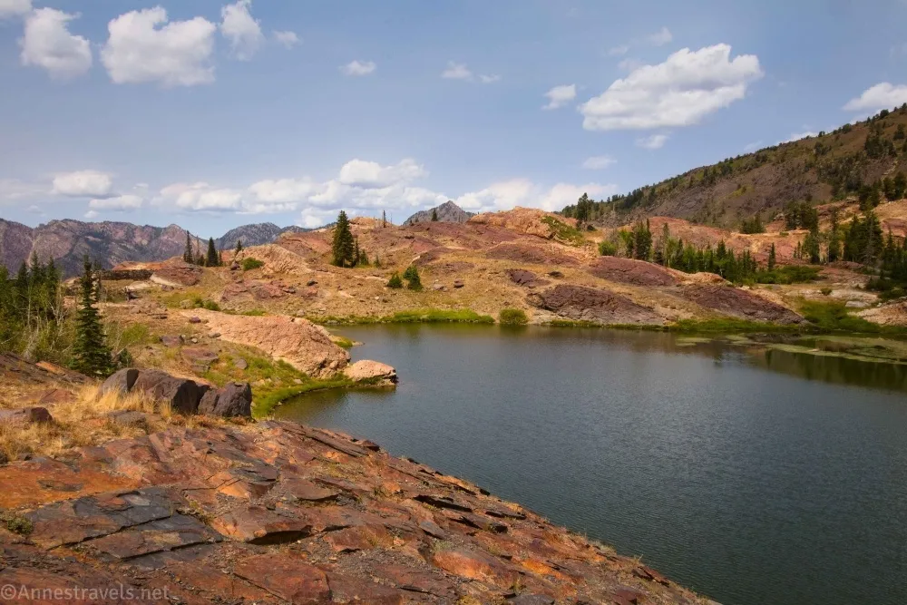
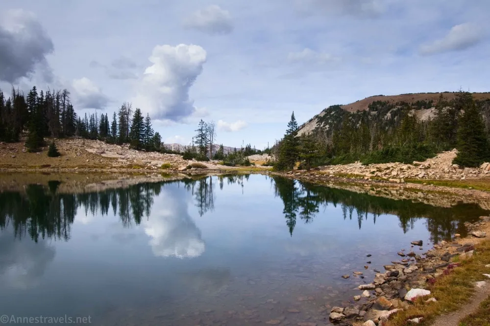
We had a few hours of daylight left after all of my hike browsing, so we drove up American Fork Canyon and then up the incredibly rough road to the Silver Lake Trailhead. The trail was far overused, but it led to a nice lake and some great views back down the valley.
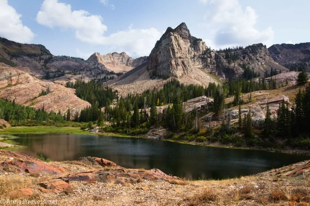
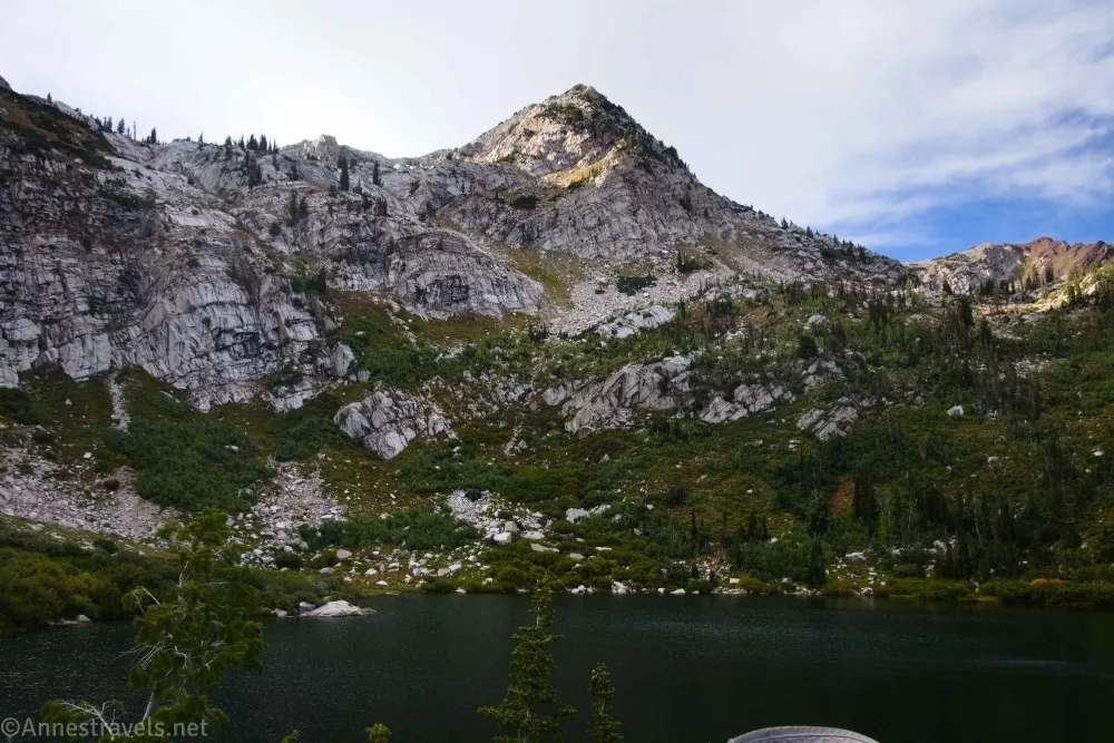
The next day, I decided to do the hike I most often hear associated with the Wasatch Mountains: Lake Blanche. There, we discovered what I was already dreading: The trails in the Wasatch are crazy steep. What little hiking I did in this area before this trip convinced me that the trails are some of the steepest in the nation (or maybe just outside of the Adirondacks). So even a six-mile trail is harder than you’d expect just because of the steepness.
We followed a trail leading beyond Lake Blanche’s old dam (busted through in the 1970s when the USFS decided it was a flood hazard), which led us to two more lakes. Both were absolutely lovely and much quieter than their more famous upper neighbor.
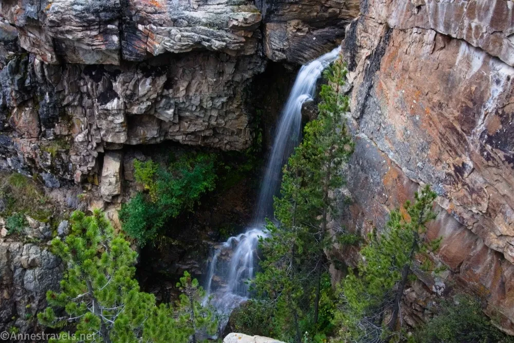
Hidden Falls was across the road from where we had parked, so we did the quick hike up to see it.
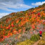
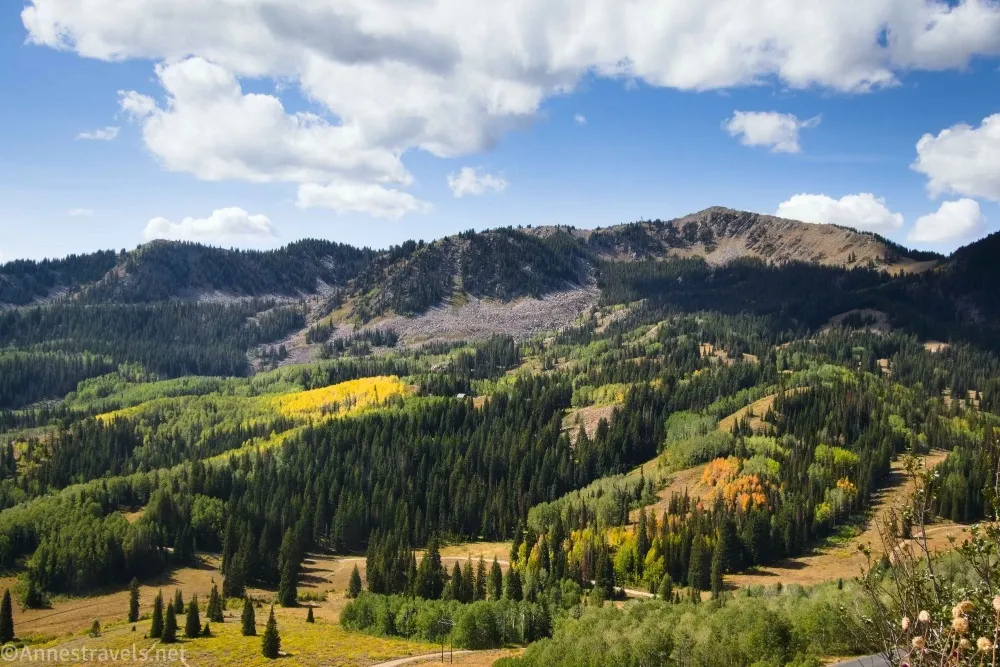
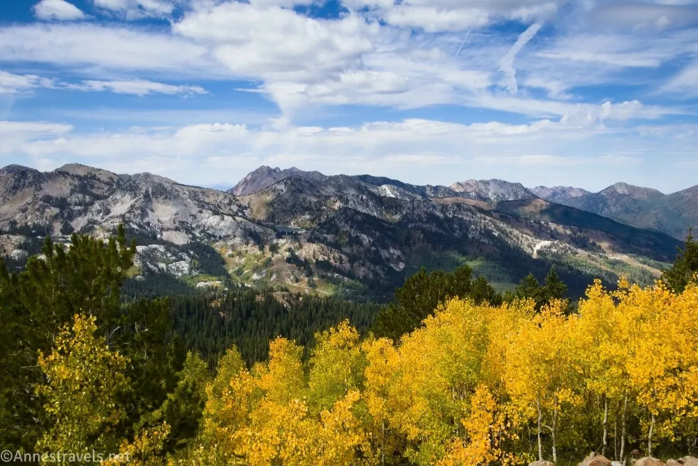
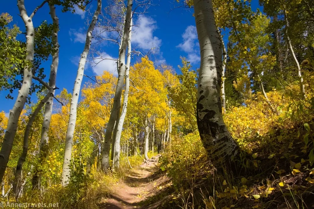
The next day, we decided on an adventure. You see, I had found trail information for how to get to Kyhv Peak from the valley below (aka from the city). But my map showed a trail down from the road on which we had been camping. I figured the map route must surely have less elevation gain (weeeellll, maybe), and the trailhead was certainly closer than driving around the mountains. It didn’t exactly go as planned (we went a looonnnggg way down before starting up again!), but the trees in their full autumn colors and the outstanding 360 view made it well worth the (somewhat extreme) effort!
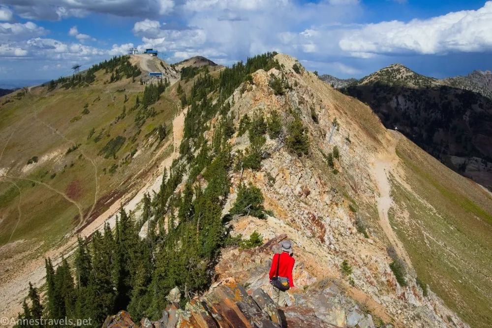
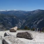
I’ve never been much of a fan of hiking in ski resorts, but I did a great job of doing just that the next day! We parked at the Snowbird Resort in Little Cottonwood Canyon and hiked up the summer trails to the top of Hidden Peak (aka the top of the aerial tramway). My goal for the day was the Twin Peaks, but it looked impossible from Hidden Peak and possible but very strenuous after scrambling rocks along the knife-edge ridgeline (actually, I had a ton of fun on those rocks – they were very stable and therefore made for great scrambling). So we didn’t quite make it to the top of the peak. No worries, though, as the views we were already seeing were great. On the way down, we walked through an old mining tunnel that is now part ski lift, part museum. Definitely not an average hike!
Our plans got a bit messed up at this point, because, well, news-worthy things were happening in the city (you gotta love frantic phone calls from the people back home telling you to be careful!), and it just didn’t seem like a good idea to go back through Orem to get to our previous campsite. So instead, we drove a crazy paved road (and yes, the police were watching the road) over the mountains and down toward Heber City, though we spent the next day in Park City, one of the most affluent towns in Utah.
That day was a comedy of miscommunication. First, the city website told me about the free bus service all around Park City. Then it told me about free parking before 6pm (yay!). Then it told me that the free bus service would take us up to the trailhead on weekends. Then it told me that the bus line to the trailheads ran all week. Except that it stopped a few miles short of said trailheads except on weekends, but they didn’t tell me that until we were at the end of the line. Soooo I scrambled around with my phone map (I am a huge fan of the OrganicMaps app after using it daily on this trip!), hemmed and hawed, looked at my information, matched up the map and my info, tried to figure out the trailhead and finally resorted to a compass, and at long last found myself under a ski lift again hiking up Jupiter Peak. At least the views were gorgeous!
The weather for the next few days didn’t look great, so we headed up into the Uinta Mountains (about an hour east of Park City and without a hint of cell service). Our first stop was at Little Deer Creek Falls.
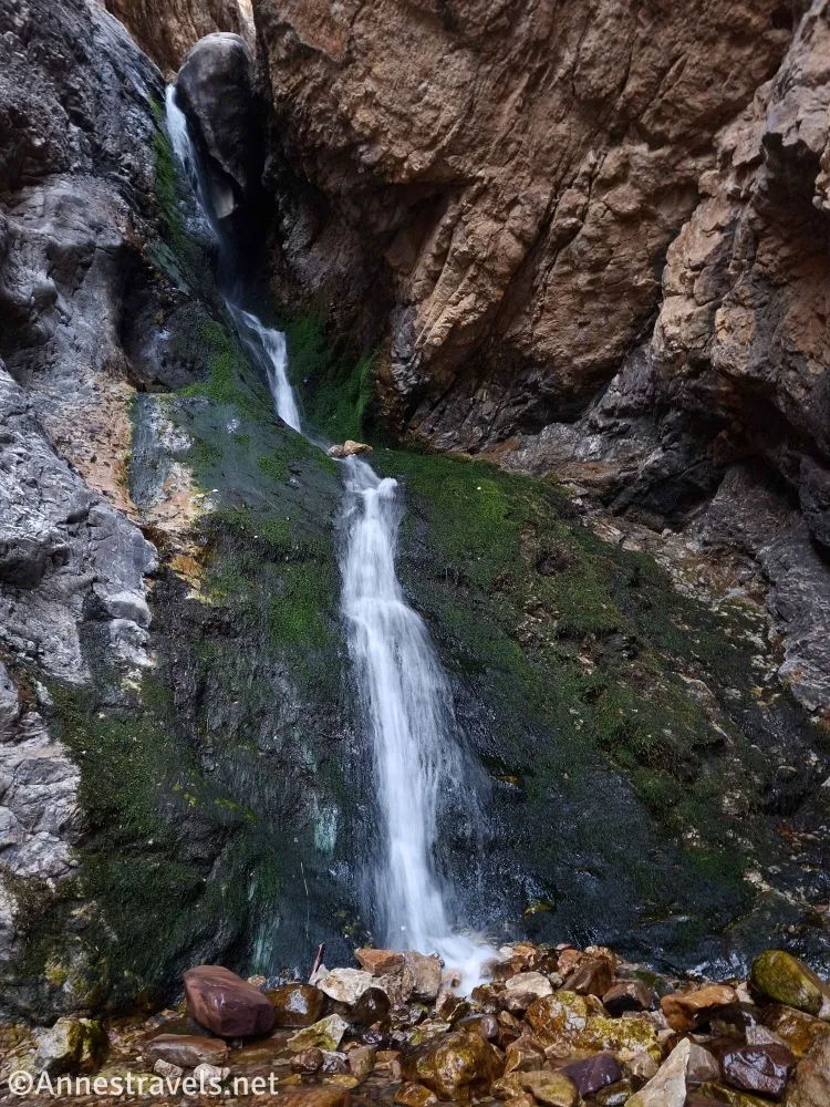
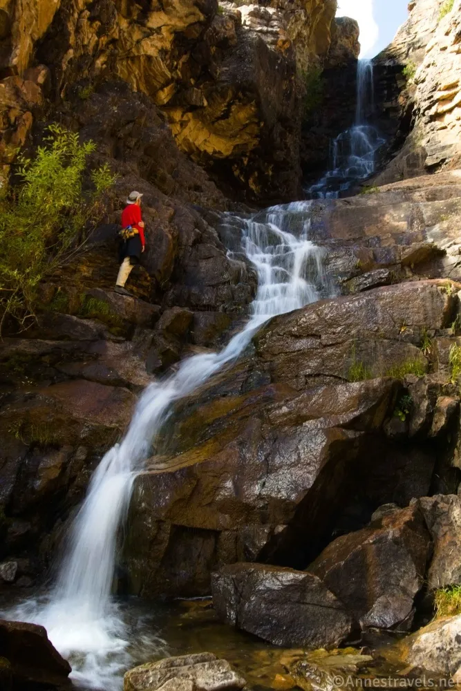
I’d read about Cataract Gorge over on the Girl on a Hike site, and it seemed like a great option for a cloudy day. It actually ended up being sunny all morning and part of the afternoon, but we did get rain after we had explored the gorge with its lovely waterfalls.
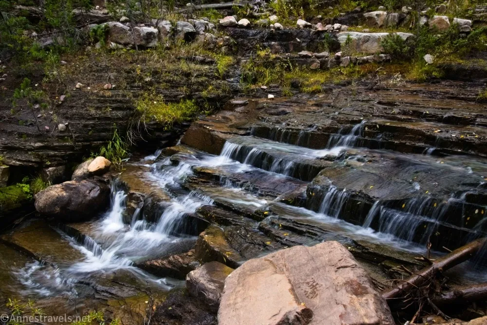
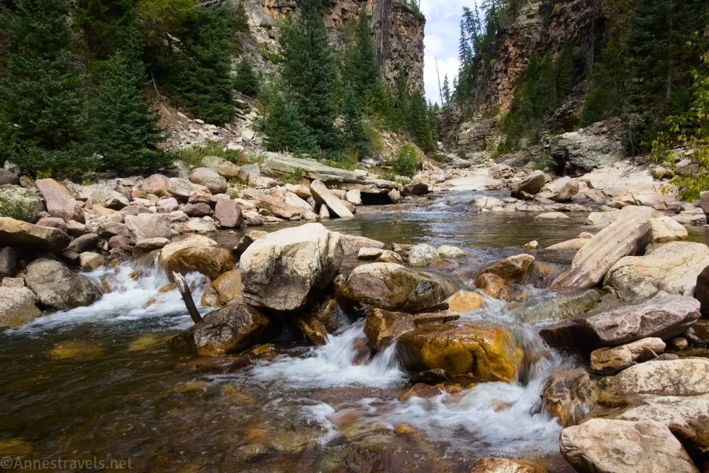
On our way back up, we decided to follow Little Deer Creek (the creek has a 100ft. waterfall near the route to the gorge which makes the trek worthwhile even if you don’t want to scramble the gorge). The creek is a series of little waterfalls as far as we could scramble without getting wet feet; after we climbed back up to the road, it continued to be waterfalls, only in a very deep and narrow canyon. Maybe someday I’ll go back and wade upstream in water shoes!
The next day was truly cloudy and not very nice. It even snowed on us after we got back in the van. We did hike the Lofty Lake Loop despite the clouds.
It was almost the end of the weekend, and we figured we might as well drive while it was raining/snowing, plus we were running out of necessities like sour cream and cheddar potato chips and peach fruit cups (actually, we needed some fluid for the van, but you might as well get peaches while you’re there, right?). So we went back to Park City (after stopping at the Walmart in Heber City) to ride the bus up to the trailhead for Clayton Peak. We ended up at Bloods Lake, Peak 10420, and Clayton Peak.
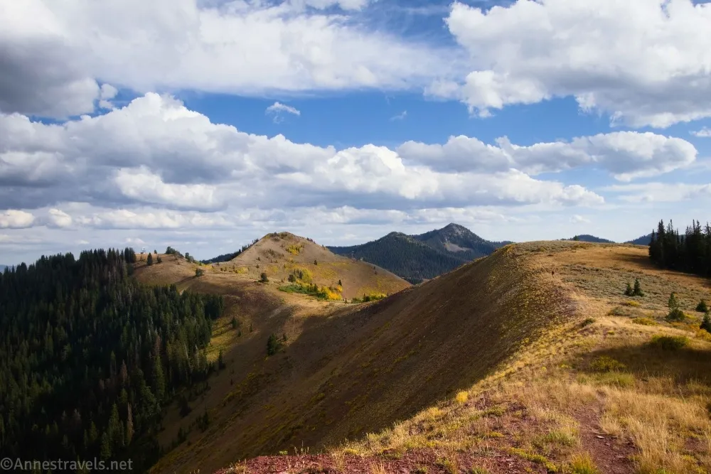
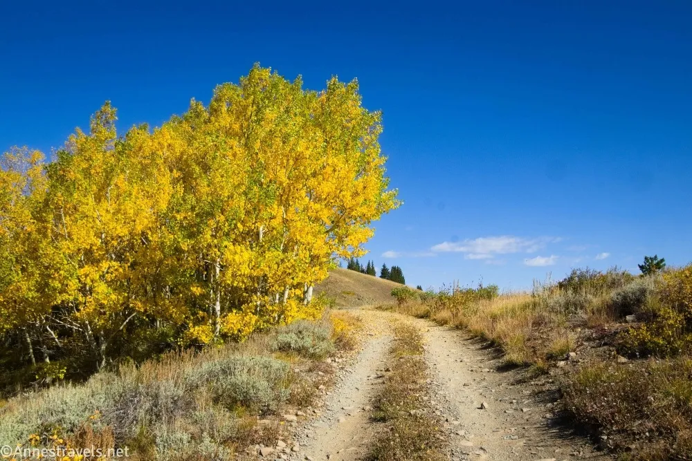
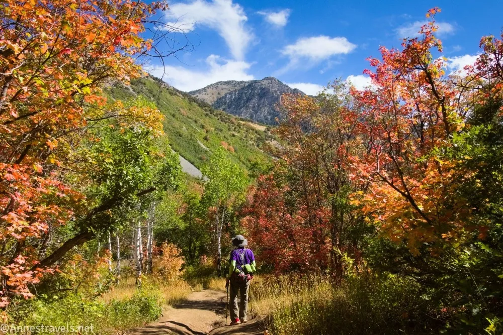
From Jupiter Peak, I’d seen a ridgeline that looked like it would have good views (it looked like it had great views, but you try not to oversell these things). My map said the “Wasatch Crest Trail” went along the ridge, complete with a parking area just barely outside of the outrageously-priced parking area (per-hour parking is the weirdest thing to me when you’re hiking), so this adventure was high on my list of places I wanted to visit. It turned out the trail actually went below the ridge, so we took that on the way out and followed the ridgeline on the way back. The best part, in my opinion, was the autumn colors, though the views were outstanding, too.
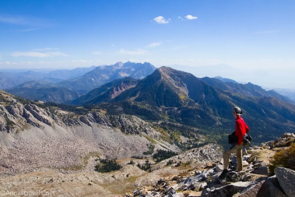
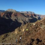
We had one day left, and I was very undecided about what I wanted to do with it. I finally circled back to my first plan, which was to climb the Pfeifferhorn above Little Cottonwood Canyon. It was a crazy, crazy hike, with “trails” that led up almost sheer hillsides (not really sheer, but they felt like it!) and a very difficult rock scramble (not enough exposure to be Class 4, so I’ll call it a Class 3+ knife edge). But the views. Wow! I truly saved the best for last!
And that’s a wrap! I’m looking forward to sharing details about all of these hikes in the next many months!
More Hikes near Salt Lake City
There is a thriving community of outdoor enthusiasts near Salt Lake City, and they have a wonderful trail system to use! Sixty trails are featured in this book, including many hikes up in the mountains. Buy your copy here.