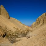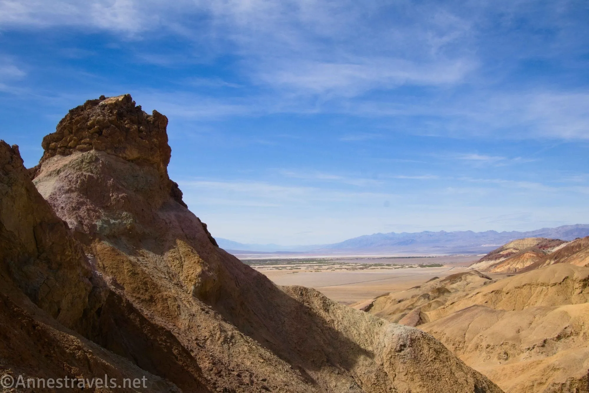
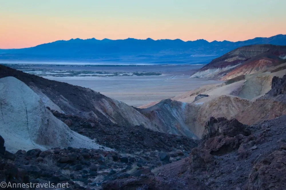
Desolation Canyon is the more beautiful and overlooked sister canyon to Golden Canyon in Death Valley National Park. Just to the south of Desolation Canyon (and accessed from the same parking area) is South Desolation Canyon. It has no trail, but it does offer two forks with yellow and very colorful walls (think Artist Pallet, which is just over the hill from here) and views down on Death Valley. It’s hard to get lost, though you might end up scrambling a bit. Almost no one hikes up here, so the chances of meeting anyone – let alone having crowds – is beautifully unlikely.
Quick Stats
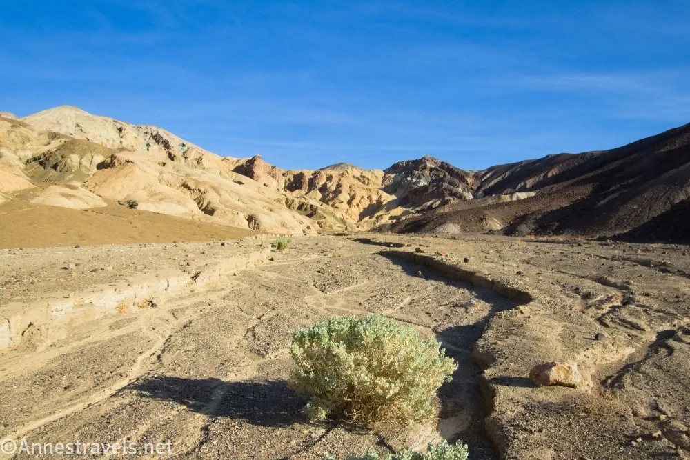
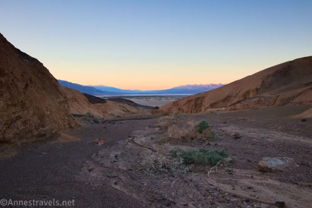
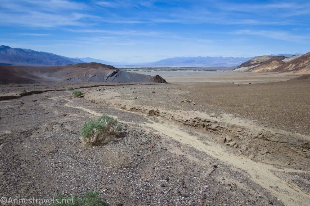
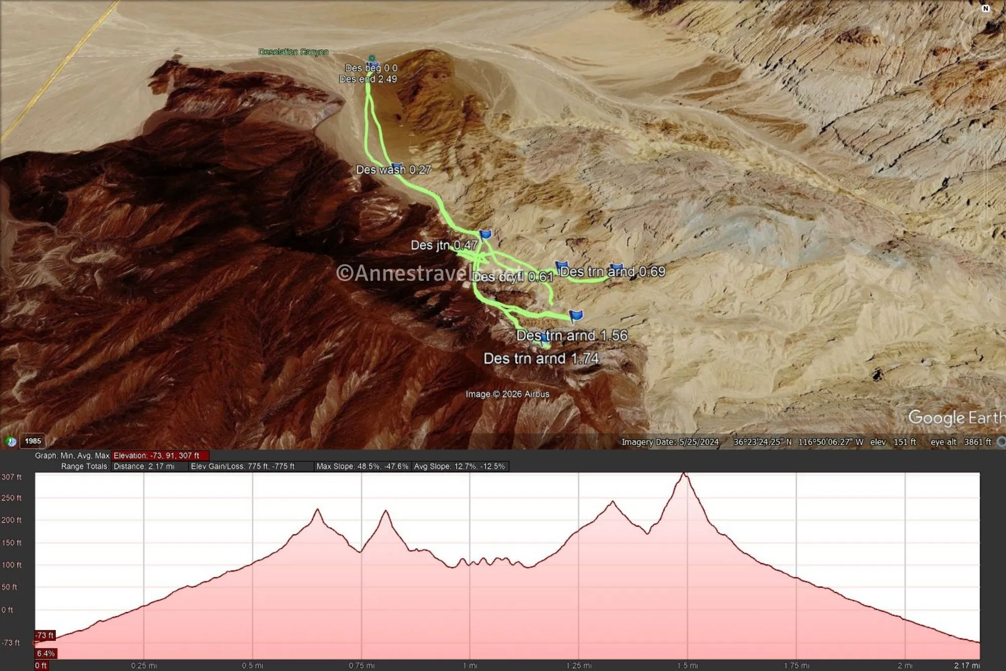
0.0 Desolation South Canyon (-73ft.). Take the lesser-used old road that heads almost due south from the parking area into a wash. Turn left (south/east) when you eventually drop into the wash. (36.395512°, -116.838714°)
0.25 Drop into wash (22ft.). Turn left up the wash (you don’t have to drop into the wash here, specifically; it’s just near where I dropped into the wash). The tread is a little firmer underfoot as the wash heads southeast into the hills. (36.3918060°, -116.8376030°)
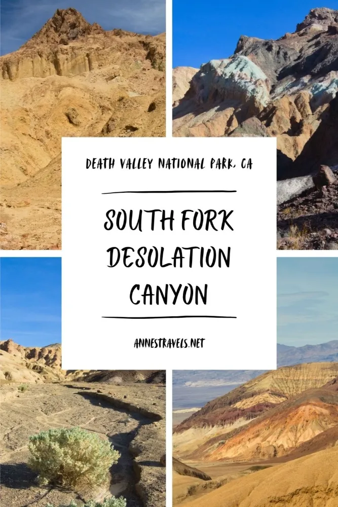
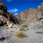
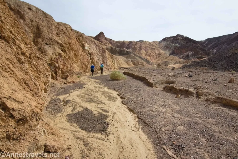
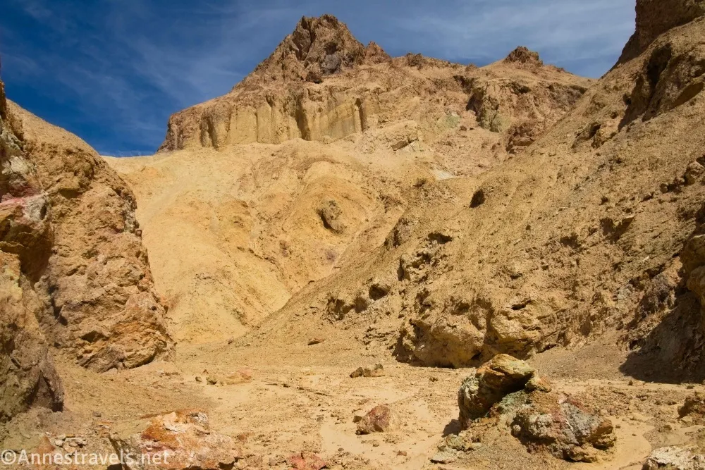
0.5 Wash split (89ft.). The wash splits in two at this point. The main canyon turns left, so that’s the way I’ll tell you to go first, even though there are some fun (if rugged) things to the right, too. The main wash continues upward between yellow hills. The canyon narrows and becomes more rugged, though in general, the scrambling is nothing more than a mild Class 3. (36.389784°, -116.835501°)
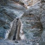
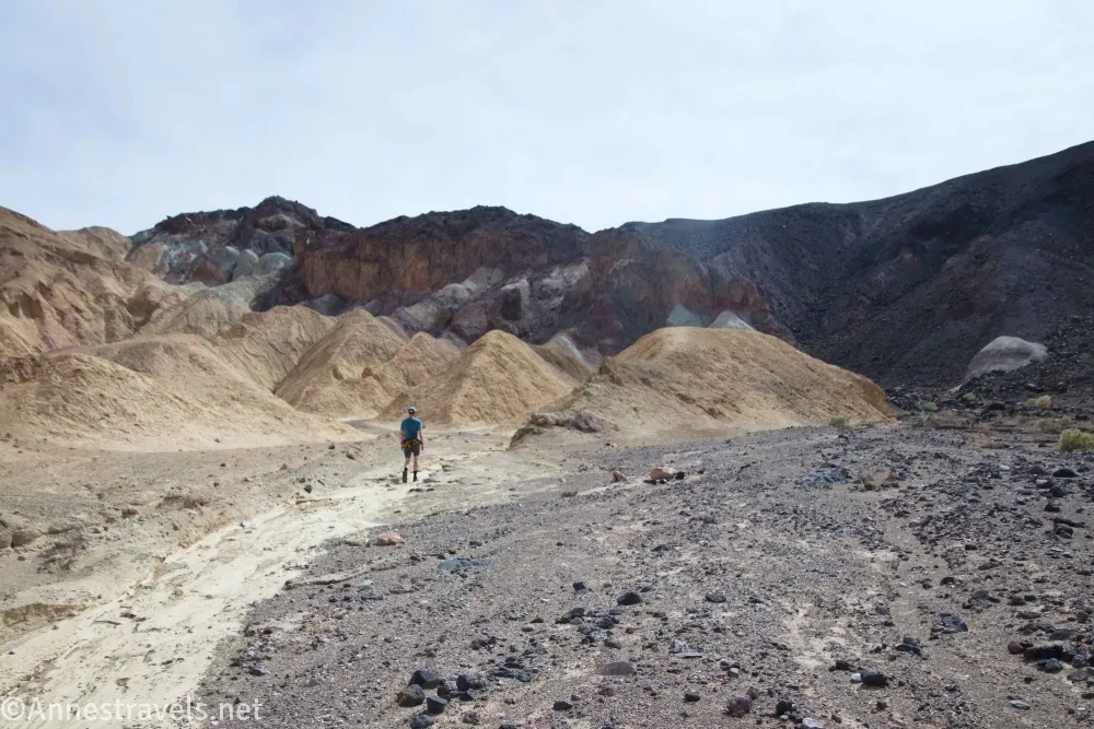
0.6 Dryfall. (179ft.). A dryfall blocks upward progress. I explored a few of the small side canyons on my way back downcanyon, but I also sat for a while in the shade. Death Valley was experiencing a late-March heat wave, and 90s was not my idea of hiking fun! (36.3887223°, -116.8330919°)
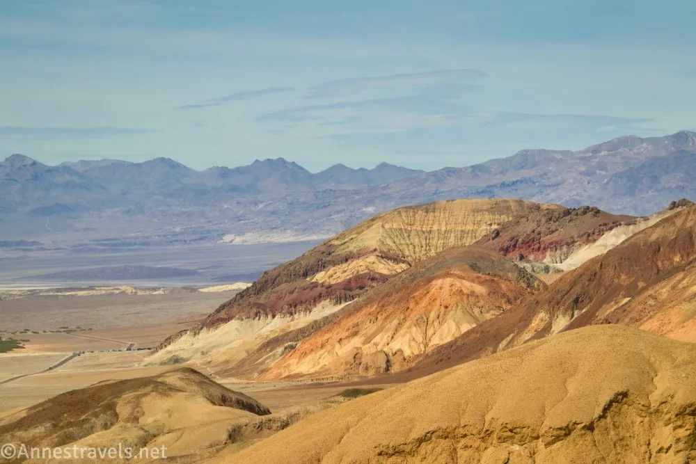
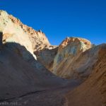
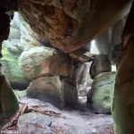
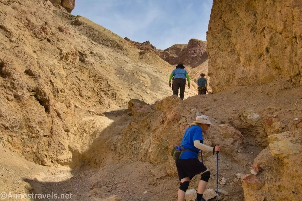
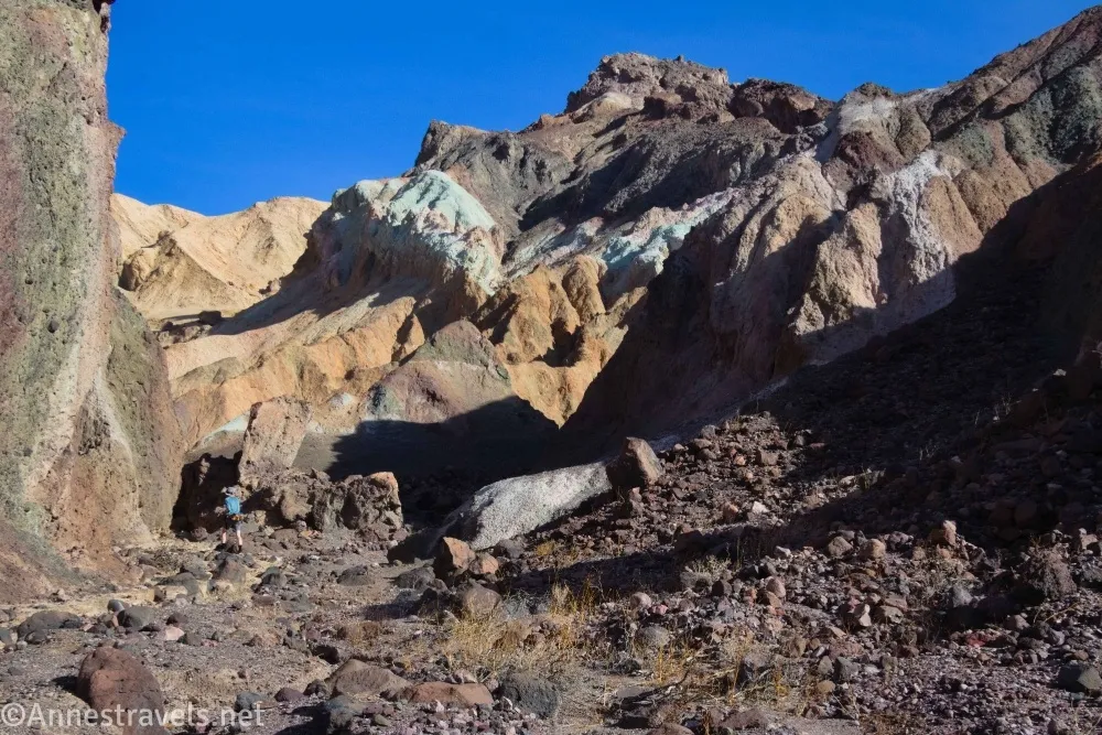
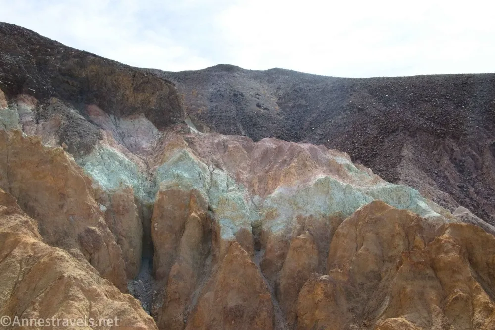
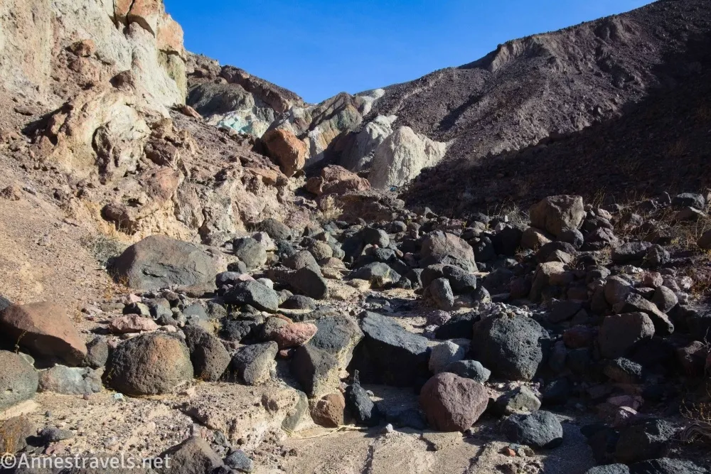
0.7 Return to wash split (89ft.). This is where you turned left up the main canyon earlier. Now, turn left (it would have been right as you came up the canyon) up the narrower canyon. The tread is rocky but no more than a Class 2 scramble. The canyon walls close in around the wash. Keep your eyes open for colorful rocks both below your feet and high on the cliffs above your head. Stay in the main wash as it passes several potentially interesting side canyons. I turned around at the ends of various colorful side canyons, including 36.3886920°, -116.8329970°, 36.3877160°, -116.8338420°, and 36.3871960°, -116.8344170°. While this fork of the canyon is much more rugged to explore, it also has much more colorful walls, hills, and rocks than the yellow main canyon. When you’re finished exploring, retrace your steps down to the parking area. (36.389784°, -116.835501°)
1.5 Return to parking area (-73ft.). (36.395512°, -116.838714°)
Round Trip Trail Length: With all of my exploring, I went 2.5 miles. Most people would go shorter, probably closer to 1.8 miles.
Elevation Gain: 775ft. (-73ft. to 307ft.) – I scrambled some extra mileage on this, so it would likely be closer to 345ft.
Facilities: None
Fees: $30/vehicle, valid 7 days. America the Beautiful National Parks & Federal Public Lands Passes and Death Valley Annual Passes are accepted.
Trail Notes: There is no trail – but it’s hard to get too lost (if you get super lost, just head downhill!) The main fork of Desolation Canyon is more colorful than the South Fork. A road used to go partway up the canyon, but I didn’t see much in the way of evidence of it. Bring your scrambling skills and enjoy!

Trail 
![]()
![]()
![]()
![]()
Road ![]()
![]()
Signs ![]()
![]()
![]()
![]()
Scenery ![]()
Would I go 100 miles out of my way for this? ![]()
Overall Rating: 
![]()
![]()
GPS Coordinates for Desolation Canyon South Fork
TH: 36.3954880°, -116.8386590° (36°23.72928′, -116°50.31954′ / 36°23’43.7568″, -116°50’19.1724″) (-53ft.) (0.0)
Wash: 36.3918060°, -116.8376030° (36°23.50836′, -116°50.25618′ / 36°23’30.5016″, -116°50’15.3708″) (22ft.) (0.27)

Wash junction: 36.3898380°, -116.8355360° (36°23.39028′, -116°50.13216′ / 36°23’23.4168″, -116°50’07.9296″) (94ft.) (0.47)
Dryfall: 36.3889420°, -116.8340220° (36°23.33652′, -116°50.04132′ / 36°23’20.1912″, -116°50’02.4792″) (179ft.) (0.61)
Turn around: 36.3886920°, -116.8329970° (36°23.32152′, -116°49.97982′ / 36°23’19.2912″, -116°49’58.7892″) (270ft.) (0.69)
Turn around: 36.3877160°, -116.8338420° (36°23.26296′, -116°50.03052′ / 36°23’15.7776″, -116°50’01.8312″) (270ft.) (1.56)

Turn around: 36.3871960°, -116.8344170° (36°23.23176′, -116°50.06502′ / 36°23’13.9056″, -116°50’03.9012″) (309ft.) (1.74)
End: 36.3955050°, -116.8387480° (36°23.73030′, -116°50.32488′ / 36°23’43.8180″, -116°50’19.4928″) (-56ft.) (2.49)

The gpx file for the South Fork of Desolation Canyon can be downloaded – please note that this and the GPS Coordinates are for reference only and should not be used as a sole resource when hiking this trail.
Download GPX File size: 66.2 KB Downloaded 67 times
(Note: I do my best to ensure that all downloads, the webpage, etc. are virus-free and accurate; however, I cannot be held responsible for any damage that might result, including but not limited to loss of data, damages to hardware, harm to users, from use of files, information, etc. from this website. Thanks!)
Getting to Desolation Canyon (South Fork) Trailhead
From Furnace Creek, take CA-190E (toward Las Vegas) for 1.3 miles. Turn right on the Badwater Road for 3.7 miles. A gravel road will be on the left (it should be signed for Desolation Canyon); turn left up this for 0.5 miles. The trailhead is at the end of this 2WD-friendly gravel road.
If you’re coming from Las Vegas or CA-127, take CA-190 West for 28.9 miles from Death Valley Junction (near the Amargosa Opera House). Turn left onto the Badwater Road for 3.7 miles. A gravel road will be on the left (it should be signed for Desolation Canyon); turn left up this for 0.5 miles. The trailhead is at the end of this 2WD-friendly gravel road.
From the south, drive north on the Badwater Road. The right turn into the gravel road is 1.1 miles north of the exit to Artist Drive (4.9 miles north of the entrance to Artist Drive).
The Very Best Hikes in Death Valley
Only want short hikes in Death Valley National Park? This book will take you to some of the best choices. Buy your copy here.

Pin This Post!