
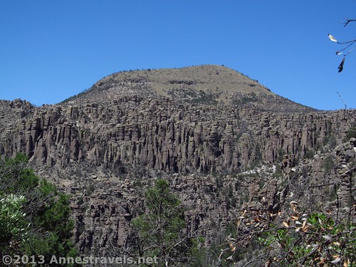
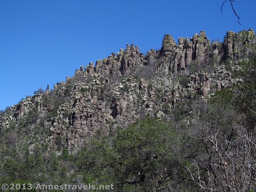
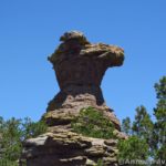
Sugar Loaf Mountain and Rock Spires from the Sarah Deming Trail
If you haven’t had enough rock formations after walking the Heart of Rocks Trail (and somehow I never have), you can continue to enjoy the formations from a distance if you walk back to your vehicle via the Sarah Deming Trail, Upper Rhyolite Trail, and the Echo Canyon Trail. Actually, the Echo Canyon trail is more up-close-and-personal with the rock formations than the other two trails; but it’s exciting enough that we’ll cover that next week. For now, we’ll focus on the panoramic (if you can call them that!) rock spires sticking skyward out of the hillsides along and around the Sarah Deming Trail and Upper Rhyolite Trail. This is still awe-inspiring, just not as “cool” or “cute” as the formations you saw in Heart of the Rocks.
Quick Stats
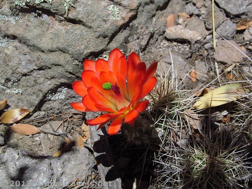
A booming cactus I discovered along the Sarah Deming Trail
After going to the Big Balancing Rock via the Ed Riggs Trail, Mushroom Rock Trail, and Big Balancing Rock Trail, then taking a side-loop to hike around the Heart of Rocks Trail, we decided to end our hike by making the trail a loop – this added less than a mile (2 km) to the overall hike length, and we knew there would be some pretty interesting formations along the way. Added to this, we’d never done the Upper Rhyolite Trail, which was enough to make some of us anxious to take the loop instead of returning the way we’d come. (Whenever we’ve done this trail in the past, we’ve taken the Lower Rhyolite Trail back down to the visitor center where we’d left our vehicle – we’d taken the park’s free shuttle up to the trailhead (you have to sign up for this shuttle at the visitor center). The pros of this is that it’s virtually all downhill after finishing out the Mushroom Rock Trail and it’s no longer than returning the way you came. The biggest con is that much of the Lower Rhyolite Trail is in the forest, which means you miss out on a lot of nice rock formation views.)
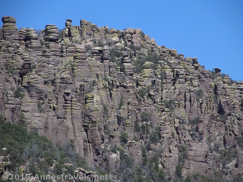
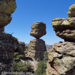
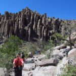
Rock formations along the Sarah Deming Trail
The Sarah Deming Trail goes right from the Heart of Rocks / Big Balancing Rock / Sarah Deming Trail Junction if you’re coming from the Heart of Rocks Trail – the trail is well-marked. It fairly quickly begins its descent into Sarah Deming Canyon via some pretty interesting pathways through the rocks – usually it’s not too hard to find the trail, although you may have to look for it in a couple places. For the next 1.6 miles (2.5 km), the trail winds its way through a dry forest, with peek-a-boo (or better) views up to spires above you and across the valley, especially once the trail leaves Sarah Deming Canyon and begins hugging the edge of Rhyolite Canyon. In this section, the views begin to open up through the trees – I found it very fun to look out across the canyon and see all spires on the hillside across the valley, with Sugarloaf Mountain behind it all.
The Sarah Deming Trail – looking back up Sarah Deming Canyon
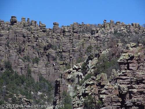
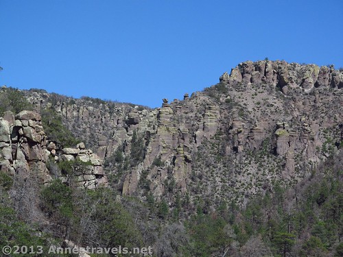
After 1.6 miles (2.5 km), the trail stops going downhill at a trail junction. This is the Rhyolite Trail; left is the Lower Rhyolite Trail (which will take you to the visitor center via a nicely shaded downhill trail) and right is the Upper Rhyolite Trail. Since we wanted to get back to our vehicle, we turned right, and were almost immediately rewarded with views of spires in Rhyolite Canyon. The formations are on both sides of the trail, but I especially enjoyed the ones across the valley.
The trail climbs steadily, entering a desert forest (i.e., a forest much dryer than what I’m used to in lush NYS) after a bit, following a sometimes dry streambed. It then leaves the brush behind as it crosses the valley and begins a set of steep switchbacks up to the Echo Canyon Trail junction, 1.1 miles (1.7 km) from the Upper/Lower Rhyolite / Sarah Deming Trail Junction. As you rise, note the formations you can see down and up Rhyolite Canyon.
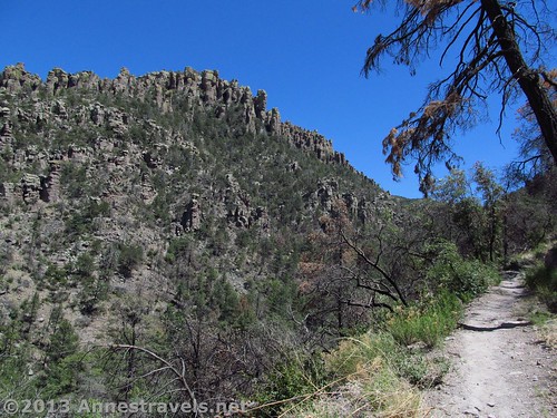
Rock formations on the right side of the trail while hiking up Rhyolite Canyon on the Upper Rhyolite Trail
I think I’ll leave you there for the moment…and I’ll take you through Echo Park back to your vehicle next week!
Round Trip Trail Length: The shortest RT trail using this route is 7.4 miles (11.9 km). RT loop (including the Heart of Rocks Trail) is 8.5 miles (13.6 km) (though my GPS came out saying 8.7 miles (14 km))
Highest Elevation (on loop): 7,480 ft. (2,280 m) (Echo Canyon Parking Area)
Lowest Elevation (on loop): 5,900 ft. (1,798 m) (Sarah Deming Trail / Rhyolite Trail Junction)
Net Elevation Gain/Loss: 1,680 ft. (512 m)
Facilities: Primitive restrooms at the Echo Canyon Trailhead – otherwise, none.
Fees: $5 per person fee (age 16 and older) to enter Chiricahua National Monument, valid 7 days. America the Beautiful (Interagency), Senior (Golden Age), Access (Golden Access), Volunteer, Military, and Chiricahua Annual Passes also accepted – however, note that these only cover the pass holder and three other individuals (we ended up having to pay for one extra person; unlike some parks, these staff members seem serious about enforcing this (but they were very nice, all the same!)). Update: The entrance fees to Chiricahua have been eliminated, so you can now visit for free!
Trail 
Road
Signs
Scenery
Would I go 100 miles out of my way for this?
Overall Rating:
Key GPS Coordinates for the trail to the Big Balanced Rock
Rock formations across Rhyolite Canyon from the Upper Rhyolite Trail
Sarah Deming / Heart of Rocks Trail Junction: 31.99459N / -109.32260W (31° 59′ 40.5234″ / -109° 19′ 21.3594″) (6,792 ft.; 2,070 m)
Lower Rhyolite / Sarah Deming Trail Junction: 32.00144N / -109.33373W (32° 0′ 5.184″ / -109° 20′ 1.428″) (5,972 ft.; 1,820 m)
Echo Canyon Trail Junction: 32.00369N / -109.32664W (32° 0′ 13.2834″ / -109° 19′ 35.9034″) (6,282 ft.; 1,914 m)
The gpx file for the Chiricahua Heart of Rocks Loop can be downloaded – please note that this and the GPS Coordinates are for reference only and should not be used as a sole resource when hiking this trail.
Download GPS File File size: 208.5 KB Downloaded 338 times
(Note: I do my best to ensure that all downloads, the webpage, etc. are virus-free and accurate; however, I cannot be held responsible for any damage that might result, including but not limited to loss of data, damages to hardware, harm to users, from use of files, information, etc. from this website. Thanks!)
Getting to the Echo Canyon Parking Area
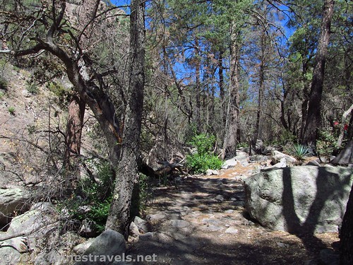
The desert forest
From I-10 in Arizona, take Exit 340 in Willcox. Head southeast (left if you’re coming from the east, right if you’re coming from the west) on Fort Grant Road/W Rex Allen Drive for 1.1 miles (1.7 km). Turn right onto AZ-186 E (signs will point toward Interstate 10 Business). After 0.7 miles (1.1 km), turn left to continue on AZ-186 E; drive 31.4 miles (50.5 km). Turn left onto AZ-181 for 3 miles (4.8 km), then continue on E Bonita Canyon Road for 7.3 miles (11.7 km). Turn right, following the signs for Sugarloaf and Echo Canyon; take an almost immediate left into the Echo Canyon Parking Area.
Looking upcanyon while switchbacking up to the Echo Canyon Trail
If you’re coming from the visitor center, turn left out of the parking area and drive 5.3 miles (8.5 km) to the turnoff for Sugarloaf. Turn right here, then take an almost immediately left into the Echo Canyon Parking Area.
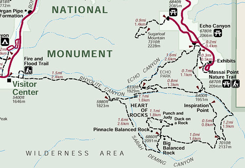
Trail map of the Heart of Rocks area, including the Sarah Deming Trail and Upper Rhyolite Trail
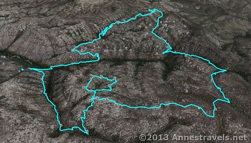
Visual map of the Heart of Rocks Loop – the Sarah Deming Trail extends to the left of the inner loop down behind the hill; from here, the Upper Rhyolite Trail travels right until it turns left again…if that makes any sense!
This Week’s Featured Product!
Want more trail information about Chiricahua and the surrounding area? This guide describes 100 hikes in the southern third of Arizona, including the National Monument.

Pingback: Anne's Travels » Finishing the Chiricahua Loop: The Echo Canyon Trail
Pingback: Anne's Travels » Chiricahua Formations: The Heart of Rocks
An excellent detailed writeup of the hike. We just completed it yesterday and I would go back again any time! My husband, Ted & I came from Canada so have travelled very far to see this wonderful natural wonder.
Marjorie, A very warm welcome to the United States! So glad you were able to enjoy some of our finest scenery, too (if I can pick and choose!)