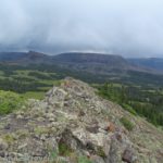

I’ve long wanted to drive to the top of Loveland Pass. When I was in my teens, my family often vacationed in Utah, which required crossing over the passes in the Rockies on I-70. We’d always see the signs for Loveland Pass and say something to the effect of, “Someday, we’ll do that. But not today.” On my way back from Utah last fall, “someday” became “today” – with spectacular views as we climbed up to 13er Cupid Peak. We even had a trail the entire way up!
Quick Stats

Most people who visit Loveland Pass pull into the parking area, walk across the road to get their photo taken with the sign, and then head down the other side either to Silverthorne or back to I-70. A fair number also climb a short distance up one side of the pass or the other. But most don’t get very far (the air is just a wee bit thin up here at nearly 12,000ft.). So your chances of having the views to yourself after a quarter mile or so are high.
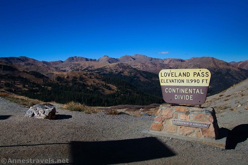
We arrived about midday (we had to drive in from Green River, UT). The pass was hopping, even on a chilly, sunny day in early October. We followed the tourists’ example, scampered across the road, and took pictures of the Loveland Pass sign.
Then we went back across the road, added a few layers of clothing (not to mention hiking boots), and headed up the eastern side of the pass (not the side with the sign).
Technically, you could also head up the west side of the pass; I hear the path is known as the West Ridge Trail. However, I thought the east route would give me a better view (more mountains, less I-70).

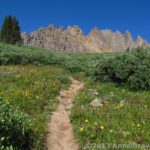
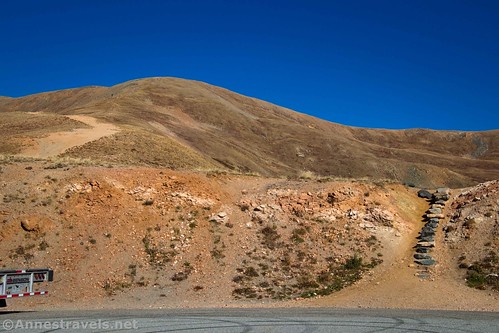
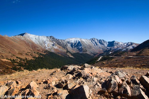
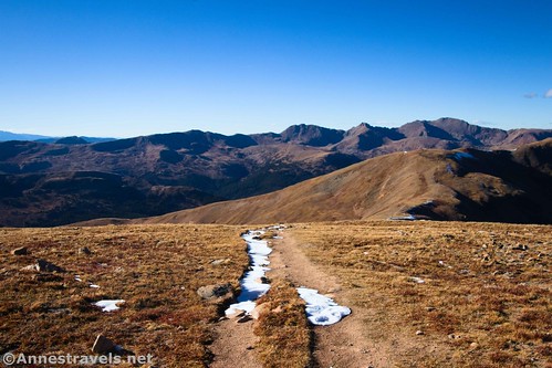
The trail up the eastern ridge is wide and well-traveled at first. As it climbs, the path slowly narrows to a more typical alpine path. A snowfall a few days earlier had left the mountains dusted with white.
After 0.6 miles, the path splits. The left trail would take you to Mt. Sniktau. However, we decided to take the lower route to the right to continue up to the ridgeline.

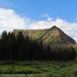
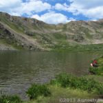
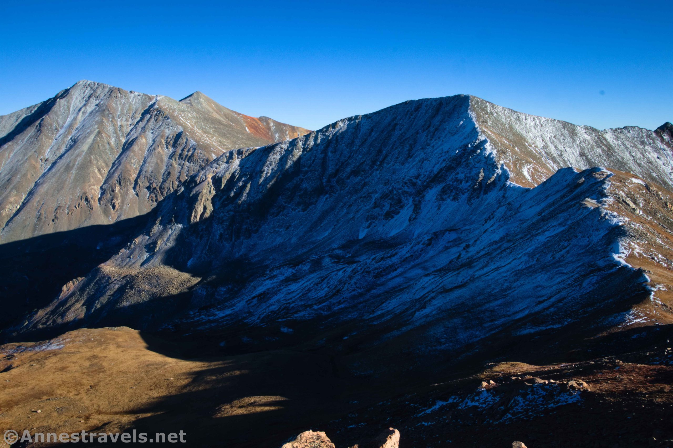
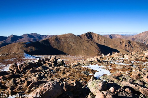
This is a gorgeous section of trail; be sure to look right down to Pass Lake as well as to the wall of mountains in front of you (Lenawee Mountain). The trail reaches the ridgeline at mile 1.1.
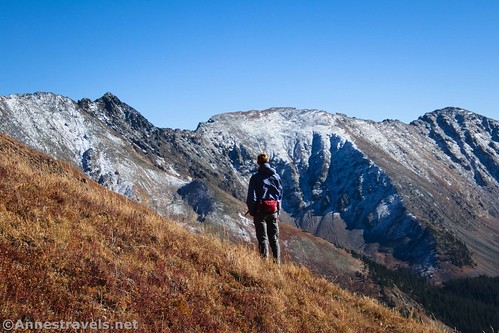
At the ridgeline, you can turn left over to Mt. Sniktau as an alternate route. We turned right to continue east up toward Cupid Peak. While the trail ascends, I found it easier than climbing up to the ridge. Views continue to be gorgeous, and now you can see across the ridge and down into Kearney Gulch (just right of Mt. Sniktau).
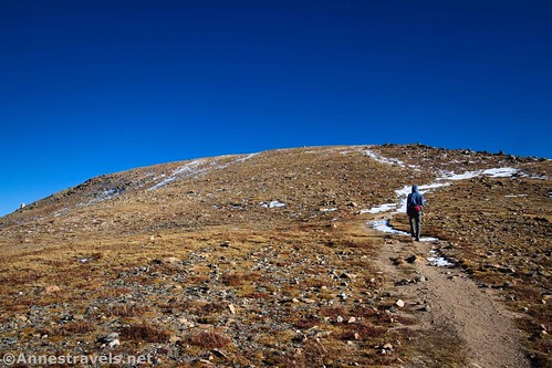
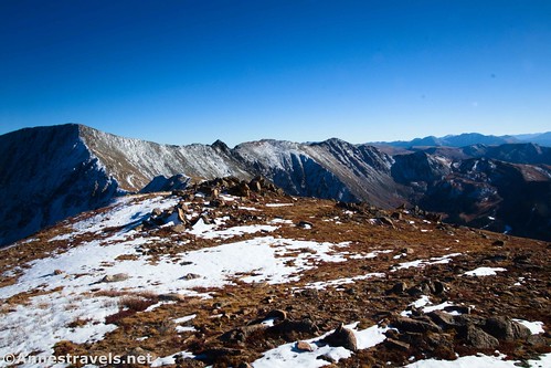
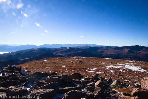
At last, 1.7 miles after leaving the parking area, the trail goes along the side of Cupid Peak. The trail doesn’t quite hit the top of the peak, so scramble off-trail to the left, trying to stay on boulders and off of the fragile alpine flora, to the highest point on the mountain, which is covered in rocks.
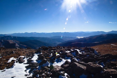
While it’s only 1.7 miles up here, it feels like a lot more since you’ve just climbed to 13,100ft. above sea level! I was finally acclimating to elevation (after spending a week around 8,000ft.), so I didn’t have as much trouble as I was expecting. In fact, I had my typical form of altitude sickness which is a type of euphoria where everything is great and I can’t seem to worry too much about anything. It’s a happy place to be, even if my lungs are telling me that they aren’t excited about the lack of oxygen!

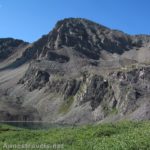
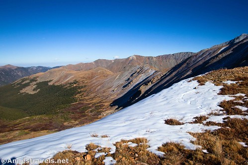
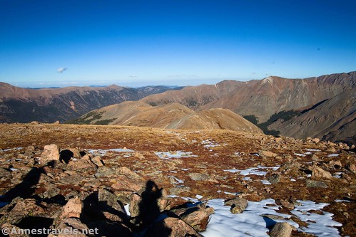
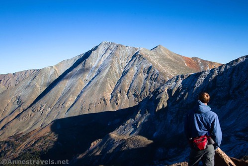
The views are great from up here. To the southeast is Grays Peak (the highest point on the North American Continental Divide) with Torreys Peak (also a 14er) just to its left. Continuing left along the ridgeline is Kelso Mountain.
At the end of the ridge which includes Cupid Peak is Grizzly Peak (to the right of Torreys) – in fact, if you continued to follow the trail beyond Cupid Peak, you’d end up at Grizzly (we didn’t have time for that). To the right of Grizzly Peak is the ridgeline that includes Lenawee Mountain.
Stretching northeast from Cupid Peak is the ridgeline of Baker Mountain, with Grizzly Gulch on its right (south) and Kearney Gulch on its left (north). Above Kearney Gulch is Mount Sniktau.
When you’ve finished looking at the view (or the sun is going down), retrace your steps to the parking area. It’s a nice little high-elevation hike with a great payoff for your effort if you happen to be in Loveland Pass!

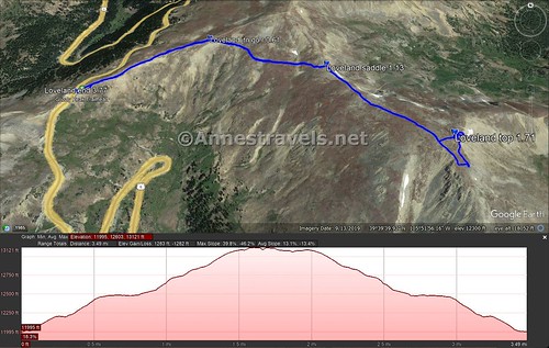
Round Trip Trail Length: I went 3.8 miles (I racked up an extra 0.4 miles while exploring on top of Cupid Peak – somehow!)
Elevation Gain: 1,283ft. (11,995ft. to 13,121ft.)
Facilities: None
Fees: None

Trail Notes: Remember that you’re over 12,000ft. for most of this hike. Take your time, use sunblock, and drink plenty of water. The trail is easy enough to follow, but it is steep at times. Loveland Pass can be crowded, but turnover is high, so you should be able to get a parking space fairly quickly.
Trail 
![]()
![]()
Road
Signs ![]()
![]()
![]()
![]()
Scenery
Would I go 100 miles out of my way for this? ![]()
Overall Rating: 
![]()

GPS Coordinates for Loveland Pass to Cupid Peak
TH: 39.6636210°, -105.8788710° (39°39.81726′, -105°52.73226′ / 39°39’49.0356″, -105°52’43.9356″) (11,994ft.) (0.0)
Junction; go right: 39.6664850°, -105.8701140° (39°39.98910′, -105°52.20684′ / 39°39’59.3460″, -105°52’12.4104″) (12,466ft.) (0.61)
Reach ridgeline (saddle): 39.6633920°, -105.8623110° (39°39.80352′, -105°51.73866′ / 39°39’48.2112″, -105°51’44.3196″) (12,719ft.) (1.13)
Top of Cupid Peak: 39.6577970°, -105.8565890° (39°39.46782′, -105°51.39534′ / 39°39’28.0692″, -105°51’23.7204″) (13,122ft.) (1.71)
End at TH: 39.6636010°, -105.8788390° (39°39.81606′, -105°52.73034′ / 39°39’48.9636″, -105°52’43.8204″) (11,997ft.) (3.77)

The gpx file for Loveland Pass to Cupid Peak can be downloaded – please note that this and the GPS Coordinates are for reference only and should not be used as a sole resource when hiking this trail.
Download GPX File size: 82.3 KB Downloaded 499 times
(Note: I do my best to ensure that all downloads, the webpage, etc. are virus-free and accurate; however, I cannot be held responsible for any damage that might result, including but not limited to loss of data, damages to hardware, harm to users, from use of files, information, etc. from this website. Thanks!)
Getting to Loveland Pass
From the east (Denver; driving I-70W), take Exit 216 for US-6W and Loveland Pass. Stay straight on US-6W, passing under I-70. Loveland Pass will be at the top of the pass 4.7 miles after exiting I-70.

From the west (Silverthorn; driving I-70E), take Exit 205 toward US-6E toward Silverthorne and Dillon. Drive up into the mountains to Loveland Pass at the top of the pass 16.3 miles after exiting I-70.
Today’s Featured Product
Enjoy multiple sports across Arapaho National Forest (including hiking) with this handy guidebook. It includes GPS coordinates, maps, route descriptions, and much more. Buy your copy here!