
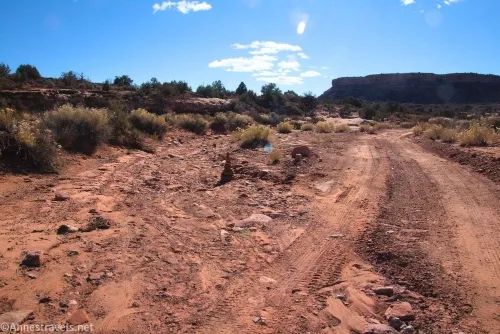
About 19.8 miles from the pavement of US-95, the Waterhole Flat Road crosses an unassuming wash. It’s actually fairly easy to find because a sideroad goes off just before the road dips to cross the dry watercourse. This is Cove Canyon, a fun little adventure that ends at a 50ft. dryfall unless you have rope and rock climbing experience.
Quick Stats
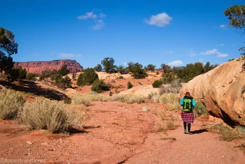
The canyon doesn’t sound all that exciting, but it’s a pretty hike, and every time I see photos of it come up on my desktop backgrounds, my mind thinks something to the tune of, “I need to post about that on the blog!” So it comes recommended if you enjoy remote canyons with rock formations, petrified wood, and one small scramble.
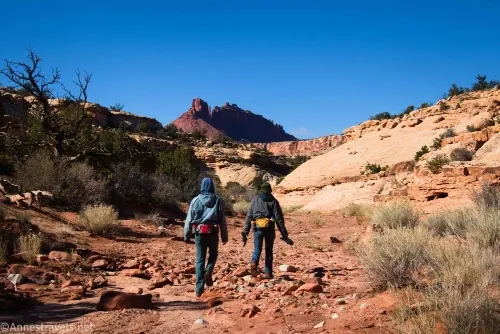
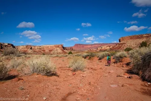
Park out of the way of traffic and also not in the wash (I used a spot just on the far side of the wash; it can hold 1-2 vehicles). Then go back to where the road crosses the wash and begin downstream. (I’ve heard that by walking upstream you can get to the South Block, but that was a lot more excitement than we wanted on a chilly November morning when we were really just trying to get in position to visit the Golden Stairs the next day).
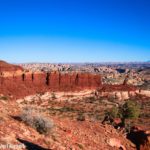
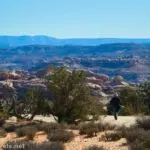
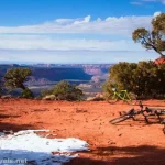
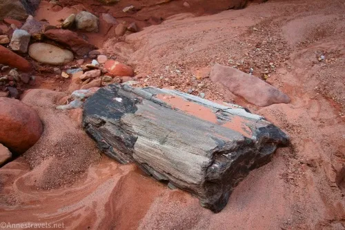
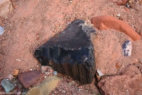
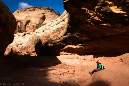
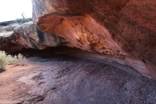
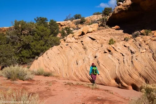
The walk down the wash is easy and mostly uneventful. There is a nice overhang around mile 0.4, and keep your eyes open for petrified wood in the wash (usually black). The walls gradually rise higher around the wash – on the way back, the views upstream are pretty incredible, so you might want to turn around and look back from time to time on your way down.
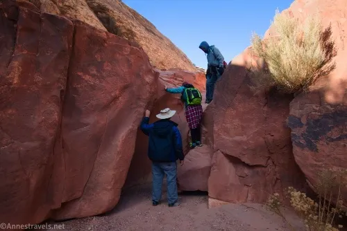
The first real excitement comes about mile 1.75 when the wash drops over a small (less than 3ft.) dryfall. This is easily negotiated.
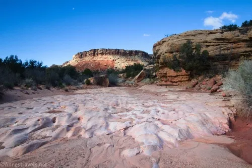
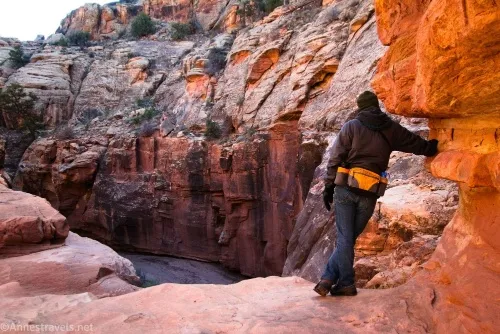
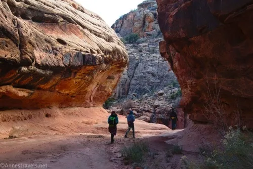
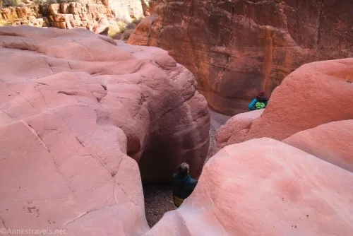
Continue downcanyon about a tenth of a mile to another dryfall – this one is much bigger and would be difficult to climb. Thankfully, there is a bypass trail on the left (while going downcanyon). I went back to the bottom of the dryfall, and it’s pretty.
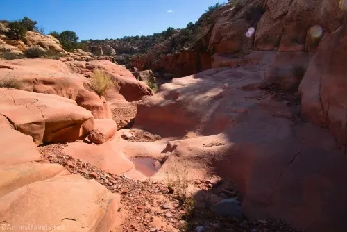
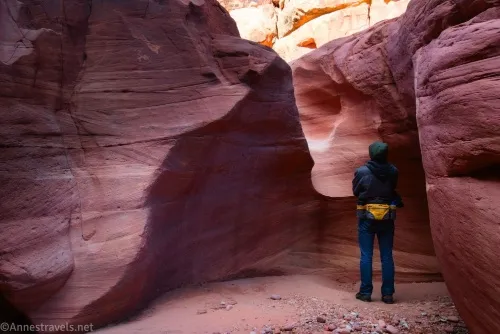
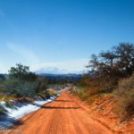
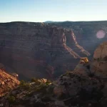
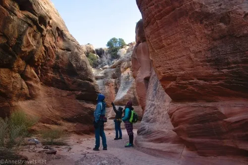
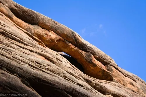
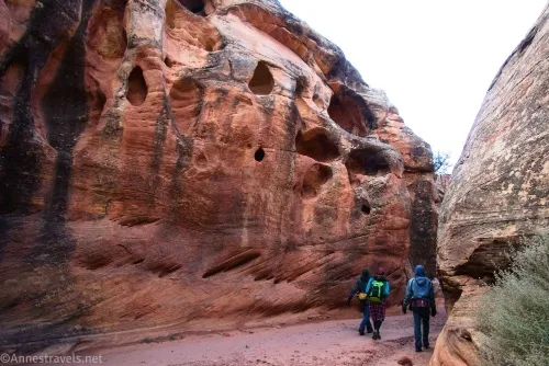
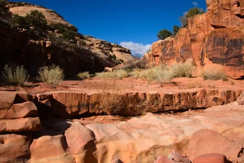
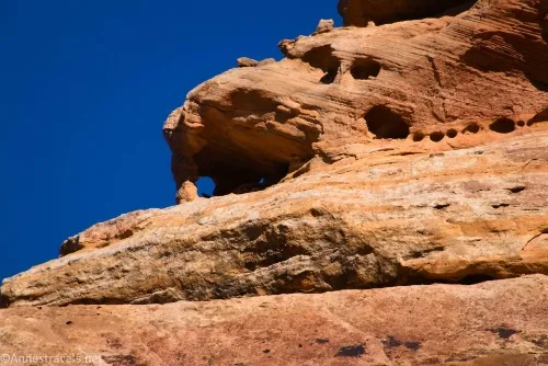
The canyon below the major dryfall is fun. The walls are higher and there are occasional arches or rock formations high on the cliffs.
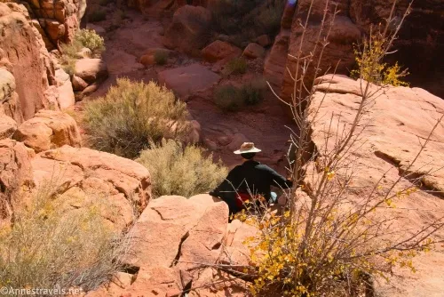
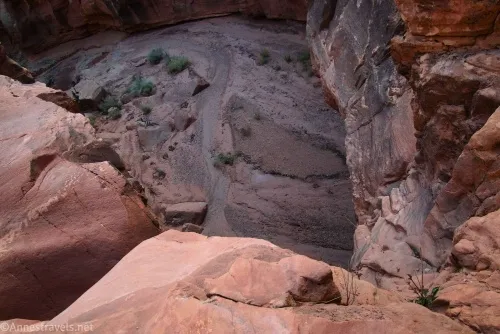
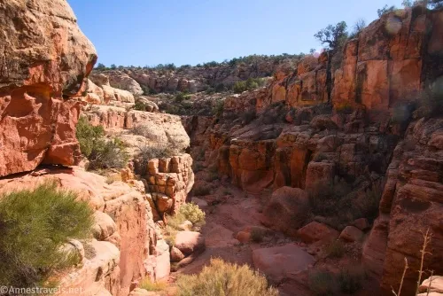
At 2.0 miles from the road, the canyon turns to the right and suddenly drops over a 50ft. dryfall. There is simply no way down this without ropes. We crept close enough to the edge to see into the canyon below, but to be honest, it’s a little freaky.
And that’s it! If you don’t have ropes and climbing experience, retrace your steps to your vehicle. If you have the proper equipment, Roadtrip Ryan has a good writeup about it.
If you want the Cliff Notes version, below the 50ft. dryfall are at least three more drops, the longest of which requires a 200ft. rope. Below the drops are pools and potential narrows.
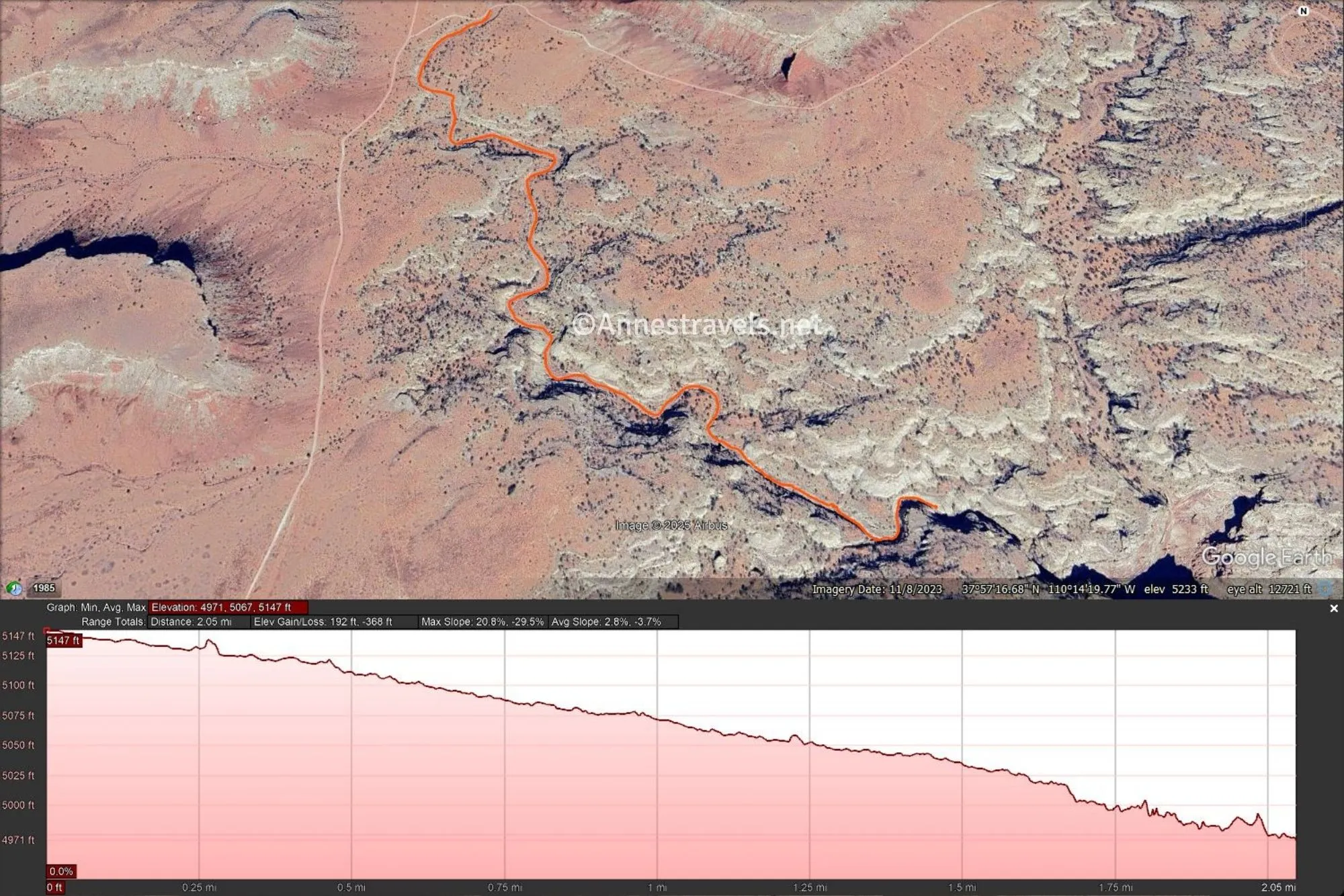
Round Trip Route Length: 4.2 miles
Elevation Gain: 560ft. (5,147ft. to 4,971ft.)
Facilities: None
Fees: None
Trail Notes: This is a fairly easy hike, but it would be hot and airless on a warm day. I was very glad to do it in November during a cold snap. It’s hard to get lost, as there are no sidecanyons to speak of. The views are best on your way back up the canyon, but the rocks on the way down are nice, too.
Trail 
![]()
![]()
![]()
![]()
Road ![]()
![]()
![]()
Signs ![]()
![]()
![]()
![]()
Scenery
Would I go 100 miles out of my way for this? ![]()
Overall Rating: 
![]()
![]()
GPS Coordinates for Cove Canyon
Waterhole Flat Road crosses Cove Canyon: 37.9649590°, -110.2451540° (37°57.89754′, -110°14.70924′ / 37°57’53.8524″, -110°14’42.5544″) (5,149ft.) (0.0)
First dryfall: 37.9506330°, -110.2365480° (37°57.03798′, -110°14.19288′ / 37°57’02.2788″, -110°14’11.5728″) (5,017ft.) (1.75)
Second dryfall: 37.9498140°, -110.2348120° (37°56.98884′, -110°14.08872′ / 37°56’59.3304″, -110°14’05.3232″) (5,001ft.) (2.28) (1.85)
Third dryfall (rope required): 37.9497070°, -110.2320700° (37°56.98242′, -110°13.92420′ / 37°56’58.9452″, -110°13’55.4520″) (4,960ft.) (2.28) (2.01)
The gpx file for Cove Canyon can be downloaded – please note that this and the GPS Coordinates are for reference only and should not be used as a sole resource when hiking this trail.
Download GPX File size: 22.0 KB Downloaded 389 times
(Note: I do my best to ensure that all downloads, the webpage, etc. are virus-free and accurate; however, I cannot be held responsible for any damage that might result, including but not limited to loss of data, damages to hardware, harm to users, from use of files, information, etc. from this website. Thanks!)
Getting to Cove Canyon
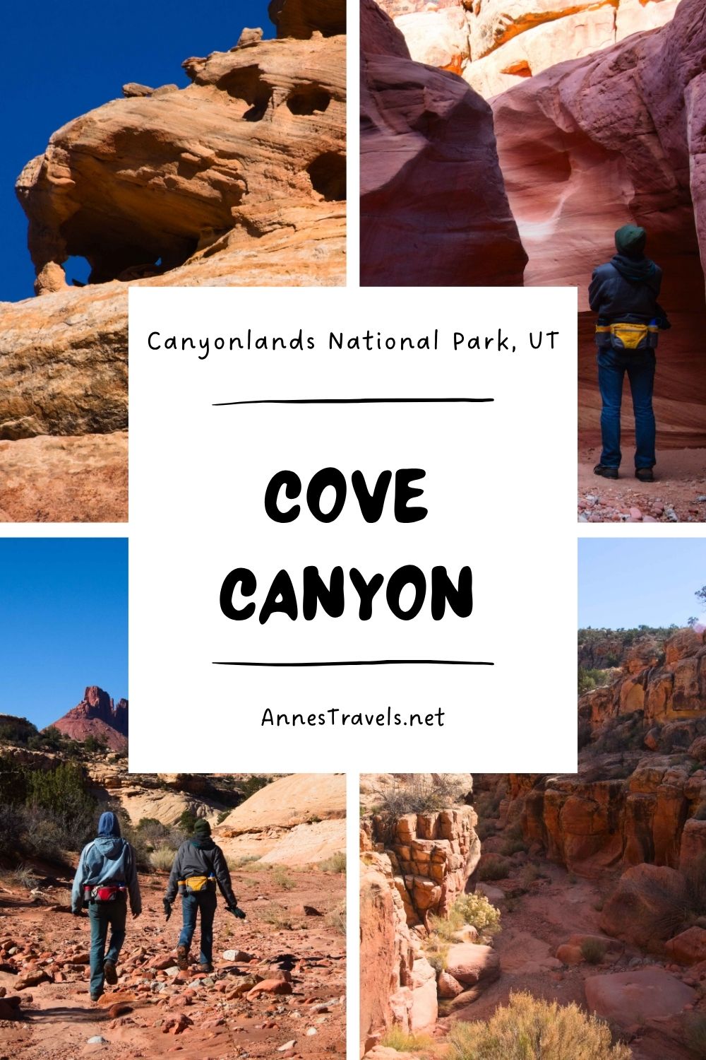
Drive the Waterhole Flat Road for 19.8 miles to where it crosses the Cove Canyon Wash. Park out of the wash and out of the way of traffic. The wash is just after a major road junction, with a sign with a skull and crossbones pointing to the right (you want to go right – the skull and crossbones represents the Poison Spring Canyon Loop, which you’re following until you arrive at Waterhole Flat).
My Favorite Guide to the Maze District
David Day’s book about Canyonlands National Park is my favorite – it covers so many hikes and trails in the park, some of which aren’t covered very well (or at all) in other guides. Buy your copy here, currently $14.99!