

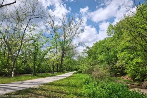
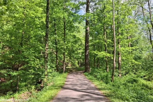
The Ohio and Erie Canal Towpath in Cuyahoga Valley National Park is a gem for bicyclists. I’ve actually now done it twice, once back in 2022 and again this past spring (2025). Both adventures were great, with smooth trails, wildlife, history, views, and simply a fun and fairly easy ride. In fact, the second time, we ended up doing 40 miles – and it really didn’t feel that bad! There’s so much to see along the Cuyahoga Valley Towpath that the miles went by quickly.
Quick Stats
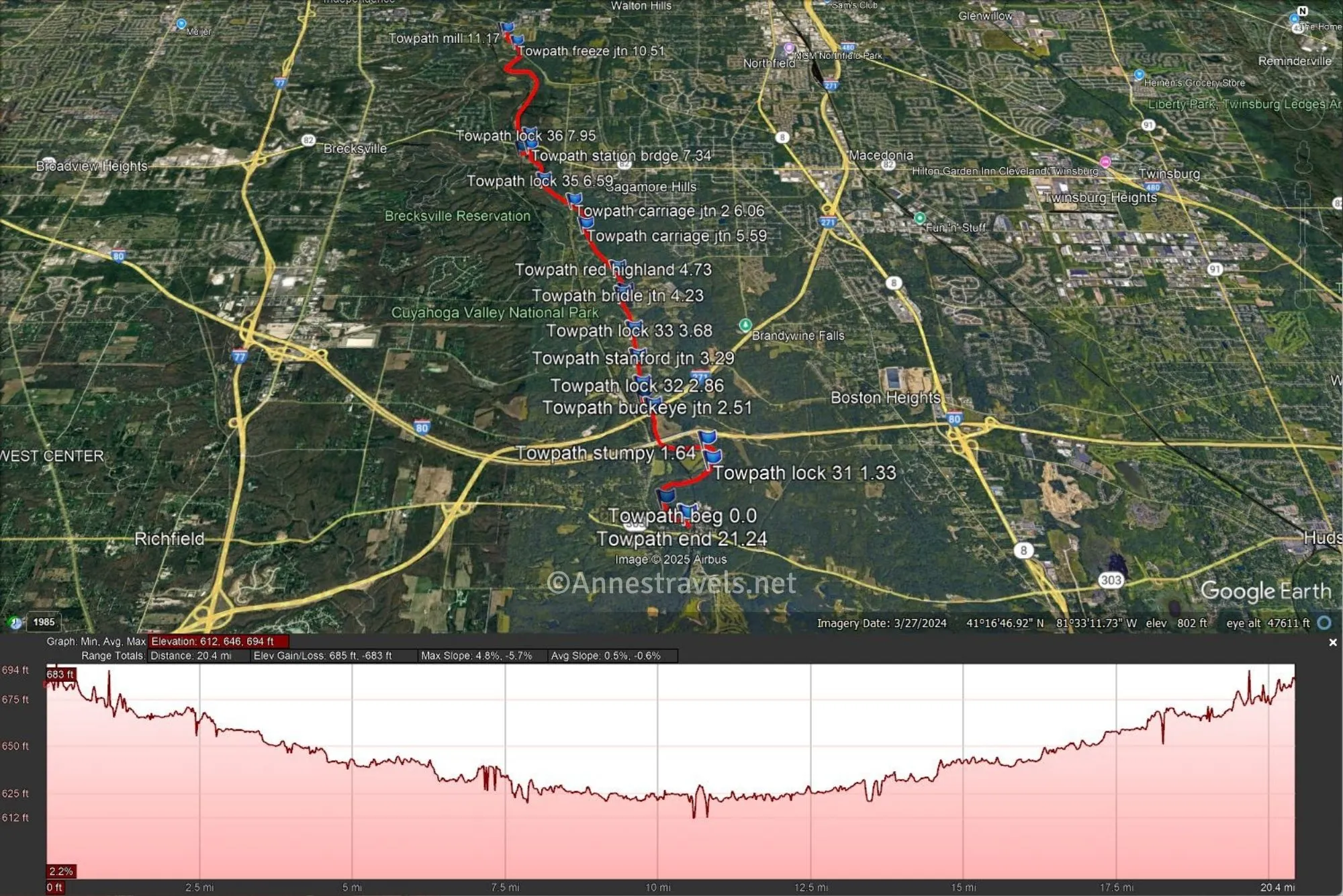
On my first visit to Cuyahoga Valley National Park, we started in Peninsula (Lock 29 between miles 23 and 24), biked down through Boston, stopped at Brecksville Station, and then took my favorite part of the trail north beside a restored section of the canal to end at Fitzwater Road (just north of mile 14). This was a great, leisurely 21-ish mile RT ride that would have been even better if my camera had been working (some of the pictures are blurry, and the lens literally fell off the camera as I was riding back… not-so-fun times. Thankfully, a quick trip to Walmart and a $1.28 repair kit fixed the issue).
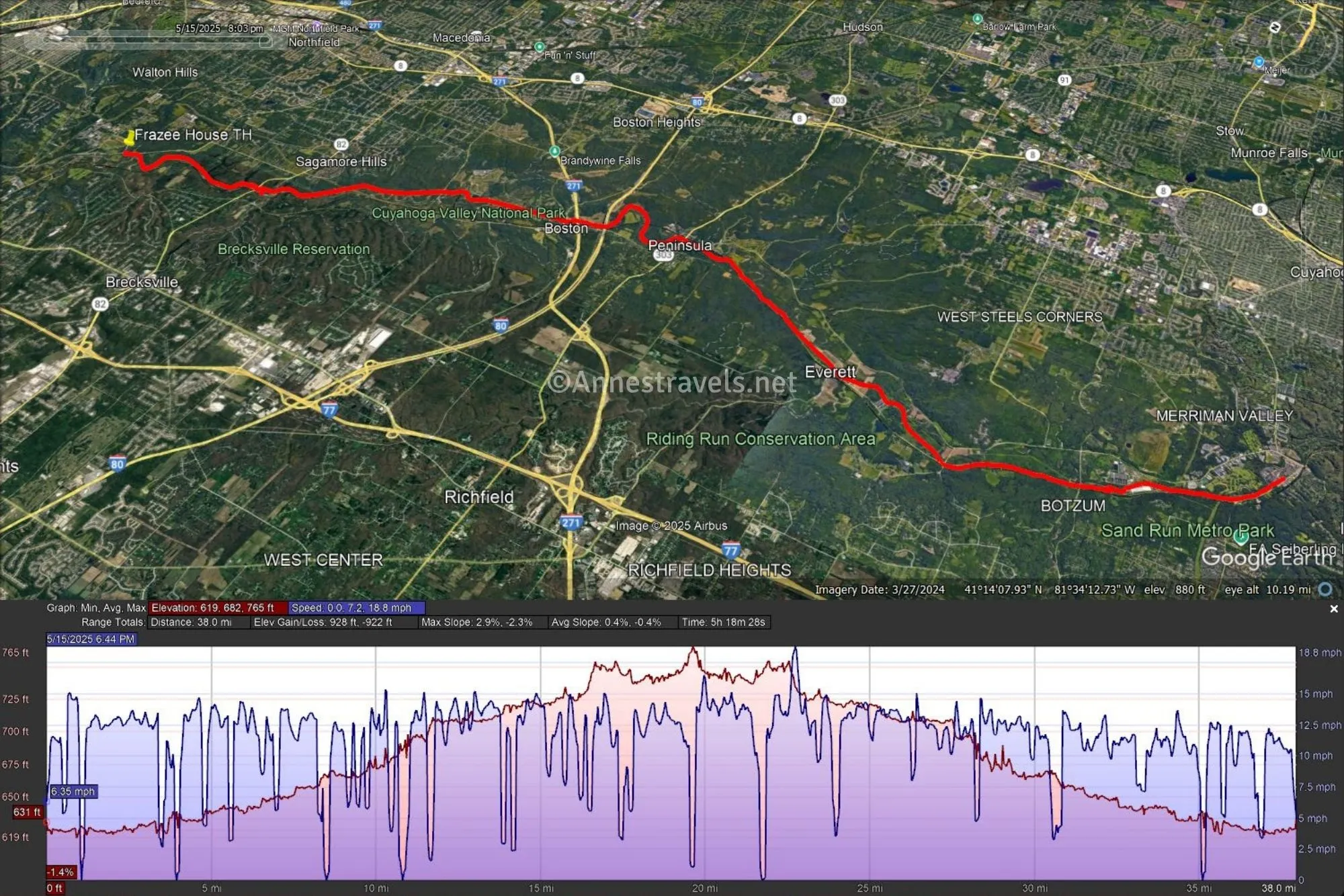
On my second adventure on the Ohio and Erie Towpath, we parked at the Frazee House (no small feat for my van… those parking spaces are tiny!), which might as well be at Fitzwater Road, and then biked south to Weathervane Lane in Akron. The entire ride through Cuyahoga Valley National Park (Fitzwater Road to Botzum Station) was fantastic, with very interesting historical signs and so much to see. As soon as we left the park, it became a bit of a community path – still fine for biking, but nowhere near as exciting or interesting or aesthetically nice as what we’d already seen. So while we went a total of 40 miles from Frazee House to Weathervane Lane, I can only really recommend (aesthetically, at least) the 35 mile RT ride between the Frazee House and Botzum Station.
In this post, I’ll talk about the ride as though I started at Frazee House and went to Weathervane Lane – many people start in Boston (as that’s where the Cuyahoga Valley National Park Visitor Center is located), and you’re welcome to start at any of the other trailheads along the way. Note that as of now (2025), the trail north of Fitzwater Road is closed due to erosion – the path is open again further north (I think north of the Canal Visitor Center, but please check it out for yourself).
From the Frazee House, ride back down the driveway and (carefully!) cross the road. A gravel path on the other side of the road takes you over the canal (which is pretty sickly at this point) and onto the Ohio and Erie Towpath. Turn left. (If you turn right, you’ll fairly quickly come to Fitzwater Road after passing Lock 37 aka Fourteen Mile Lock about mile 14).
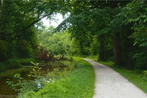
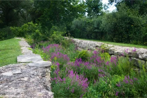
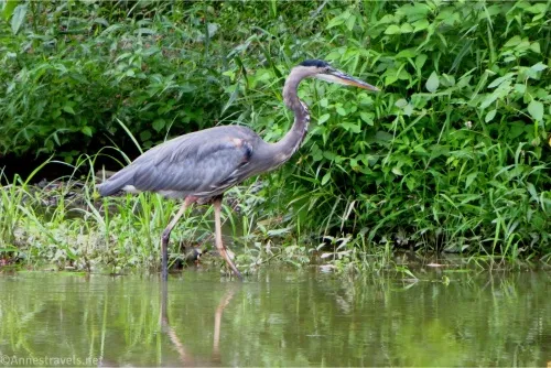
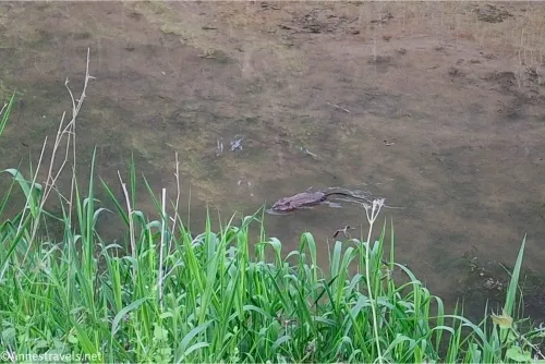
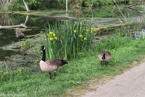
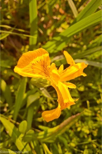
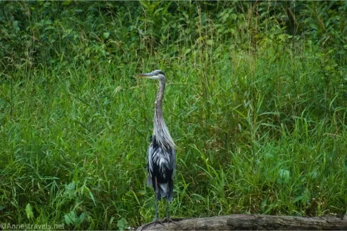
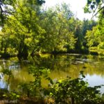
The stretch of the canal towpath between Fitzwater Road and Breckville Station is the best section IMO. The canal here has been restored, so it has water in it, along with a wide variety of wildlife – I saw ducks, Canadian geese, great blue herons, a mink, and even a couple of beavers! (I’m not sure I’ve ever seen a beaver in the wild before!)
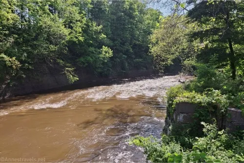
If the wildlife and general lovely ambiance wasn’t enough, in many places, you can see the Cuyahoga River on the side of the path opposite the canal. It’s just so pretty!
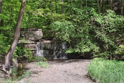
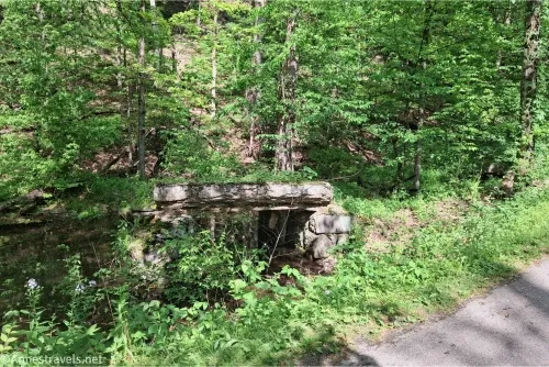
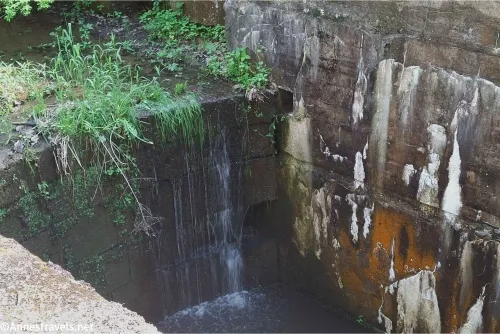
Note that in this section, horse trails loop on and off of the canal path. Give the horses plenty of space, and if you’re riding a horse, keep your eyes open to make sure you take the horse-path-required sections. I also enjoyed a pretty little waterfall at the “Mudcatcher” between mile 16 and mile 17 – the concrete barrier was constructed to keep silt and debris from flowing down into the canal after heavy rains. Lock 36 (Pinery Lock) is shortly after this.
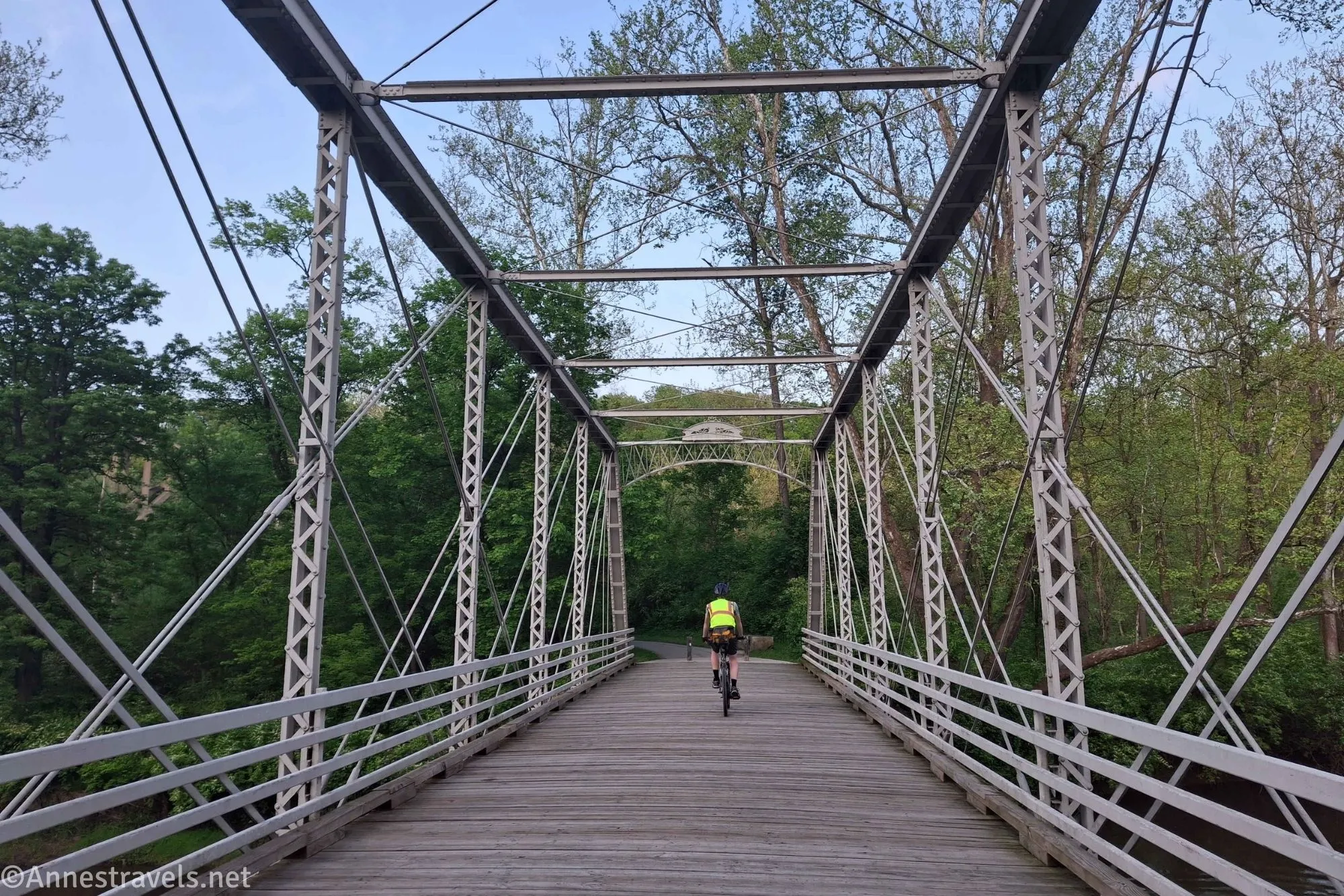
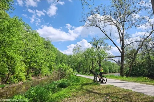
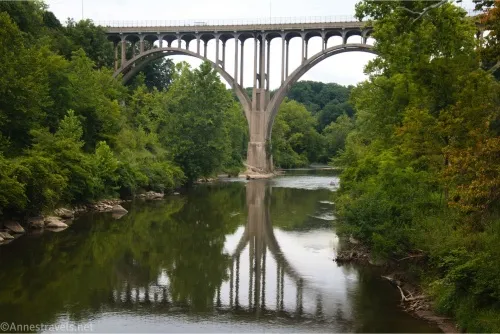
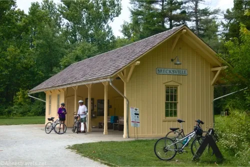
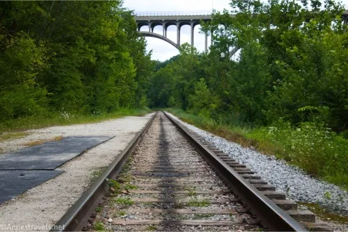
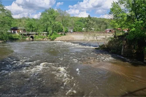
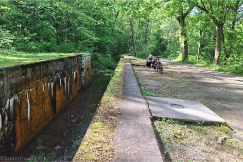
A broad path goes off on the right right about mile 17 – this will quickly lead you to an old bridge over the Cuyahoga River, a crossing of the Cuyahoga Valley Scenic Railroad (look both ways before you cross the tracks!), and the Brecksville Station. Water and flush-toilet restrooms are available here, along with a good-sized parking area. This is a worthy side-trek if for no other reason than to see the huge Brecksville-Northfield Bridge high above the Cuyahoga River Gorge.
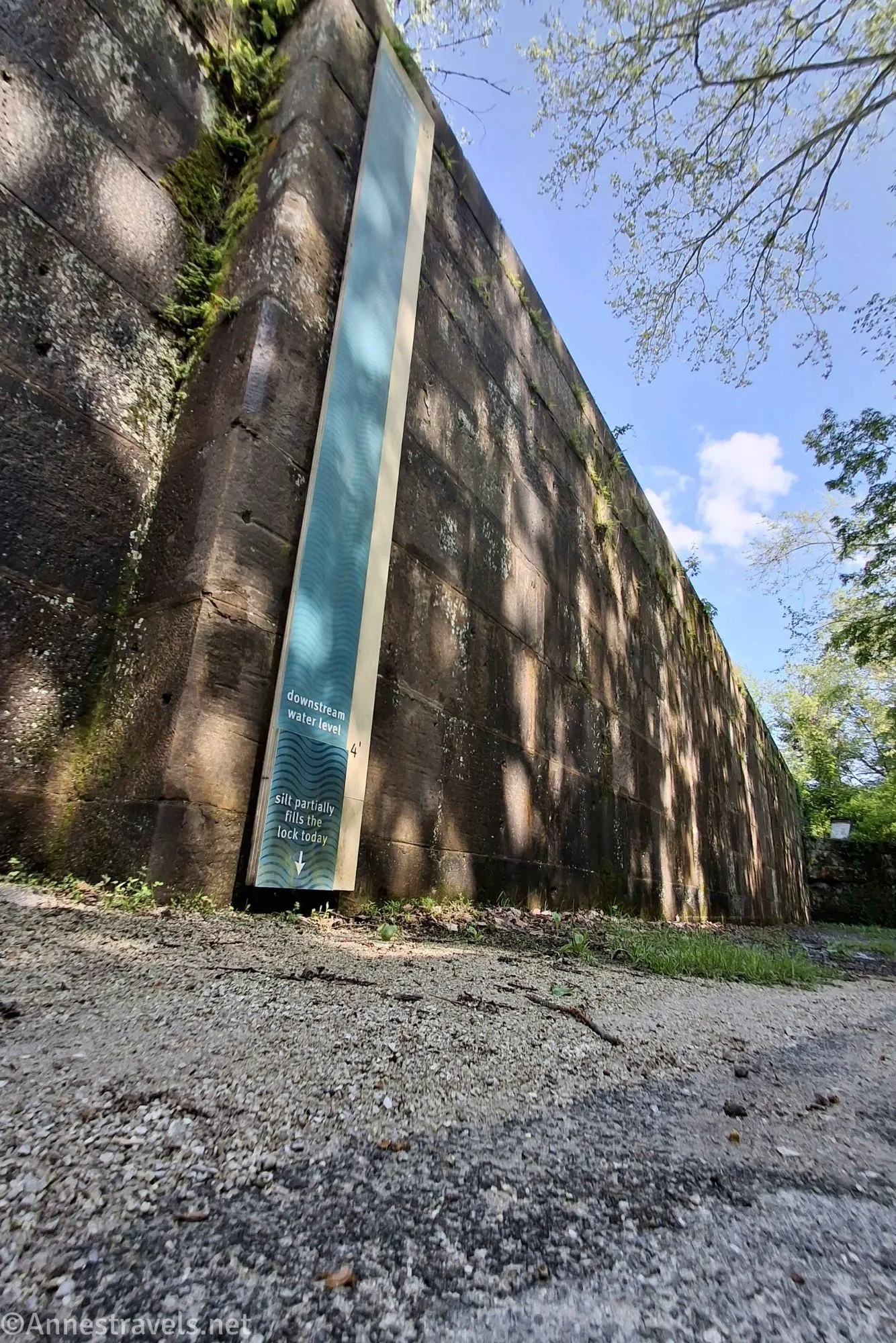
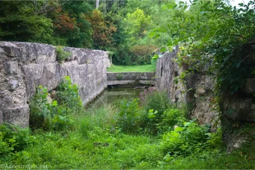
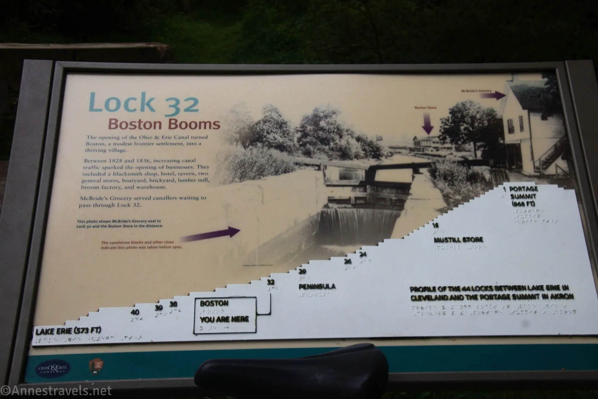
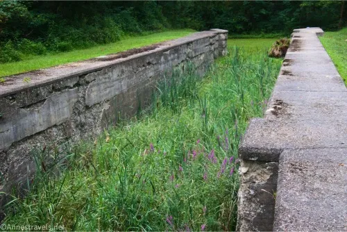
Continuing south, pass the remains of Lock 35 (Whiskey Lock; shortly before mile 18), two junctions for the Old Carriage Trail (both before mile 19), and the Red Lock (Lock 34; shortly before mile 20). Then pass the Old Jaite Mill (with all its history), the Valley Bridal Trail, Lock 33 (Wallace Lock), the Stanford Trail (all before mile 21), and Lock 32 (Boston Lock; very shortly before Boston). All of the locks have very interesting signs; I give Cuyahoga Valley National Park five stars for making their signs something I’d actually want to read!
This part of the trail (down to Boston) is also quite nice. The canal isn’t full of water, but the ambiance is pleasant. It’s also one of the busier sections of trail, so watch out for other cyclists, walkers, hikers, families, etc..
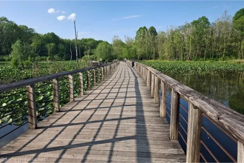
Carefully cross the road in Boston – shops near the trail offer snacks and ice cream, and another path goes off on the right over toward the visitor center. The trees after this fade away, and you’ll ride through a meadow, passing the turnoff for the Buckeye Trail and crossing under I-271 and I-80 around mile 22. Just after this, the hard-packed gravel path (it’s a great surface for riding!) becomes a boardwalk and travels through Stumpy Basin. The area is now a swamp, but at one time, it was a wide place in the canal for boats to tie up or turn around – or simply to wait their turn to unload cargo.
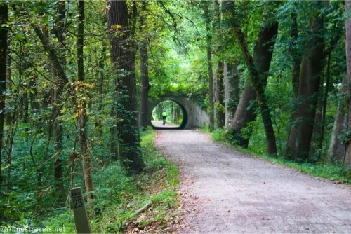
Shortly after Stumpy Swamp is Lonesome Lock (Lock 31) – it was so lonely out here, it was a great place for thieves and other no-accounts to hang out. Continuing south, you get to ride through a round tunnel – definitely neat! – and pass more historic features (including Lock 30 (Peninsula Feeder Lock) halfway between mile 23 and mile 24) before arriving in Peninsula.
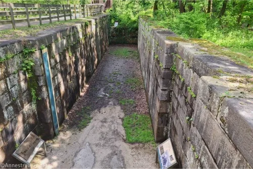
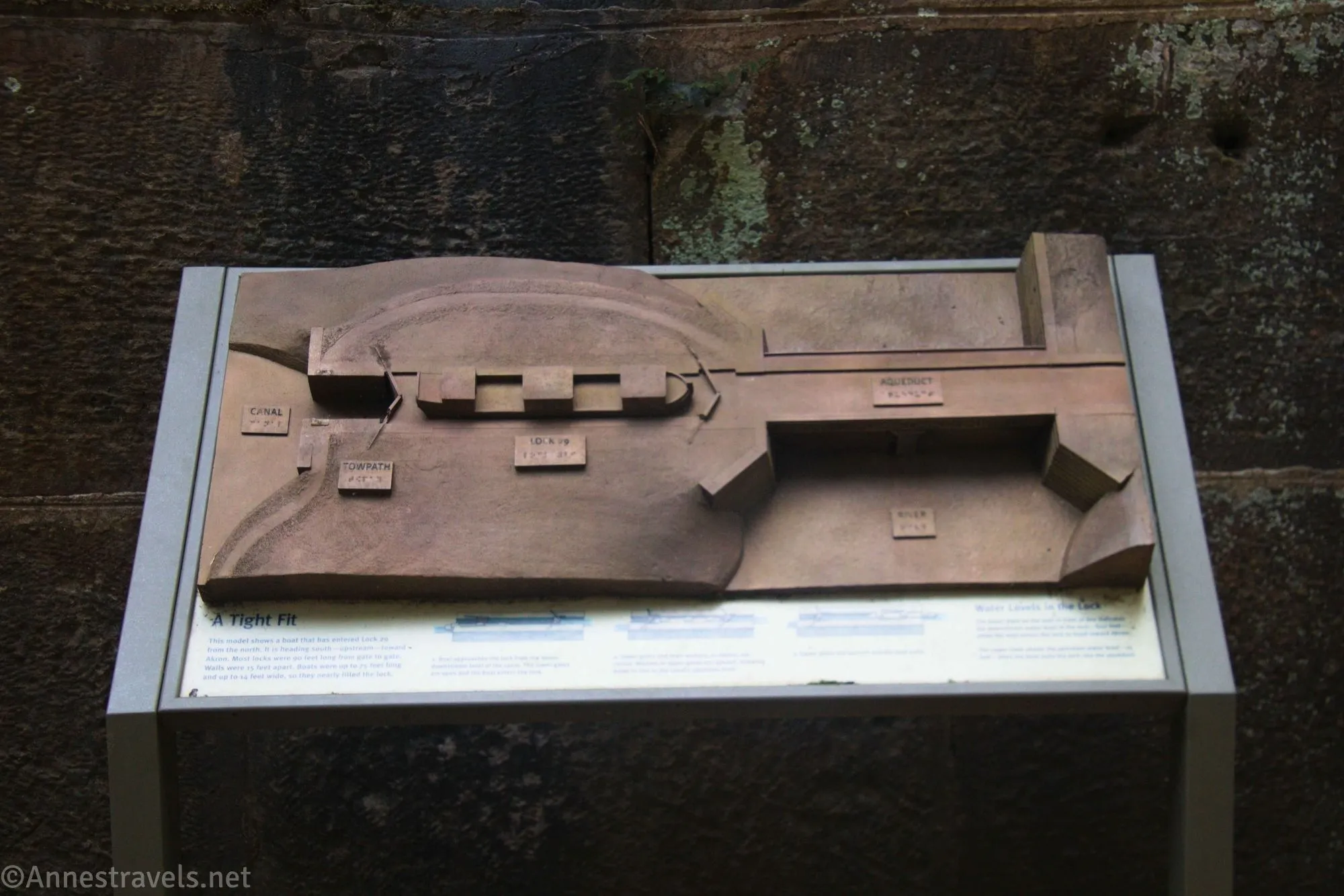
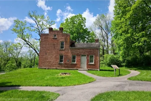
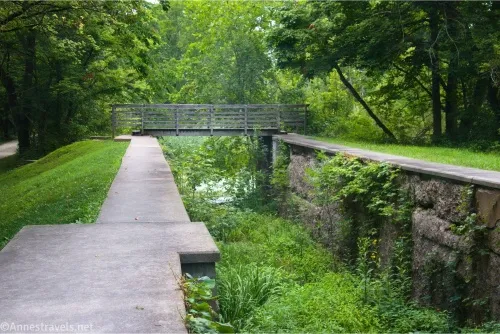
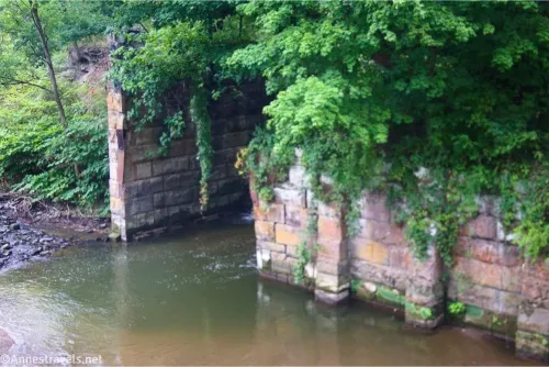
Lock 29 in Peninsula is well worth exploring. If you turn left just before the uphill, you can enter the bottom of the lock. If you go right (which you’ll want to do eventually if you’re continuing south), you get to cross over the lock, ride along the top, then follow the old route and see the old stonework for where the canal crossed the Cuyahoga River via an aqueduct. It’s very interesting and worth a stop!
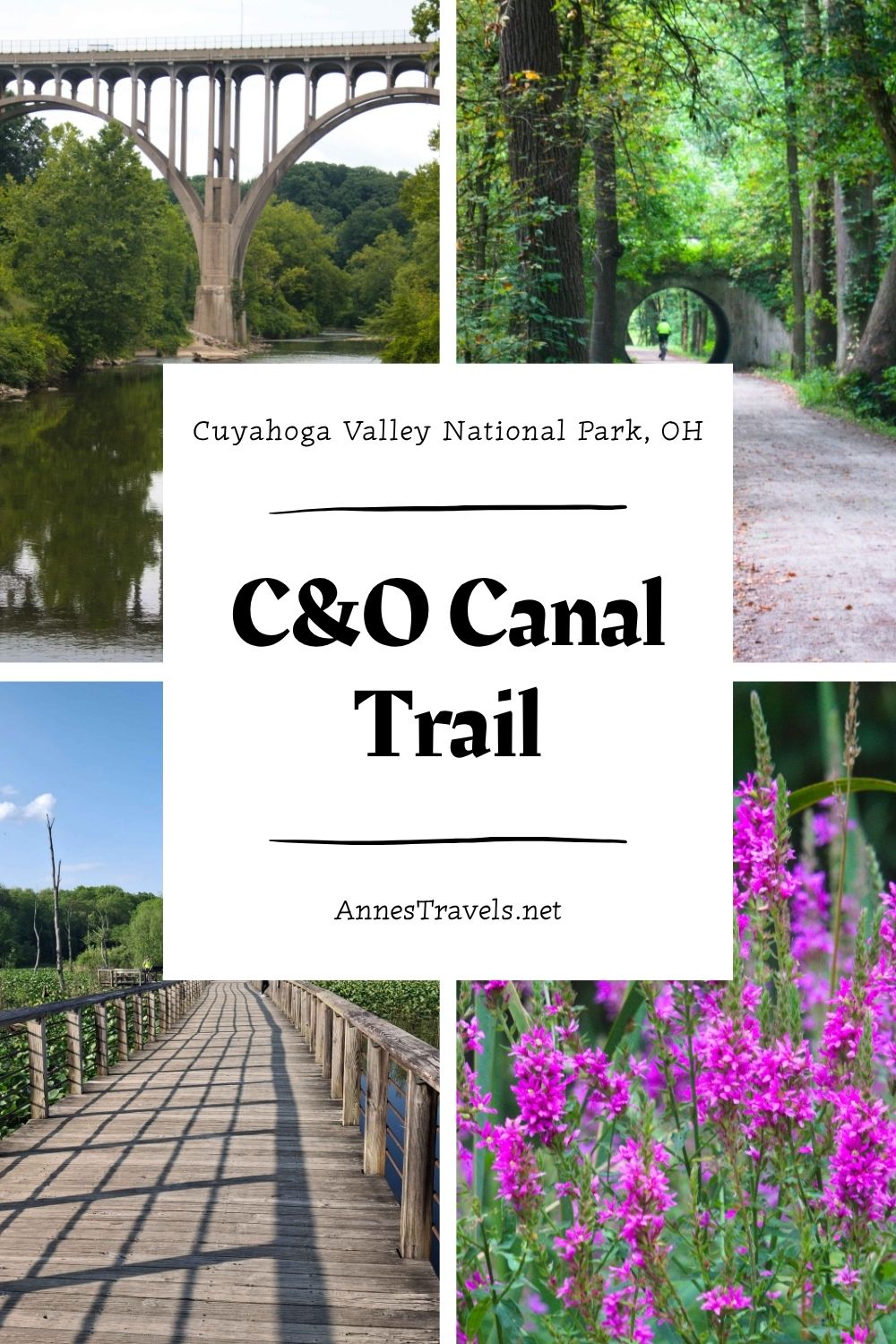
The trail chills after Peninsula. The scenery is mostly heavily wooded, though there are a few peek-a-boo views to the Cuyahoga River and nearby roads. Pass the Deep Lock Quarry Metropark and the Deep Lock (Lock 28, the deepest lock on the canal) between mile 24 and mile 25.
There’s nothing too exciting after this until you get to Johnny Cake Lock (Lock 27) and then the Hunt Farm Visitor Center between miles 26 and 27. The next worthwhile stop is the Beaver Marsh at about mile 28. Again, there’s a boardwalk, and there are typically a lot of birds and other wildlife. It’s also close enough to trailheads (the Ira Trailhead, specifically) that there are quite a few walkers in this section. Use care and signal clearly if you’re going to pass someone.
Just south of the Beaver Marsh is Pancake Lock (Lock 26). There is one “fun” double road crossing just after this at Ira Road, thankfully, drivers seemed to know bikers cross often and are amazingly courteous. Then after mile 29, pass Lock 25 (Mudcatcher Lock) and Lock 24 (Niles Lock). By this point, you’re out of the popular parts of the trail, and it’s more likely to follow a road closely (though it’s still a trail and is separated from said road, so it’s still safe for kids). You also often follow the Cuyahoga Valley Scenic Railway.
Botzum Station (south of mile 30) has a large parking lot and is near the southern boundary of Cuyahoga Valley National Park. This is a great place to turn around, and we ended up sitting at one of the picnic tables to eat our first supper (tuna packets… I forgot tortillas or bread, so we ate them straight out of the packets). If you want to continue south, take a left with the trail to go around the left side of the parking area. Cross the road near the driveway to the parking area and pick up the trail on the other side.
For a bit, the trail is quiet, then it runs behind housing developments, follows a huge pipe, and generally becomes much more urban for still having grass on both sides of the trail. By the time we got to Weathervane Lane, it was definitely urban. I guess the trail wiggles a bit to cross roads, etc., in Akron, but we turned around… 40 miles seemed like plenty to us!
Round Trip Trail Length: Varies; I’ve gone as far as 40 miles. The part through the park is 17.5 miles OW from Frazee House.
Elevation Gain: Varies; the 40-mile ride was 928ft. (619ft. to 765ft.)
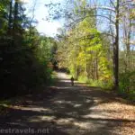
Facilities: Restrooms and water available at Brecksville Station, the Boston Visitor Center, and Peninsula among other places; restrooms are available at several other trailheads, as well, including a pit toilet at both the Frazee House and Botzum Station (see a list of the trailheads here)
Fees: None
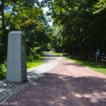
Trail Notes: The path is entirely paved or hard-packed, very small-crushed gravel or boardwalks – all great for bicycling. The speed limit for bicycles is 15mph, and bicyclists yield to all other users, especially horses. Give a clear warning before passing on the left. Pets are welcome but must be on a 6ft. or shorter leash. Headlights are required after dark. For an interactive map of the Ohio and Erie Canal Towpath Trail, click here.
Trail 
Road ![]()
Signs
Scenery ![]()
![]()
![]()
Would I go 100 miles out of my way for this? ![]()
Overall Rating: ![]()
GPS Coordinates from my first bike trip on the Ohio and Erie Canal Path
Beginning in Peninsula: 41.2431200°, -081.5503770° (41°14.58720′, -081°33.02262′ / 41°14’35.2320″, -081°33’01.3572″) (684ft.) (0.0)
Lock 30: 41.2455400°, -081.5541980° (41°14.73240′, -081°33.25188′ / 41°14’43.9440″, -081°33’15.1128″) (681ft.) (0.51)
Lock 31: 41.2518810°, -081.5458800° (41°15.11286′, -081°32.75280′ / 41°15’06.7716″, -081°32’45.1680″) (672ft.) (1.33)
Stumpy Swamp: 41.2552480°, -081.5466800° (41°15.31488′, -081°32.80080′ / 41°15’18.8928″, -081°32’48.0480″) (663ft.) (1.64)
Buckeye Trail Junction: 41.2612360°, -081.5566730° (41°15.67416′, -081°33.40038′ / 41°15’40.4496″, -081°33’24.0228″) (669ft.) (2.51)
Boston: 41.2635300°, -081.5584440° (41°15.81180′, -081°33.50664′ / 41°15’48.7080″, -081°33’30.3984″) (667ft.) (2.71)
Lock 32: 41.2652020°, -081.5587530° (41°15.91212′, -081°33.52518′ / 41°15’54.7272″, -081°33’31.5108″) (663ft.) (2.86)
Stanford Trail Junction: 41.2704190°, -081.5596870° (41°16.22514′, -081°33.58122′ / 41°16’13.5084″, -081°33’34.8732″) (657ft.) (3.29)
Lock 33: 41.2759500°, -081.5605920° (41°16.55700′, -081°33.63552′ / 41°16’33.4200″, -081°33’38.1312″) (654ft.) (3.68)
Bridal Path Junction: 41.2833050°, -081.5632080° (41°16.99830′, -081°33.79248′ / 41°16’59.8980″, -081°33’47.5488″) (651ft.) (4.23)
Old Jaite Mill: 41.2840100°, -081.5625900° (41°17.04060′, -081°33.75540′ / 41°17’02.4360″, -081°33’45.3240″) (650ft.) (4.30)
Red Highland: 41.2890040°, -081.5643800° (41°17.34024′, -081°33.86280′ / 41°17’20.4144″, -081°33’51.7680″) (646ft.) (4.73)
Old Carriage Trail Junction: 41.2991690°, -081.5717380° (41°17.95014′, -081°34.30428′ / 41°17’57.0084″, -081°34’18.2568″) (640ft.) (5.59)
Old Carriage Trail Junction 2: 41.3051480°, -081.5747440° (41°18.30888′, -081°34.48464′ / 41°18’18.5328″, -081°34’29.0784″) (637ft.) (6.06)
Lock 35: 41.3104270°, -081.5819440° (41°18.62562′, -081°34.91664′ / 41°18’37.5372″, -081°34’54.9984″) (635ft.) (6.59)
Station Bridge Junction: 41.3199360°, -081.5860020° (41°19.19616′, -081°35.16012′ / 41°19’11.7696″, -081°35’09.6072″) (636ft.) (7.34)
Brecksville: 41.3191780°, -081.5879500° (41°19.15068′, -081°35.27700′ / 41°19’09.0408″, -081°35’16.6200″) (640ft.) (7.54)
Lock 36: 41.3229740°, -081.5865790° (41°19.37844′, -081°35.19474′ / 41°19’22.7064″, -081°35’11.6844″) (623ft.) (7.95)
Frazee House Junction: 41.3521820°, -081.5931370° (41°21.13092′, -081°35.58822′ / 41°21’07.8552″, -081°35’35.2932″) (623ft.) (10.51)
Lock 37: 41.3567450°, -081.5970550° (41°21.40470′, -081°35.82330′ / 41°21’24.2820″, -081°35’49.3980″) (622ft.) (10.91)
Wilson Feed Mill: 41.3564280°, -081.5961700° (41°21.38568′, -081°35.77020′ / 41°21’23.1408″, -081°35’46.2120″) (627ft.) (11.17)
End: 41.2431660°, -081.5504110° (41°14.58996′, -081°33.02466′ / 41°14’35.3976″, -081°33’01.4796″) (684ft.) (21.24)
I didn’t end up taking any coordinates on my second ride (just a track using the Organic Maps app), but here are the most important points on the trail:
Frazee House: 41.3524750°, -081.5923465° (41°21.14850′, -081°35.54079′ / 41°21’08.9100″, -081°35’32.4474″) (my TH – you can also park at Fitzwater Road (41.3558754°, -081.5991244° (41°21.35252′, -081°35.94746′ / 41°21’21.1514″, -081°35’56.8478″); walk across the bridge and pick up the trail on the east side of the river); it would be easier if you have a large vehicle – parking at the Frazee house is narrow and short)
The Mudcatcher: 41.3241980°, -081.5873890° (41°19.45188′, -081°35.24334′ / 41°19’27.1127″, -081°35’14.6004″)
Botzum Station (lots of parking and the southern border of Cuyahoga Valley National Park): 41.1590401°, -081.5743539° (41°09.54241′, -081°34.46123′ / 41°09’32.5444″, -081°34’27.6740″)
Where I turned around in Akron at Weathervane Lane: 41.1350847°, -081.5533600° (41°08.10508′, -081°33.20160′ / 41°08’06.3049″, -081°33’12.0960″)
The gpx file for the Ohio & Erie Canal Path from Frazee House to Weathervane Lane can be downloaded – please note that this and the GPS Coordinates are for reference only and should not be used as a sole resource when hiking this trail.
Download GPX File size: 395.6 KB Downloaded 382 times
You’re also welcome to download my first trek, from Peninsula to Frizwater Road.
Download GPX File size: 107.1 KB Downloaded 357 times
(Note: I do my best to ensure that all downloads, the webpage, etc. are virus-free and accurate; however, I cannot be held responsible for any damage that might result, including but not limited to loss of data, damages to hardware, harm to users, from use of files, information, etc. from this website. Thanks!)
Getting to the Ohio and Erie Canal Towpath Trailhead in Cuyahoga Valley National Park
There are simply too many trail heads, and the roads around the park are crazy! So instead of trying to write even more words in this very long post, I’ll give you links to some of the main trailheads along the towpath.
Breckville Station Trailhead (Station Road Bridge Trailhead)
Boston Store Trailhead (in Boston; follow the path south and it will connect to the towpath)
Hunt Farm Visitor Center Trailhead
Discover more bike trails in the Midwest
More than 70 rails-to-trails feature in this guide to Ohio, Indiana, and Illinois. Buy your copy here (affiliate link; there is no extra cost to you).

More Related Posts:
 Beautiful Keuka Outlet Trail!
 Genesee Valley Greenway – Oakland to Letchworth
 Great Allegheny Passage: Salisbury Viaduct to the Mason-Dixon Line
 Genesee Riverway – Ontario Beach Park, Turning Point Park, & Maplewood Park
 Erie Canal: Meridian Center (Rochester) to San Souci Park (Brockport)
 Genesee Valley Greenway-Lehigh Valley Trail Loop in Rochester!