

Back in 2014, I took my first bike trip on the Genesee Valley Greenway. It was a fantastic ride between Mt. Morris and the Brookdale Preserve just south of Rochester, New York. We passed through farmland, crossed plenty of creeks on both railroad-era and newer bridges, and even took a pretty side trek to get around a small closure. Then in 2019, I did a second section ride from Oakland, New York to Letchworth State Park (basically, as far as possible toward Portageville). And in 2020, I did the section between the towns of Fillmore and Belfast. Between the three rides, I’d done most of the continuous route (not all of the Genesee Valley Greenway is currently open to bikers due to missing bridges, private property, etc., but it grows every year). At that point, I just needed to complete the northernmost section – the part between the Brookdale Preserve and the Erie Canal Path.
Quick Stats
Note: Some of the links in this post are affiliate links. If you click one and purchase something, I may earn a small commission without an extra cost to you.
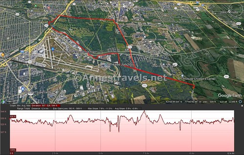
We ended up turning it into a loop – the Brookdale Preserve up to the Erie Canal Path; the Erie Canal Path over to the northern terminus of the Lehigh Valley Trail (Rochester Spur), and then the Lehigh Valley Trail down to Brighten-Henrietta Townline Road/Jefferson Road just long enough to get back on the Genesee Valley Greenway. (A lot of information, but I think locals will follow!) We also found an old turntable and roundhouse along the way, which was super cool!

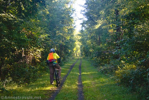
We started out at the Brookdale Preserve on Brook Road, just off Scottsville Road. Heading north, it’s about 1.5 miles up to Ballantyne Road (aka Jefferson Road just to the east). Be sure to look for old telegraph poles along the route.

To simply continue on the Genesee Valley Greenway without interruption or excitement, turn right on Ballantyne Road up to the first major intersection (traffic light) and turn left on Scottsville Road. You’ll pick up the paved trail just after crossing the railroad tracks. However, doing this detour will make you miss out on the coolest feature along this section of trail, so we continued straight on the traditional Genesee Valley Greenway Trail.
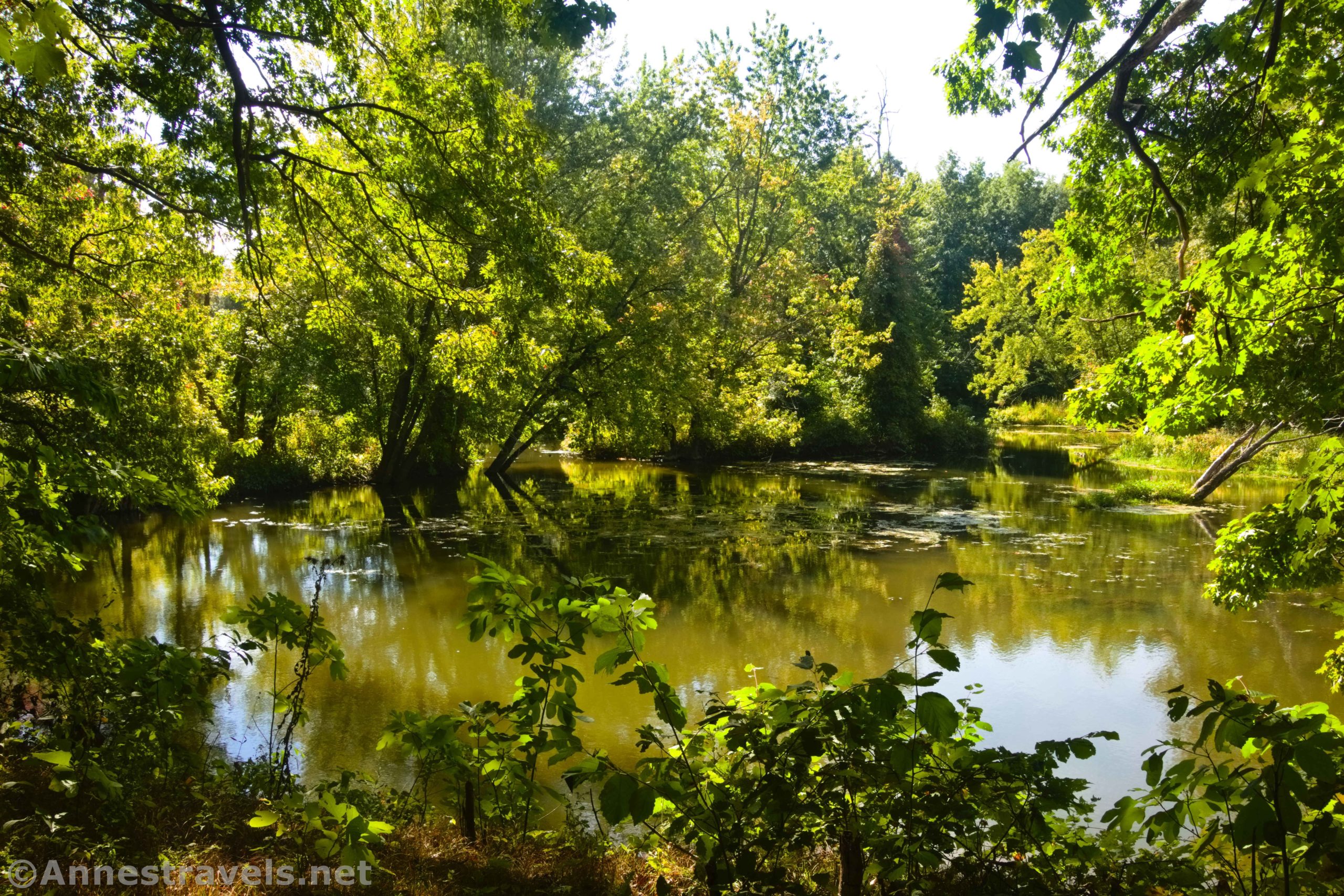
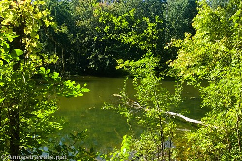
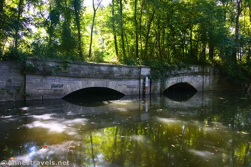
About 0.3 miles beyond the road, you’ll come to the bridge over Black Creek. It’s actually much more impressive from the creek than from the trail (see the pictures from my kayak on Black Creek to see what I mean). But you can see Black Creek, and a moth-eaten sign talks about the railway, the construction of the “culvert” (bridge – it’s technically called the Black Creek Culvert since it carried the Genesee Valley Canal over the creek), and more.
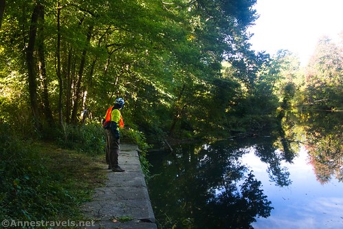
If you continue beyond the Black Creek Culvert, you’ll end up at the railroad tracks after 0.2 miles. These tracks are active and are owned by CSX. Do NOT go out on the railroad tracks – not only is it illegal, but it’s also highly dangerous. You’re supposed to go back out to Ballantyne Road, turn east (left if you’re coming back from the culvert back toward the Brookdale Preserve), turn left (north) on Scottsville Road (at the light) and then pick up the paved path again just on the other side of the railroad tracks. We scuttled along the right-of-way beneath the power lines and out to Scottsville Road (I have no idea how legal this is, so I don’t recommend it).
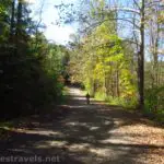
After the railroad tracks, a paved path on the left (west) side of Scottsville Road is the trail. After about a half a mile, the trail turns left into Black Creek Park to pick up the old railroad grade again (yay!). Life chills a little as the trail loops around to travel along Scottsville Road once again. About half a mile beyond Black Creek Park, the trail crosses Scottsville Road at the light for Paul Road. When I rode the trail in the fall of 2021, I had to go across the parking lot and pick up the trail (pretty easy, really, since there was a classic yellow gate marking the trail). I see from more recent photos (fall 2022) that they’ve created a crosswalk and a trail directly from the road so you don’t have to through the parking area. Yay!
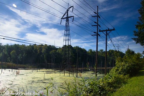
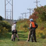
Enjoy the fact that the craziness of following the trail is over! You just need to keep going on the paved path as it takes you past views of the airport control tower and occasional views into the backyards of the businesses along Scottsville Road (if you see something strange, it’s probably the Rochester Fire Academy).

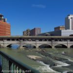
About 1.75 miles after crossing Scottsville Road, you’ll pass under I-390 and come to the Erie Canal. Things can be a little bit confusing in this area since it’s the junction of the Genesee Valley Greenway (northern terminus), the Erie Canal Path (both east and west), and the Genesee Valley Riverway. I wanted to go east on the Erie Canal Path to pick up the Lehigh Valley Trail (Rochester Spur), so I followed the signs for the Genesee Riverway Trail (north) over the bridge across the Erie Canal. Then, on the other side, I stayed on the trail a short distance to turn right on the bridge across the Genesee River and into Genesee Valley Park. At the base of the bridge, turn right and follow the path as best as possible to the Erie Canal Path. Wow! More complicated than you’d think!

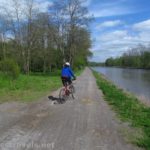
Keep going not quite half a mile to the point where you’ll turn onto the Lehigh Valley Trail. At this point, the Lehigh Valley Trail is unassuming; you’ll just turn right (south) on an old rail bridge. I don’t think I even saw a sign. The bridge crosses the Erie Canal and I-390 and then the gravel path goes south to cross East River Road after 0.4 miles and Crittenden Road 0.8 miles later. Along the way, you might get a glimpse of swamps and industry.

About 1.9 miles south of the Erie Canal Path, the Rochester Spur of the Lehigh Valley Trail ends suddenly at Brighton-Henrietta Town Line Road. You’ll have to turn right here for a quarter mile down to Jefferson Road (crossing over the railroad tracks for CSX and near the Livonia, Avon, and Lakeville Railroad).
Turn right on Jefferson Road (at the light). While Brighton-Henrietta Townline Road had a sidewalk, Jefferson Road lacks one on the right side for a while. The shoulder is adequate, but traffic can be heavy, so I’d have appreciated it being wider. Cross over the Genesee River and return to where the Genesee Valley Greenway crosses Ballantyne Road (Jefferson turns into Ballantyne on the other side of the Genesee) about mile 10.2. Turn left, and you’ll be back to the Brookdale Preserve 1.5 miles later!

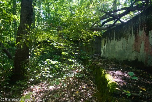
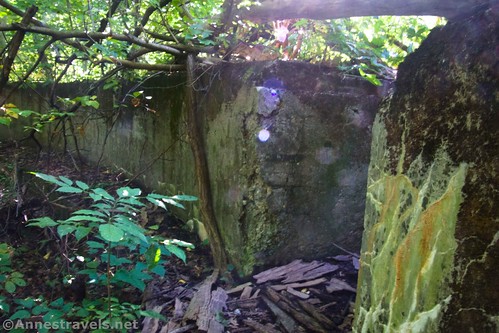
Except… we hadn’t found the old turntable at Genesee Junction. I knew it was around; I’d seen photos online and even knew generally where it should be (the most specific I’ll get is that it’s between Black Creek and the railroad tracks, about 100 yards west of the trail). So we trucked back up the Greenway to the culvert to see what we could find!

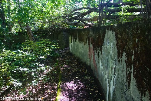
Once I figured out where it was, the old turntable pit wasn’t too hard to discover. The place is overgrown (watch out for poison ivy; there is some in the area though it’s not too bad), but it’s in amazingly good condition and vandals haven’t desecrated it too badly (let’s keep it that way, ok?)

We walked all of the way around the outside of the concrete walls of the old turntable pit. I hear it was a yard and junction point for the Rochester & Southern Railroad, the Baltimore & Ohio Railroad/Buffalo, Rochester & Pittsburg Railway, Pennsylvania Railroad, and CSX. Further research suggests that it was a major interchange point for the B&O/BR&P between the coal fields in Pennsylvania and trains heading for New England. Someone found the date “1910” stamped on the concrete, but I sadly didn’t see it.
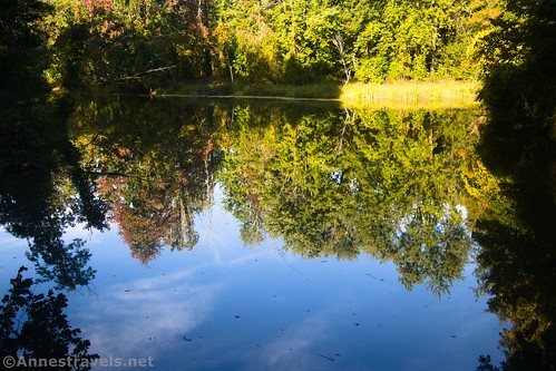
I tiptoed my way back to the main path, mostly avoiding the poison ivy, for one more look into Black Creek before returning to the parking area!
Round Trip Trail Length: My ride would have been 11.7 miles if I hadn’t gone back to the culvert. As it was, I went 13.4 miles.
Elevation Gain: About 589ft. (507ft. to 544ft.)
Facilities: There should be restrooms and picnicking in Genesee Valley Park. Sometimes some of the parking areas have port-a-potties but don’t count on it.
Fees: None
Trail Notes: There are a lot of turns in this loop. It would be nicer with fewer road sections, but that’s how it goes. Parts of the Genesee Valley Greenway have been closed recently for resurfacing, so it should be in pretty good shape at this point. Remember to leave everything as you found it (except to pick up trash) and don’t deface anything historical you might find.
Trail 
![]()
Road ![]()
Signs ![]()
![]()
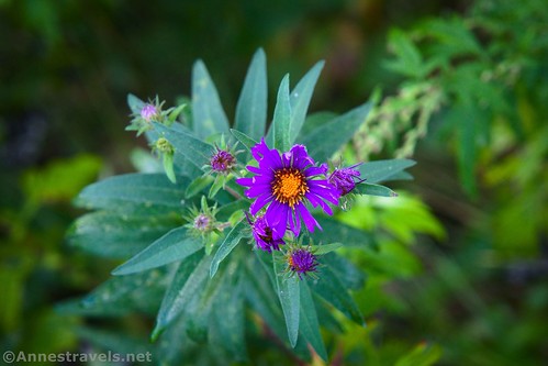
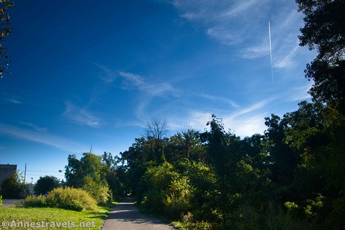
Scenery ![]()
![]()
![]()
Would I go 100 miles out of my way for this? ![]()
![]()
Overall Rating: ![]()
![]()

GPS Coordinates for the Genesee Valley Greenway/Lehigh Valley Trail Loop
Parking area near Brookdale Preserve: 43.077343000, -77.710109000 (43°04.64058′, -077°42.60654′ / 43°04’38.4348″, -077°42’36.3924″) (503ft.) (0.0)
Ballantyne Road: 43.093550000, -77.691500000 (43°05.61300′, -077°41.49000′ / 43°05’36.7800″, -077°41’29.4000″) (526ft.) (1.49)
Culvert (historic bridge): 43.097528000, -77.687239000 (43°05.85168′, -077°41.23434′ / 43°05’51.1008″, -077°41’14.0604″) (534ft.) (1.84)
Railroad Tracks: 43.098431000, -77.686299000 (43°05.90586′, -077°41.17794′ / 43°05’54.3516″, -077°41’10.6764″) (531ft.) (2.00)
Scottsville Road: 43.098431000, -77.686299000 (43°05.90586′, -077°41.17794′ / 43°05’54.3516″, -077°41’10.6764″) (535ft.) (2.47)
Black Creek Park: 43.105533000, -77.677127000 (43°06.33198′, -077°40.62762′ / 43°06’19.9188″, -077°40’37.6572″) (530ft.) (3.04)
Pick up trail: 43.108597000, -77.674119000 (43°06.51582′, -077°40.44714′ / 43°06’30.9492″, -077°40’26.8284″) (536ft.) (3.51)
Erie Canal Path: 43.121424000, -77.644881000 (43°07.28544′, -077°38.69286′ / 43°07’17.1264″, -077°38’41.5716″) (521ft.) (5.25)
North end of the Genesee Valley Greenway: 43.122657000, -77.639805000 (43°07.35942′, -077°38.38830′ / 43°07’21.5652″, -077°38’23.2980″) (528ft.) (5.57)
North end of the Lehigh Valley Trail (spur to Rochester): 43.122657000, -77.639805000 (43°07.35942′, -077°38.38830′ / 43°07’21.5652″, -077°38’23.2980″) (541ft.) (6.14)
Road crossing: 43.113953000, -77.637236000 (43°06.83718′, -077°38.23416′ / 43°06’50.2308″, -077°38’14.0496″) (536ft.) (6.46)
Road crossing: 43.113953000, -77.637236000 (43°06.83718′, -077°38.23416′ / 43°06’50.2308″, -077°38’14.0496″) (527ft.) (7.26)
Brighten-Henrietta Townline Road: 43.093582000, -77.649274000 (43°05.61492′, -077°38.95644′ / 43°05’36.8952″, -077°38’57.3864″) (526ft.) (8.02)
Jefferson Road: 43.092943000, -77.653630000 (43°05.57658′, -077°39.21780′ / 43°05’34.5948″, -077°39’13.0680″) (523ft.) (8.26)
Return to the Greenway: 43.092943000, -77.653630000 (43°05.57658′, -077°39.21780′ / 43°05’34.5948″, -077°39’13.0680″) (522ft.) (10.19)
End: 43.098250000, -77.690145000 (43°05.89500′, -077°41.40870′ / 43°05’53.7000″, -077°41’24.5220″) (531ft.) (13.45)

The gpx file for the Genesee Valley Greenway/Lehigh Valley Loop can be downloaded – please note that this and the GPS Coordinates are for reference only and should not be used as a sole resource when hiking this trail. Also, note that I have removed my trek to the old turntable in order to (hopefully) keep the riff-raff out – I apologize for any inconvenience this may cause to law-abiding citizens.
Download GPX File size: 33.9 KB Downloaded 511 times
(Note: I do my best to ensure that all downloads, the webpage, etc. are virus-free and accurate; however, I cannot be held responsible for any damage that might result, including but not limited to loss of data, damages to hardware, harm to users, from use of files, information, etc. from this website. Thanks!)
Getting to the Brookdale Preserve
From the north, take I-390 to Exit 17 toward Scottsville Road. Turn right to go south on Scottsville Road for 4.7 miles. Turn right onto Brook Road (not quite 2 miles south of where Jefferson Road turns into Ballantyne Road) for 0.2 miles to the small gravel parking area on the right.
From I-90, take Exit 46 onto I-390N toward Rochester. Take the first exit onto NY-253 (also known as Lehigh Station Road). Turn left to travel west for 2.5 miles. Turn right onto E River Road for another 2.5 miles; turn left onto Jefferson Road to cross over the Genesee River. Take an immediate left onto Scottsville Road for 1.8 miles to Brook Road, on the right. Turn onto Brook Road for 0.2 miles to the small gravel parking area on the right.
This Week’s Featured Product!
This is a fantastic resource for bikers who love trails and live near Rochester, New York! I’ve used it for a number of adventures, and it’s great. Get your copy here.

More Related Posts:
 Genesee Riverway and Erie Canal Path: History via Bikes
 Genesee Valley Greenway – Oakland to Letchworth
 Erie Canal: Meridian Center (Rochester) to San Souci Park (Brockport)
 Beautiful Keuka Outlet Trail!
 Genesee Riverway – Ontario Beach Park, Turning Point Park, & Maplewood Park
 Genesee Valley Greenway – Fillmore to Belfast