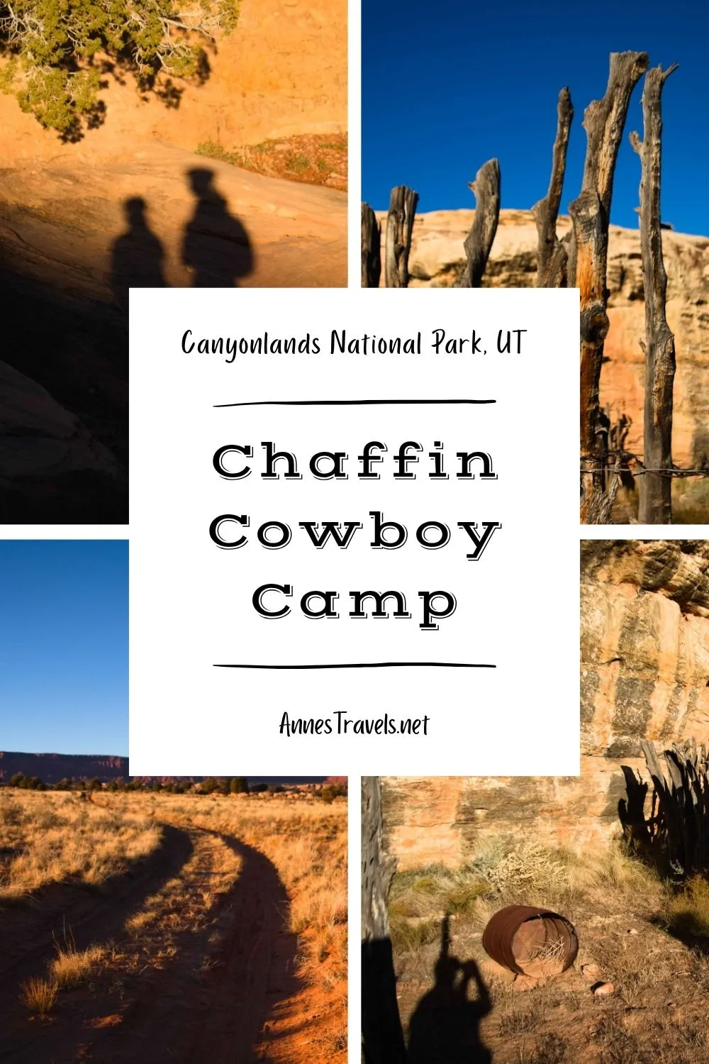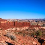

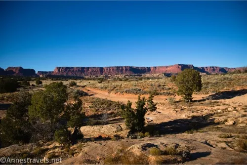
You can drive to the Chaffin Cowboy Camp on Waterhole Flat (almost) in the Maze District of Canyonlands National Park, Utah. However, it’s more fun to bicycle or hike the access road to fully appreciate the views. (My hiking companions tell me that any hike with a grassy meadow is my favorite, and while that may be true, this meadow also has distant but very beautiful views of rock formations.) Whether you drive or hike, you can also hike down Waterhole Canyon to the first major dryfall (300ft. at the least, probably more). It’s not a long trek, but if you’re looking for hikes in the Maze District, it is one place to get some interesting history and a canyon along the way to other destinations like the Dollhouse, Sunset Pass, or the Maze Overlook/Harvest Panel.
Quick Stats
This post contains affiliate links. If you click a link and purchase something, I may receive a small commission. Thank you for supporting Anne’s Travels!
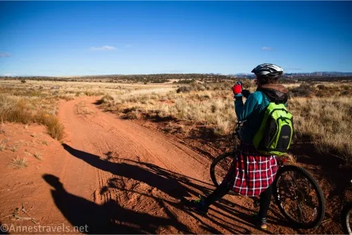
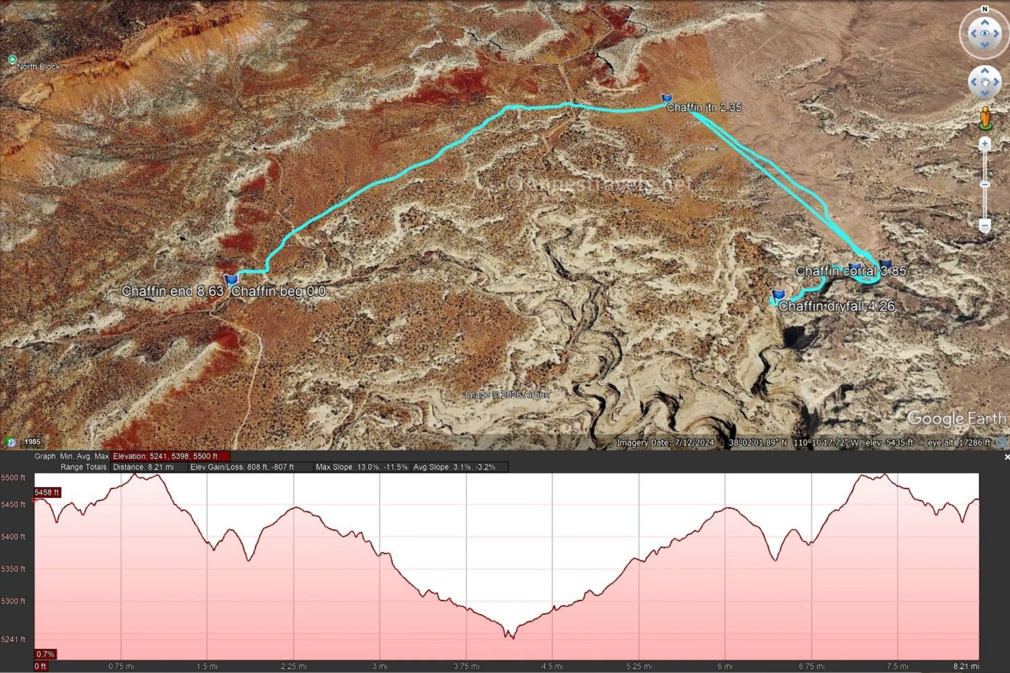
I ended up bicycling the access road simply because we didn’t feel like driving any further. We hadn’t picked up permits for camping in the Maze (my loss, I know) so we were stuck camping outside the boundary of the Orange Cliffs District (good thing others before us have been in the same quandary!) We ended up parking just to the BLM side of the cattle guard and “no camping zone” signage (there’s a parking pulloff there, after all) and biking the 2.2 miles to the turnoff (on right and unmarked) for the Cowboy Camp.

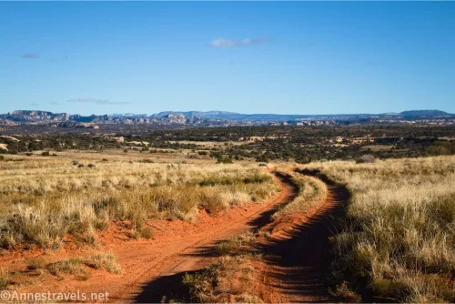
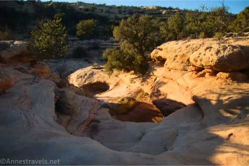
0.0 Sideroad to Chaffin Cowboy Camp on the east side of the Waterhole Flat Road (5,446ft.). Drive (or bike, or hike) south on the slightly overgrown dirt road. Views are very nice across Waterhole Flat and well beyond to mountains and cliffs. While the road itself is not 4×4, a hump in the middle of the road makes high clearance a must. The road rises slightly before descending to a low area near a pond. (38.044660°, -110.159048°)
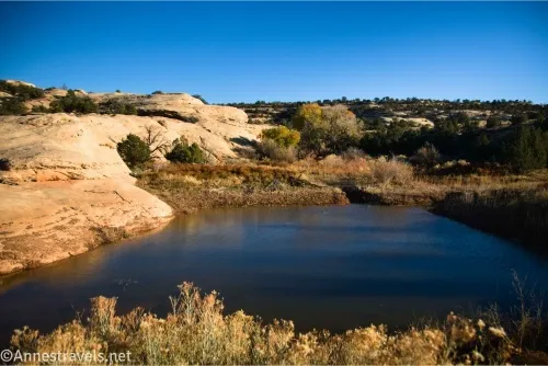
1.3 End of Road (5,309ft.). The road ends near a water collection pond, created by damming up part of nearby Waterhole Canyon’s wash. This is the end of the road, but you can explore on foot (and you probably want to explore if you want to see anything besides the pond!). (38.030914°, -110.147171°)
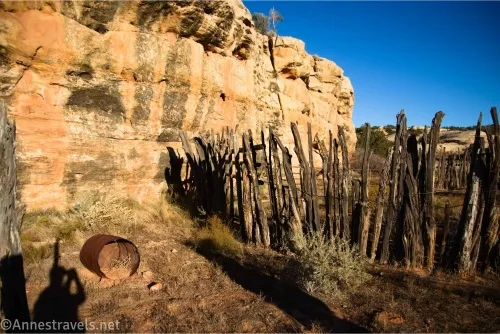
The Chaffin family ranched extensively in what is now the Maze District. It was a hard life, and the father and various sons made a living not only by ranching, but also by helping neighbors for pay and guiding prospectors, explorers, and early tourists to the area. They also named many of the features in the Maze, including Lou’s Spring and Sweet Alice Canyon (named for the father and mother, respectively), Clell’s Spring (named for a son), and many more. This was one of their more frequently used camps because of the ready water supply.
0.0 End of Chaffin Cowboy Camp Road (5,314ft.). Take the route or trail west down the slickrock and into the wash. (Away from the pond – there are trails that lead to the pond, too.) Turn right (south) down the wash until you reach the old corral. (38.030861°, -110.147168°)
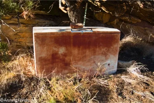
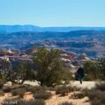
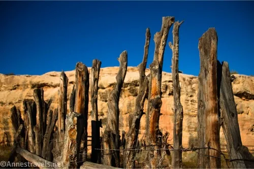
0.15 Old corral (5,295ft.). There isn’t much left of the cowboy camp, despite its long occupation. A tent cabin was made on the southern side of the canyon. There are still a few bits and pieces of junk here and there, including an old Sears & Roebuck freezer. You’re welcome to turn around here, or you can continue downcanyon – the excitement is over unless you like dramatic dryfalls. (38.030359°, -110.149055°)
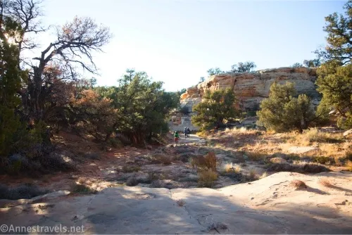
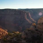
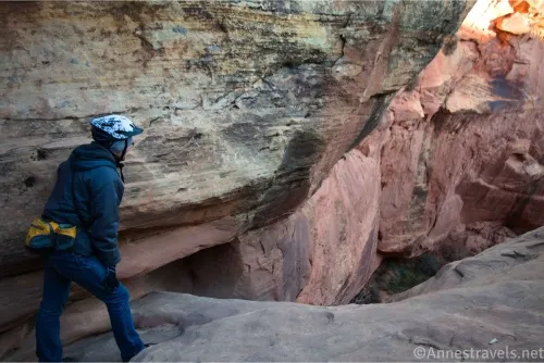
0.25 Overhang (5,293ft.). An overhang on the right (north) side of the wash should be explored – two early visitors (1897) etched their names into a rock beneath the overhang. (Do not in any way deface the rock – writing on the rock is illegal now.) I don’t know who Ella Butler and Geo. E. Felton were, but they left their mark here. Sadly, despite looking for the overhang, I missed it, so hopefully the names still exist. Just before reaching the lip of the massive dryfall, there are several smaller dryfalls. We gave up and walked along the left side of the canyon to get a view of the larger dryfall. (38.031242°, -110.150115°)
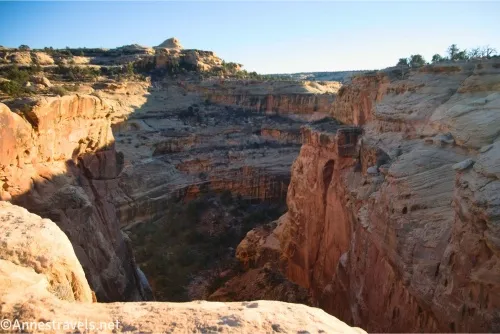
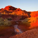
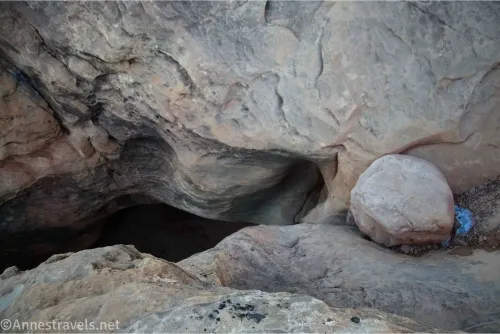
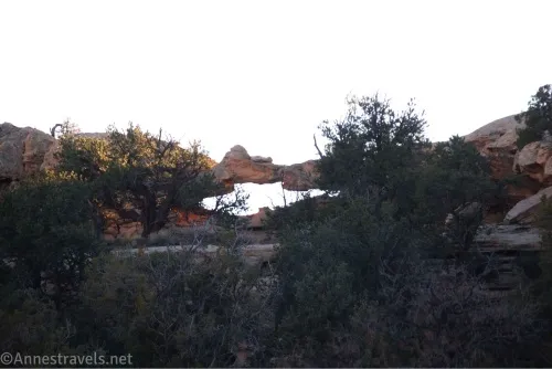
0.6 Lip of dryfall (5,253ft.). Downcanyon hiking ends here. The dryfall is massive; we guessed 300-500ft. in vertical drop. There are a few smaller drops before the biggest one, but they’re hard to see from this side of the canyon. You can walk back upstream far enough to cross above the dryfalls to see them from the other side. If you look up on the cliffs to the west, you may spot an arch. We were able to scramble down into the canyon just above the largest drop (the 300+ ft. one)… now that will make your stomach flip! When you’re finished exploring, retrace your steps to your vehicle. (38.028698°, -110.154706°)
Round Trip Trail Length: Just to the corral and back is 0.3 miles; the entirety of the non-technical part of Waterhole Canyon would be 1.2 miles RT. Including the access road and exploring, I went about 3.8 miles (actually 8.6 miles if you include biking from the cattleguard!)
Elevation Gain: Just the corral and Waterhole Canyon is 172ft. (5,314ft. to 5,248ft.).
Facilities: None
Fees: None
Trail Notes: If you’d like to read more about the Chaffin family, one of the sons gave Canyonlands National Park two interviews, which you can read here for free – they’re very interesting, but be ready for some cowboy language (not quite a sailor, but you get the idea). The area is hot and dry in the summer, but it was cold and icy when I visited during a cold snap in November. Remember to leave everything exactly as you found it. Wet weather quickly makes the roads deteriorate, so try to visit when the roads are dry.
Trail 
![]()
![]()
![]()
Road ![]()
![]()
![]()
Signs ![]()
![]()
![]()
![]()
Scenery ![]()
![]()
Would I go 100 miles out of my way for this? ![]()
![]()
![]()
Overall Rating: ![]()
![]()
![]()

GPS Coordinates for the Chaffin Cowboy Camp
These were taken on my bike ride/hike, so they reflect mileages, etc., from there rather than the more accurate coordinates above.
Entering Orange Cliffs Sign: 38.0293220°, -110.1889330° (38°01.75932′, -110°11.33598′ / 38°01’45.5592″, -110°11’20.1588″) (5,461ft.) (0.0)
Chaffin Cowboy Camp Road Junction: 38.0446590°, -110.1589900° (38°02.67954′, -110°09.53940′ / 38°02’40.7724″, -110°09’32.3640″) (5,450ft.) (2.35)
Road end: 38.0307380°, -110.1470940° (38°01.84428′, -110°08.82564′ / 38°01’50.6568″, -110°08’49.5384″) (5,317ft.) (3.60)
Corral: 38.0305510°, -110.1491290° (38°01.83306′, -110°08.94774′ / 38°01’49.9836″, -110°08’56.8644″) (5,300ft.) (3.85)
Dryfall: 38.0288150°, -110.1545220° (38°01.72890′, -110°09.27132′ / 38°01’43.7340″, -110°09’16.2792″) (5,262ft.) (4.26)
End: 38.0293310°, -110.1889080° (38°01.75986′, -110°11.33448′ / 38°01’45.5916″, -110°11’20.0688″) (5,460ft.) (8.63)

The gpx file for the Chaffin Cowboy Camp Road can be downloaded – please note that this and the GPS Coordinates are for reference only and should not be used as a sole resource when hiking this trail.
Download GPX File size: 16.9 KB Downloaded 187 times
The gpx file for the Chaffin Cowboy Camp and Waterhole Canyon can be downloaded – please note that this and the GPS Coordinates are for reference only and should not be used as a sole resource when hiking this trail.
Download GPX File size: 12.1 KB Downloaded 179 times
(Note: I do my best to ensure that all downloads, the webpage, etc. are virus-free and accurate; however, I cannot be held responsible for any damage that might result, including but not limited to loss of data, damages to hardware, harm to users, from use of files, information, etc. from this website. Thanks!)
Getting to the Chaffin Cowboy Camp Trailhead
Drive the Waterhole Flat Road for 29.2 miles to an unmarked sideroad on the right. Park nearby (out of the way of traffic) or turn right to drive down the one-lane dirt road to the water collection pond.

The Best Guide to Canyonlands National Park
If you’re looking for history, hikes, and drives in the Maze (or in the rest of Canyonlands National Park), this is the best resource I’ve found. Buy your copy here.