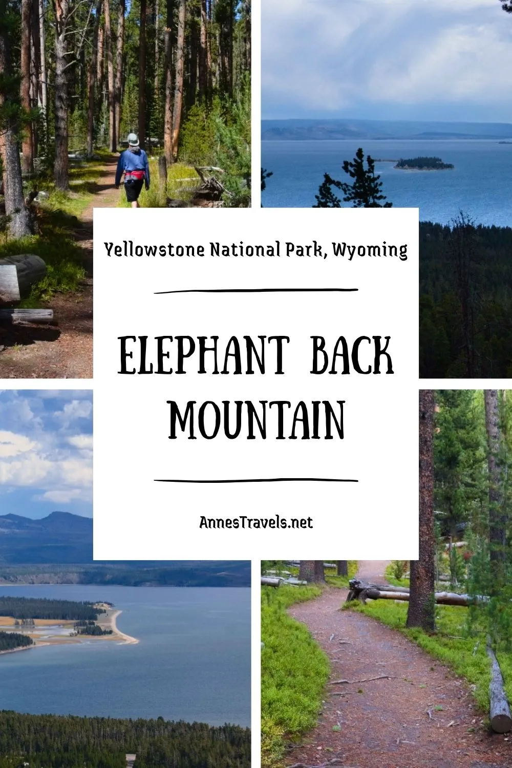

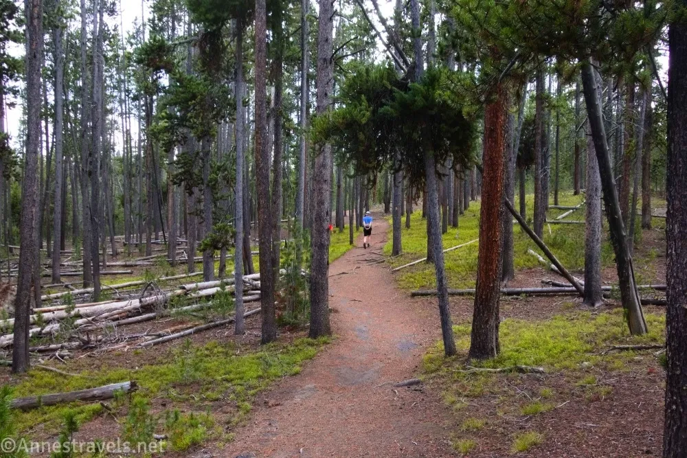
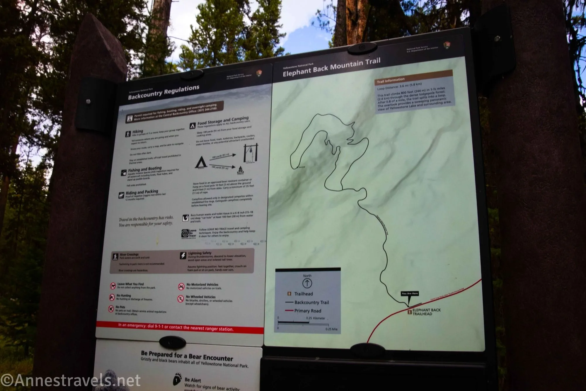
Elephant Back Mountain is one of two semi-famous overlooks of Yellowstone Lake between West Thumb and Fishing Bridge. The trail is a great hike in Yellowstone National Park, but it’s also steep and has limited views except at the viewpoint, itself. That all said, the rocks on the way down are very interesting to see. So while I recommend the Yellowstone Lake Overlook in West Thumb (shorter and with a better view), Elephant Back Mountain is a great alternative if you don’t want to drive so far south. And besides, the name is much more exciting!
Quick Stats
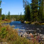
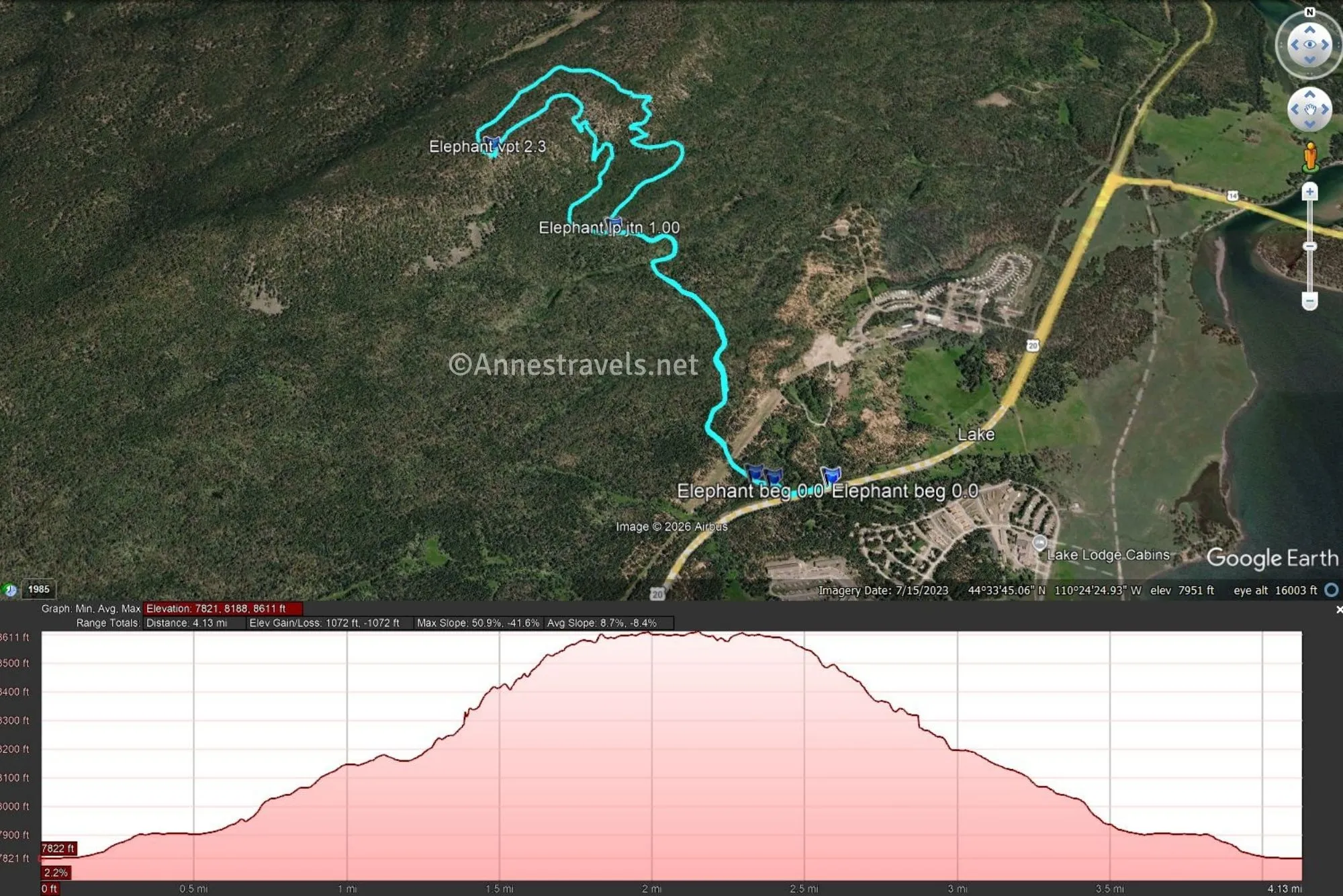
0.0 Elephant Back Mountain Trailhead (7,822ft.). The trailhead is unassuming (just a sign beside a pulloff), but it is marked. Walk left along the road or (better) on the trail just inside the forest. (44.5567600°, -110.4017280°)
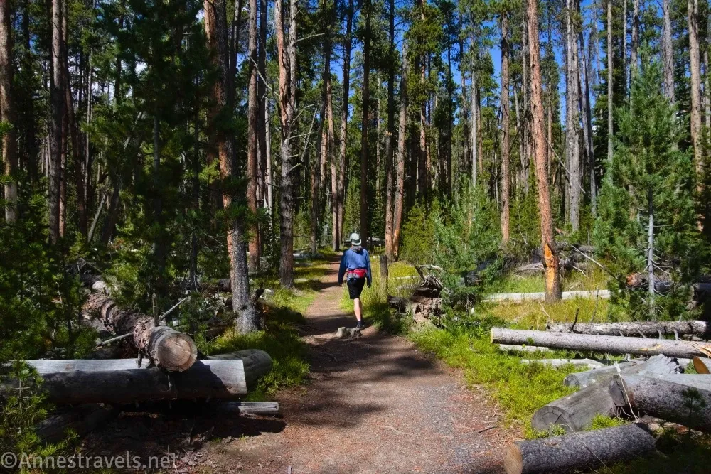
0.1 Trail Sign (7,826ft.). This is where you turn away from the road to begin on the trail. You’ll be heading through the woods in a generally northward direction (with your back to Yellowstone Lake, if you have a good sense of direction). (44.5567220°, -110.4036290°)
0.15 Trail Junction (7,832ft.). The left trail goes to Employee Housing. Continue right (north) through the trees. (44.5568440°, -110.4042240°)
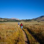
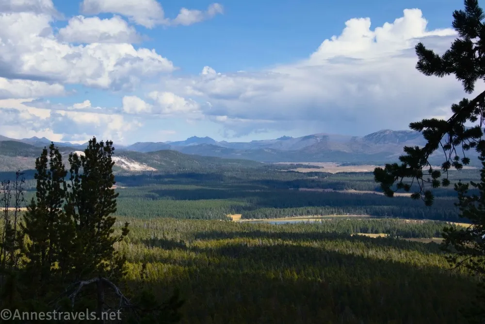
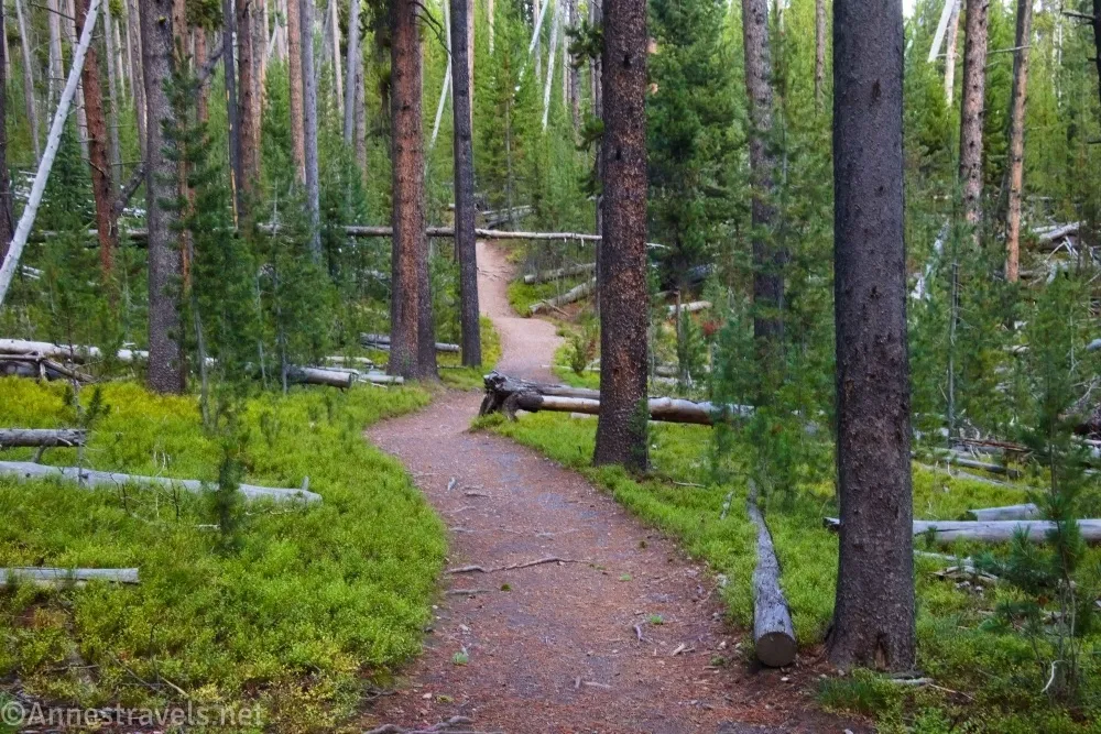
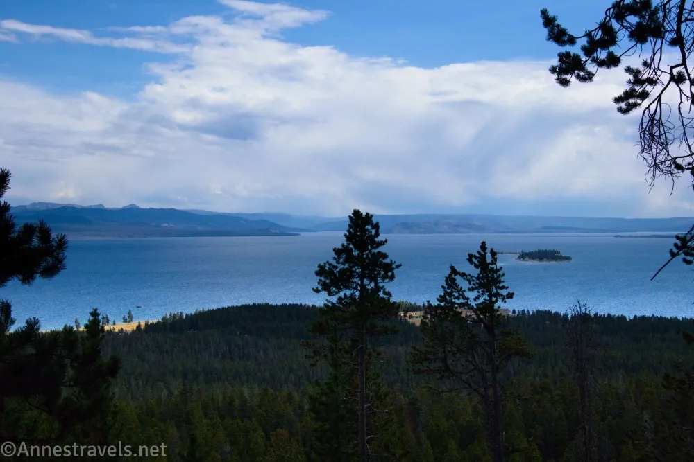
1.0 Loop Junction (8,124ft.). You can go either direction here; I opted to go right. Both sides of the trail are very steep, though I’d guess the left side (my return route) is slightly steeper. I figured we could go across the top of the mountain (which is tree-covered) first, which meant that we got the views on our way out and the fun rocks on our way back down. Turning right, the trail almost immediately begins to climb steeply uphill… and continues to climb for quite some time! At the end of one of the final switchbacks, there is a reasonable if a little peek-a-boo view down to Yellowstone Lake and the surrounding area. Keep following the trail through the trees as it crests and then continues over Elephant Back Mountain and descends to the overlook. (44.5646530°, -110.4091730°)
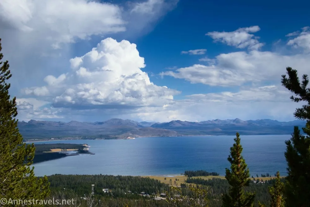
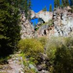
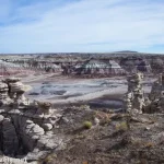
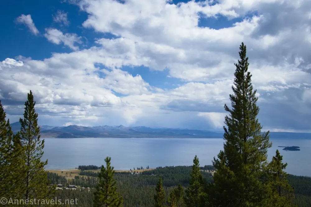
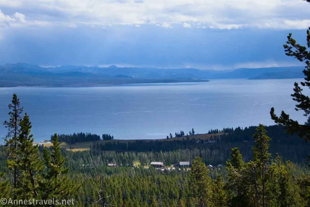
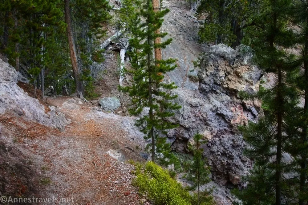
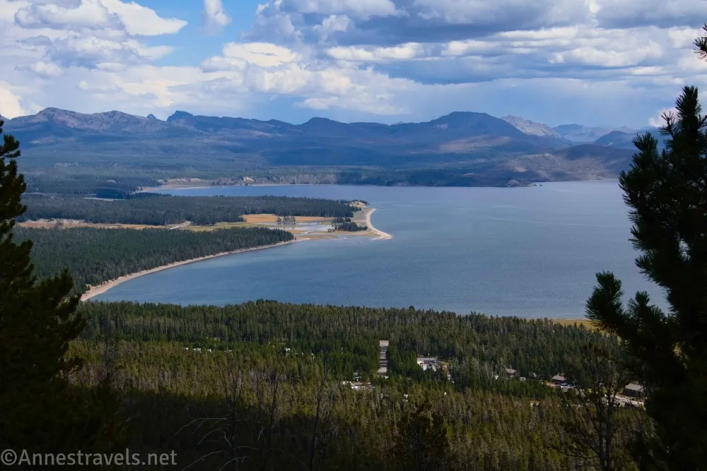
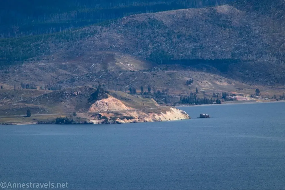
2.3 Overlook (8,603ft.). This is the one good view on the trail, so be sure to enjoy it! There are quite a few logs for benches. I descended the hill slightly to get away from the “crowds” (three or four other groups). The views over Yellowstone Lake are spectacular to the mountains of eastern Yellowstone National Park, but you can also see where the lake empties into the Yellowstone River and much more. When you’re finished admiring the view, continue along the trail to begin the descent back to the parking area. At first, the trees are similar to what you have seen all along, but then the view changes to a neat area of rocks. It’s not spectacular by any means, but it sure is more interesting than trees! (44.5666140°, -110.4139770°)
3.4 Return to the loop junction (8,128ft.). Turn right to return to the parking area, being sure to turn left at the junction for the Employee Housing, then turning left to walk back along the road toward your vehicle. (44.5646980°, -110.4092380°)
4.3 Elephant Back Mountain Trailhead (7,822ft.). (44.5567810°, -110.4017570°)
Round Trip Trail Length: I went 4.3 miles
Elevation Gain: 1,072ft. (7,821ft. to 8,611ft.)
Facilities: None
Fees: $35/vehicle, valid 7 days. America the Beautiful National Parks and Federal Public Lands Passes and Yellowstone Annual Passes are accepted.
Trail Notes: I’ve already said what I think about all the trees, but in case you missed it, this is a forest hike with two views. Neither of them are on top of the mountain, just along the way. The trail is steep on both sides of the loop, but I’d guess the left (western) side of the loop is slightly steeper – which would make me want to go up it, because I prefer to go up steeply than down steeply! The left side of the loop also has some very interesting rocks. Views are best in the afternoon as the views face east.
Trail 
![]()
![]()
Road ![]()
Signs ![]()
![]()
Scenery ![]()
Would I go 100 miles out of my way for this? ![]()
![]()
Overall Rating: 
![]()
Elephant Back Mountain
TH: 44.5567600°, -110.4017280° (44°33.40560′, -110°24.10368′ / 44°33’24.3360″, -110°24’06.2208″) (7,822ft.) (0.0)
Sign: 44.5567220°, -110.4036290° (44°33.40332′, -110°24.21774′ / 44°33’24.1992″, -110°24’13.0644″) (7,826ft.) (0.12)
Junction (to employee housing): 44.5568440°, -110.4042240° (44°33.41064′, -110°24.25344′ / 44°33’24.6384″, -110°24’15.2064″) (7,832ft.) (0.16)
Loop Junction: 44.5646530°, -110.4091730° (44°33.87918′, -110°24.55038′ / 44°33’52.7508″, -110°24’33.0228″) (8,124ft.) (1.00)
Viewpoint: 44.5666140°, -110.414.3 39770° (44°33.99684′, -110°24.83862′ / 44°33’59.8104″, -110°24’50.3172″) (8,603ft.) (2.3)
Return to the Loop Junction: 44.5646980°, -110.4092380° (44°33.88188′, -110°24.55428′ / 44°33’52.9128″, -110°24’33.2568″) (8,128ft.) (3.37)
End at TH: 44.5567810°, -110.4017570° (44°33.40686′, -110°24.10542′ / 44°33’24.4116″, -110°24’06.3252″) (7,822ft.) (4.34)
The gpx file for Elephant Back Mountain can be downloaded – please note that this and the GPS Coordinates are for reference only and should not be used as a sole resource when hiking this trail.
Download GPX File size: 72.2 KB Downloaded 53 times
(Note: I do my best to ensure that all downloads, the webpage, etc. are virus-free and accurate; however, I cannot be held responsible for any damage that might result, including but not limited to loss of data, damages to hardware, harm to users, from use of files, information, etc. from this website. Thanks!)
Getting to the Elephant Back Mountain Trailhead
From Canyon Junction, drive south (toward West Thumb and Fishing Bridge). After 15.4 miles, continue straight when the road to Fishing Bridge and the East Entrance goes off on the left. About 1.1 miles later, park in the small pulloff on the right side of the road.
From West Thumb, drive north on US-20 toward Fishing Bridge and Canyon (not US-191 toward Old Faithful). The small pulloff will be on the left after 19.5 miles – but along the way, you’ll get some great views of Yellowstone Lake from the road!
Easy Hikes in Yellowstone
Cut out the research by getting this book – which lists some of the best easy hikes in the park! Buy your copy here.