

What to do on a rainy day on the west side of the Tetons? It’s no good wasting a perfectly lovely view on a day when you can’t see it because of the mist and clouds. So we decided on a little adventure – the South Leigh Creek Trail to the Andy Stone Trail, then a bit up the sides of Beard Mountain to get the best of what little view could be had. I won’t call it the best hike – or even close to the best view – in the Tetons, but we did have a good time, it didn’t pour on us, and we had a nice little dip in a nearby stream after the hike (after it got sunny).
Quick Stats
We didn’t realize that getting to the trailhead would be one of the biggest adventures. I had a topo map which clearly marked S Leigh Canyon Road as a left turnoff from the main S Leigh Canyon Road. It’s even on Google Maps (Yahoo Maps calls it Beard Road). The GPS was all set and programed to take us there. Technically, it would take us to a trailhead that would significantly cut down the distance of a trail to a place above the treeline where we could (hopefully) get a view toward the Tetons. Well, we got to the turnoff, and what do you know, but someone has built (literally, built) a house directly in the middle of the road. No joke, there is a house in the middle of where the GPS says the road is. You could even see where the road had been, starting in their driveway, then extending beyond the house into its backyard.
Ok. So what to do?
We kept driving on the main road, then saw a side road that would take us to where the road picked up again behind the house. Great. We’re on our way.
Except that almost immediately after turning onto the not-so-main road again, there’s a very permanent-looking fence across the road. No joke. A fence has been installed, without regard to whether the road is there or not. Trying to get around only put us in a farmer’s field.
Oh well. So much for that. Back to the drawing board.
The Drawing Board turned out to be to continue on the main S Leigh Canyon Road to the South Leigh Creek Trailhead. It sprinkled a bit as we got ready, but didn’t really rain. The sign kiosk is impressive and had a good map on it (thankfully – after that road fiasco, I wasn’t sure I could trust my topo map – but then again, the same non-existent road was on their map, so hey, who knows?)
(Affiliate links are present on this page.)
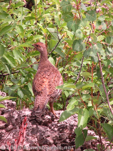
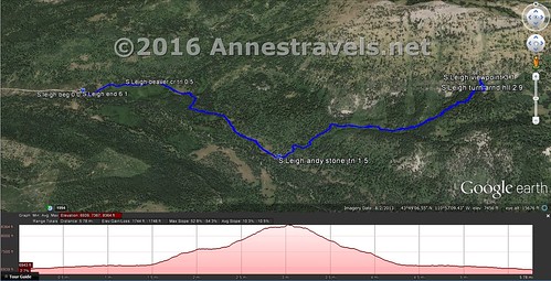
The trail begins in a pine forest, but quickly enters a meadow. At 0.5 miles, stay right on the South Leigh Creek Trail. After the junction, the trail almost immediately enters the forest. It’s a nice sort of forest, with plenty of little stream crossings via logs or stepping stones, nothing to really get your feet wet, just enough to be really pretty. At mile 1.5, you’ll come to a second trail junction, this time with the Andy Stone Trail. Turn left up this trail.
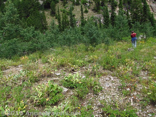
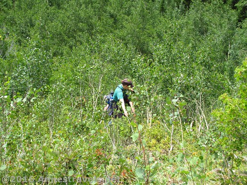
The South Leigh Creek Trail was really just a flat stroll. The Andy Stone Trail, however, is a steep upward trek through bushes. The trail is there – no fear of getting lost – but it’s not as well-trod as the South Leigh Creek Trail. And it’s relentlessly steep. Up and up and up. We stopped for lunch, and finally some of the group decided to take their time going back, while the rest of us would go forward as fast as we could to see if we could find a view of one kind or another.
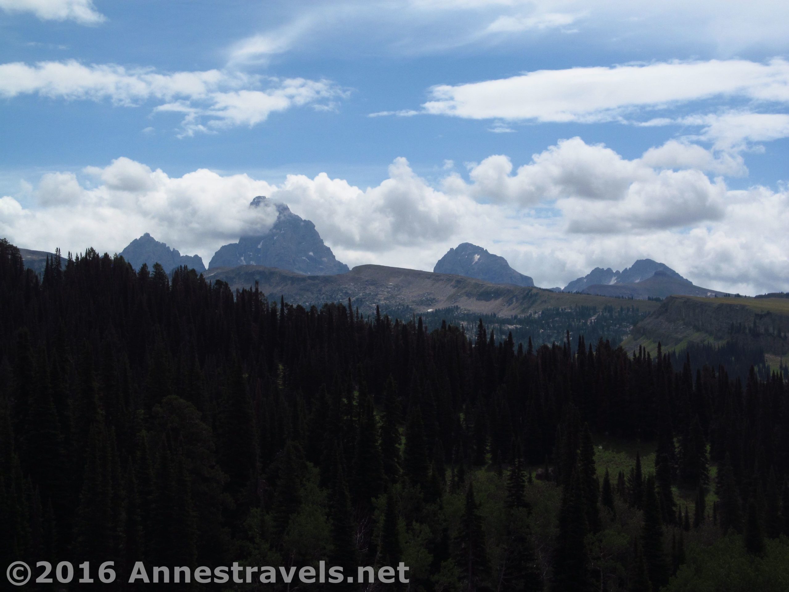
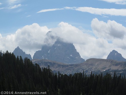
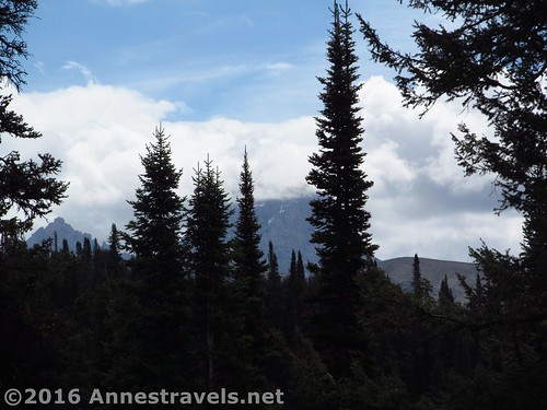
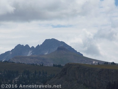
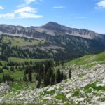
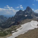
Just as we hit our time limit (it had been decided we’d turn around at such-and-such time so we didn’t get carried away and go on hiking forever in search of the best view), we came out of the trees for a brief moment on a hilltop. This was the best view we could hope for, so we stopped walking and started taking pictures.
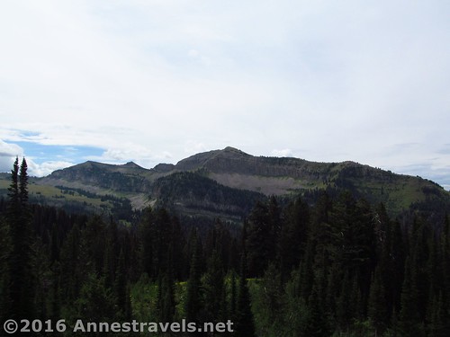
But it wasn’t good enough for me. So I told the rest of the group I was heading up the hillside behind us (the slopes of Beard Mountain) and began thrashing my way through poplars and other brush and then up the hillside. (Actually, I didn’t thrash too much – I’ve hiked enough in the woods to know how to find the easiest ways through the bramble.)
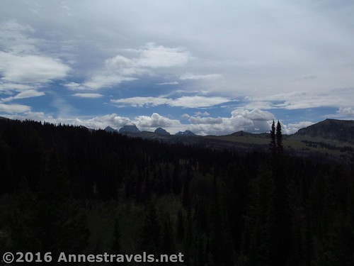
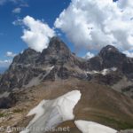
It wasn’t long until I was high enough on the extremely steep slopes to see over the trees. And it really was the best view I saw all day. The Tetons were far away, but they were very much there. With more time, it might have been fun to go all the way to the top of Beard Mountain (it would have taken some significant scrambling), but we were a bit pressed for time, the rest of the group not knowing exactly where we were. It wasn’t long, though, before the rest of the group who was with me had joined me on the slopes and we were all snapping pictures as sunshine allowed!
Then it was hop, skip, jump, and push through the bushes back to the trail, and back to the parking area… for a swim in the creek!
Round Trip Trail Length: 6.1 miles
Net Elevation Change: 1,387ft.
Facilities: None
Fees: None
Trail Notes: I wouldn’t call this the best hike on the west side of the Tetons (especially if you’re in search of views). However, it would be great for a lonely backpack or an extended horseback riding trip. Also, looking at topo maps later, I think if we’d gone just slightly further down the trail there would have been more meadows and possibly more good views.
Trail 
![]()
![]()
Road ![]()
![]()
Signs ![]()
![]()
Scenery ![]()
![]()
Would I go 100 miles out of my way for this? ![]()
![]()
![]()
Overall Rating: ![]()
![]()
Key GPS Coordinates for the South Leigh Creek Trail / Andy Stone Trail
Trail beginning: 43.82164N / -110.97384W (43° 49′ 17.904″ / -110° 58′ 25.8234″) (6,955 ft.) (ended 6.1)
Beaver Creek Trail Junction: 43.82253N / -110.96547W (43° 49′ 21.108″ / -110° 57′ 55.6914″) (7,032 ft.) (0.5) (turn right on S. Leigh)
South Leigh Trail / Andy Stone Trail Junction: 43.81420N / -110.95238W (43° 48′ 51.1194″ / -110° 57′ 8.568″) (7,092 ft.) (1.5)
Turn around hilltop: 43.81746N / -110.93318W (43° 49′ 2.8554″ / -110° 55′ 59.4474″) (8,269 ft.) (2.9)
Viewpoint: 43.81835N / -110.93313W (43° 49′ 6.06″ / -110° 55′ 59.268″) (8,342 ft.) (3.1)
The gpx file for the Sough Leigh Creek Trail / Andy Stone Trail can be downloaded – please note that this and the GPS Coordinates are for reference only and should not be used as a sole resource when hiking this trail.
Download GPX File size: 128.9 KB Downloaded 574 times
(Note: I do my best to ensure that all downloads, the webpage, etc. are virus-free and accurate; however, I cannot be held responsible for any damage that might result, including but not limited to loss of data, damages to hardware, harm to users, from use of files, information, etc. from this website. Thanks!)
Getting to the South Leigh Creek Trailhead
From Driggs, ID, head north on WY-33N. After 5.6 miles, and just as WY-33 takes a sharp turn to the left, take a right onto N 500 W. After a quarter mile, take a right onto W 5750 N. Drive half a mile, then turn left onto N Baseline Road. Continue on this road 3 miles until it T’s into N Stateline Road. Turn left for a quarter mile, when the road will turn to the right and change names to S Leigh Canyon Road. Continue almost 4 miles to the trailhead at the end of the road. (0.8 miles after the road changes names to S Leigh Canyon Road, you can see the house, on the left, built in the middle of what was once a well-used dirt road.)
Zoom map out to browse nearby hikes & places of interest
This Week’s Featured Product!
Looking for more out-of-the-way and slightly more famous trails in Wyoming – including several in the Jedediah Smith Wilderness – check out this book!


One response to “Day Hiking the Andy Stone Trail (Tetons)”
[…] to be good, we just take a less-exciting trail and wait out the clouds, like when we took the Andy Stone Trail in the […]