


I love the scenery of Yosemite: Towering waterfalls, towering trees, sheer cliffs, rocky domes, and the peaks of the High Sierras. It’s a view junkie’s paradise.
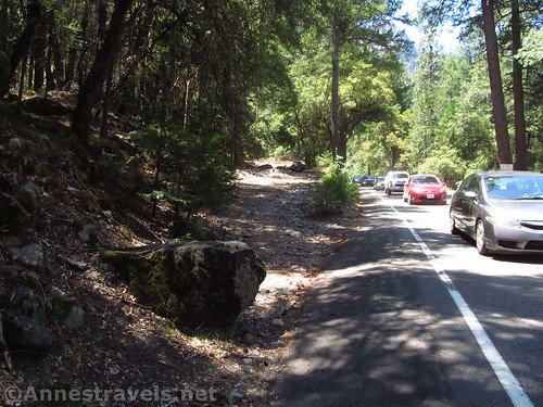
But I don’t like the crowds. There’s no place to park, no place to camp, and even if you’re lucky enough to get through the traffic jams, you’re shoulder-to-shoulder with a few thousand other people all wanting to see the same sights. And that’s no understatement: an average of 2.8 million people visit Yosemite from May to October (that’s 75k to 150k people each week), with another 875,000 visitors the rest of the year.

So here’s how to enjoy some of Yosemite’s best scenery without the crowds. Will you still see people? Yes – but at least you’ll be able to park at (most of) the trailheads after 7am. And you can even take pictures of the view you came to see without having a tour bus full of others taking the same picture, either next to your elbow or in your viewfinder.
The Hikes
I’ve detailed here some of the most scenic hikes in Yosemite that don’t offer as many people as views. To avoid the crowds you might want to…
Check out trails on the Tioga Road…

Mono Pass or Parker Pass. Views over Mono Lake plus mountain peaks, lakes, and a mountain pass. 7.4 miles RT to Mono Pass; about 11 miles RT to Parker Pass

Gaylor Lakes. The trail climbs over a scenic pass, then drops to a lake basin with a total of five lakes. You can keep hiking to an old mine, if time and energy allow. About 4 miles RT, depending on how you go

Cathedral Lakes. Rising from near Tuolumne Meadows, the trail takes hikers to two incredibly scenic lakes below the Cathedral Peaks. 8 miles RT
Pothole Dome. An off-shoot from the much more popular Tuolumne Meadows Trail, hiking up the dome means you get to look down on the meadows instead of just across them – without compromising the view of nearby domes and peaks. Up to 1.3 miles RT.
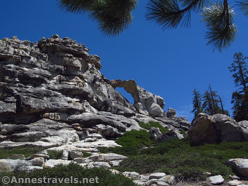
Indian Rock. Hike through a peaceful forest to Yosemite’s only named arch – and you might even get to see Half Dome! 6.6 miles RT

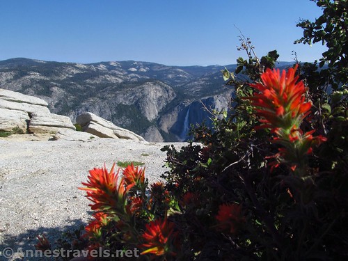
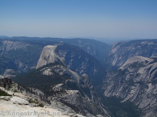
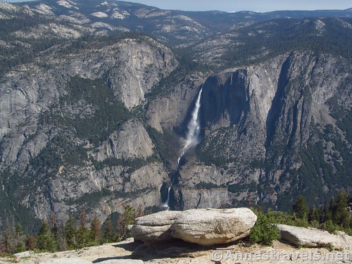
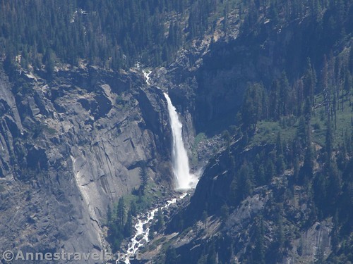
North Dome. If you want to see Half Dome, this is the trail to take. And as an added bonus, you get to see Vernal Falls from a distance, not to mention the High Sierras. 10.4 miles RT

Tenaya Lake. Bang for buck, this is a short trail with fantastic views across the lake of granite domes reflected in the water. There is also a sand beach. 2.5 mile loop
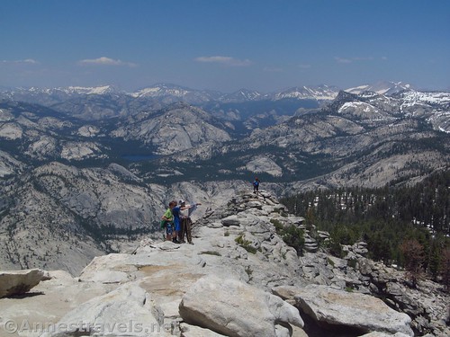
Cloud’s Rest. If you really like the bang-factor, this trail delivers it. Forests, waterfalls (seasonal), lakes, and a breathtaking view on the peak of the High Sierras, Half Dome, Yosemite Valley, and more domes and lakes than you can count. 14.6 miles RT
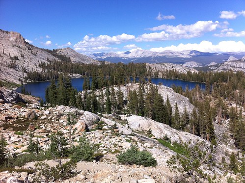
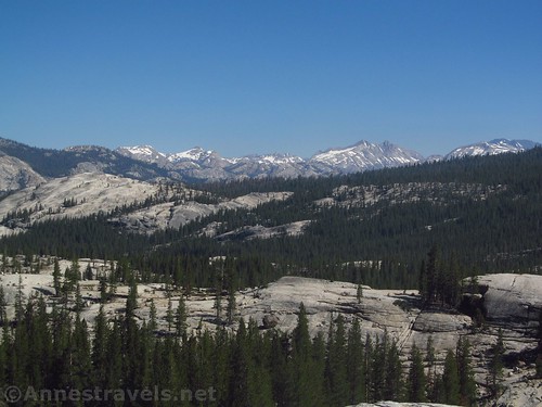
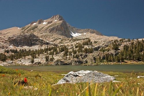
May Lake & Mt. Hoffmann. Lake views or mountains? Get both on this short trail to May Lake, then up Mt. Hoffmann, with views of both the lake and nearby domes and peaks. 2.5 miles to the lake; 6 miles including Mt. Hoffmann
Try Trail near (but not in) Yosemite Valley…
Artist Point (via the Old Carriage Road). A very peaceful, deserted walk on an upward-sloping old road takes you to a view that rivals Tunnel View. Or so I say. 3.0 miles RT
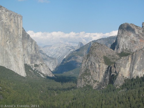
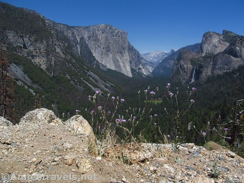
Artist Point (from Tunnel View). Hike from Tunnel View to an old road, then descend to a view of El Capitan, Bridal Veil Falls, Half Dome, and more. 2 miles RT

Inspiration Point. It’s something like Tunnel View, only higher up. The very steep trail begins at the famous viewpoint, crossing the old carriage road and continuing up to the viewpoint. 2.6 miles RT

Pohono Trail. Better done as a point-to-point because of its length, this one trail takes in Tunnel View (crowded), Inspiration Point, Dewey, Stafford, and Crocker Points, Taft Point, Sentinel Dome, and finally ends at Glacier Point (crowded). It’s views enough to make your head spin. 13 miles OW
Or hike some hikes on the Glacier Point Road…

Dewey, Crocker, and Stanford Points. Views of the valley, but from a very different perspective. Be ready for views of domes, sheer cliffs, and El Capitan. 7.8 to 10.5 miles RT
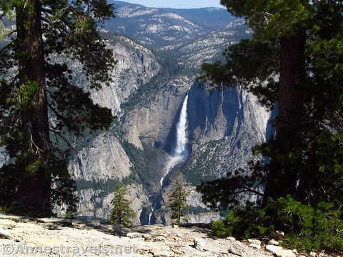
Sentinel Dome. I know of few better places to view the whole of Yosemite Falls than Sentinel Dome. Then throw in Nevada Falls, Half Dome, El Capitan, and a lot more. The link here is a shorter trail, bypassing the popular Taft Point Parking Area. 1.4 miles RT

Illilouette Falls. Often overlooked because it happens to be up a side valley from the more famous Vernal and Nevada Falls, this waterfall is accessed from Glacier Point. 5 miles RT
For big trees without big crowds check out…

Tuolumne Grove of Giant Sequoias. Located at the eastern end of the Tioga Pass Road at Crane Flat. 2.5 miles RT

Merced Grove of Giant Sequoias. Smallest and least crowded grove of sequoias in the park, west of Crane Flat. 3.0 miles RT

Nelder Grove of Giant Sequoias. Located south of Wawona and outside the park, proper. If you’re looking for a less-crowded Mariposa Grove experience, this comes closer than the other two. 0.2-5.5 miles RT
You can also hike outside the park…
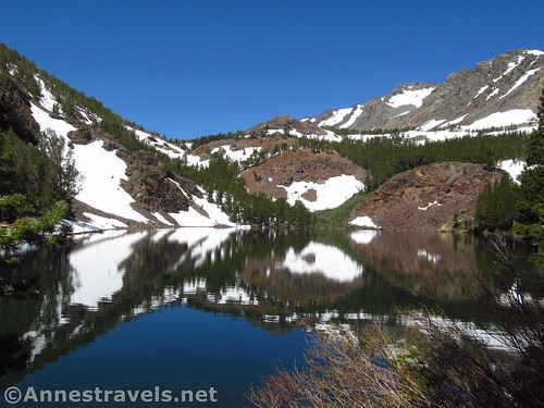
20 Lakes Basin. On the Tioga Road, just outside the park proper, the 20 Lakes Basin is a paradise of lakes, cliffs, and peaks. 4.9 to 9.1 mile loop
Virginia Lakes. A lengthy drive to the north, but not far from the park as the crow flies, the Virginia Lakes are an angler’s paradise. Walk up the valley past several lakes, or even all the way up to the pass, or to summit lake on the other side of the pass, if you have the time and energy. 3.2 to 10.0 miles RT
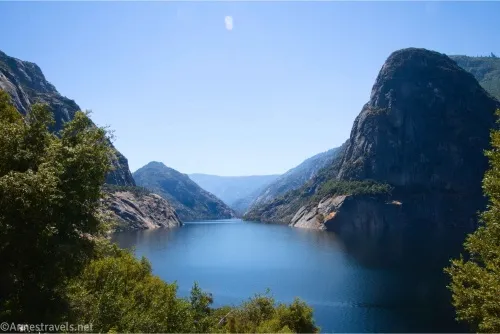
And to really avoid the crowds, try any trail in Hetch Hetchy.
Other Tips for Avoiding Yosemite’s Crowds
Don’t even enter Yosemite Valley. It’s overcrowded at almost every time of year, and in the summer, just trying to get into the valley could mean an hour or more in a traffic jam.
If you really want to hike one of the more popular trails, start out as soon as it’s light and try to be off the trail by 10am. (Note that Yosemite Falls will be in the shadow of the cliffs until at least 8am.)
Visit in the off season – November to April. The high country will be snowed in, though, and famous roads (like the road to Glacier Point and the Tioga Pass Road) may not be open.
Yosemite Falls flows from about November to sometime in July (it all depends on snowmelt). May is peak season, so visiting in April may allow for viewing a higher flow rate without (quite so many) crowds. Other falls may only be active March to June or December to April or… (see this link for more information on average flow of waterfalls).
Fees: $35/vehicle. Yosemite Annual and National Parks & Federal Lands Recreation Passes also accepted.
Visitor Centers: Tuolumne Meadows Visitor Center on the Tioga Road; an information station near the Big Oak Flat Entrance (north of Crane Flat); Yosemite Valley Visitor Center in the valley; Wawona Visitor Center north of the Mariposa Grove Road (open summer only).
This Week’s Featured Product!
My favorite book on hiking and day hiking Yosemite! Beyond the most popular trails, the author also includes hidden gems and quiet treks for all skill levels.
2 responses to “The Best Day Hikes in Yosemite National Park (to beat the crowds)”
Cool.
Do you still have a link to the book about making your van a living/ sleeping space?
Hi Andrea,
I haven’t written a book on living or sleeping in a van (yet! – I probably should), but all my articles on how we pack and make our van livable-in can be found in the DIY section: https://www.annestravels.net/category/travel-diy/