
Nevada has only one glacier. I’ll admit that I didn’t think it had any, although the state does have a few mountain ranges running through it. The one-and-only is situated below Wheeler Peak, the highest mountain in Great Basin National Park. Many mountain enthusiasts come every year to climb this peak, while many others come to enjoy Lehman Cave’s formations beneath the park. Still others come to see the Bristlecone Pine forest, which shares a trail with the Glacier. I can personally say that all of these are worth doing at least once (except for the mountain, which I’ve never climbed), but the glacier was an experience I likely won’t forget soon.
(Affiliate links are present on this page.)
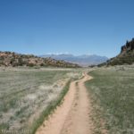
To get to the parking area for the trail to the glacier from the east, take US 50/US 6 west for 91 miles from Delta, Utah. You will enter Nevada 3 miles before your turnoff. Turn left onto Baker Shortcut Rd (follow the signs for Baker Archeological Site) and follow the road 2.9 miles, where it T’s into SR-487. Turn left onto SR 487 and drive 1.5 miles to the town of Baker; turn right onto SR 488 (Lehman Caves Road).
To come in from the west, drive 55 miles east on US 50/US 6. Turn right onto SR 487 and go 5 miles to the town of Baker; turn right on SR 488 (Lehman Caves Road).
Just before you get to the turn onto SR 488 there is a Great Basin Visitor Center where you can stop and get information, look at the exhibits, use the restrooms, and seasonally get water. This is the main visitor center, although there is another up by Lehman Caves.
For all routes, go 5 miles on SR 488; then turn right onto NF 466 (Wheeler Peak Scenic Drive) and drive 11 miles up to the parking area at the end of the road (just before Wheeler Campground). Here there is a primitive restroom, a few picnic tables, and a drinking fountain (seasonally).

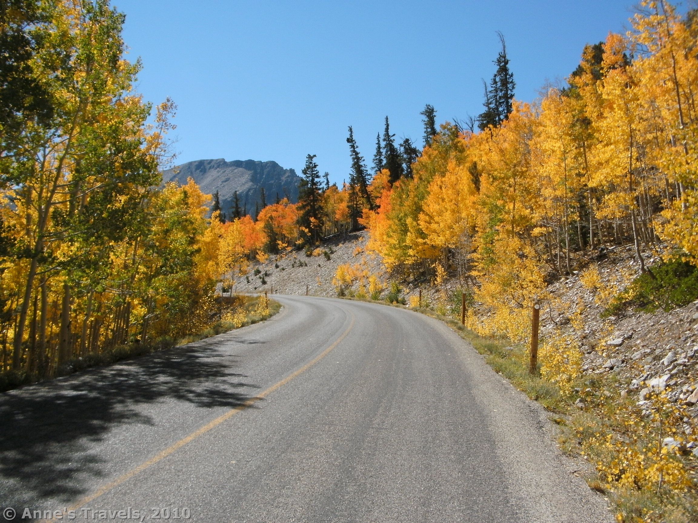
I’ve actually hiked the Bristlecone Pine Trail twice. The first time, we’d just reached the forest when the sky let loose, and it poured the entire time we were hiking back to the parking lot. However, on our second visit (just 11 years later) we had better weather. In fact, the sun was shining brilliantly, making the fall colors glorious. It was so odd to see rocks and desert-ish vegetation all around you, and to look out over the Great Basin and see desert wilderness, but in between the two to see a hill covered in orange, yellow, and green fall colored trees. It really looked out of place.
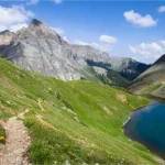
The trail begins across the road at the far end of the parking lot (right if you’re facing the campground). For a few feet, it is also a wheelchair accessible nature trail, then it crosses a bridge, and begins to ascend the hillside. It’s not terribly steep, but it does go up and up and up for quite a while. After about a mile you will come to a well-marked trail split. You can go right and take a short side trip to see Theresa Lake (it’s quite pretty), or you can go left to get to the Bristlecone Pine Forest and the Glacier.

In all the trail is 2.4 miles long (one way), and goes up 600 feet in elevation. The trail is never really steep, but it is constantly going uphill. The good thing is that there are peek-a-boo views out into the Great Basin after the trail split, so you can enjoy the view when you stop to huff and puff.
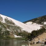
After 1.7 miles you will reach the Bristlecone Forest. This is an area that is well worth exploring. A short trail leads through the bristlecone trees, and you can experience them first-hand. Little signs explain about the trees. As the oldest living things on earth, the trees’ ages can be mind-boggling.
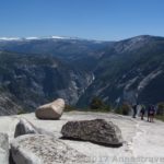
After you’ve looked at the trees, you can continue up to the Glacier. The trail winds its way among rock piles until—well, that depends on the time of year. When we were there in mid-September, there wasn’t much snow left, and the trail ended long before you actually reached the snow itself. However, you are at the bottom of the rock glacier. If you like being safe, the end of the trail (there’s a sign that says you’re at the Glacier) is the place to stop. However, we did scramble up to the ice/snow itself. I personally would not recommend doing this to anyone for a few reasons. First, the rocks are very, very unstable. In fact, I’ve never been on a rock slide that was so unstable. Every rock you stood on could, at any second, wobble and slip out from under your foot. Second, there are some very steep places getting up there, which are difficult to climb. Third, it would be very easy to send rocks down on top of the people below you (if more than one of you is climbing up there).

So, I’ll tell you what’s up there so you don’t have to do it. When we got up to the snowline, we didn’t know it, because the ice is so mixed with sand and gravel that we could hike up it easily. However, it soon got slipperier as there is less sand and more ice and gravel. Eventually it is all ice with very few rocks in it. The Glacier is on a very steep slope, and so climbing up onto it without proper equipment would be very dangerous.
Return by the way you came. This hike would probably be a really good one in the morning, because then the sun would be shining on the fantastic rock formations that line the edges of the canyon around the Glacier instead of behind them, making for better pictures. Also, by late afternoon the sun was off of the Bristlecone Pine Forest, and off of the Glacier as well (although I’m not sure that would be in sun the morning, either). Still, at any time of the day, it is a beautiful place to sit back and just look and listen to the things that are going on around you—it was so deserted that it almost felt a bit lonely. That’s not a bad thing, though, because it means it hasn’t been commercialized to the point of being someplace you’d never want to go.

Fees: None to hike the trail. A fee applies if you want to take a tour in Lehman Caves.
Trail 
![]()
Road
Signs ![]()
Scenery
Overall Rating: 
This Week’s Featured Product!
Check out more great hikes in Great Basin and the surrounding area with this book!