I didn’t hike Kyhv Peak the traditional way. Most people start down at the Rock Canyon Trailhead in Provo. But given that I was already on the dirt road high in the mountains (the Kyhv Peak Road), I decided to come at it from the Rock Canyon Group Campground. My route had about 200ft. less elevation gain and 0.6 fewer miles overall, but that doesn’t mean it was easy – just that we went down and then up instead of up, up, up! Other than the one steep section, it was a pleasant trail with some great views, plus the view at the top of the peak is fantastic. So I highly recommend it if you’re in good shape – you’ll need those lungs and non-slipping skills for the steep trail!
Quick Stats
This post may contain affiliate links, which provide me with a small commission if you buy a product. There is no extra cost to you.

Note: Until recently, Kyhv Peak was called Squaw Peak. I’ve talked at length about what I think about changing the name (I’m descended from the tribe from which the term “squaw” was adopted), but if you’re wondering what happened to Squaw Peak Road and Squaw Peak… well, someone decided to change it. At least we could all pronounce squaw. Now I have to tell you that you pronounce Kyhv “Kive” (rhymes with hive).
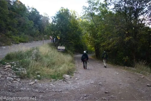
My first surprise for the day was finding the campground closed. It turns out the campground is only for groups, and day hikers are never allowed to park at the trailhead. So you’ll have to find someplace to park. We continued up the main road just beyond the gate, then parked right behind an easel telling drivers and hikers of fire closures in the area. A few weeks before, the Kyhv Peak Trail and Rock Canyon had both been closed, but now it was open again, and the closures were further up the road. I figured the easel was blocking the road just about as much as my van, and there was plenty of space to get around us (I expect two vehicles could have passed each other even with my van there).
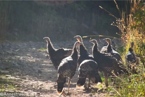
We headed down into the campground and discovered a flock of turkeys. They skittered out of our way, protesting that they were here first. Turn right at two junctions in the campground. After the second turn, you’ll come to a vault toilet about 0.4 miles from the beginning of the campground road. The trail you want is marked by a fence/gate to the right of the restrooms. Sadly, the restrooms were locked.
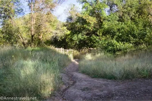
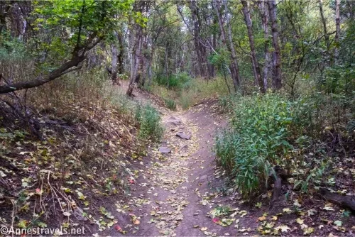
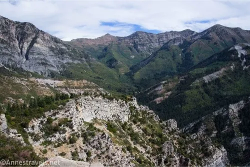
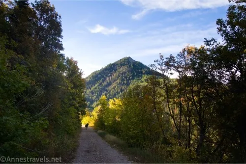
Begin down this road that quickly becomes a trail through the forest. You’ll go down… and down… and down some more before you break out of the trees near the Rock Canyon Overlook (mile 0.9). The overlook is nothing exciting in the morning, but in the afternoon, the views are good despite the low oak shrubs that surround it.
After walking downhill a bit further, the trail will become a narrow gravel road (an ATV could drive it easily, but it would likely be too narrow for a truck). You’re now following Rock Creek (on your left). The road is easy walking except that you’re still going downhill. About mile 1.4, you’ll pass a junction on the left – stay on the main road that doesn’t cross the creek (though I gather this sidetrail does reconnect at some point).
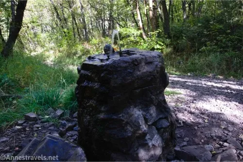
Another interesting feature along the way is a water fountain. It bubbles constantly and obviously hasn’t been mended in years. But it’s still sitting there, providing water. I had no idea if the water was drinkable, so I didn’t partake. It’s definitely neat, though!
The really important turn comes about mile 1.75. There are actually two ways to get on the right trail, but I took the first social trail which took me to a campspot. Here, I turned left and walked down to turn right on the Kyhv Peak Trail at mile 1.8. You could continue on the main road/trail down to where the main Kyhv Peak Trail connects, but this would have required a little bit more elevation gain, and with Open Street Maps showing the shortcut in the OrganicMaps app… well, I figured I might as well use that map to my best advantage!
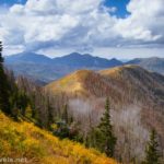
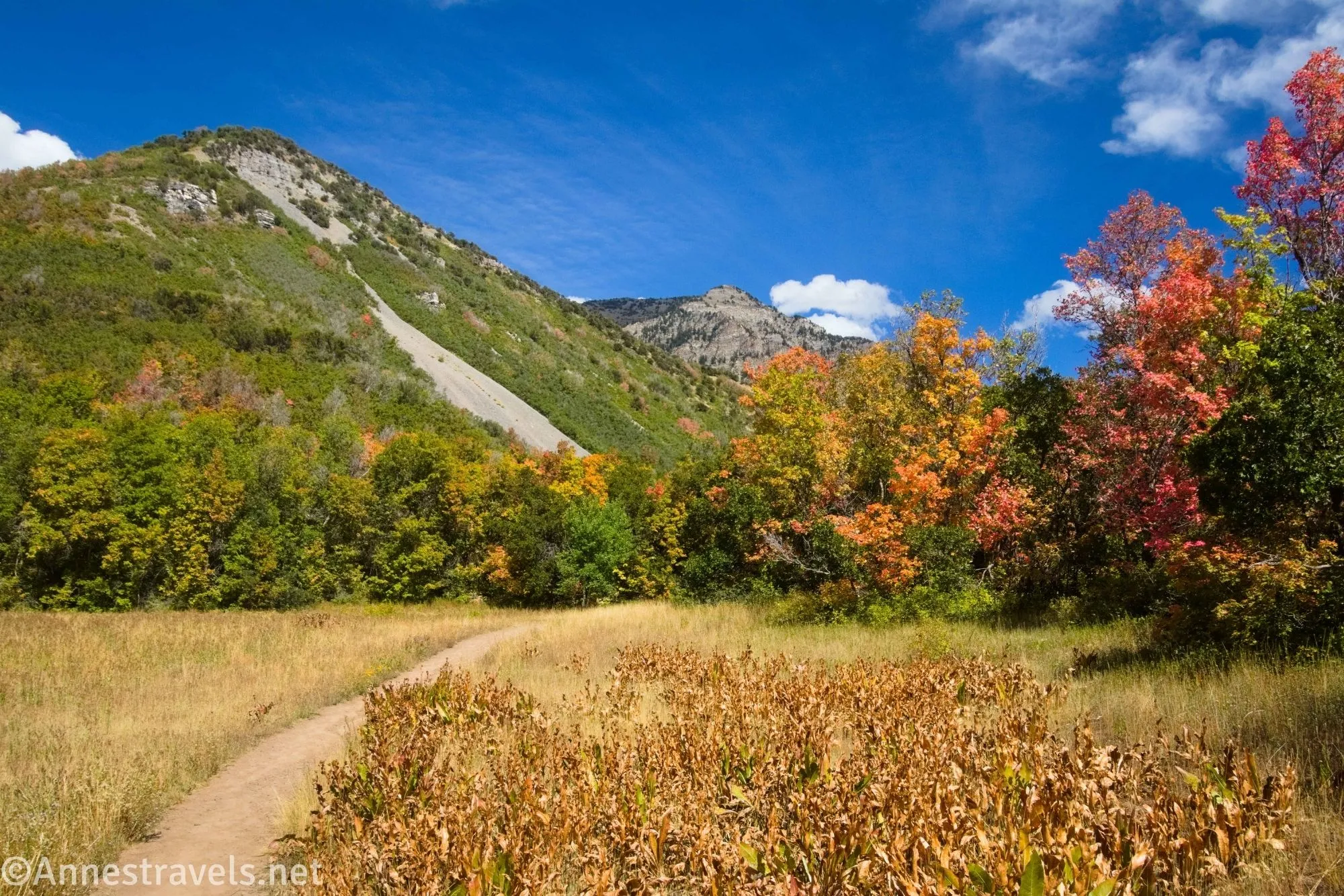
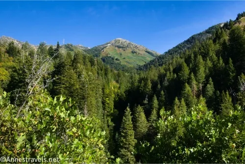
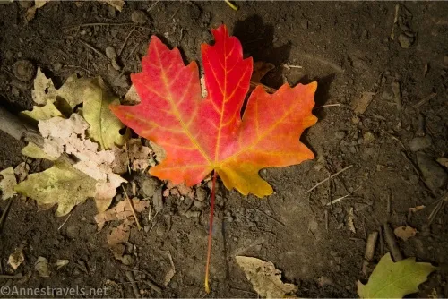
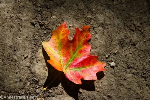
At this point, you’re done going downhill until your return journey. In fact, be prepared for the next 1.2 miles to be almost straight uphill! The slope just doesn’t let up. I happened to hike in early September, and the maples were beginning to turn color. The leaves on the ground were so beautiful!
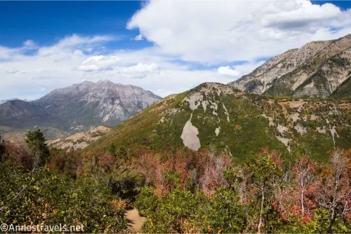
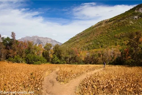
At mile 3.0, the trail suddenly pops out of the woods into Buffalo Meadow. Halfway across, a well-defined but unmarked trail comes in from the right. This is the Little Rock Canyon Trail. You want to continue straight (left) across the meadow to begin ascending once again, albeit not as steeply and with a lot more open views.
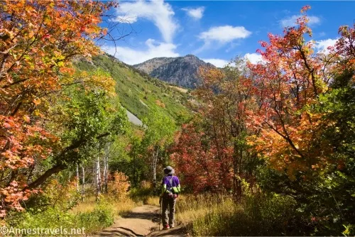
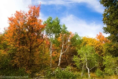
The next mile is quite pleasant if still a little steep (just not as bad as further down the trail). The trees were changing color, there were open meadows in places, and you get a taste of the mountain and lake views you’ll see at the top.
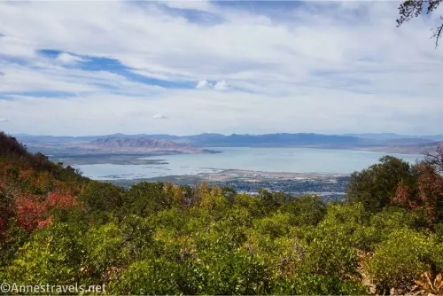
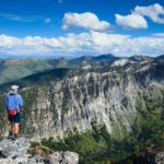
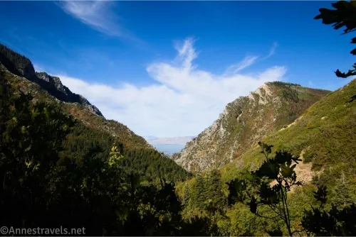
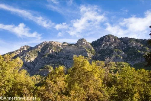
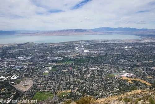
About 4.0 miles from the beginning of the campground road (3.1 miles from the trailhead in the campground), summit Kyhv Peak. Take a deep breath, then enjoy the massive views, moving around the peak to take in all of the different angles. Below you is Rock Canyon, with Y Mountain in all its glory to the south (it’s quite impressive with all its rock layers).
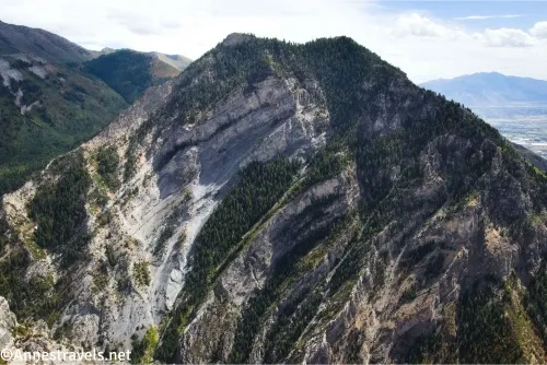
Looking west, you can see Provo and Orem, as well as Utah Lake. To the north is Mount Timpanogos (among other mountains), closer to the northeast is Buffalo Mountain (I would have enjoyed hiking it, too, but ran out of time and energy – the trail begins from the Kyhv Peak Road). To the west are many more mountains, including Shingle Peak, though Provo Peak is to the southeast.
Enjoy the views, eat a snack, and take a sip of water before retracing your steps to the trailhead!
Round Trip Trail Length: I hiked 8.25 miles
Elevation Gain: 3,292ft. (6,160ft. to 7,819ft.)
Facilities: None
Fees: None
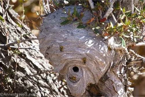
Trail Notes: Definitely be ready for steep trails here. Give groups privacy if they’re camping in the campground. As I said before, I don’t know if the water from the drinking fountain is potable, so filter or treat it before drinking. We did find a hornet nest on a tree about halfway between the Little Rock Canyon Trail and the summit – it’s far enough off the trail to not be an issue, but be warned if you are highly allergic. I’m not much on hiking to mountains overlooking cities, but I did enjoy this one.
Trail 
![]()
![]()
Road ![]()
![]()
Signs ![]()
![]()
![]()
![]()
Scenery
Would I go 100 miles out of my way for this?
Overall Rating: 
![]()
GPS Coordinates for Kyhv Peak
TH: 40.2723610°, -111.5869700° (40°16.34166′, -111°35.21820′ / 40°16’20.4996″, -111°35’13.0920″) (7,103ft.) (0.0) (wrong… more like 40.2721380°, -111.5873660° (40°16.32828′, -111°35.24196′ / 40°16’19.6968″, -111°35’14.5176″))
TH in the campground: 40.2685160°, -111.5876920° (40°16.11096′, -111°35.26152′ / 40°16’06.6576″, -111°35’15.6912″) (6,844ft.) (0.46)
Rock Canyon Overlook: 40.2689440°, -111.5921240° (40°16.13664′, -111°35.52744′ / 40°16’08.1984″, -111°35’31.6464″) (6,627ft.) (0.89)
Junction on left (stay straight on old road): 40.2679060°, -111.5977980° (40°16.07436′, -111°35.86788′ / 40°16’04.4616″, -111°35’52.0728″) (6,321ft.) (1.45)
Turn right on social path: 40.2691090°, -111.6020250° (40°16.14654′, -111°36.12150′ / 40°16’08.7924″, -111°36’07.2900″) (6,152ft.) (1.73)
Meet real trail; turn right: 40.2693660°, -111.6026720° (40°16.16196′, -111°36.16032′ / 40°16’09.7176″, -111°36’09.6192″) (6,135ft.) (1.79)
Junction with trail from valley (Buffalo Valley): 40.2794420°, -111.6165490° (40°16.76652′, -111°36.99294′ / 40°16’45.9912″, -111°36’59.5764″) (7,240ft.) (3.02)
Top: 40.2711770°, -111.6169910° (40°16.27062′, -111°37.01946′ / 40°16’16.2372″, -111°37’01.1676″) (7,747ft.) (3.98)
End (more accurate TH): 40.2722250°, -111.5874490° (40°16.33350′, -111°35.24694′ / 40°16’20.0100″, -111°35’14.8164″) (7,021ft.) (8.25)
The gpx file for Kyhv Peak from Rock Canyon Campground can be downloaded – please note that this and the GPS Coordinates are for reference only and should not be used as a sole resource when hiking this trail.
Download GPX File size: 198.2 KB Downloaded 113 times
(Note: I do my best to ensure that all downloads, the webpage, etc. are virus-free and accurate; however, I cannot be held responsible for any damage that might result, including but not limited to loss of data, damages to hardware, harm to users, from use of files, information, etc. from this website. Thanks!)

Getting to the Kyhv Peak Trailhead (Rock Canyon Campground)
From I-15, take Exit 272 for US-189. Continue onto UT-52E / W 800N for 3.7 miles, then use the left lane to take the ramp onto US-189N. 1.9 miles later, turn right onto Kyhv Peak Road (formally Squaw Peak Road. I didn’t know about the change until I went to write this post, but I was surprised, as it still had the old name when I was in the area back in late 2023). You’ll want to follow this road for 9.5 miles to where the Rock Canyon Campground road goes off on the right – it starts as a paved road and then eventually becomes gravel/dirt. High clearance is fine in dry weather, but there are one or two sections that would be difficult with low clearance. Park in the general area near the campground, out of the way of traffic. Do not block the gates, as there is a gate on the main road and another for the campground.

More Hikes in the Provo Area
For even more hikes, check out this guide to hiking in the Salt Lake City area (including Provo, Ogden, and the Uinta Mountains). From short strolls to major hikes, there’s a lot of variety and scenery within these pages. Buy your copy here.