

In an out-of-the-way corner of Big Bend National Park, there is an attraction that, although visited, would probably be a huge attraction if it was along a main road and in a heavily-visited national park. However, because it’s along a dirt road near the Rio Grande in the southern part of Big Bend, it’s only moderately visited. If you’re there in the middle of the day, you’ll probably see people, but if you wait long enough, you can have it to yourself. This attraction is Mariscal Mine, an old mercury mine located on the River Road, which connects Rio Grande Village (on the east end of the park) and Castolon (on the western side of the park). The most interesting thing about it to me is that you can actually walk around the area and around the remains of the refining equipment itself. Although I believe there are signs asking you not to climb on the structures, there are no huge fences saying “Keep out! Stay off! Violators will be levied $1,000,000 fines”. This makes it a much friendlier environment to walk around and actually enjoy the remains of the refinery instead of trying to get a good glimpse of it from behind a heavy fence.
(Affiliate links are present on this page.)
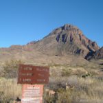
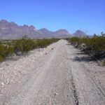
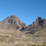
To get to Mariscal Mine and the mercury refinery, you will need to drive down the River Road, a fairly well-maintained dirt road that goes along the southern part of Big Bend National Park. It got its name from the Rio Grande River, which the road follows for much of its length. Depending on road conditions, you may be able to get to the refinery with a car, but I personally wouldn’t try it without high clearance. Four-wheel-drive may be required in some circumstances, and the road would be totally impassable when wet. The River Road begins 5 miles north of Rio Grande Village in the eastern section of the park. You’ll need to drive approximately 19 miles down this road to get to Mariscal Mine. Alternatively, you could drive 35 miles from the western end of the river road (which begins on the Ross Maxwell Scenic Drive north of Castolon). However, be aware that some of the roughest sections of the road are just west of Mariscal Mine. Because of the roughness of the road (on both sides), a half a day is recommended as the minimum you’ll need to see the mine and refinery if you come from the east end of the park (which is the way I’ll assume you’re coming from).

A small dirt parking area is located just off of the River Road on the south (left) side of the road. The parking area itself is just beyond Fresno campsite, so that is an indication you are getting close. Also, you will be able to see the refinery tower sticking up above everything else on the left side of the road, so it’s difficult to miss. Actually, across the road from the parking area is some houses that you may want to check out. I’ve never actually visited these, so I can’t tell you much about them. A map of the different buildings as well as some information about the mine and refinery can be found at http://www.nps.gov/bibe/historyculture/upload/Mariscal%20Mine%20SB%202004%202.pdf

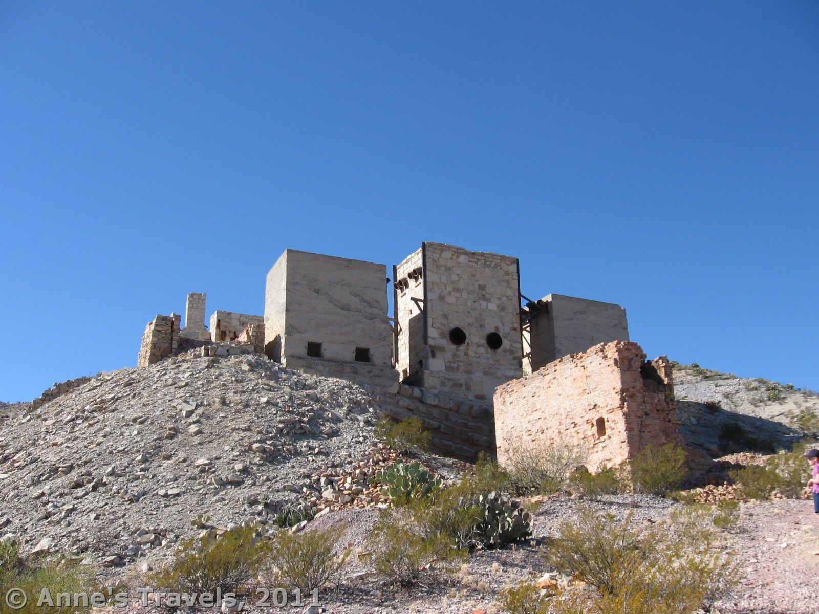
From the parking area, head up the sandy trail towards the refinery buildings. There may be a few signs in this area that explain about the mine and refinery. I think there is also a box for brochures, but it was empty last time we were there. The path itself winds its way up the hill towards the structures, probably about a ½ mile away (maybe a little less—it feels like forever if it’s hot!). On the way up, you will pass some miner’s houses and the brick kiln, although you may not be able to see these very well because of the mesquite bushes that grow in this area. Eventually, you will end up on the left side of a few ruined buildings (the paymaster’s office/Mariscal Mining Company commisary and the Ellis Mine Condensers), then cross over to the right side of the buildings. Then the trail (which looks sort of like an old mining road) heads up along a long line of buildings on your left. This is the Mariscal Mining Company Processing Plant which was used from 1919 to 1923. The entire thing worked on gravity. I’ll explain the process and tell you about what you’re seeing at the same time.

As you’re crossing over from the left side of the structures to the right, you’ll pass the Scott Furnace on your left. Here the ore was heated to 360 degrees F, and the mercury vaporized. As the burned slag was removed from the bottom of the furnace, more fresh ore was added from the top. Meanwhile, the vaporized mercury headed out into a series of condensers, where the mercury became liquid again and dripped out of iron pipes into iron flasks. The first three of these condensers are just above the furnace on your left as you’re walking up the path. Very little mercury was recovered from the first two condensers, but by the time the vapor entered the third condenser, it had cooled enough for much of the mercury to liquidize. More mercury was recovered in the fourth condenser, which is located next to the other three condensers. The rest of the vapor was then channeled into two redwood tanks, where it was further condensed. The remains of these tanks are beyond the open space where ore was once carted to the Scott Furnace. The platform in this area was also used in the ore delivery system. Meanwhile, the rest of the vapor went up the 30-foot smoke stack, with remarkably little loss of mercury. A cement conduit was covered with ceramic tiles and served as a final condenser beyond the smokestack. The liquidized mercury was then transported to market.

Keep walking past the cement walls that were put in place to stabilize the slope. After you reach the top of this next hill you will be able to see some office buildings on your left as well as several structures/ruins from other mining periods. If you continue straight along the narrow-gauge rail that was mostly removed in the 1950s, you will come to a barred mine shaft. It is quite interesting, even though you can’t get in (which is a plus in my opinion!). Many of the mines in the area are barred or have grills over them to keep you from falling in. That’s not a substitute for common sense, but it gives somewhat of a sense of security when you’re walking around the area.

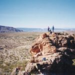
If you want to see some more mines, an old engine, or are in the mood for a very nice view, keep walking up the mining road. Eventually, it will peter out at the top of the hill (½ mile or a little farther), but getting there is half the fun. (Actually, I think you could hike farther along the road if you wanted to, but we’ve never done it). The road climbs up around the hill with views opening up on your right and in front of you. Eventually, almost at the far side of the hill, you will come to an area with quite a few old mines. These are wired off (some even have metal grates over the top of them) so you can’t fall down into them. Also in this area is an old engine. I have no idea what it is doing there, or what it once did, but the engineers in my group had fun looking at it!
Return by the way you came. This is a great place to learn about mercury refining, as well as an interesting historical sight. I’m sure I would never know what they did with mercury ore if I hadn’t gone here!
Round Trip Trail Length: Less than a mile (2 km)
Facilities: None
Fees: $20 per vehicle; good 7 days. America the Beautiful (Interagency), Senior (Golden Age), Access (Golden Access), Volunteer, Military, and Big Bend Annual Passes also accepted
Trail 
![]()
![]()
Road ![]()
![]()
Signs ![]()
![]()
![]()
Scenery
Would I go 100 miles out of my way for this? ![]()
![]()
Overall Rating: ![]()
![]()
This Week’s Featured Product!
This guide to Big Bend covers more than 50 hikes in the region. You’ll get to see historic places and ruins, canyons, mountains, and so much more.

4 responses to “Mariscal Mine: Big Bend’s Mercury Mine”
[…] Mariscal Mine Trail – This short trail takes you to an old mercury mine refinery. The refinery is incredible in […]
I have been going to Big Bend for over forty years and never get tried of seeing and visiting the Mariscal Mine. In fact I painted it and other Big Bend landscape (www.richardsukupart.com). Thanks for nice article Anne.
[…] #6) Mariscal Mine. Mariscal Mine is a bit one-of-a-kind. Once a mercury mine and refinery, today it’s just a skeleton…but a rather fine specimen at that. Sure, you’ll have to drive at least 19 miles of the very rough River Road (high clearance a necessity) through the south of Big Bend National Park (sometimes less than miles from the Mexican border), but the incredible scenery makes the drive to the mine worthwhile (and for peaceful campsites, it’s hard to beat the primitive ones along the River Road!) […]
[…] along the rugged River Road in Big Bend National Park, Texas, the Mariscal Mine processed mercury ore mined from nearby hills for more compact […]