
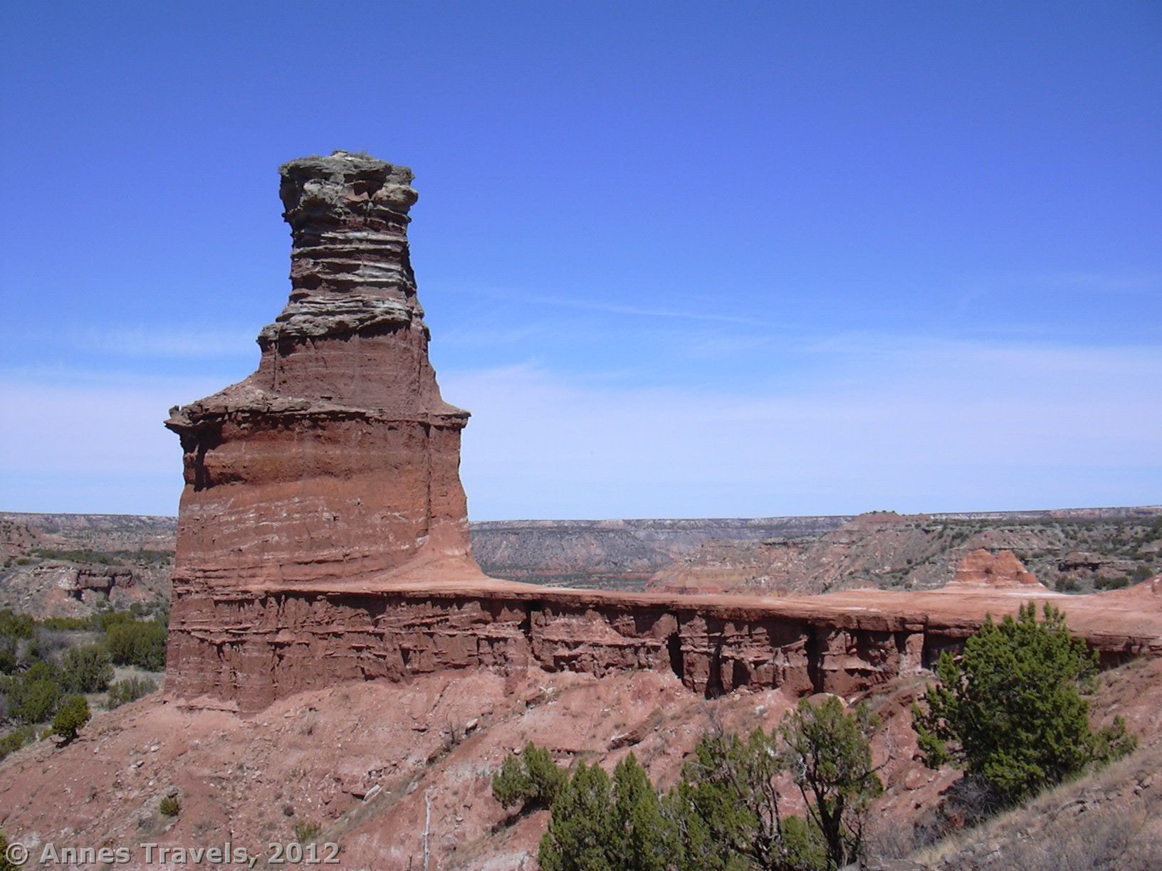

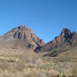
I have to admit that most of my Texas adventures have been south of the state’s panhandle. However, one park that I’ve enjoyed more than once was Palo Duro Canyon State Park, located only 30 miles from Amarillo near I-27. Known as “The Grand Canyon of Texas” (although they don’t have much in common in my mind), the highlight of the park is The Lighthouse, a 300-foot rock formation that resembles a lighthouse on a cliff overlooking the canyon. This is truly an awesome formation, and well worth visiting if you’re in the area and looking for a nice hike. In fact, it’s the only hike I’ve done there that I would recommend, although it was so awesome that I’ve done it twice, once in November and once in April a few years later. The trail is open to horses and bike riders as well as hikers, so there’s something for just about everyone who’s up to a 5.75 (RT) trail!
(Affiliate links are present on this page.)
To get to the parking area for the Lighthouse, from I-27, take Exit 106 (south of Amarillo) to the frontage road. The first crossroad you should come to is 4th Ave (TX-271). If you’re coming from the North (Amarillo) turn left. If you’re coming from the south, turn right. Drive for 10.5 miles on this road. You will pass St. Paul Cemetery and the Palo Duro Riding Stables. At this point, the road will change names to State Hwy Park Rd 5. Follow this road through the entrance station, and past the visitor center and two campgrounds. Just after the second river crossing, you should find the parking area for the Palo Duro Lighthouse Trail. A map of the park can be found at http://www.tpwd.state.tx.us/publications/pwdpubs/media/park_maps/pwd_mp_p4506_007g.pdf

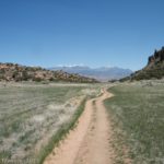
Two trails begin from the parking area; both connect to the Lighthouse Trail, so you can take either—follow the signs. As I said before, the Palo Duro Lighthouse Trail is multi-use; I’ve seen both horses and mountain bikes on the trail (one time we visited, there was a bike race on the trail!). The trail can be crowded at times, although it’s never been overrun when we’ve hiked it. Also, this trail can be very, very hot—there is little shade most of the way, and the Texas sun is merciless. Bring plenty of water and sunscreen! The trail is rated as “easy”, but I wouldn’t consider it a very easy trail. At times it is quite sandy, making it seem more difficult than other 6-mile trails. Still, it isn’t difficult, as the trail is mostly flat, especially in the beginning. Something you’ll notice is that the trail gets progressively narrower as it gets closer to the Lighthouse; an indication that many people start the hike but don’t go all the way to the end.

At the beginning, the trail is fairly sandy and flat. It winds through scrub and bushes that block any kind of a breeze that might otherwise be blowing down the canyon. The most noticeable thing about this section of trail is the quietness. The sand and bushes seem to block any noise, so you feel very alone in the silence. After a while of hiking, the trail begins to roll with the terrain. You will be required to cross several creek beds, but I don’t recall any of them having water in them. As you get further into the canyon, you will begin walking among juniper trees that offer some shade from the relentless sun. At 1.5 miles you will get your first view of the Palo Duro Lighthouse, far off on your left. Many people turn around here, but others keep going. Continue following the trail up Palo Duro Canyon as the trail continues to roll up and down with the terrain. You will pass a few other trails along the way, but keep following the one towards the Lighthouse.

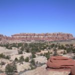
After about 2.5 miles, you will come to the bass of the plateau that the Palo Duro Lighthouse is perched on. Don’t stop here! The best views can be had by climbing up the steep trail to the base of the Lighthouse itself. The trail here is more difficult than the trail prior to this; logs have been placed to keep the soil from eroding, but this effort hasn’t worked as well as was hoped, so there are now logs in the trail with gaping holes around them. Pick your way up the trail, which is also steeper than the trail before this, until, at 2.88 miles from the trailhead, you arrive at the plateau that is the base of the Lighthouse. From here, the views are stunning. Not only can you get a close-up view of the Lighthouse, but you can also see parts of Palo Duro Canyon which are very nice—colored badlands, cliffs, etc. You can also see some of this from the trail, but here you get a really good view of it.

If you’re looking for more views, follow the social trail at the end of the plateau away from the Lighthouse formation. This is a flat, narrow trail that will take you along the edge of the cliff to another area where you can view the Lighthouse. This trail gets you far enough away from the formation so that you can actually get good pictures of it. You can also get great views of the canyon from this vantage point.
Return by the way you came. The Lighthouse is an awesome formation, so if you’re anywhere in the area, and up to the hike, I highly recommend you go see it. You won’t be disappointed.

Round Trip Trail Length: 5.75 miles
Facilities: On the trail, none. Near the trailhead is just about every conceivable amenity, including a visitor center, picnic areas, historical sights, restrooms, showers, camping, etc.
Fees: $5 per person per day for those 13 or older to enter the park (children 12 and under are free). Texas State Parks Passes, Youth Group Annual Entrance Permits, and Texas Parklands Passports (Bluebonnet Passes) also accepted.
Trail 
![]()
![]()
Road ![]()
Signs ![]()
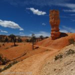
Scenery
Would I go 100 miles out of my way for this? ![]()
![]()
Overall Rating: ![]()
This Week’s Featured Product!
From swamps to desert, from mountaintops to canyons, this guide covers so much of the great scenery that Texas has to offer.
3 responses to “Palo Duro Lighthouse”
it’s a very good Article,thank you very much!
I have been browsing on-line more than three hours as of late, but I never found any interesting article like yours. It’s pretty price sufficient for me. In my opinion, if all site owners and bloggers made just right content material as you probably did, the web will be much more helpful than ever before.
[…] nice scenery. Black cliffs and buttes can be seen for quite a bit of the hike, reminding me of Palo Duro State Park. You are fairly high above the surrounding area, so the views are nice from that angle, too. […]