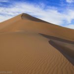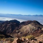
There are a few collections of sand dunes in Death Valley. The most famous are the Mesquite Dunes, located along the main highway near Stovepipe Wells. I’ve also been to the Ibex Dunes in the far south of the park. But a couple of years ago, I took advantage of the Lake Hill Road being open after Hurricane Hillary tore through much of the rest of the park (closing all but the main roads even months after the storm), and I hiked out to the Panamint Dunes. It was such a great hike (if you don’t mind off-trail hiking) – and we didn’t see anyone all day long!
Quick Stats
This post may contain affiliate links, which provide me with a small commission if you buy a product. There is no extra cost to you.
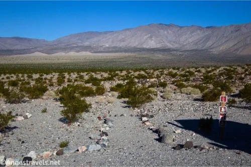
The Panamint Dunes Trailhead is an unmarked parking area (of sorts… it’s better than a wide spot in the road) just before the Lake Hill Road becomes too rough for 2WD vehicles. (It’s iffy whether low clearance vehicles can get here – several deep, narrow washes along the road are not kind to undercarriages.) There is a sign with the icons that fires are not allowed, hikers are allowed, dogs are not allowed, and bicycles are not allowed. When I visited in 2023, there was a rock-lined path leading out into the desert. This is the trailhead.
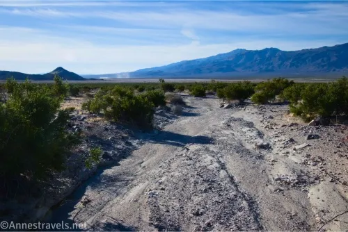
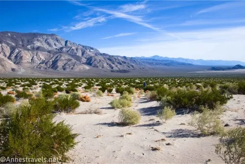
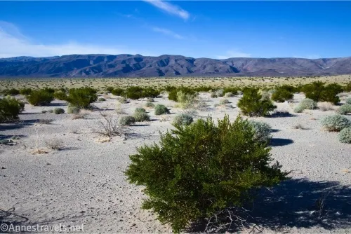
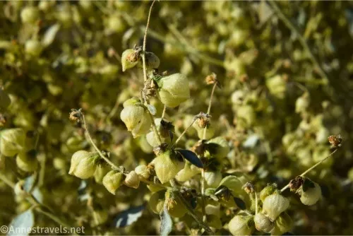
The first part of the hike is simple enough. Just stay within the rocks and on the beaten desert that’s obviously a trail (or only a faint trail). Then, after 0.2 miles, the path seemed to end. However, it picked up again until mile 0.5. The trail permanently disappears at this point, and you’re on your own. The good news? It’s hard to get too lost. There are greasebushes, but it’s still easy to see in all directions, including toward the sand dunes.
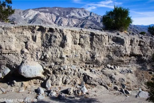
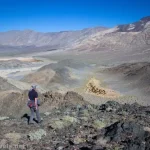
There is one obstacle on your way to Panamint Dunes. A deep wash has cut itself through the desert. If you can’t find a safe way to cross it, turn left (south) and follow the gorge until the walls drop enough for an easy crossing. Then start heading for the dunes again. The surface of the desert is generally smaller, stable pebbles. It’s not the easiest walking, but it’s not terribly difficult, either.
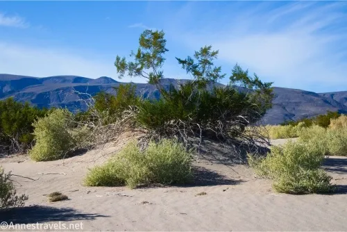
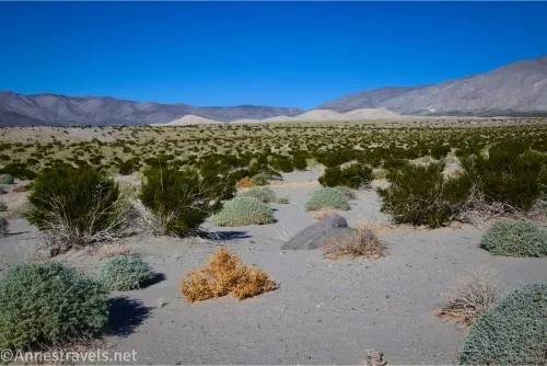
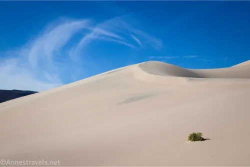
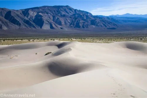
About a mile before reaching the edge of the dunes (about mile 2.7), the gravel gives way to sand. Again, it’s not the easiest hiking, but it’s firm enough not to be too much of a slog. Reach the edge of the sand dunes about mile 3.7.
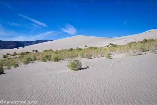
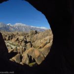
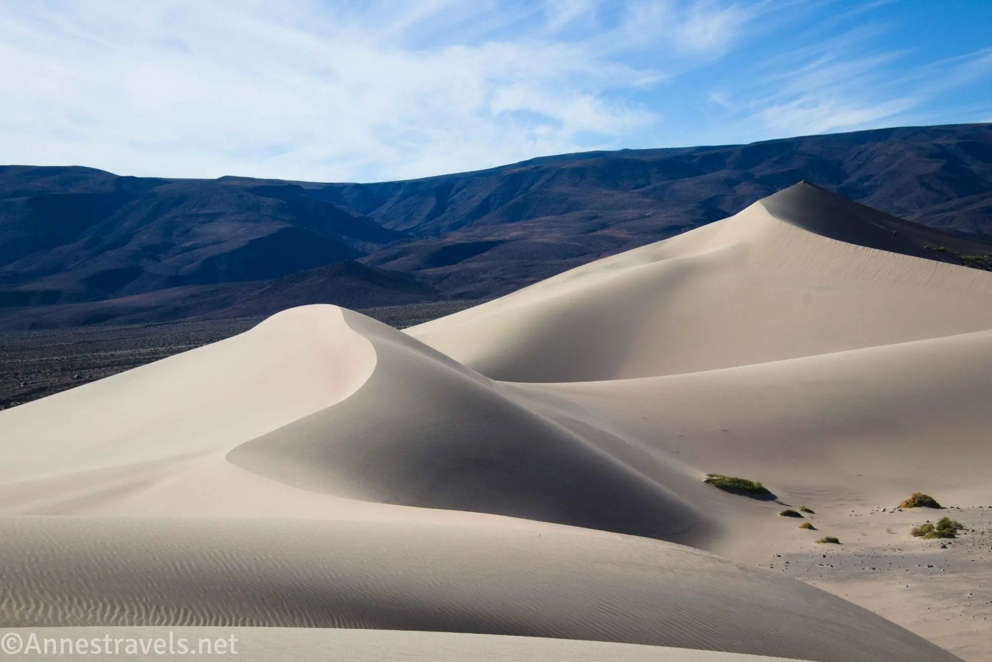
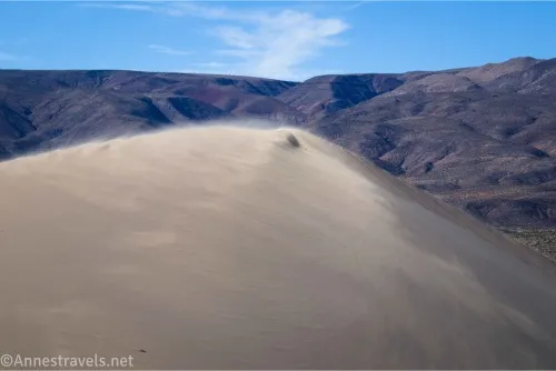
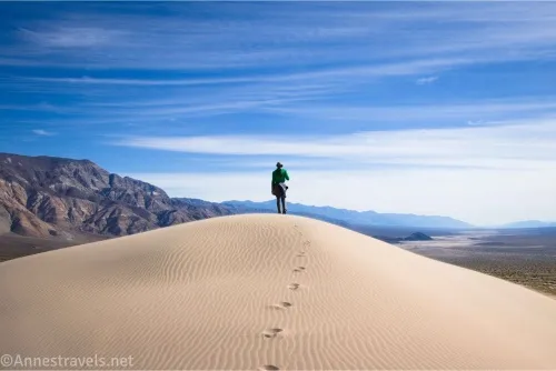
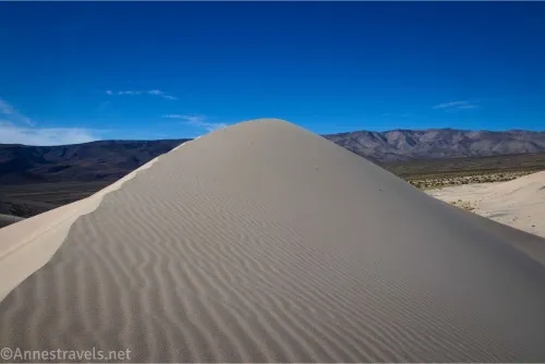
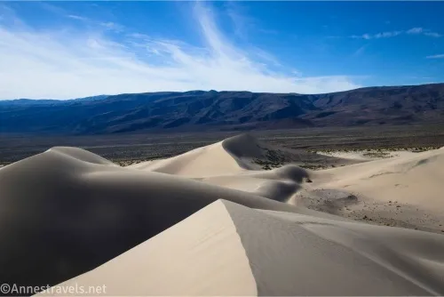
At this point, it’s up to you how much and where you want to explore. We decided to climb to the top of the highest dune via various sand ridgelines. It worked pretty well, though there was enough wind to make us think twice about getting our faces too close to the top of the sand dunes – the wind was blowing quite a bit of sand against our legs! Reach the high point about mile 4.1.
From here, we dropped off the ridgelines into a hollow in the sand to eat some lunch. (We were famished but none of us wanted sand in our tortillas, so it was important to get as much out of the wind as possible.) This turned out to be such a peaceful, great place to just hang out for a few minutes.
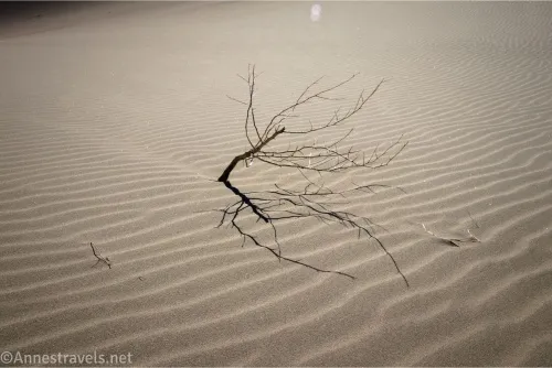
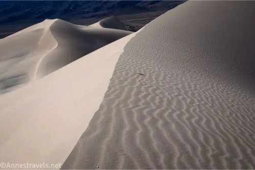
The best part of the Panamints Dunes (IMO) was the photography opportunities. I took so many pictures! But the views changed so beautifully and subtly around every curve of the dunes. Amazing!
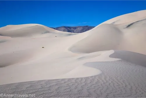
Sadly, it was totally the wrong time of day for photography out here. But I didn’t let it stop me from getting what photos I could in the nicely-angled November sunshine. Maybe I’ll pack my sleeping bag out there some night so I can get golden hour shots.
When you’re finished, retrace your steps to your vehicle. I opted to hike from here up to the Big 4 Mine, but the terrain between the dunes and the mine included a lot of fist-size or a little bigger rocks – it was not fun hiking at all! So if you want to do it, I’d recommend making a beeline for the Lake Hill Road to the left (north) of the parking area and following the road up to the mine. Your legs will thank you!
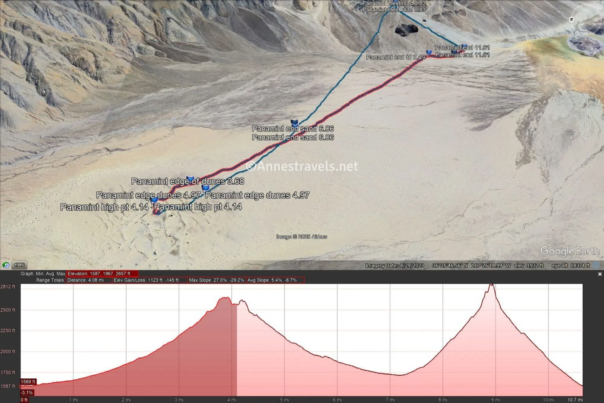
Round Trip Trail Length: If I had just done Panamint Dunes as an out and back, it would have been around 10.5 miles. I explored quite a bit in the dunes, so you could probably cut it back to 8 or 9 miles.
Elevation Gain: 1,268ft. (1,587ft. to 2,657ft.)
Facilities: None
Fees: $30/vehicle, valid 7 days. America the Beautiful National Parks & Federal Public Lands Passes and Death Valley Annual Passes are accepted.
Trail Notes: Remember, there is a trail for only half a mile (each way) of the hike. The rest is cross-country, though it’s hard to get lost on the way to the dunes, and on the way back, just keep heading toward the mountains on the other side of the valley and you’ll come to the Lake Hill Road sooner or later – hopefully close enough to your vehicle to spot it (if the road is heading significantly if not steeply uphill, turn right and descend to your vehicle. If the road is mostly flat, turn left to get back to the parking area). The route is very exposed; a very windy day would be brutal, as would a hot day. Horses are not allowed on the sand dunes. Don’t worry about leaving footprints on the dunes – they will blow away quickly, sometimes within a few hours. That said, if someone is trying to get great dune shots, give them some privacy.
Trail 
![]()
![]()
![]()
![]()
Road ![]()
![]()
![]()
Signs ![]()
![]()
![]()
![]()
Scenery
Would I go 100 miles out of my way for this?
Overall Rating: ![]()
![]()
GPS Coordinates for Panamint Dunes
TH: 36.4213350°, -117.4122040° (36°25.28010′, -117°24.73224′ / 36°25’16.8060″, -117°24’43.9344″) (1,594ft.) (0.0)
First end of trail: 36.4232330°, -117.4143200° (36°25.39398′, -117°24.85920′ / 36°25’23.6388″, -117°24’51.5520″) (1,592ft.) (0.20)
End trail: 36.4271560°, -117.4144910° (36°25.62936′, -117°24.86946′ / 36°25’37.7616″, -117°24’52.1676″) (1,620ft.) (0.49)
Edge of dunes: 36.4584880°, -117.4507580° (36°27.50928′, -117°27.04548′ / 36°27’30.5568″, -117°27’02.7288″) (2,433ft.) (3.68)
High point of dunes: 36.4616090°, -117.4552230° (36°27.69654′, -117°27.31338′ / 36°27’41.7924″, -117°27’18.8028″) (2,635ft.) (4.14)
Edge of dunes: 36.4566140°, -117.4521660° (36°27.39684′, -117°27.12996′ / 36°27’23.8104″, -117°27’07.7976″) (2,388ft.) (4.97)
Edge of sand (-ish): 36.4471420°, -117.4378360° (36°26.82852′, -117°26.27016′ / 36°26’49.7112″, -117°26’16.2096″) (1,964ft.) (6.06)
Deep wash: 36.4472670°, -117.4367700° (36°26.83602′, -117°26.20620′ / 36°26’50.1612″, -117°26’12.3720″) (1,962ft.) (6.20)
The gpx file for Panamint Dunes can be downloaded – please note that this and the GPS Coordinates are for reference only and should not be used as a sole resource when hiking this trail.
Download GPX File size: 258.3 KB Downloaded 71 times
(Note: I do my best to ensure that all downloads, the webpage, etc. are virus-free and accurate; however, I cannot be held responsible for any damage that might result, including but not limited to loss of data, damages to hardware, harm to users, from use of files, information, etc. from this website. Thanks!)
Getting to the Panamint Dunes Trailhead
From Stovepipe Wells, head west on CA-190. After 26 miles, turn right on the unmarked gravel Lake Hill Road (almost 2 miles before a paved the Panamint Valley Road goes off on the left). Drive 5.75 miles to a pulloff on the left just before the road begins uphill and becomes rougher.
From Panamint Springs, drive east on CA-190. About 1.9 miles beyond the turnoff (on the right) for the Panamint Valley Road, turn left on the unmarked gravel Lake Hill Road. Drive 5.75 miles to a pulloff on the left just before the road begins uphill and becomes rougher.
More Adventures in Panamint Valley
If you want the most detailed, complete guide to hiking in the western part of Death Valley, this is the book to get. Sand dunes, canyons, historic mines, and much more feature within these pages, which include 200 destinations for hikers and 4×4 drivers. Buy your copy here.