Early morning in Wyoming. Who even knew Wyoming had scenery like this? It’s a tempting thing to think that you come to a state boarder and all that classic Colorado scenery stops, and, oh, now we’ve got Wyoming scenery – flat tableland endlessly waving with sage brush or grass turned a deep golden brown by the searing summer sun. But natural geography is no respecter of state lines. Colorado flows into Wyoming; Wyoming into Montana; Montana into North Dakota… the “classic” scenery encompassing only a part of those multi-thousand-square-mile states.
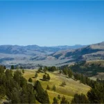
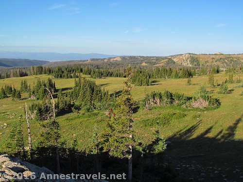
But that morning, the cold sun slanting across the rolling hills, I was only vaguely contemplating that I didn’t know Wyoming looked like Colorado as I gazed north toward the Snowy Range of the Medicine Bow Mountains. My mind was enjoying the fact that, by some miracle, we were here; in the middle of nowhere, with two whole weeks ahead of us to explore not only the Snowy Range, but also as much of Colorado as we could bring ourselves to. Spirits ran high, the sun rose higher still, and even cold cereal on the lee side of the van couldn’t dampen us.
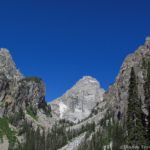
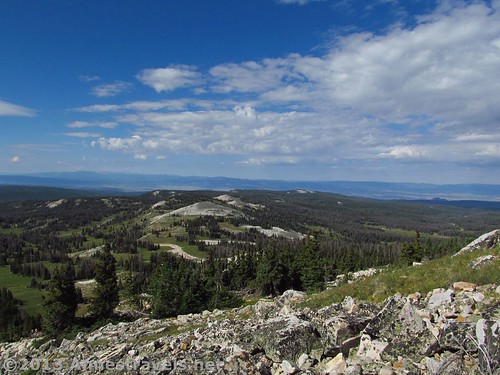
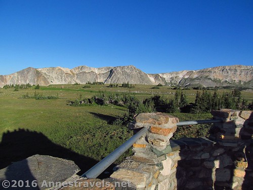
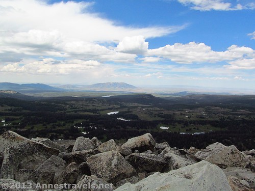
Who could complain with this kind of scenery around the breakfast table? To the south, east, and west, the rolling green meadows stretched away almost endlessly, broken only by an occasional tree or higher hillock, and to the south were a jagged ridge of the higher Rockies, misty, vague, and seemingly out of place in this flat and rolling land. To the north rose the sheer cliff faces of the Snowy Range, grey still speckled with snow in August, a hulking ridge sulking proudly in the new day’s sun.
I stood there, in the Libby Flats parking lot, letting my eyes feast on the beauty, balancing cereal bowl in one arm, spoon in the other hand, eating breakfast while chatting on the speaker phone of our little flip phone. It would be our one means of communication for the next two weeks with those back home, a sometimes annoying necessity (the phone reception, not the people).
One of the kids leaned down to pick up something they’d dropped on the blacktop. Standing up, their head grazed my hand balancing the phone. Before I could as much as say a word, the phone flew out of my hand, arced through the sunshine, and landed with a high pitched thud on the pavement.
I rushed to pick it up; it had dropped the call, of course, and it wasn’t on. Try as I would, try as any of us would (it was pretty quickly out of my hands) the phone would not wake up. Dark screen, no response. That phone was toast.
The sun was still shining, the hills still green, the cliffs still mockingly sparkling in the sunshine. The phone was our one means of communication. Something had to happen – without a Verizon store within 100 miles.
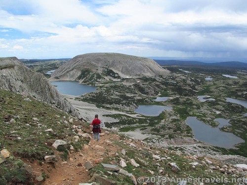
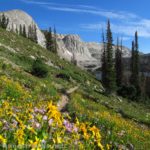
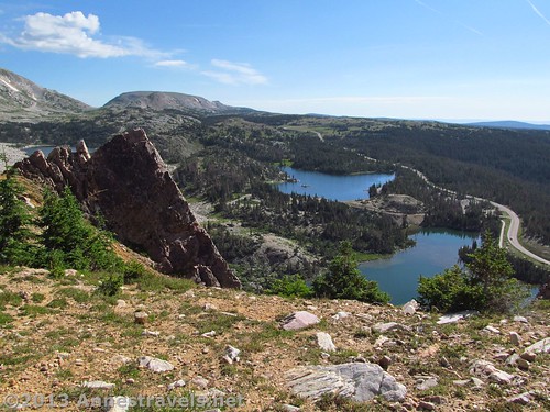
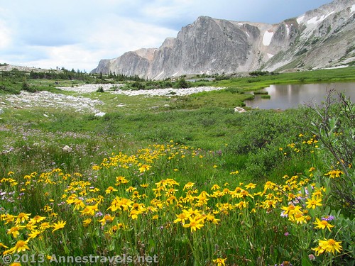
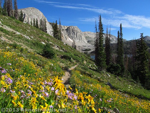
Somewhat subdued, we finished breakfast and drove down to Lake Marie to begin our hike. As disappointed as we were, it would be hard for hearts to stay downcast in such scenery. Switchbacking up a hillside studded with purple, yellow, and red flowers in every shape and size, the hills swept away to pristine alpine lakes sparkling in the sunshine below sheer grey cliffs; beyond the lakes and cliffs, more lakes and cliffs rose, higher and prouder, like a line of sentinels at their posts, more for show than for security, or a mountain spreading its arms to overshadow the lakes in the protection of its heights. How can I be sad in a place like that?
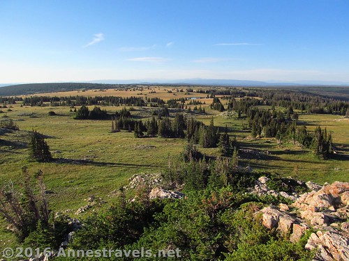
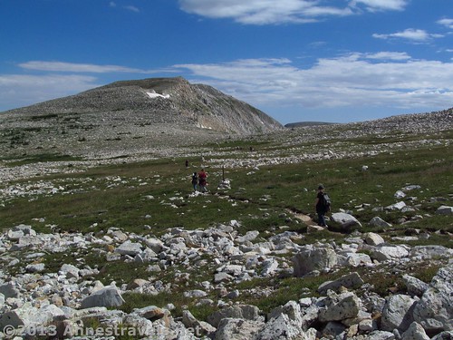
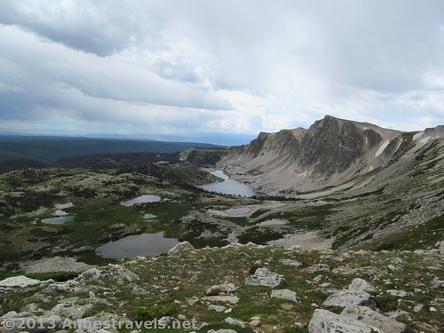
Higher and higher, more and more winding, leaving behind the meadows and lakes to enter a grassy land studded with snow-white rocks – everywhere, scattered like a brown and green sugar cookie with white sprinkles. Almost unreal; rocks can’t be this white in real life. The trail wandered between them, sometimes on them, marked by posts set up in cairns of white rock, like a pathway through the remains of a prehistoric hailstorm.
Meanwhile, I let my thoughts drift to the phone, like the clouds that were dispelling the sun and turning the meadows dark, now like a river filled with white boulders, the wind the rushing water between the stones. What would we do without the phone? There wasn’t a Verizon store for a hundred, maybe two hundred, miles from this place, and I didn’t really want to try and seek one out anyway.
I prayed on it, and suddenly was startled with a sight on the screen of my imagination: angels in the van with pliers and screwdrivers, pulling enormous white and red wires out of the phone. I didn’t think the phone actually had wires that huge, but that was beside the point. Those angels were having fun, giggling as they pulled wires here and there, cutting this, crimping that, pushing another wire out of the way with their pliers and screw drivers; one seeming to oversee the work while the others fixed whatever was broken.
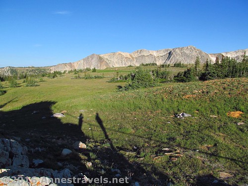
We finally reached the highest point in the range, Medicine Bow Peak. By now the clouds had encompassed the sky, dark, threatening, exactly what you don’t want to see at over 12,000ft. above sea level, especially when you’re the highest thing around. Eating a quick snack, crouching on the cold tan boulders – like sandy blocks of ice – and shale-like rock of the peak, we felt the hair on the back of our necks and arms begin to rise with static electricity. Peter, choosing that moment to stick his hand straight up over his head, was surprised to see electric shocks shooting out of his upward pointed finger. Scrambling in our haste, we stuffed snacks back in the packs and headed for lower ground.
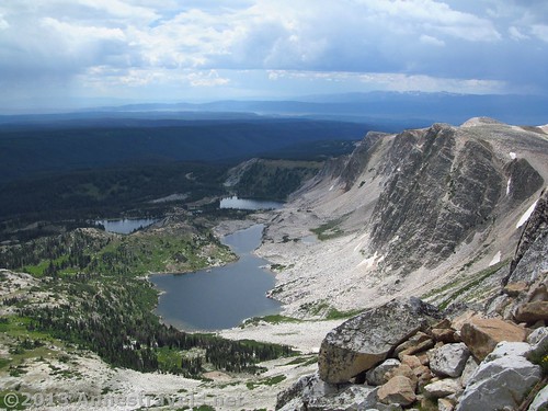
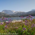
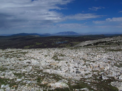
The trail down the peak was steep to say the least, but it was also jaw-droppingly scenic. I found myself tripping over my own feet, trying to hike, to get to lower ground, and yet to look out over the expanse below. The cliffs rose here, higher than before, arching in a sheer faced ridgeline of grey and white rock. Nestled below them, studded with green, was one blue lake after another; those that were not surrounded with green foliage were offset by rocky shorelines and more cliffs. The sun appeared suddenly, a shaft making the lake glow, the surrounding area still overshadowed by clouds. It was stunning, and I was disappointed the descending trail was so short.
Back at the van, we found a place for supper, only to discover that the rolls we’d purchased a few days earlier were totally moldy, even though the sell-by date wasn’t for another week. Ugh. I tried the phone, nothing. Daddy came along and tried it, nothing. So he anointed it with DW-40, and held down the off button for about 30 seconds.
Silence.
Then…
Ching-a-ching, ching, “Welcome to Verizon”.
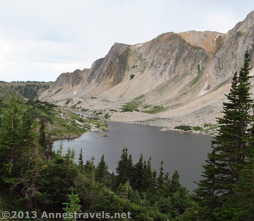
The evening sun broke through the clouds to dry the picnic table and the wet leaves on the trees around the picnic area, making nearby Lake Marie to sparkle like a hundred thousand gems within its blue-green depths. The phone, safely tucked away in the van, would carry us through the trip, well beyond the trip, through more than four more trips into and through the wilderness. It’s going on five years since the phone died its first death, and it’s still going strong.
A few years later, surrounded by alternative-medicine seeking tourists and local travel bugs at a hot spring in one of Wyoming’s tiny ranching towns, one of the townspeople told me of the prettiest roads in Wyoming. I mumbled something about checking it out. But really, I had already driven that road, past Lake Marie, past the Snowy Range, past Medicine Bow Peak, where we were not struck by lightning, and where our phone had come back to life. Perhaps I’ll return some day to see this “prettiest road in Wyoming” once again.