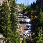
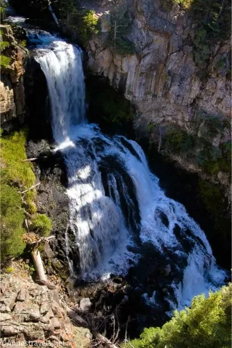
There are two ways to see Undine Falls in Yellowstone National Park. The first is the official overlook, which requites virtually no hike and has a lovely view of the falls. The second is to start at the Lava Creek Picnic Area, pick up the Lava Creek Trail, and then hike down the opposite side of the gorge until you come to a place where you can see the falls. I’ve done both, and there’s no question that the official overlook has a more accessible, fuller view of Undine Falls. That said, the hike is pretty enough, especially when it’s not a hot and airless summer afternoon (don’t ask me how I know such things).
Quick Stats
This guide may contain affiliate links. There is no extra cost to you for clicking on these links.
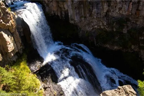
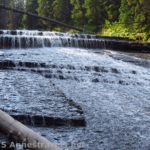
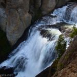
We’ll tackle the official Undine Falls Overlook first. Park in the parking area, walk to the viewpoint. Sweet and simple.
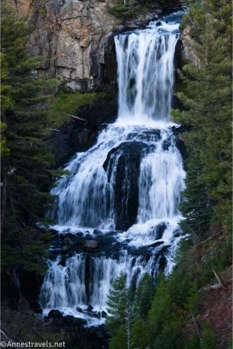
I visited in the evening, so the falls were lovely for long shutter speed shots, but the gorge didn’t have great lighting.
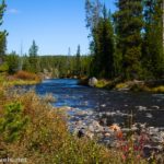
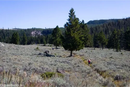
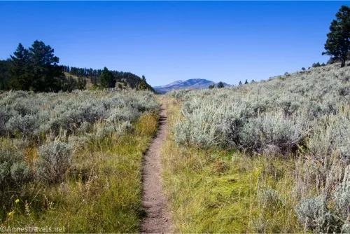
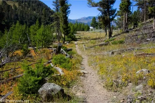
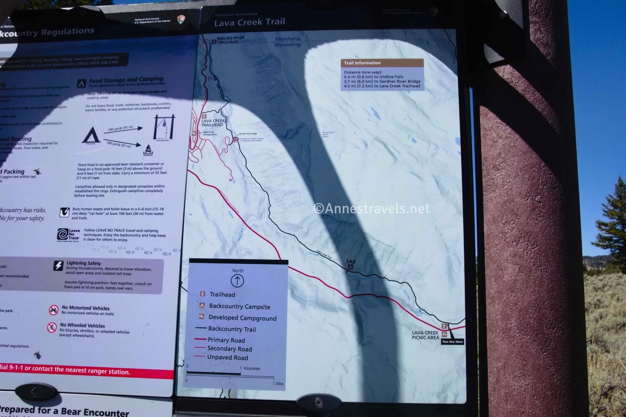
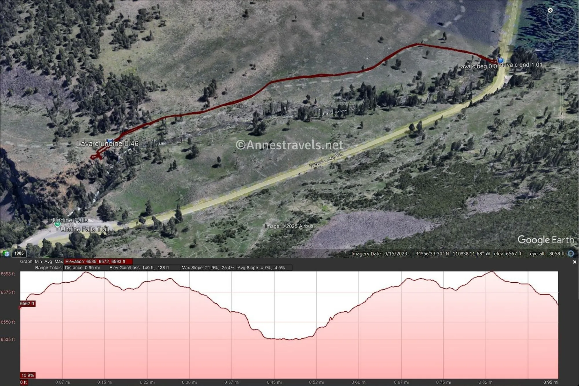
Now for the hike. Begin at the Lava Creek Picnic Area, turn right on the road, and cross the bridge. On the other side, a marked but inauspicious trail heads north (on the opposite side of the road from the picnic area). Once through the first fringe of trees, there will be a sign with an official Yellowstone National Park Issue map. A short distance beyond this, the trail T’s into the Lava Creek Trail. Turn left (toward Mammoth). The views in this section are nice if a little limited, but it was too hot to really enjoy them at noon in September.
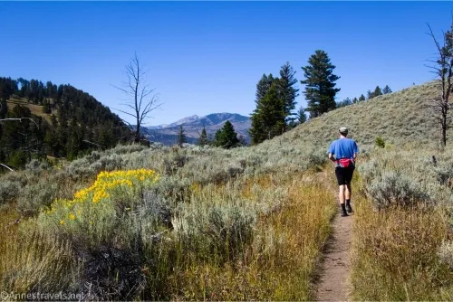
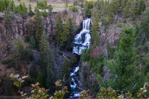
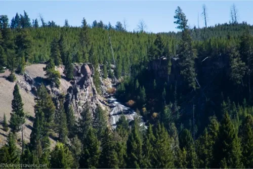
After less than half a mile, you will likely hear Undine Falls on your left. You’ll probably have to walk off-trail to see the falls; use care as there are no guardrails or an official viewpoint – you can wander along the top of the lava cliffs that make up the top of the gorge below the falls to find the best viewing point.
The views here are closer than the official viewpoint, but you can’t see the entire falls. So it’s a little disappointing.
When you’ve finished looking at the falls, retrace your steps to the picnic area, or enjoy even more views by continuing down toward Mammoth!
Round Trip Trail Length: Official Viewpoint is 100ft. I went 1.0 mile via the Lava Creek Trail.
Elevation Gain: 140ft. (6,535ft. to 6,593ft.) for the hike; the overlook has negligible elevation gain.
Facilities: Picnic area and primitive toilet at the trailhead
Fees: $35/vehicle to enter Yellowstone National Park, valid 7 days. America the Beautiful National Park & Federal Public Lands Passes and Yellowstone Annual Passes are accepted.
Trail Notes: Use care near the cliff edges as it’s a steep drop into the gorge from both viewpoints, and there are no railings along the Lava Creek Trail. Water flow is highest in the spring, but I was quite happy with the autumn flow, as well. Note that the bridge to Mammoth along the Lava Creek Trail has been out since 2022, so research whether or not it’s been replaced before planning a shuttle hike.
Trail 
![]()
![]()
Road ![]()
Signs ![]()
Scenery ![]()
![]()
Would I go 100 miles out of my way for this? ![]()
![]()
![]()
Overall Rating: ![]()
![]()
GPS Coordinates for Undine Falls
Official Viewpoint TH: 44.9435560°, -110.6404390° (44°56.61336′, -110°38.42634′ / 44°56’36.8016″, -110°38’25.5804″) (6,598ft.) (0.0)
Official Viewpoint: 44.9436930°, -110.6404550° (44°56.62158′, -110°38.42730′ / 44°56’37.2948″, -110°38’25.6380″) (6,592ft.) (50ft.)
Lava Creek Picnic Area TH: 44.9408960°, -110.6321480° (44°56.45376′, -110°37.92888′ / 44°56’27.2256″, -110°37’55.7328″) (6,564ft.) (0.0)
Undine Falls Viewpoint: 44.9442750°, -110.6387030° (44°56.65650′, -110°38.32218′ / 44°56’39.3900″, -110°38’19.3308″) (6,527ft.) (0.46)
End at TH: 44.9409120°, -110.6321050° (44°56.45472′, -110°37.92630′ / 44°56’27.2832″, -110°37’55.5780″) (6,564ft.) (1.01)
The gpx file for Undine Falls via the Lava Creek Trail can be downloaded – please note that this and the GPS Coordinates are for reference only and should not be used as a sole resource when hiking this trail.
Download GPX File size: 16.7 KB Downloaded 115 times
(Note: I do my best to ensure that all downloads, the webpage, etc. are virus-free and accurate; however, I cannot be held responsible for any damage that might result, including but not limited to loss of data, damages to hardware, harm to users, from use of files, information, etc. from this website. Thanks!)
Getting to Undine Falls
The Official Undine Falls Viewpoint is located on the left, 4.0 miles east of Mammoth toward Tower. It’s also on the right, 14.1 miles west of Tower Junction.
The Lava Creek Picnic Area is on the right, 4.4 miles east of Mammoth toward Tower. It’s also on the left, 13.7 miles west of Tower Junction.
For more easy hikes in Yellowstone…
Check out this brand-new guide to the easiest day hikes in the park! From geysers and thermal areas to mountains, lakes, and waterfalls, there is so much to be seen without an arduous trek. Buy your copy here.