
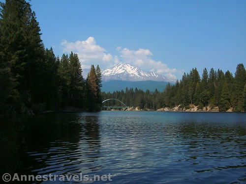
Views across Lake Siskiyou toward Mt. Shasta
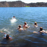
I’m sitting here at my computer desk, and on the wall is one of those analog calendars; the kind with a picture on top and the days of the month in big squares so you can write all your appointments down. The top is a spectacular photo of six heads bobbing just above the water; the lake is a rippling, dappled blue, the shore is a sandy tan, and the firs above the shore are a deep, wilderness green. But what really makes the picture is 1) the blue arc of a bridge at one end of the lake, and 2) the towering, massive, snow-studded peak of Mt. Shasta over the bridge. It’s Lake Siskyou, just west of the town of Mt. Shasta, and it’s probably one of the most spectacular swimming places I’ve ever been. Even without my glasses, the beauty and tranquility of the place was almost more than was believable.
Getting to the swimming place was the hardest part. We desperately needed to jump in something after a week of 100+ temps driving across the country, crawling through caves at Lava Beds, and hiking on Mt. Shasta for two days, so after descending from Hidden Valley, we followed a brown sign pointing toward Lake Siskyou.
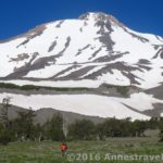
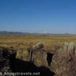
Looking the other direction from Mt. Shasta
Well, signs there might have been at the highway, but there weren’t enough signs to get us to the lake, proper. We finally pulled into a hikers’ parking lot with a sign and a map. Using that and my hiking GPS, we wound our way on tiny mountainous roads over streams and through the thick forest, turning hopefully in the right places, to emerge in a parking area packed with trucks and a few cars. There was even a double primitive restroom.
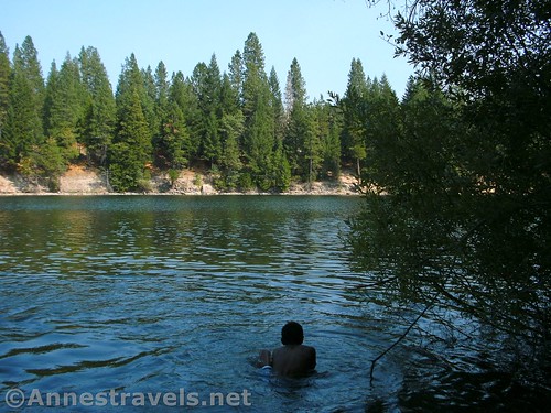
We parked, changed, and headed down to the lakeshore. But instead of walking to the end of the road where everyone else seemed to be hanging out, we went down a path in the vegetation to a little pebbly beach, nicely secluded, and with a stunning view of Mt. Shasta and the nearby bridge. (It was also in the shade, which meant we didn’t have put on yet another coat of sunscreen.)
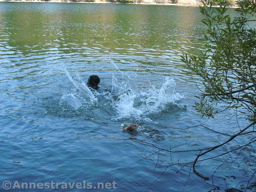
He asked me to get a picture of him falling backward off the stump…
We swam, we jumped off submersed tree stumps, we threw in big rocks. We watched a couple people paddle by in canoes and kayaks, and shook our heads at the people jumping off the bridge (blatant signs at the bridge prohibit jumping). In general, we cooled off and marveled at the fantastic scenery.
We probably spent 90 minutes enjoying the lake before trekking back up to the parking area. But the pictures and the memories of the beautiful swimming spot aren’t dimmed – if I’m ever in the area, I’ll be sure to head back!
Round Trip Trail Length: Not far; you just have to walk or scramble down to the lakeshore
Fees: None
Facilities: Primitive restrooms
Notes: There are no lifeguards; swim at your own risk. Also, with the recent very wet winter, I suspect Lake Siskyou is quite a bit higher than when I visited. So that pebbly beach may be under several feet of water at this point…
Interest 
Signs
Cleanliness
Fun
Ease of Access
Would I go 100 miles out of my way for this?
Overall Rating:
Key GPS Coordinates for swimming at Lake Siskiyou
Parking area is about 41.283691N / -122.330250W (41° 17′ 1.287″ / -122° 19′ 48.9″)
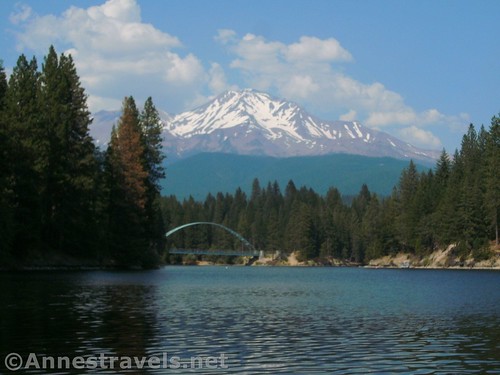
The bridge and Mt. Shasta over Lake Siskiyou
Getting to the swimming place at Lake Siskiyou
From I-5, take Exit 738 toward the town of Mt. Shasta. Follow the signs west toward Lake Siskiyou. After 0.4 miles, turn left onto Old Stage Road. Continue another 0.2 miles and stay right onto W A Barr Road (you may not see a street sign – it’s the slight right with lots of signs around it). Drive 0.8 miles and turn right onto N Shore Road. The road will become dusty gravel, still passible by passenger cars. After 1.1 miles, just after passing the bridge (on left), turn left at an unmarked junction for 0.2 miles to the end of the road and the parking area under a stand of trees.
Zoom map out to browse nearby hikes & places of interest
This Week’s Featured Product!
Even if you don’t plan to hike the big mountain, this book offers day trek options both on Mt. Shasta and in the surrounding area.
Pingback: Sneak Peak: A Land of Volcanos and Oceans - Anne's Travels