
When I looked up the best hikes around Roanoke, Virginia, one of the most popular was the Roanoke Star. Mind you, you can drive nearly to it. I suppose you can also hike up the hill from the bottom instead of driving, but I opted to take the easy route since we’d already hiked Tinker Cliffs that day. If you happen to be in the area, or driving the Blue Ridge Parkway, it’s well worth the stop to see the star and the view over the city.
Quick Stats
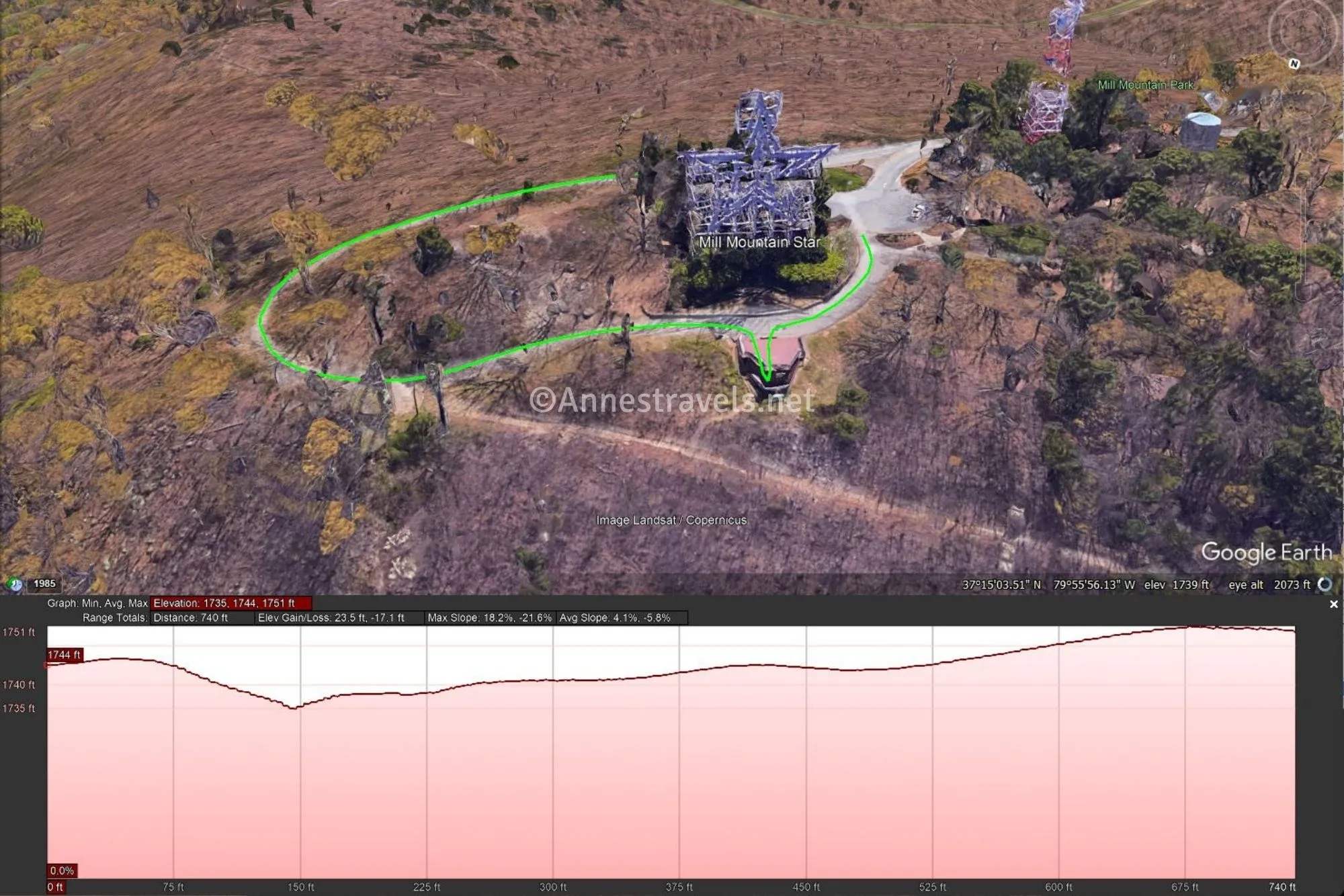
From the parking area, walk on the sidewalk along the parking area to the right of the buildings until you come to the final sidewalk. It’s really not to hard to find, especially since there’s a sign early on about how you’ll be on “Star Cam” – if you stand by the star and go to www.roanokeva.gov/starcam, you’ll get to see yourself on camera!
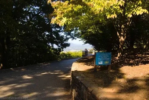
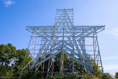
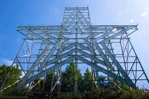
Keep walking on the gentle slope to the viewing area, passing a side path on the left (this would loop you down to the playground/discovery center area). Once at the viewpoint, you can turn back to see the huge star…
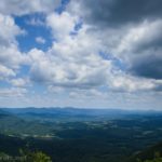
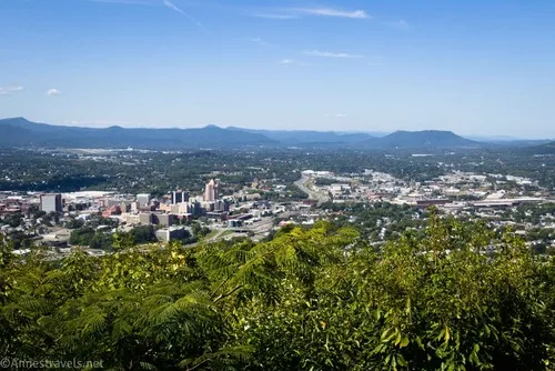
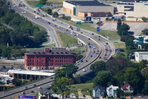
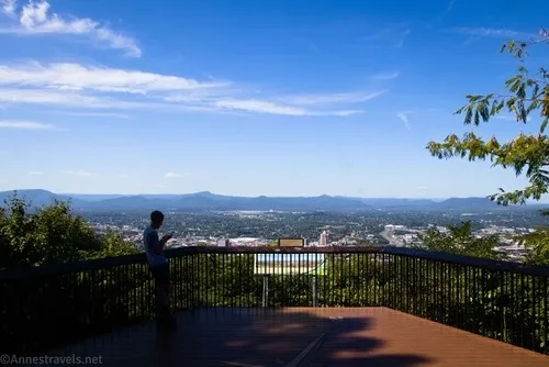
…or you can walk over to the fence for a great view down on Roanoke.
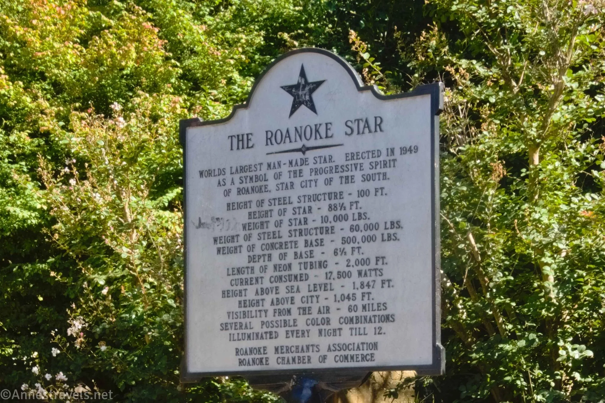
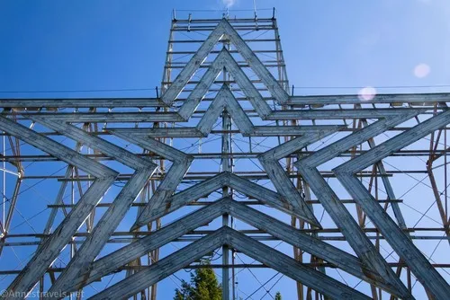
Below the star is a sign about the Roanoke Star – it’s the largest man-made star in the world, was erected in 1949, and was simply a symbol of “the progressive spirit” of Roanoke (their words; I’m not making fun here). The star is 88.5ft. tall, weighs 10,000lb., and has 2,000ft. of neon tubing.
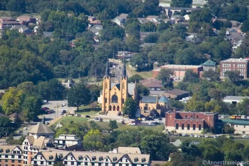
I enjoyed taking some close-up pictures of the city far below as well as more distant views.
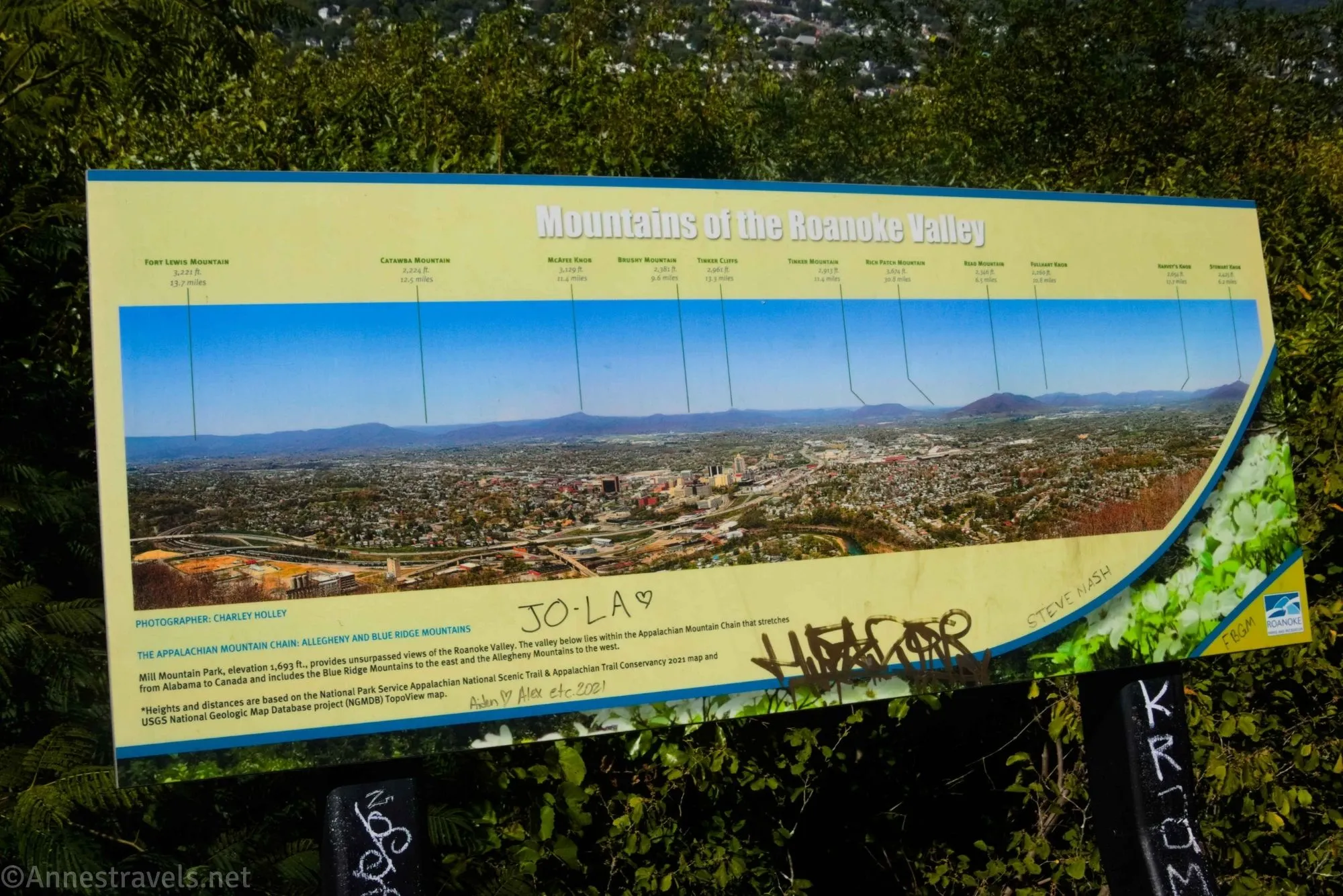
A sign on the fence identifies interesting features in the mountains, including McAfee Knob and Tinker Cliffs.
We also texted home so that the rest of the family could see us on the Star Cam before walking back to the parking area! We opted to walk back the way we came, but you can also take the trail that extends to the right beyond the viewpoint – this will loop you back to the parking area about 0.1 miles later.
Round Trip Trail Length: 300ft. If you take the long loop back to the parking area, it is about 0.15 miles
Elevation Gain: 8ft. (1,745ft. to 1,739ft.) (or 41ft. with the looping trail)
Facilities: Restrooms, zoo, playground, and discovery center nearby (just down the hill – actually, the restrooms are the buildings to the west of the star parking area at the end of the road).
Fees: None
Trail Notes: This is very much wheelchair and stroller accessible. The sign lights up at night, usually until midnight, so it might be worth sticking around until it turns on just to see it. The nearby zoo is $10-12/person.

Trail 
Road ![]()
Signs ![]()
Scenery ![]()
![]()
Would I go 100 miles out of my way for this? ![]()
![]()
![]()
Overall Rating: 
![]()
GPS Coordinates for the Roanoke Star
TH: 37.2507400°, -079.9325620° (37°15.04440′, -079°55.95372′ / 37°15’02.6640″, -079°55’57.2232″) (1,739ft.) (0.0)
Viewpoint: 37.2510900°, -079.9324670° (37°15.06540′, -079°55.94802′ / 37°15’03.9240″, -079°55’56.8812″) (1,717ft.) (150ft.)
The gpx file for the Roanoke Star (including the extra loop) can be downloaded – please note that this and the GPS Coordinates are for reference only and should not be used as a sole resource when hiking this trail.
Download GPX File size: 5.0 KB Downloaded 388 times
(Note: I do my best to ensure that all downloads, the webpage, etc. are virus-free and accurate; however, I cannot be held responsible for any damage that might result, including but not limited to loss of data, damages to hardware, harm to users, from use of files, information, etc. from this website. Thanks!)
Getting to the Roanoke Star Trailhead
From Roanoke, head south on I-581S. Take the exit to Elm Avenue West and turn right. After 0.2 miles, turn left onto S Jefferson Street for another 0.4 miles. Turn left onto Walnut Avenue SE to pass under the highway. Continue on this road for 2.1 miles, then take a very sharp right turn onto Mill Mountain Spur SE (it is signed for several attractions, including the Star Overlook). The parking area at the end of the road 0.7 miles later is the trailhead.
From the Blue Ridge Parkway near Milepost 120, take the turn toward Mill Mtn. Park & Zoo; Historic Roanoke Star; Downtown Roanoke. After 2.4 miles, turn left onto Mill Mountain Spur SE (it is signed for several things, including the Star Overlook). The parking area at the end of the road 0.7 miles later is the trailhead.
More Trails near Roanoke
Explore 40 more trails near Roanoke, Virginia, with this guide. Waterfalls, mountain views, and much more are featured on varied lengths of day hikes that are sure to suit every hiker. Buy your copy here.