I’ve heard about the Blue Ridge Parkway most of my life, but I didn’t have a chance to really enjoy it until last summer when my aunt and uncle took several of us up to “The Parkway” for the afternoon. We had a great time stopping at Lover’s Leap and having lunch at the Poor Farmer’s Market in the Meadows of Dan before heading up to the Blue Ridge Parkway. Then we stopped at Mabry Mill (so fun!) before heading up to the overlooks on Rocky Knob (about milepost 170).
Quick Stats
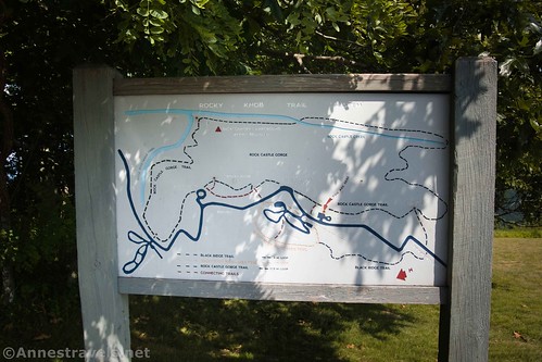
There are three overlooks on Rocky Knob: the 12 O’clock Knob Overlook (sometimes called Rocky Knob View), the Rock Castle Gorge Overlook, and The Saddle Overlook. The Rock Castle Gorge Trail connects the overlooks (and goes well beyond on both ends), but we were driving that day instead of hiking.

Of the three overlooks, The Saddle was my favorite with Rock Castle Gorge Overlook as a close second. There’s nothing wrong with 12 O’clock Knob Overlook; I just didn’t find it quite as interesting historically or from a view standpoint as the other two.
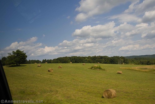
Getting to the overlooks is almost as scenic as the overlooks, themselves. The Blue Ridge Parkway twists and turns through the forest, over hills, between fields, and occasionally with great views down valleys or across meadows. Most of the time, you’re in the forest.
The entire region was once forested, then the entire region was farmed. Now it’s a mixture of farmland and forest, with the forests winning in terms of which is taking over the other. It just isn’t profitable to farm the Blue Ridge in this area.
12 O’clock Knob Overlook is the first overlook north of Mabry Mill (about 7 miles). It’s on the east side of the road and is little more than a parking area with a grassy hill leading down to the brush and the hiking trail.
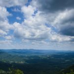
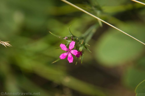
Views spread across the hills and flatlands. A few summer wildflowers also caught my attention.

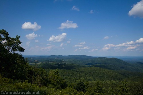
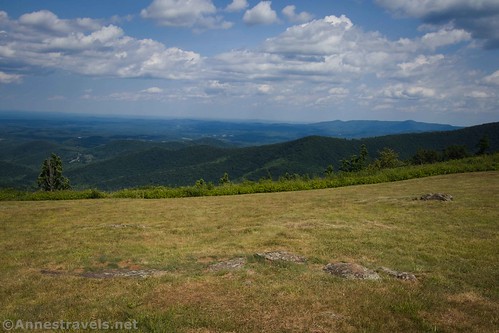
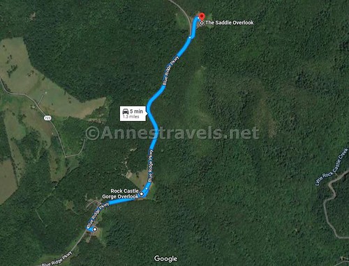
Only 0.3 miles north on the Blue Ridge Parkway is Rock Castle Gorge Overlook. (As you drive between the two, you’ll pass the ranger station that seems to be semi-permanently closed – I hear there’s a picnic area near the ranger station.) The views of similar hills and flatlands are better from here (at least per me). It’s one of those iconic patchwork-field photos only with darker green hills to boot.

Rock Castle Gorge is named for the six-sided crystals of quartz that were found by early settlers, who thought the crystals resembled castle towers. Cabins were built in the gorge by settlers before the American Revolution – farms produced oats, corn, buckwheat, sorghum, apples, and chestnuts. Only one house remains today, and the forest is reclaiming the gorge.

But it’s the clouds that really caught my eye. Amazing!
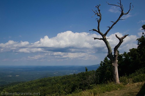
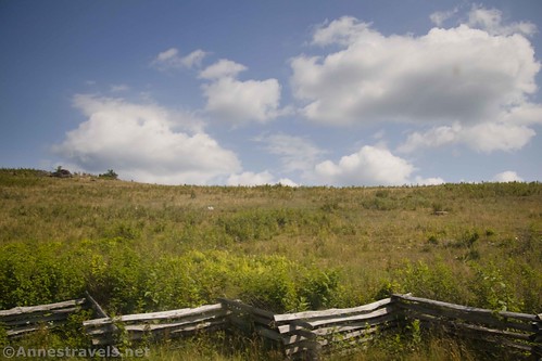
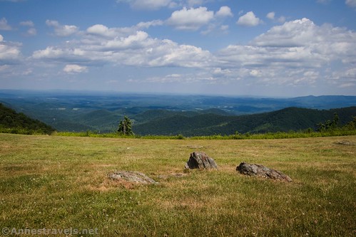
Eight-tenths of a mile north of the Rock Castle Gorge Overlook is The Saddle Overlook. This is the highest of the three overlooks and gives a great view of the area, though it is hemmed in a little by nearby hills.

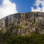
If you look west, you can see Buffalo Mountain. At 3,972ft., it’s more than 1,000ft. above the surrounding land. The mountain was rich in lead and was mined for many years. It was an important landmark for locals, especially in the days when maps and roads were both scarce.

But back on the east side, a helpful (maybe?) sign tells you that you’re on the “The Saddle” – but doesn’t bother to tell you what that means. It also includes a map that doesn’t show where The Saddle is. Maybe I just didn’t read it right, but I decided that looking at the view was more enlightening.

There’s also a stone wall, the kind that is so classic along the Blue Ridge Parkway. It’s perfect for standing on and looking down into the valley below.

A guy came along after a while and we all tried to identify some birds that were flying around. After we got back to the house, I did a little research and I’m fairly sure it was an indigo bunting.

That was as far as we went on the Blue Ridge Parkway! There isn’t much more to see for a bit, so we cheerfully went back down the way we’d come still thinking of visions of the views from the overlooks!

Round Trip Trail Length: No hiking required
Facilities: None (though the ranger station and nearby picnic area may have restrooms and/or picnic tables).
Fees: None
Trail Notes: Just enjoy the scenery here! It’s not a crazy hike, but it is very scenic. Note that the road is very twisty, curvy, and slow. If you’re like me, you might want a window seat and a package of pretzels. If you’re like my aunt, you may just want to drive. It’s how we both deal with motion sickness…

Trail 
Road ![]()
Signs ![]()
Scenery ![]()
Would I go 100 miles out of my way for this? ![]()
Overall Rating: ![]()

GPS Coordinates for the Rocky Knob Overlooks
12 O’clock Knob Overlook: 36.8098939°, -080.3500954° (36°48.59363′, -080°21.00572′ / 36°48’35.6179″, -080°21’00.3435″)
Rock Castle Gorge Overlook: 36.8121545°, -080.3459604° (36°48.72927′, -080°20.75763′ / 36°48’43.7564″, -080°20’45.4575″)
The Saddle Overlook: 36.8231127°, -080.3415289° (36°49.38676′, -080°20.49173′ / 36°49’23.2059″, -080°20’29.5041″)
Getting to the Rocky Knob Overlooks on the Blue Ridge Parkway
The overlooks on Rocky Knob are around Milepost 170 on the Blue Ridge Parkway
From I-81, take Exit 114 toward Floyd. Turn onto VA-8S (aka W Main Street) (left if coming from I-81S, right if coming from I-81N). Drive 25.4 miles south on VA-8S. Take the exit on the left onto the Blue Ridge Parkway; once at the parkway, turn right. Take the Blue Ridge Parkway 2.9 miles to The Saddle Overlook, on the left. (Note that coming from this direction, you’ll see the overlooks in the reverse order of how I presented them in the description.)
From Greensboro, follow I-73N. Continue straight when the road becomes US-220N. Seventeen miles from here, turn left onto Martinsville loop, then 0.8 miles later, turn left onto Spencer Road. You will enter Virginia within 0.4 miles before you continue straight on Horsepasture Price Road. After 6.8 miles, turn left onto US-58W for 33.8 miles. Turn right onto State Rt. 795 for 0.4 miles, then continue straight on State Rt. 603 for 0.5 miles. Turn left toward the Blue Ridge Parkway; once on the parkway, turn right. The first overlook will be on your right after 8.2 miles.
This Week’s Featured Product!
Enjoy easy hikes along the Blue Ridge Parkway using this book. Maps and mile-by-mile descriptions help you choose the best hikes for your fitness level and time constraints.