When I visited the Sawtooth Mountains, I asked Google for all the blog posts about the “best” hikes in the region. Several suggested Bridalveil Falls as one of the top-tier hikes in the area. Having hiked it, I’m really not sure why it’s considered “best.” Maybe I just visited in the fall, when the falls wasn’t roaring, but even spring wouldn’t fix the crazily steep social trail required to see the falls. The good views are also over very early in the hike. The best part of the hike (to us) was visiting Lady Face Falls – which you can hear but you can’t see. (We scrambled around and at least saw waterfalls below Lady Face Falls, which were very pretty.) Anyway, I’m not selling this hike very well, but feel free to read on if you need an early-season hike without a ton of elevation gain, since it thaws out earlier than many of the higher-elevation hikes. (And if you want to know what I’d consider the best hikes in the Sawtooths, I made my own post here!)
Quick Stats
This post contains affiliate links. If you click a link and purchase something, I may receive a small commission. Thank you for supporting Anne’s Travels!
0.0 Parking area for Bridal Veil Falls (6,559ft.). Continue to walk up the road for about 500ft to where the path takes off on the left. (44.2475540°, -115.0663100°)
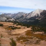
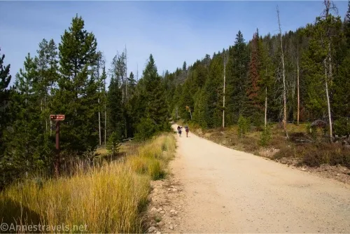
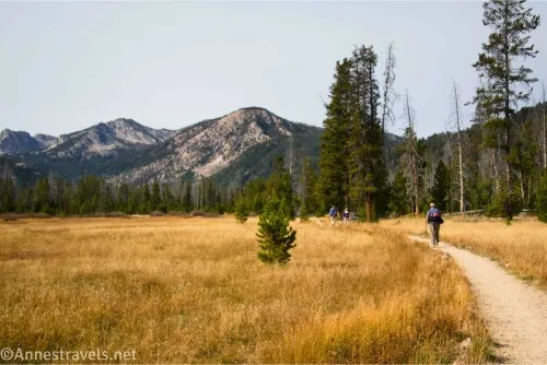
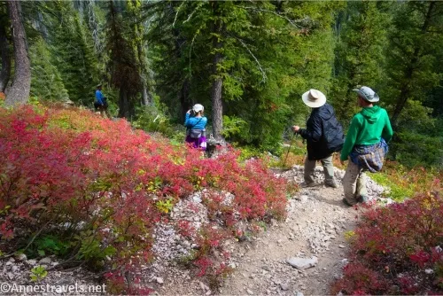
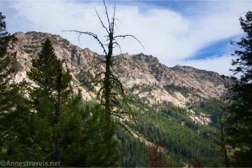
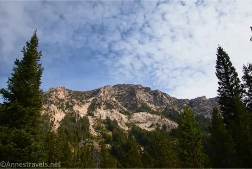
500ft. Elk Mountain Loop turns left (6,584ft.). Turn left here off of the road and onto a very visible (if not very wide) trail. The path after this passes through light forests and meadows with a few reasonable views that would be lovely with snow still clinging to the peaks. (44.2481130°, -115.0679810°)
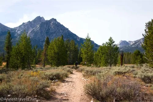
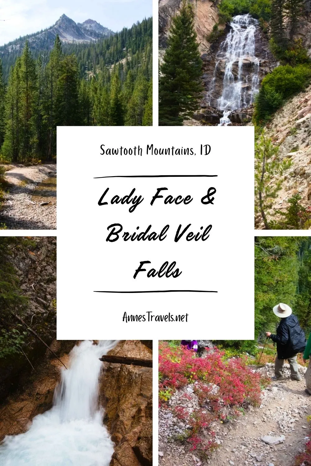
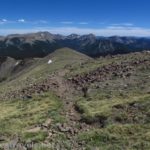
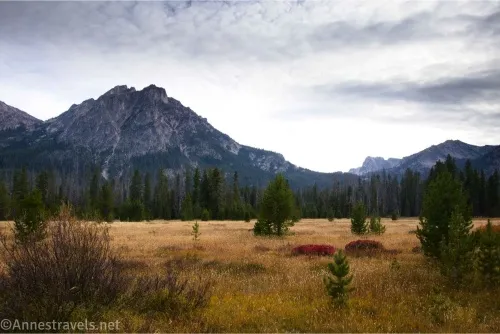
0.7 Trail Register (6,543ft.). Continue right with the Stanley Lake Trail No. 640 after signing in. Enjoy the views in this meadow – they’re the best you get on the hike. (44.2429920°, -115.0757990°)
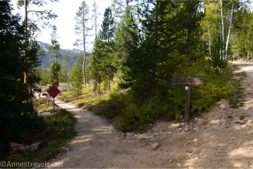
1.3 Alpine Way Junction on left (6,560ft.). The Alpine Way (Trail No. 528) turns left here on a very unassuming trail. Continue right (straight) on the Stanley Lake Trail No. 640 as it wanders through the woods. (44.2379340°, -115.0855120°)
2.0 Lady Face Falls Junction on left (6,780ft.). A well-worn path turns left here beside a sign for Lady Face Falls. (Enjoy this sign. It’s the last you’ll see for a long time.) Turn left. The path narrows significantly as it wanders through the fir trees, but it eventually takes you to the rim of a gorge (or close to the rim of a gorge). (44.2309490°, -115.0987620°)
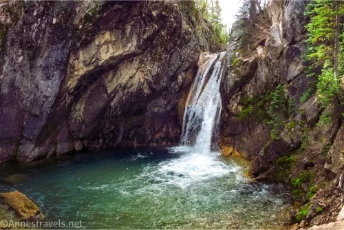
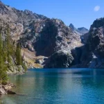
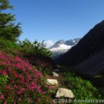
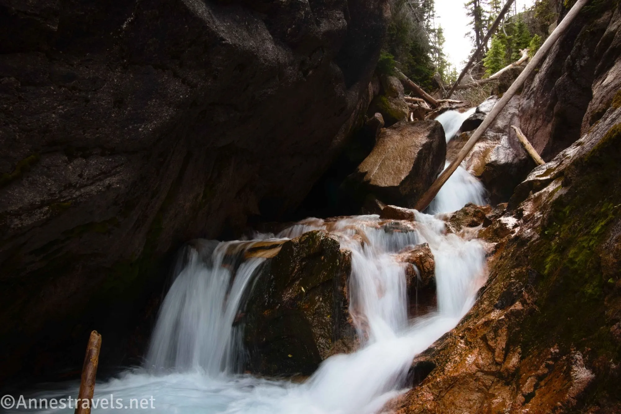
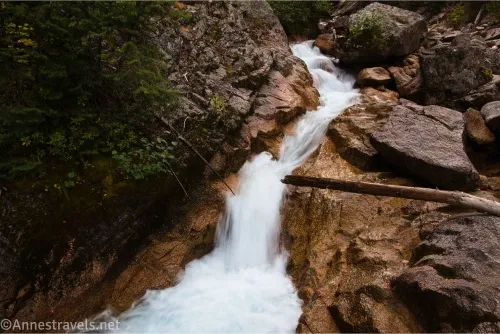
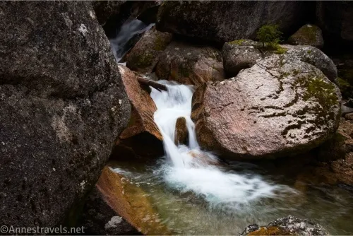
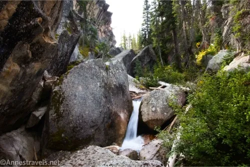
2.6 Lady Face Falls (6,713ft.). You can hear the falls from here, but the view is entirely of trees and rocks. One of my group members wiggled and scrambled his way down to see Lady Face Falls, but his report was that the effort was well more than what it’s worth to see the falls. I walked left and followed social trails (and scrambled a bit) to get down to the creek below Lady Face Falls – while I didn’t see the named falls, there are quite a few other small waterfalls in the gorge. Some of them were pretty. Return to the main trail (but only after you’re done exploring). (44.2308680°, -115.0967330°)
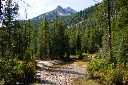
3.1 Return to the main trail (6,781ft.). Most people turn around here, from what I can tell from the trail register (everyone was going to Lady Face Falls!) However, believing the best about what would come next, we trekked on through the forest and eventually crossed the creek at a ford about mile 3.5 – helpful hikers had put down logs, so it wasn’t a big deal to cross, even though the stream is wide at this point. (44.2309180°, -115.0987400°)
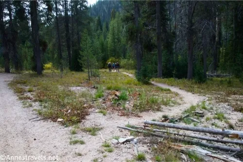
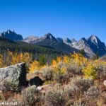
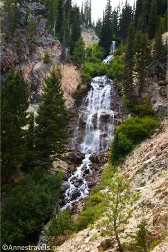
4.4 Unmarked side trail on right (7,284ft.). I missed this junction on the first pass – not because I didn’t see it, but because I was expecting a destination as famous as Bridalveil Falls to have a sign! (After all, up until now, the trail had been pretty well-signed). I hiked about a quarter mile in the wrong direction, pulled out my GPS coordinates, and we headed back to pick up the right trail to see the falls. At first, the trail is social in nature but not terrible – getting across the creek was a small challenge, but we kept our feet dry without issue in September. Then the trail began to climb. And the higher it climbed, the more obvious it became that this trail was not official in the least! It’s slippery, steep, rocky, and not one bit fun to ascend (let alone come back down). But we did eventually make it up to a place where we could see Bridalveil Falls! (44.2144940°, -115.1010680°)
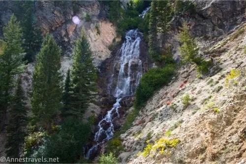
5.0 Bridalveil Falls Viewpoint (7,284ft.). I hesitate to call this a viewpoint; it’s simply a place without too many trees on the hillside where you can see the falls. The path continues, but we decided the view wasn’t going to get much better and we were done with trails so steep we were afraid of sliding back down the mountain instead of hiking! Because it was September, the falls were lacy and veil-like. I hear they roar quite nicely in the spring. We sat down on semi-stable rocks, balanced paper plates, and ate lunch while enjoying the view of the falls before retracing our steps back to the main trail. (44.2120070°, -115.1065110°)
5.6 Return to the main trail (6,853ft.). Turn left and retrace your steps (thankfully on a mostly flat trail!) back to the parking area. (44.2145410°, -115.1010620°)
9.3 Bridalveil Falls Trailhead (6,556ft.). (44.2475130°, -115.0663640°)
Round Trip Trail Length: Not including my 0.4 mile extra miles when I missed the turn, I went 9.3 miles.
Elevation Gain: 1,772ft. (6,527ft. to 7,300ft.)
Facilities: Campground close to the trailhead
Fees: None
Trail Notes: I’ve probably painted a gloomy picture of this trail in part because I was expecting much better, given everything else on the lists on the internet (which were hard but at least had spectacular views). So if you think you’d enjoy hiking the trail, go for it! In the spring, the mountains will still be streaked with snow, which would improve the views dramatically. Use care with the stream crossings, especially during spring runoff. Hiking poles are very helpful for not sliding too badly on the social trail up to Bridalveil Falls.
Trail 
![]()
![]()
![]()
Road ![]()
Signs ![]()
![]()
Scenery ![]()
![]()
![]()
Would I go 100 miles out of my way for this? ![]()
![]()
![]()
Overall Rating: 
![]()
![]()
GPS Coordinates for Lady’s Face Falls and Bridalveil Falls
TH: 44.2475540°, -115.0663100° (44°14.85324′, -115°03.97860′ / 44°14’51.1944″, -115°03’58.7160″) (6,559ft.) (0.0)
Elk Mountain Loop (Stanley Lake Trail No. 640) Junction: 44.2481130°, -115.0679810° (44°14.88678′, -115°04.07886′ / 44°14’53.2068″, -115°04’04.7316″) (6,584ft.) (482ft.)
Trail Register (junction in the meadow – Stanley Lake Trail No. 640): 44.2429920°, -115.0757990° (44°14.57952′, -115°04.54794′ / 44°14’34.7712″, -115°04’32.8764″) (6,543ft.) (0.68)
Alpine Way Junction (go right (not left) for Bridalveil Falls – stay on Trail No. 640 not 528): 44.2379340°, -115.0855120° (44°14.27604′, -115°05.13072′ / 44°14’16.5624″, -115°05’07.8432″) (6,560ft.) (1.36)
Leave trail for Lady Face Falls: 44.2309490°, -115.0987620° (44°13.85694′, -115°05.92572′ / 44°13’51.4164″, -115°05’55.5432″) (6,780ft.) (2.05)
Lady Face Falls: 44.2308680°, -115.0967330° (44°13.85208′, -115°05.80398′ / 44°13’51.1248″, -115°05’48.2388″) (6,713ft.) (2.64)
Return to the main trail: 44.2309180°, -115.0987400° (44°13.85508′, -115°05.92440′ / 44°13’51.3048″, -115°05’55.4640″) (6,781ft.) (3.13)
Unmarked junction: 44.2144940°, -115.1010680° (44°12.86964′, -115°06.06408′ / 44°12’52.1784″, -115°06’03.8448″) (6,855ft.) (4.78; was 4.4 when I arrived the first time)
Bridal Veil Falls Viewpoint: 44.2120070°, -115.1065110° (44°12.72042′, -115°06.39066′ / 44°12’43.2252″, -115°06’23.4396″) (7,284ft.) (5.40)
Return to the main trail: 44.2145410°, -115.1010620° (44°12.87246′, -115°06.06372′ / 44°12’52.3476″, -115°06’03.8232″) (6,853ft.) (5.99)
End: 44.2475130°, -115.0663640° (44°14.85078′, -115°03.98184′ / 44°14’51.0468″, -115°03’58.9104″) (6,556ft.) (9.75)
The gpx file for Bridalveil Falls can be downloaded – please note that this and the GPS Coordinates are for reference only and should not be used as a sole resource when hiking this trail.
Download GPX File size: 161.5 KB Downloaded 197 times
(Note: I do my best to ensure that all downloads, the webpage, etc. are virus-free and accurate; however, I cannot be held responsible for any damage that might result, including but not limited to loss of data, damages to hardware, harm to users, from use of files, information, etc. from this website. Thanks!)

Getting to the Bridalveil Falls Trailhead
The hike begins from the Stanley Lake Trailhead – there is a paid campground nearby. From the town of Stanley, head west on ID-21 for 5.0 miles. Turn left onto Elk Mountain Road (which may not be marked, but a sign a little way down the road gives the status of Stanley Lake Campground and Lake View Campground). Drive this road for 3.7 miles, then turn left into the Trailhead Parking.
Find Your Perfect Hike in the Sawtooth Mountains
There are dozens of trails in the Sawtooth Mountains, and this book helps you figure out which one(s) are best for you given your length restrictions and location. Buy your copy here.