
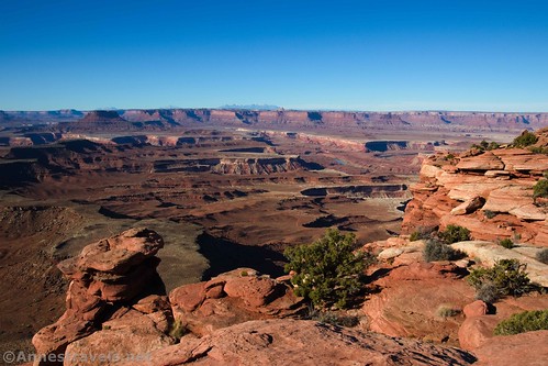
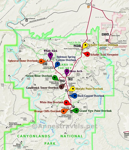
There are quite a number of viewpoints in the Island in the Sky District of Canyonlands National Park. Most are right along the road (or nearly so!) and take you to sweeping vistas of the canyons below. In this post, I’ll take you to most (if not all) of the viewpoints along the main road in Island in the Sky – there’s some great stuff to see with very little effort!
Note: Some of the links in this post are affiliate links. If you click one and purchase something, I may earn a small commission without an extra cost to you.

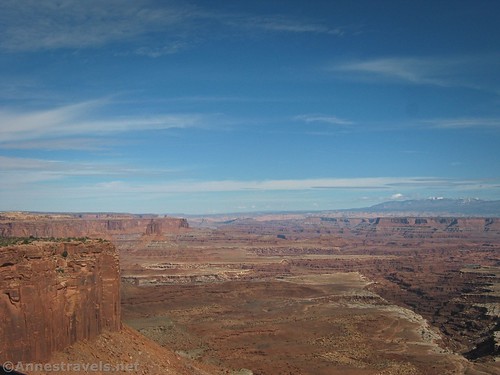
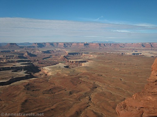
Schafer Canyon Overlook
Driving south on the main park road, the first viewpoint you’ll come to is the Shafer Canyon Overlook. A short (0.3 miles out & back) path leads down to a viewing area where you can look down on Schafer Canyon and the switchbacks of the Shafer Trail. Learn more about the Shafer Trail Overlook here.
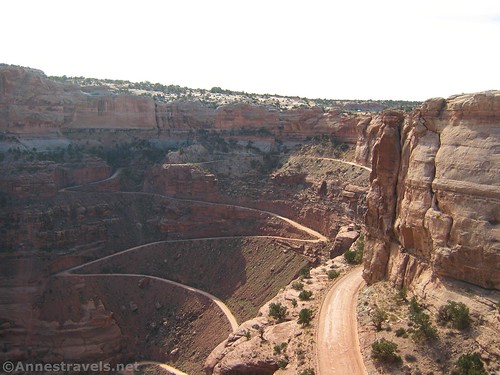
My rating: 3/5
Tips: Visit in the afternoon for the best views of the La Sal Mountains, Schafer Canyon, and vehicles coming up the Schafer Trail.
GPS Coordinates: 38.4526052°, -109.8199273°

Schafer Trail Viewpoint
This one isn’t typically shown on park maps, but it’s still a fun little stop. A small pulloff a short distance south along the park road allows you to walk over to a fence and look down on the switchbacks of the Shafer Trail and down into Schafer Canyon.
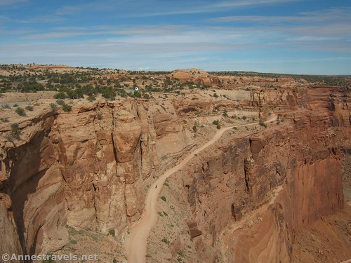
My rating: 3/5
Tips: Go in the afternoon to see vehicles coming up the switchbacks. The views are also better in the later part of the day, but too late, and Schafer Canyon (and the Schafer Trail) become shadowed.
GPS Coordinates: 38.452694°, -109.819875°

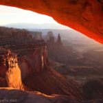
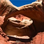
Mesa Arch
This is another short (0.75 mile) trail. It’s famous at sunrise, when photographers line up for the perfect shot. It’s pretty nice any time of day, though. Trail description here.

My rating: 4/5
Tips: Sunrise is extremely crowded. For the best experience, hike just after sunrise – you’ll still get those sunrise views, but there will be a lot fewer people around and it’s a much more friendly atmosphere. Later afternoon would be another great time to visit, while noontime makes the arch sort of blah.
GPS Coordinates: 38.3891167°, -109.8680333°
Note: Just after Mesa Arch, the road splits, with the Upheaval Dome Road turning right (west). I’m going to continue south on the main road and then circle back to the Upheaval Dome Road in a minute.

Candlestick Tower Overlook
To be honest, I’d forgotten this one existed. I’m not sure I’ve ever even stopped, despite the fact that it’s just a pulloff along the road. But I’d guess you can get some nice views of Candlestick Tower (surprising, isn’t it?) Photos I’ve seen suggest that the views here are more limited than some of the other viewpoints.
My rating: 2/5
Tips: Views here are best in the morning so you’re not looking into the setting sun to see Candlestick Tower.
GPS Coordinates: 38.3744524°, -109.8686582°
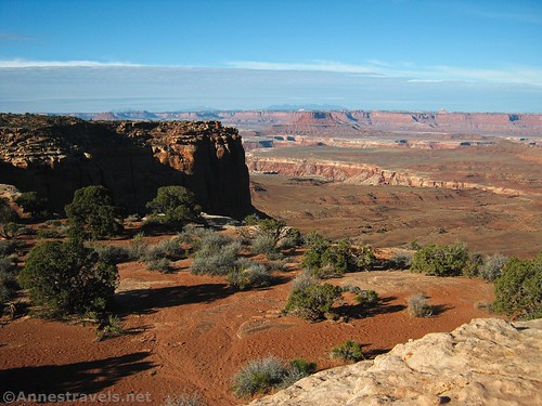
Murphy Point Overlook
This one is actually a pretty stiff hike at 3.5 miles RT. But it’s also mostly flat. Read about the hike here. It’s a great morning trek to spectacular views of Murphy Hogback, canyons, cliffs, mountains, and so much more.

My rating: 5/5
Tips: Definitely best as a morning hike, but there are enough views to the south that it can be done in the afternoon, too. The peaks you can see in the distance are the Henry Mountains.
GPS Coordinates: 38.3549500°, -109.8639833°

Buck Canyon Overlook
This overlook is a short paved path to a viewpoint. You can see Buck Canyon far below and a clear view straight to the La Sal Mountains.
My rating: 3/5
Tips: This is an afternoon viewpoint if ever there was one. If you can catch it when snow has settled on the La Sal Mountains, it’s a treat.
GPS Coordinates: 38.345853°, -109.860952°
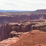
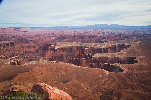
White Rim Overlook
A late afternoon or evening stroll to White Rim Overlook is a hike you won’t forget. From Monument Basin far below to the La Sal Mountains to Gooseberry Canyon on the other side of the mesa, the views from the viewpoint are enough to make your jaw drop. All you’re required to do for this pleasure is to hike the rugged (if mostly flat) 1.9 mile RT trail. More info about hiking the trail here.

My rating: 5/5
Tips: Go in the afternoon for the best views. The spires in Monument Basin are especially nice. The viewpoint has extremely limited parking (think less than 10 spaces), so visit at a less-popular time of year if possible.
GPS Coordinates: 38.3228500°, -109.8494833°
Orange Cliffs Overlook
There’s no question that you see the Orange Cliffs from this viewpoint! A simple pulloff allows you to see far-ranging views across the Canyonlands to more Orange Cliffs (likely in the Maze District). While it’s a nice viewpoint, skip it in favor of either the Green River Overlook or the Murphy Point Overlook if you’re short on time.

My rating: 3/5
Tips: A morning view, the Henry Mountains are visible far to the west.
GPS Coordinates: 38.3136041°, -109.8572750°
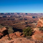
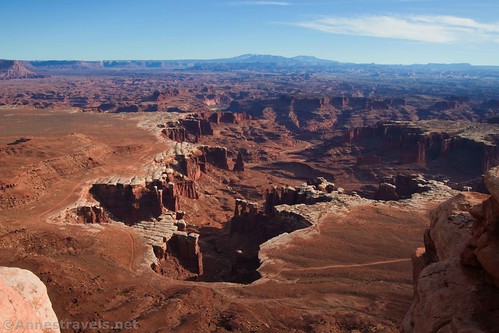
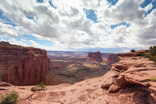
Grand View Point Overlook
You’ve driven a long way to see this viewpoint at the very end of the main road, but I’d call it the most spectacular overlook in Island in the Sky. A paved path takes you 0.1 miles (each way) to an overlook of Monument Basin, or you can take the 2 mile (RT) hike out to even more spectacular vistas.

My rating: 5/5
Tips: While I like to do this one in the late afternoon for the best light on Monument Basin, views stretch south, west, and east, so it’s pretty good at any time of day. There’s so much to see from this viewpoint! Be sure to identify the Henry Mountains (west), the La Sal Mountains (east), and all three districts of Canyonlands National Park.
GPS Coordinates: 38.310695°, -109.856597°

And now, back to the Upheaval Dome Road…

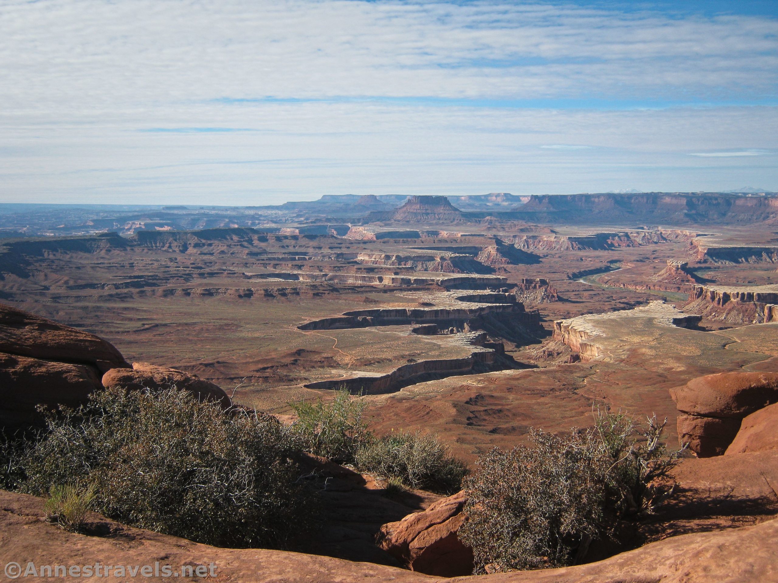
Green River Overlook
This is another of the best-of-the-best overlooks in Island in the Sky. A short (0.2 miles out & back) paved path leads from the parking area to a railing with far-reaching views across the Canyonlands, including the Green River, the Maze District, and so much more! You can also see the Henry Mountains to the west.
My rating: 5/5
Tips: The views are best from this viewpoint in the morning. There is some space to roam nearby if you don’t want to stand next to the official viewpoint. Signs talk about the history and geology of the area.
GPS Coordinates: 38.379246°, -109.888042°
Holeman Spring Canyon Overlook
This is another of those overlooks that I’ve somehow managed to miss along the way. It overlooks Holeman Canyon with some nice views toward cliffs and spires.

My rating: 2/5
Tips: This is a west-facing viewpoint, so it’s best in the morning. While the views are nice, they’re a little bit more limited than some of the other viewpoints, so it’s a good one to skip if you don’t have a lot of time.
GPS Coordinates: 38.41201384°, -109.904789°

Whale Rock
This is technically a trail, but it’s a short one (1 mile out & back). You get to hike up to the top of a slickrock dome that (might, possibly) looks like a whale. Views spread out across the Canyonlands. Trip report here.
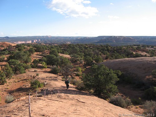
My rating: 4/5
Tips: The views from here are pretty good at any time of day. It’s also a great hike for kids due to the scramble section (easy) that makes it fun, but don’t try hiking it during a thunderstorm.
GPS Coordinates: 38.426862°, -109.914007°

Upheaval Dome Overlooks
Hike across slickrock to two viewpoints into a collapsed salt dome (unless, of course, it’s a meteor crater). Either way, it’s a sweet little hike with some nice views and geological interest. Trail report coming soon!

My rating: 5/5
Tips: Views into the craters will be best in the later morning, though they will be passable most of the day (early morning and late afternoon might have deep shadows). One of the great things about this hike is that it’s not really a view down on the Canyonlands – so it’s different from the other viewpoints in Island in the Sky!
GPS Coordinates: 38.426302°, -109.926149°

Need to Know
There is a $30/vehicle fee to enter Canyonlands National Park. It is valid for 7 days. America the Beautiful National Park & Federal Lands Passes and Southeast Utah Parks Passes are also accepted.
Camping is extremely limited (virtually non-existent) within the park. Plan to camp or lodge outside of the park.
Island in the Sky is very warm in the summer and cold and snowy in the winter. Spring and fall are typically more comfortable times to visit.
Water is available at the visitor center. Picnicking is available at the visitor center, Upheaval Dome, and the White Rim Overlook Trailhead. Restrooms can be found at the visitor center, Green River Overlook, Upheaval Dome, Mesa Arch, White Rim Overlook Trailhead, and Grand View Point Overlook Trailhead.

Getting to Island in the Sky
From Moab, take US-191N out of town and across the Colorado River. Continue another 8.3 miles; turn left onto UT-313W.
From I-70, take Exit 182 into US-191S. Drive 20.5 miles, then turn left onto UT-313. The road ascends through slickrock; drive straight 21.4 miles to the Island in the Sky Visitor Center.
This Week’s Featured Product!
This is one of my favorite books about hiking in Canyonlands National Park! It’s filled with trails, jeep roads, and great history, maps, and more. Buy your copy here!