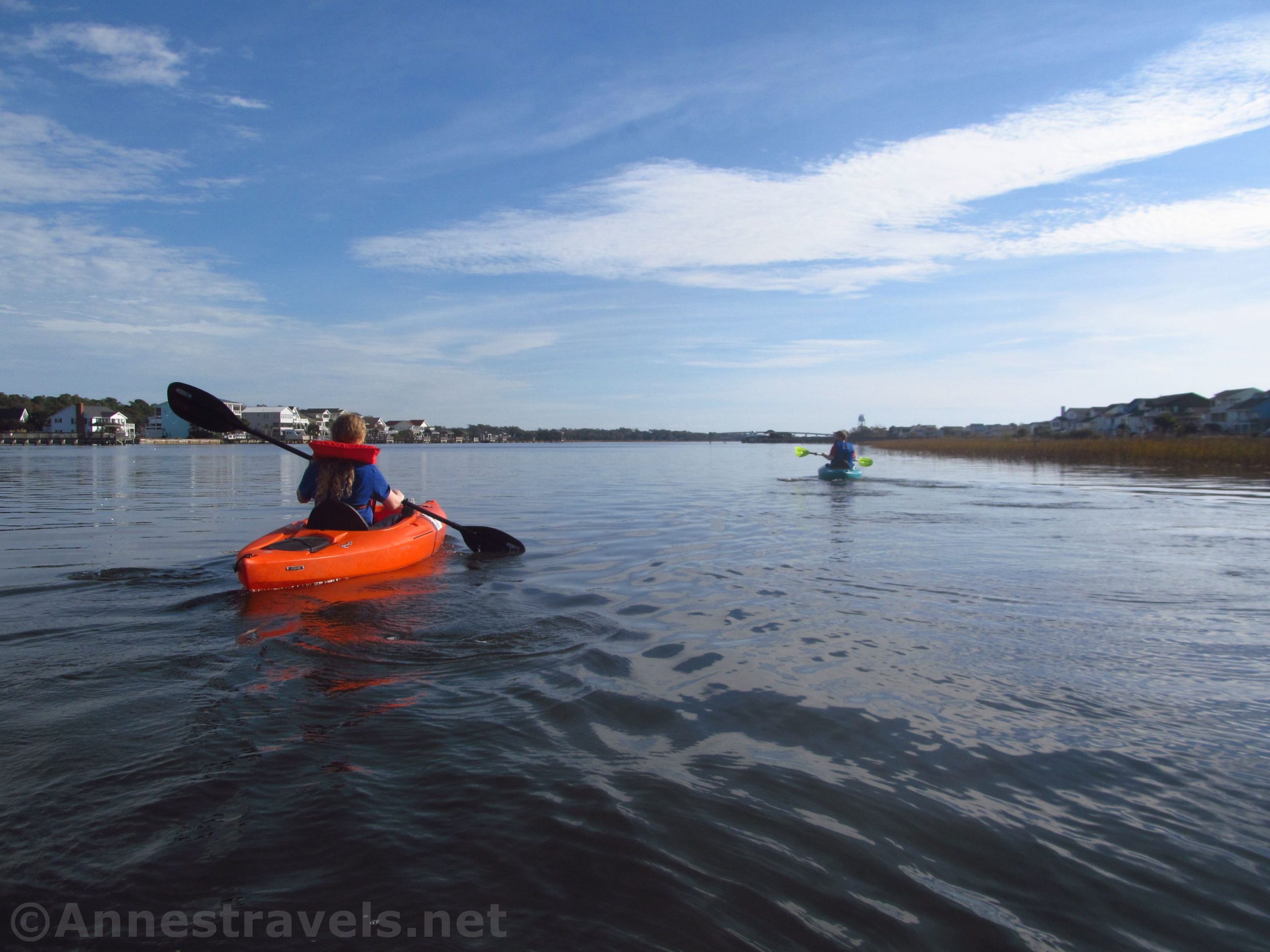

The Intracoastal Waterway (sometimes known as the ICW) is a well-known route for yachts and fishermen. But it’s also a great place to go paddling – kayaking or even canoeing. Birds roost in the marshes along the edge of the water, boats chug by, all kinds of sea life might be spotted below you, and views over the water can be very peaceful (depending on the time of year). You’ll want to watch the tides and the weather, but on a nice day, the Intracoastal Waterway can be a beautiful place to paddle!
Quick Stats
(Affiliate links are present on this page.)
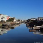
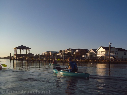
I’ve went kayaking on the Intracoastal Waterway near Holden Beach, North Carolina. The island creates a natural barrier between the Waterway and the ocean, making it more sheltered than kayaking on the ocean (you won’t have much in the way of waves except for 1) poor weather and 2) the wake of motor boats).
You can access the Intracoastal Waterway from two places (easily, at least). You can rent or own a house with a dock into one of the canals along the Intracoastal Waterway. Or you can use the public boat ramp underneath the causeway onto the island.

Either way you do it, keep an eye on a tide chart. The water rushes out both ends of the island when the tide is going out and it rushes in when the tide is coming in. What that means for kayakers is that 1) you’ll probably be fighting the tide at least one way, and 2) don’t get too close to the end of the island on the ebb – you’ll probably be taken out to sea. I got almost too close and it was quite the fight to get back – and I was close to the shoreline where the flow is less noticeable.

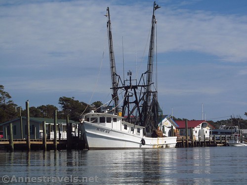
If you go east under the causeway, you’ll pass by the fishing area of Holden Beach. There are a few fishing charter companies that take people out to fish for a fee. There are also a few professional companies – these mostly stock the restaurants on the island and along the nearby coast.
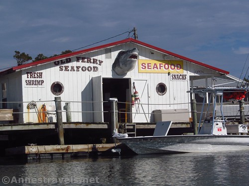
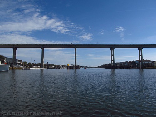
Continuing east, you’ll pass by the place where the old ferry used to take people from the mainland to the island and back (the ferry was discontinued when the bridge was built). After some villas on the island, the bank is mostly clothed with brush. The mainland side has a mixture of houses with docks and brush.
From the causeway to the end of the island is about 1.6 miles. While you technically could kayak across to Oak Island, I don’t recommend it in a kayak except perhaps at dead low tide – and even that would be very risky due to the currents.

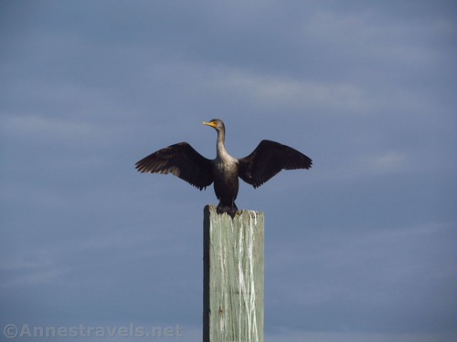
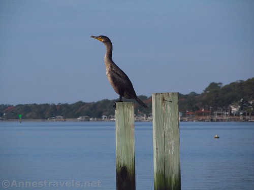
The wildlife you can see along the Intracoastal Waterway varies, but I’ve seen pelicans, cormorants, kingfishers, gulls, terns, dolphins, rays, and a wide number of crustaceans.
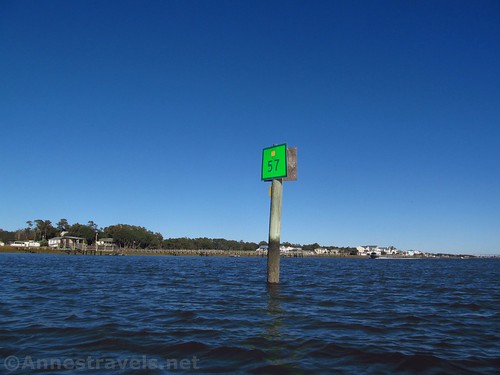
Going west, the scenery doesn’t very much. There are either houses or marshes on the island side and mostly houses with docks on the mainland. You may also spot some of the Intracoastal Waterway buoys.
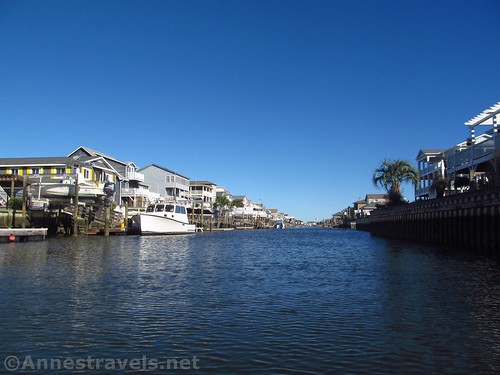
The good thing about going west is that you can explore the multiple canals that make their way into the island of Holden Beach. They’re pretty much the same after one or two, but it’s sort of fun to paddle by the boats (and houses) of the rich and not-famous.

About 6 miles from the causeway is an inlet (on right/north) that goes up into the Shallotte River. I did not explore this far, so I’m not sure what the currents are like, but I’d guess they’re a force to be tangled with at times. You’ll have to travel another 0.8 miles to get to the end of the island and you’ll pass Saucepan Creek on the right just before the end. Again, I’d imagine the currents are not something you’ll want to kayak through.

Whichever way you go – or if you’re at a similar island like Oak Island, Ocean Isle, or Bird Island – kayaking is a great way to explore the Intracoastal Waterway!

Round Trip Paddle Length: Whatever you want to make it; total from end to end of Holden Beach is 8.4 miles one way (16.8 miles RT)
Facilities: Often a port-a-potty at the boat launch under the causeway; park and picnic tables nearby.
Fees: None for kayaks, canoes, or most boats
Paddle Notes: I’ve said it before, but I’ll say it again: stay away from the ends of the island due to the tides and currents. It’s likely you’ll see one or more kinds of wildlife. You’ll also probably see quite a few boats – from locals out in their small motor boats to yachts en route to Texas or New Jersey to deep sea fishermen to barges with tug boats.

Signs 
![]()
![]()
![]()
Parking ![]()
Scenery ![]()
![]()
Interest ![]()
![]()
Fun Factor ![]()
![]()
![]()
Ease of access ![]()
![]()
Would I go 100 miles out of my way for this? ![]()
Overall Rating: ![]()
![]()

GPS Coordinates for the Intracoastal Waterway on Holden Beach
Public boat ramp near the causeway: 33.916262, -78.267502 (33°54.97572′, -078°16.05012′ / 33°54’58.5432″, -078°16’03.0072″)
Getting to the Public Boat Ramp on Holden Beach
From Shallotte, NC, take US-17 BUS North/Main Street for 1.6 miles. Turn right onto US-17 N for 3.8 miles; turn right onto Mount Pisgah Road SW. After 4.0 miles, the road becomes NC-130 E. Drive 3.3 miles and turn right to stay on NC-103 E for another 1.1 miles. After crossing the causeway, turn left. Take the first left to a small street, then turn left to pass under the causeway and park near the boat ramp – there are signs about where you can and cannot park.
Alternatively, from Supply, NC, from US-17 turn onto Stone Chimney Road. Drive 5.7 miles, then continue straight onto Old Ferry Connection SW for 1.1 miles. Turn right onto Sabbath Home Road for 0.7 miles; turn left onto NC-130E for another 1.1 miles. After crossing the causeway, turn left. Take the first left to a small street, then turn left to pass under the causeway and park near the boat ramp – there are signs about where you can and cannot park.
Zoom map out to browse nearby hikes & places of interest
This Week’s Featured Product!
If you want to explore even more paddling opportunities in North Carolina, check out this book. It includes 109 different streams with tips on making sure your paddle is as much fun as possible.