
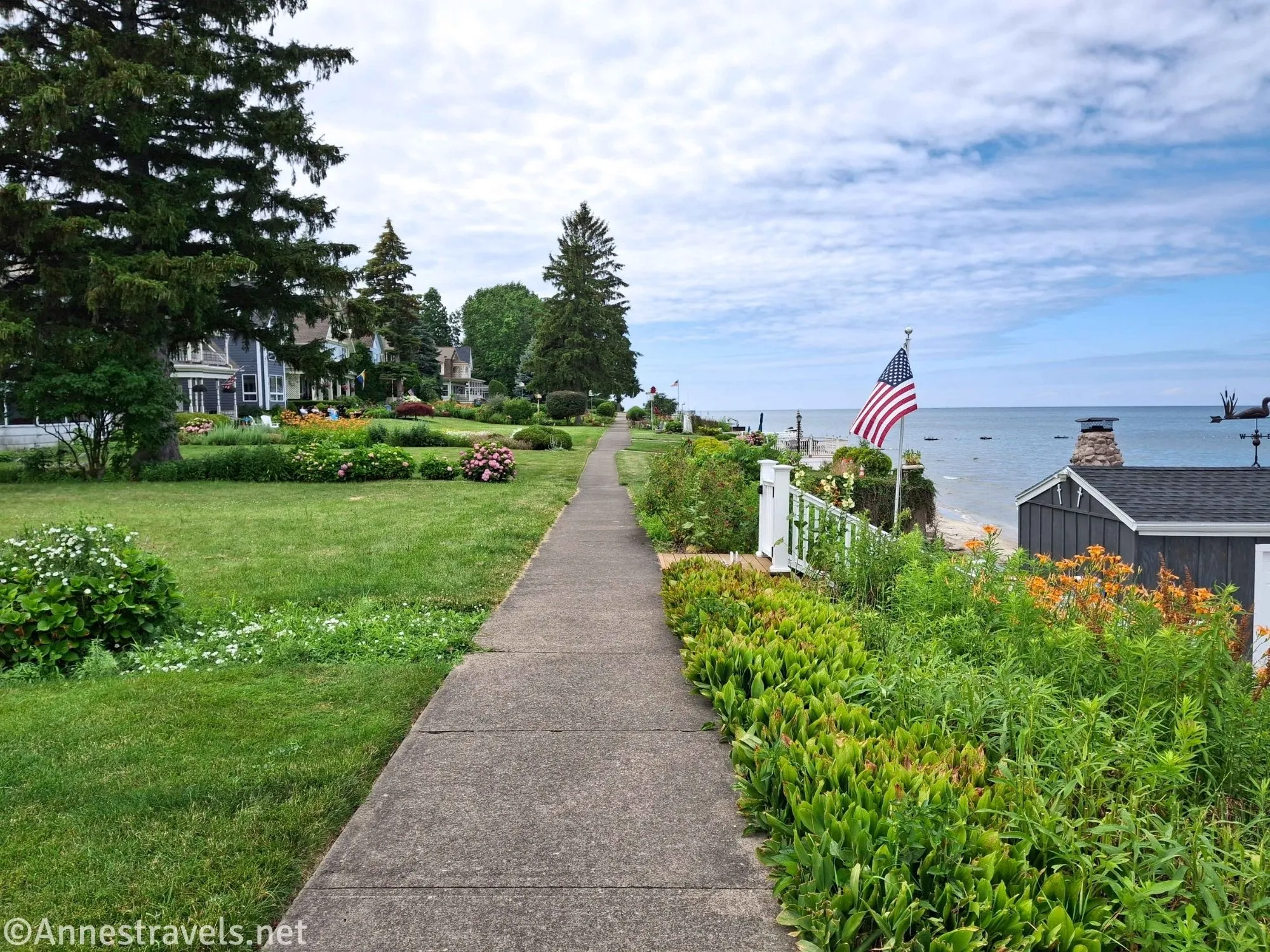
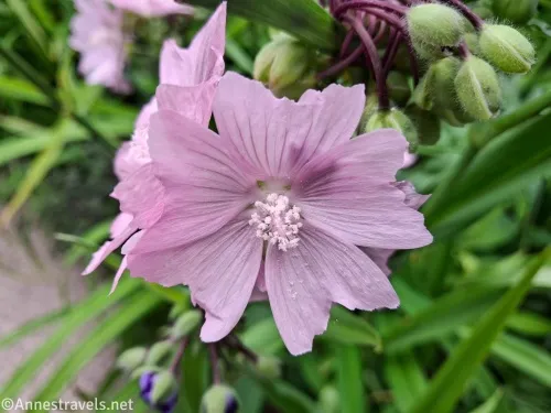
The Secret Sidewalk is a Rochester, New York, secret. Tucked behind mansions on Beach Avenue, most people park at Ontario Beach Park and walk the regular sidewalk down to the beginning of the secret one. I recommend going on a sunny day in the spring, summer, or fall when the nearby flowers are in bloom and you can enjoy the expansive views across Lake Ontario.
Quick Stats
This post contains affiliate links. There is no extra cost to you to click these links, though I may receive a small commission.
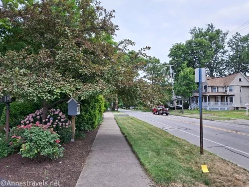
I started at Ontario Beach parking lot. Head west to the edge of the park and continue to walk along Beach Avenue until you reach the Secret Sidewalk – from the end of the park to the beginning of the sidewalk is about 0.5 miles.
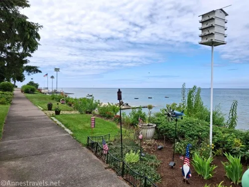
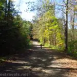
Turn right onto the sidewalk that goes between two houses (it’s pretty obvious, and there should be a “no bicycle” icon painted in yellow on it). Then continue along the sidewalk as it passes above the lakeshore/beach and behind the houses. The sidewalk used to be a road but is now a right-of-way.
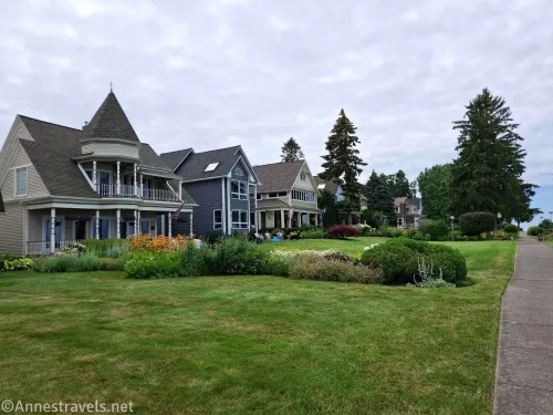
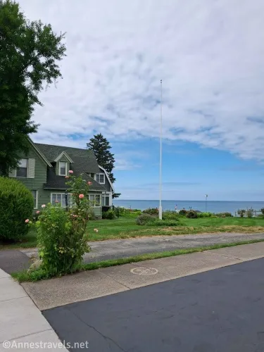
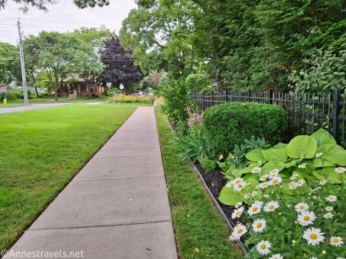
These are nice houses. Maybe not super expensive, but certainly expensive enough considering they’re lakefront, and the people keep them up quite nicely. Many have flowers and yard decorations. Remember, you’re not allowed out onto their docks or decks – stay on the sidewalk and give the people privacy.
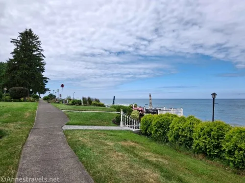
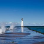
Yes, it is legal to be here, even if it doesn’t always feel like it! The views are expansive out to Lake Ontario.

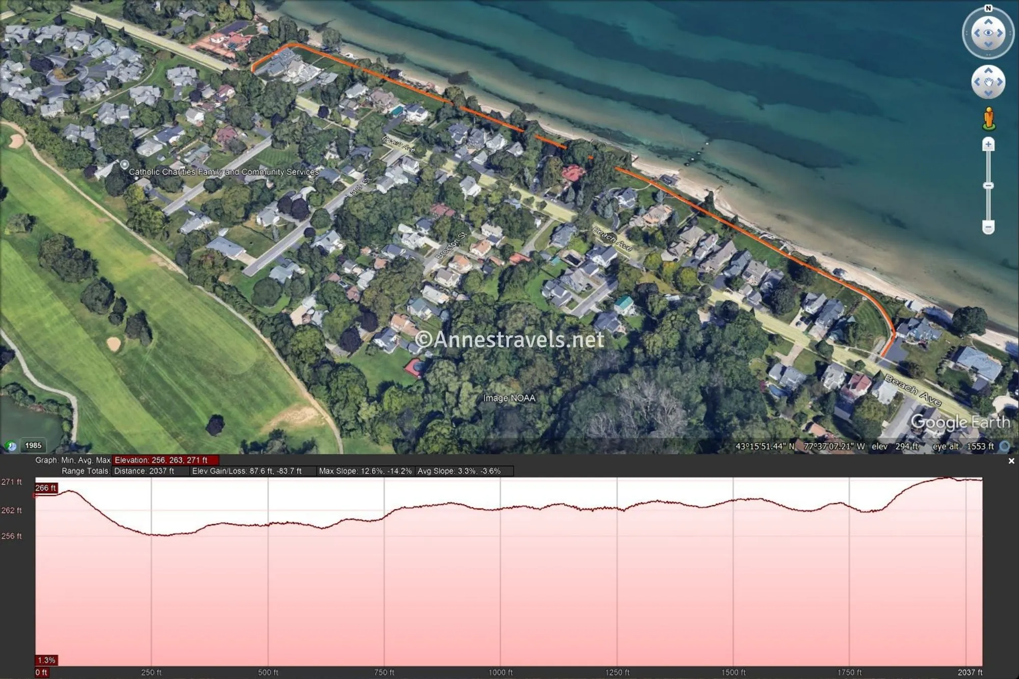
The Secret Sidewalk is about 0.4 miles long; it loops back out to Beach Avenue.
At this point, I turned around and headed back the way I’d come to return to Ontario Beach Park. It wasn’t a long trek, but it was fun!

Round Trip Trail Length: 0.8-1.8 miles
Elevation Gain: 87-100ft., more or less. My super-duper programs claim an elevation gain of 170ft. just for the Secret Sidewalk, but I find that highly overkill. 87ft. sounds more likely if still on the high side (271ft. to 256ft.). Going from Ontario Beach Park, the elevation gain is about 169ft. if you listen to the programs and probably closer to 100ft.
Facilities: Park facilities, including restrooms, at Ontario Beach Park (depending on the time of year). There’s even a Bill Gray’s in the parking lot!
Fees: None
Trail Notes: The closest parking is at Ontario Beach Park. Please respect signs and the privacy of the people along this route, especially homeowners. The Secret Sidewalk is open all year, from what I can tell, but the summer is best for the flowers. The entire route is wheelchair-accessible. Bicycles are not allowed on the Secret Sidewalk.
Trail 
Road ![]()
Signs ![]()
![]()
![]()
![]()
Scenery ![]()
![]()
![]()
Would I go 100 miles out of my way for this? ![]()
![]()
![]()
![]()
Overall Rating: 
![]()
![]()

GPS Coordinates for the Secret Sidewalk
Generally where I parked: 43.2565370°, -077.6064840° (43°15.39222′, -077°36.38904′ / 43°15’23.5332″, -077°36’23.3424″) (250ft.) (-0.5)
TH (east end): 43.2633980°, -077.6160350° (43°15.80388′, -077°36.96210′ / 43°15’48.2328″, -077°36’57.7260″) (264ft.) (0.0)
West End: 43.2660770°, -077.6212900°(43°15.96462′, -077°37.27740′ / 43°15’57.8772″, -077°37’16.6440″) (270ft.) (0.9)

The gpx file for the Secret Sidewalk (including walking from Ontario Beach Park) can be downloaded – please note that this and the GPS Coordinates are for reference only and should not be used as a sole resource when hiking this trail.
Download GPX File size: 4.0 KB Downloaded 47 times
(Note: I do my best to ensure that all downloads, the webpage, etc. are virus-free and accurate; however, I cannot be held responsible for any damage that might result, including but not limited to loss of data, damages to hardware, harm to users, from use of files, information, etc. from this website. Thanks!)

Getting to Ontario Beach Park
From the west: Take Rt-390 north to Exit 27A toward Ontario Parkway East toward Rochester (or that’s what the sign says). After 3 miles, turn left onto Lake Avenue (if you cross the drawbridge over the Genesee River, you’ve gone too far). Drive 0.6 miles, then turn right onto Corrigan Street; take an almost immediate left into the parking area for the Port of Rochester and Ontario Beach Park.
From the east: From Seabreeze, wiggle your way around the traffic circles to Durand Blvd. Turn west onto Durand Blvd and continue straight when the road enters Durand Eastman Park and changes names to Sweet Fern Road. Continue to continue straight for 4.1 miles (you’ll pass through Durand Eastman Park which was very nice but I hear is overcrowded in the summer with picnickers). At the traffic light, turn right on St. Paul Blvd, then take a quick left onto Pattonwood Drive (before you get to the train bridge). After 0.9 miles, shortly after crossing the drawbridge, turn right onto Lake Avenue. Drive 0.6 miles, then turn right onto Corrigan Street; take an almost immediate left into the parking area for the Port of Rochester and Ontario Beach Park.
From the south: You have three choices: take Rt. 390 (as described in “From the west”), take Rt. 590 north to Seabreeze (as described in “From the east”), or take Lake Avenue north all the way to Ontario Beach Park.

A Hiking Guide Just for Rochester!
Did you know there’s a hiking guide just for trails around Rochester? It covers 20 fantastic places to hike – plus one great trail in Letchworth State Park. Buy your copy here.

More Related Posts:
 Irondequoit Lakeside Multi-Use Trail
 Erie Canal: Meridian Center (Rochester) to San Souci Park (Brockport)
 Genesee Riverway – Ontario Beach Park, Turning Point Park, & Maplewood Park
 Genesee Valley Greenway – Oakland to Letchworth
 Biking the Sodus-Wallington Trail to Sodus Point
 Fun Hike to Indian Pass & Summit Rock