There are two slot canyons (among others, I’m sure) along the Smokey Mountain Road east of Big Water, Utah: Resurrection Canyon (my favorite) and Wiregrass Canyon (much more popular and easier to find). In this post, I’ll focus on Wiregrass Canyon from the trailhead down to Wiregrass Arch – a route that includes a slot canyon and Wiregrass Natural Bridge along the way!
Quick Stats
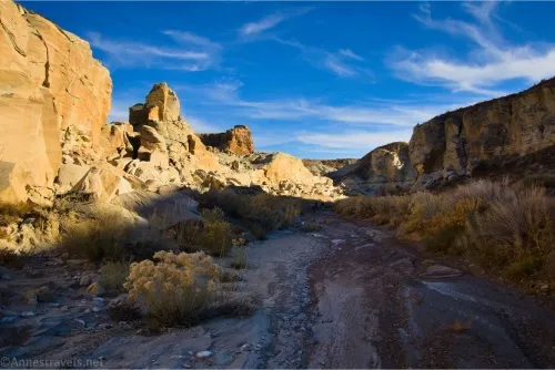
The trailhead for Wiregrass Canyon is marked along the Smokey Mountain Road. A fairly well-defined use path descends into the canyon just to the left of the sign, and you’re on your way.
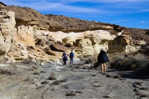
The first part of the wash is fairly easy walking and mostly flat. After almost half a mile, the canyon descends a series of dryfalls. At this point, you can choose to go right or left. I did right on the way down and left on the way back, and let me tell you, it’s easier to take the left trail! It’s even sparsely cairned.
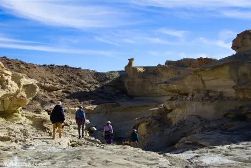
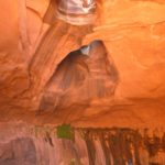
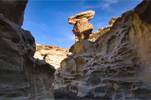
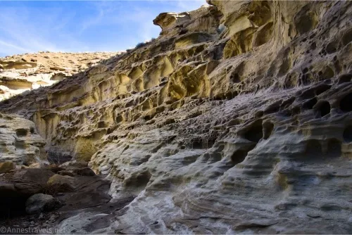
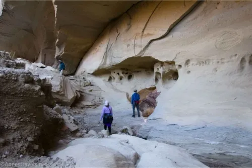
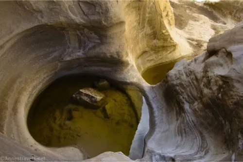
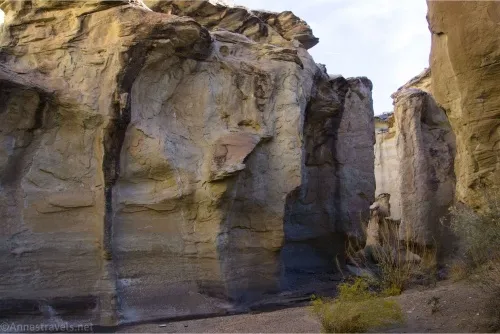
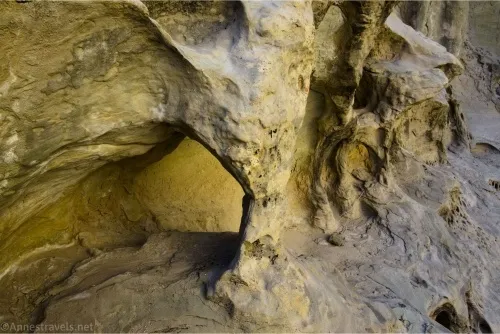
The cairned bypass trail drops you back into the canyon maybe 0.1 miles later, at the bottom of the slot. It’s well worth the minimal effort to walk back up the slot as far as possible. The rock formations are so cool, as are the holes in the wall!
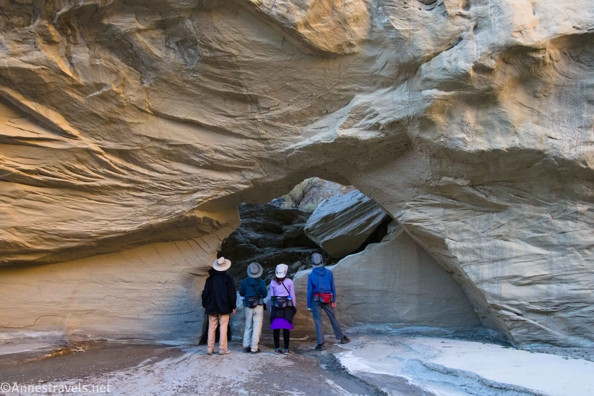
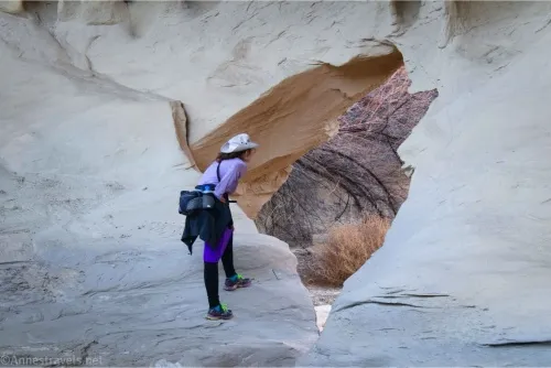
When you’ve finished with the slot, continue walking downcanyon. About a quarter mile beyond the end of the slot, look for Wiregrass Natural Bridge on your left. This is a hole in the canyon wall that takes you into a second canyon.
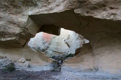
We were feeling adventurous (or maybe I was; I’m not sure the group was 100% with me on this one), so we scrambled up through the natural bridge into the other side canyon. We did walk a short distance (about 0.3 miles RT) upcanyon, but the real treat was walking downcanyon (turning right) – it will take you downstream to the main canyon again about half a mile below the natural bridge!
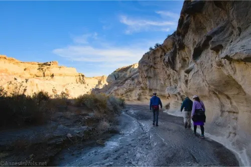
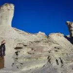
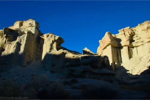
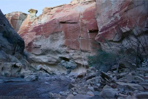
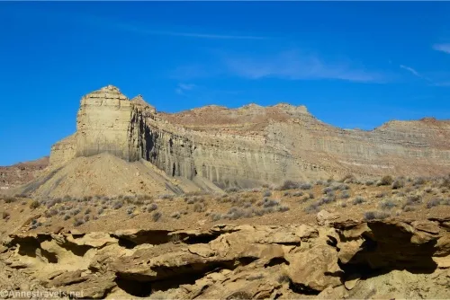
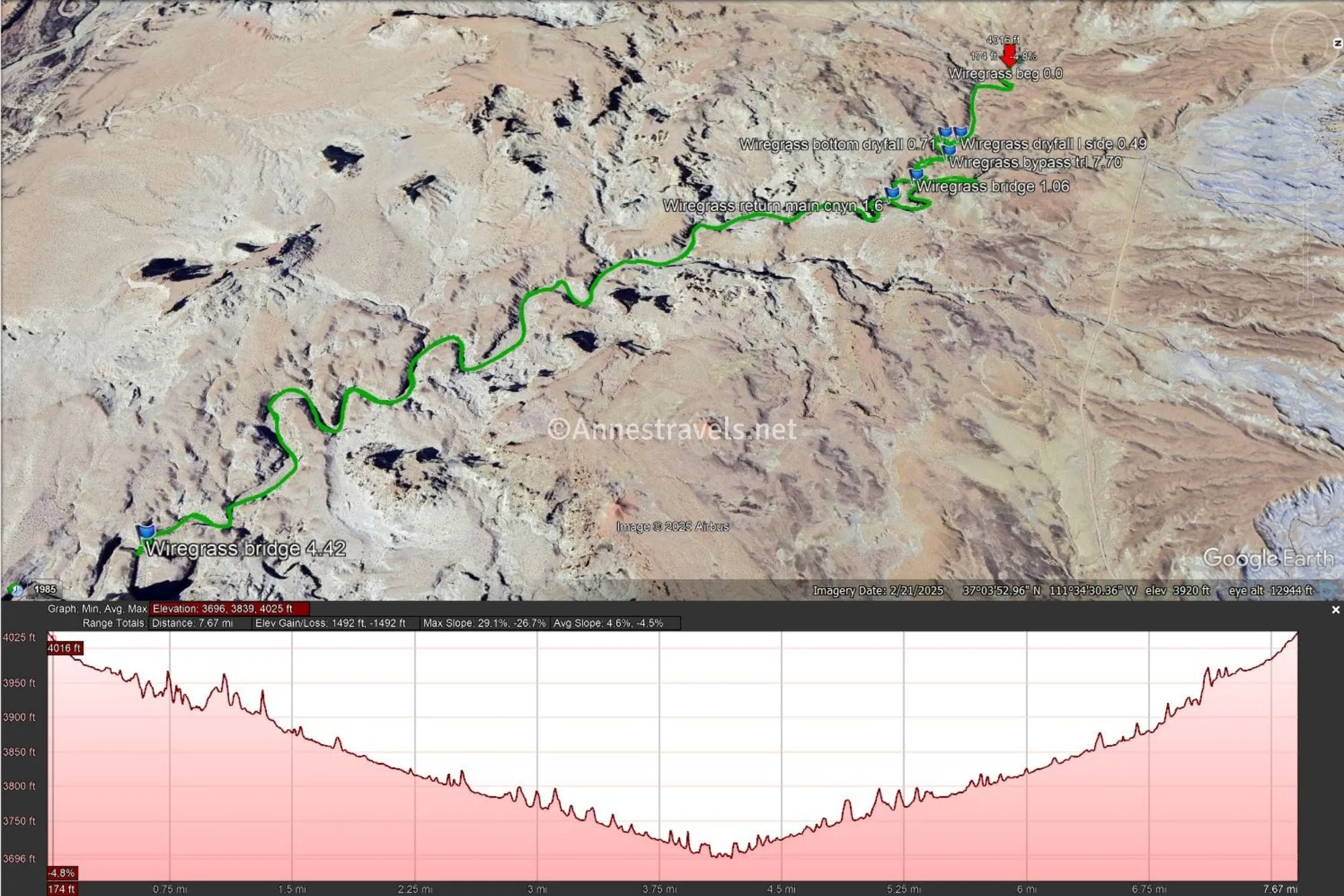
Keep walking downcanyon another 2.8 miles. The canyon is winding and never terribly narrow. There are some nice buttes and cliffs and overhangs, but in general, it would be a very hot, miserable hike on a warm day. Thankfully, it was November during a cold snap, so we were more likely to freeze than fry!
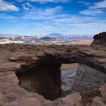
By this time, we were racing daylight. We finally decided to go around a certain number of bends, and if we saw nothing, we were going to have to turn around. Thankfully, 4.4 miles from the trailhead per my GPS (so 4.1 miles if you don’t go upcanyon like I did), we stumbled onto Wiregrass Arch!
It was easy to find; the water runs through it to continue down toward Lake Powell. We scrambled through and enjoyed the views of it from the far side, as well.
I hear you can continue several miles all of the way down to Lake Powell (mileage dependent on lake levels, and it’s not short in any event). However, given the quickly gathering darkness, we ate a hasty snack and then set off back upcanyon.
As it was, we used our headlamps for the last tenth of a mile or so. But it was a fun hike, and I’m glad we found the arch as well as the natural bridge!

Round Trip Trail Length: I went 8.3 miles; cut 0.3 miles off of that for my short trek up the side canyon
Elevation Gain: 1,492ft. (4,025ft. to 3,696ft.)
Facilities: None
Fees: None
Trail Notes: There is no official trail. Most of the hike is walking downcanyon or upcanyon, so it’s hard to get too lost. There is a small scramble on the bypass around the slot canyon and another to get down to the other side of Wiregrass Arch, but neither is too difficult (the second is easier if you’re taller – some helpful person had stacked rocks below the biggest step, for which I was very grateful!) The one questionable area for wayfinding is coming back upcanyon – the sidecayon (which will lead up to Wiregrass National Bridge) comes in from the right; you want to stay left. I hear this is a good hike for families with children who enjoy hiking.
Trail 
![]()
![]()
![]()
Road ![]()
![]()
Signs ![]()
![]()
![]()
Scenery ![]()
![]()
Would I go 100 miles out of my way for this? ![]()
Overall Rating: ![]()
![]()
GPS Coordinates for Wiregrass Canyon
TH: 37.0774440°, -111.5895930° (37°04.64664′, -111°35.37558′ / 37°04’38.7984″, -111°35’22.5348″) (4,025ft.) (0.0)
Dryfall go up left side: 37.0747550°, -111.5841220° (37°04.48530′, -111°35.04732′ / 37°04’29.1180″, -111°35’02.8392″) (3,955ft.) (0.49)
Bottom of dryfall: 37.0742460°, -111.5841790° (37°04.45476′, -111°35.05074′ / 37°04’27.2856″, -111°35’03.0444″) (3,949ft.) (0.71)
Natural Bridge on left: 37.0728930°, -111.5815560° (37°04.37358′, -111°34.89336′ / 37°04’22.4148″, -111°34’53.6016″) (3,906ft.) (1.06)
Return to the main canyon: 37.0719730°, -111.5805380° (37°04.31838′, -111°34.83228′ / 37°04’19.1028″, -111°34’49.9368″) (3,884ft.) (1.6)
Natural Bridge: 37.0511690°, -111.5655800° (37°03.07014′, -111°33.93480′ / 37°03’04.2084″, -111°33’56.0880″) (3,767ft.) (4.42)
Bypass Trail: 37.0741670°, -111.5828860° (37°04.45002′, -111°34.97316′ / 37°04’27.0012″, -111°34’58.3896″) (3,952ft.) (7.70)
End: 37.0774340°, -111.5895650° (37°04.64604′, -111°35.37390′ / 37°04’38.7624″, -111°35’22.4340″) (4,024ft.) (8.33)
The gpx file for Wiregrass Canyon can be downloaded – please note that this and the GPS Coordinates are for reference only and should not be used as a sole resource when hiking this trail.
Download GPX File size: 124.3 KB Downloaded 245 times
(Note: I do my best to ensure that all downloads, the webpage, etc. are virus-free and accurate; however, I cannot be held responsible for any damage that might result, including but not limited to loss of data, damages to hardware, harm to users, from use of files, information, etc. from this website. Thanks!)
Getting to Wiregrass Canyon
From Page, AZ, drive north on US-89. Cross over the Glen Canyon Dam and continue 14.7 miles (beyond the dam). Turn right on Ethen Allen; 0.3 miles later, turn right on E Concord Brg, more commonly known as the Smokey Mountain Road. (Mind you, there might not be street signs.) Clock off 4.6 miles to a small parking area (almost a pulloff) on the right with a metal informational sign that says “Wiregrass Canyon.” Note that you’ll need to cross over Wahweap Creek; as long as it’s not too deep, the crossing is fairly firm. I’d still recommend high clearance, and 4×4 wouldn’t go amiss.
From Kanab, drive east (south) on US-89 for 56 miles to the town of Big Water. Turn left on Ethen Allen; 0.3 miles later, turn right on E Concord Brg. (Mind you, there might not be street signs.) Clock off 4.6 miles to a small parking area (almost a pulloff) on the right with a metal informational sign that says “Wiregrass Canyon.” Note that you’ll need to cross over Wahweap Creek; as long as it’s not too deep, the crossing is fairly firm. I’d still recommend high clearance, and 4×4 wouldn’t go amiss. I wouldn’t try to get to the trailhead with low clearance.
More Hikes in Grand Staircase-Escalante
Almost 60 hikes are packed into this guide of the area in and around Grand Staircase-Escalante National Monument. With maps and detailed descriptions of each hike, you’re sure to find some great trails. Buy your copy here.