
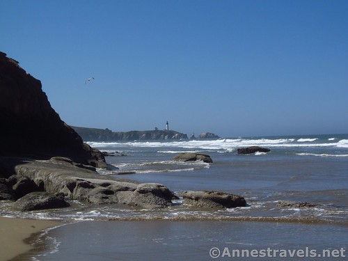
Yaquina Head Lighthouse and volcanic rocks from just north of Schooner Point
Have you ever thought how nice it would be to walk along the Oregon Coast? To hike a stretch of beach without high rises and hotels and restaurants and just enjoy its sand, uniquely shaped rocks, sheer cliffs, and an idyllic lighthouse always in view? Sound a little too good to be true? Maybe a bit. But the stretch of beach between Devil’s Punchbowl State Park and Schooner Point (or even further) really is a great beach hike, with all of the above, plus a few tide pools, a stream or two, and the excitement of racing the tide (if you hike at the “wrong” moment – a few of us got our shoes a bit damp). Oh, and did I mention it’s just lovely?
Quick Stats
Pool of water and seaweed at low tide
We hiked down to the beginning of the trail twice – the second time to do the hike, the first to try and find the Devil’s Punchbowl. From the Devil’s Punchbowl sign next to the parking area, walk down the long set of stairs to the beach. At the bottom of the stairs, I highly recommend walking as quickly as possibly down near the surf – the sand is firmer there and easier to walk on. If you turn right, there are some very nice cliffs and a sea cave – both are very difficult to access (impossible at high tide), and you’ll have to cross a stream. But there are some tide pools, and the scenery is nice. You can’t actually go around the point here to get to the Punchbowl – you’ll have to do that from atop the headland.
Exploring the beach walking right from the bottom of the stairs
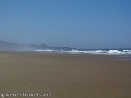
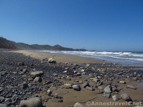
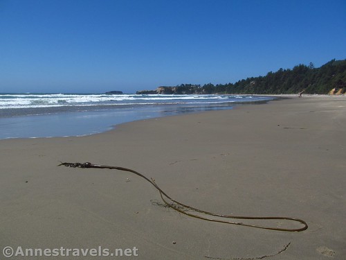
Turning left (the actual way we want to go on our hike), wander along the line of surf. At high tide, there’s far less beach than at low tide; we began not too long after low tide, so the beach was wide, with a large stretch of firm sand. A few of our group decided to go barefoot, but I’m too much of a tenderfoot to want to walk all day on sand without shoes – my feet would feel like I’d been walking on sandpaper, and there were still quite a number of hikes I wanted to do on the way home!
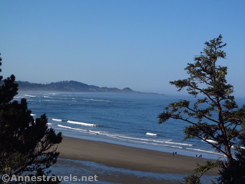
Wandering southward
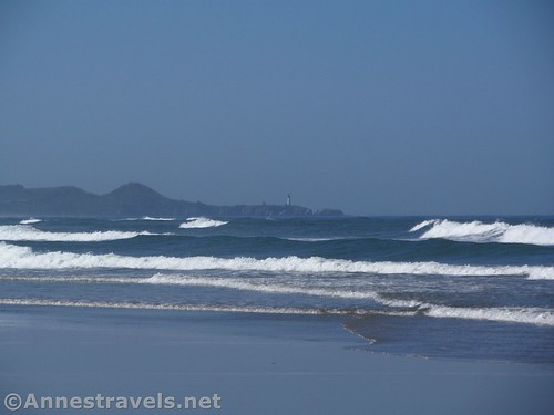
Ahead, the Yaquina Head Lighthouse comes into view. It’s very far away now, so picture opportunities will be better further down the beach.
Can you even see the lighthouse in this photo?
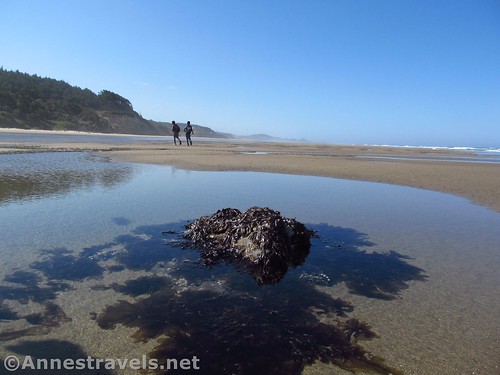
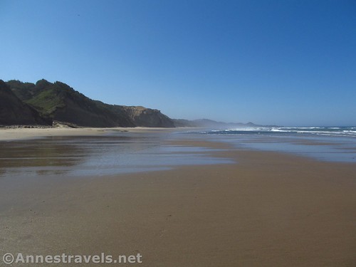
At low tide, there are tide pools and little pools of water in the rippled sand. On your right is the ocean (very cold, I might add), while on the left are tree-studded hills. Ahead are cliffs and headlands – not really like the iconic coast, but still very nice, especially in the early morning mist.
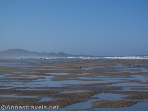
Pools of water at low tide
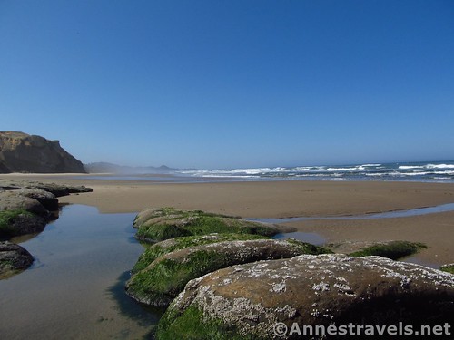
Along the way are also some almost volcanic-looking rocks – long stretch of flat, hole-pocked, sometimes rippled rock, expanses of it, sometimes with lumpy ridges, like some kind of miniature mountain range (y’know, New York-style mountains). These get more exciting closer to Schooner Point.
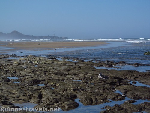
Volcanic rock and a sea gull, with Yaquina Head Light in the background
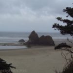
There are larger, more normal rocks as well – sometimes swathed in seaweed, sometimes out in the waves, like miniature sea stacks.
Rocks like miniature sea stacks
Cross Beverly Creek at mile 1.4 near Beverly Beach State Park (go up toward the highway bridge and it’s easier to rock-hop across the stream). During the day, this is a very popular destination for more localish holiday makers (or at least, at midday there was quite the crowd enjoying the beach), though in the early morning it was almost deserted. Keep walking along the beach past Moolack Beach at mile 3.3 (you might miss this one, though again there may be some people but not as many as Beverly Beach).
Pools, rocks, and seaweed
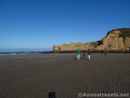
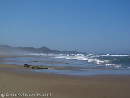
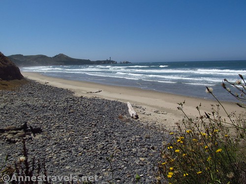
Keep going as the scenery gets even better as you approach Schooner Point, the volcanic rocks more prevalent, the cliffs more visible, the lighthouse closer and more iconic. The Point itself can only be rounded at high tide – and it’s further than it looks to get to the other side. I got caught half way by waves coming from both directions, and a few of my group member were just a little ruffled (ok, a lot ruffled) that they now had wet feet!
The beach south of Scooner Point
So we walked up onto the grassy bluff just after crossing Schooner Creek, crossed the parking area, took off our shoes and socks, spread them out in the sunshine, and ate lunch among the grass, thistles, driftwood, and wildflowers, with a beautiful view of the Yaquina Head Lighthouse. Really – it’s worth coming down to Schooner Point (accessible to vehicles) just to see the view.
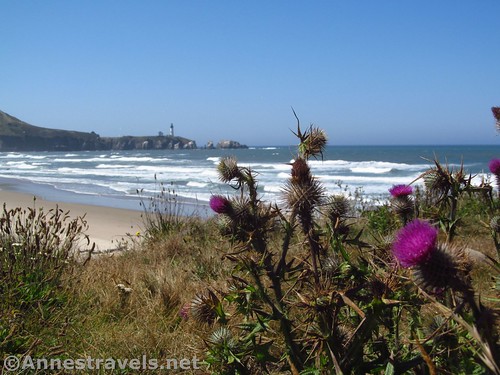
A thistle near where we ate lunch
You can keep going all the way to Starfish Cove along the beach. However, my group was ready to call it a day (wet feet weren’t making them happier, and just how many more views of the lighthouse did we need, they asked). Since we now could no longer go back around the point (tide will do that), we walked up the access road to US-101, turned left, and walked along the highway about 1.25 miles back up to Moolack Beach, where we could reaccess the beach (there are a lot of houses along this stretch of highway, so no easy way to access the beach until Moolack).
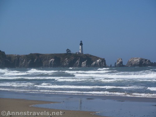
Close up of the Yaquina Head Light from near Schooner Point
From there, it was just a matter of walking back to the Devil’s Punchbowl parking area, our backs to the lighthouse, and our faces toward the surfers enjoying the waves below the parking area.
Walking back toward the Punchbowl Headland
Overall? Just a really nice hike that can be lengthened or shortened. Start at Beverly Beach State Park or Moolack Point to shorten it, or continue beyond Schooner Point to Starfish Cove below Yaquina Head Lighthouse (technically, that hike would be about 10.5 miles RT). Or you could start at Schooner Point and hike toward Starfish Cove for another adventure.
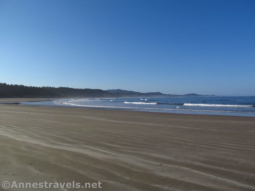
Walking toward Schooner Point
Round Trip Trail Length: About 9 miles total from the Punchbowl parking area to Schooner Point and back
Net Elevation Change: 53ft. (53ft. at the parking area to 0ft. at the ocean)
Facilities: Restrooms and water at the trailhead (assuming they’re open) along with a few picnic tables and restaurants down the road; I believe there are also restrooms at Beverly Beach State Park. There are no facilities at Schooner Point.
Fees: None
Trail Notes: There is no trail; you’re always on the beach. So while it’s really hard to get lost, it’s also worth paying attention to the tide (the hike may be impossible during storms, and going around Schooner Point is impossible at any time but low tide – the parking area is just south of Schooner Point) and realize you’ll be walking on sand the entire hike.
The sea and Yaquina Head Light
Trail 
Road
Signs
Scenery
Would I go 100 miles out of my way for this?
Overall Rating:
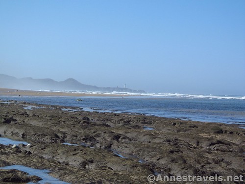
More volcanic rocks
Key GPS Coordinates for the Beverly Beach Hike
Beverly Beach / Punchbowl Parking: 44.74765N / -124.06215W (44° 44′ 51.5400″ / -124° 3′ 43.7400″) (53ft.)
Trail Beginning: 44.74718N / -124.06225W (44° 44′ 49.8480″ / -124° 3′ 44.1000″) (92ft.) (0.0; ended 9.3)
Beverly Creek: 44.72954N / -124.05773W (44° 43′ 46.3440″ / -124° 3′ 27.8280″) (11ft.) (way out 1.4; way back 7.94)
Moolack Beach Trail Down: 44.70395N / -124.06134W (44° 42′ 14.2194″ / -124° 3′ 40.8240″) (53ft.) (way out 3.3, way back 6.0)
Schooner Point: 44.68739N / -124.06666W (44° 41′ 14.6040″ / -124° 3′ 59.9754″) (21ft.) (4.5)
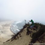
Views from the top of the stairs leading down to the beach near the parking area
The gpx file for the Beverly Beach Hike can be downloaded – please note that this and the GPS Coordinates are for reference only and should not be used as a sole resource when hiking this trail.
Download GPX File size: 150.0 KB Downloaded 83 times
(Note: I do my best to ensure that all downloads, the webpage, etc. are virus-free and accurate; however, I cannot be held responsible for any damage that might result, including but not limited to loss of data, damages to hardware, harm to users, from use of files, information, etc. from this website. Thanks!)
Wildflowers and beach views toward the Yaquina Head Lighthouse from near the parking area south of Schooner Point
Getting to the Beverly Beach Hike
From Newport, OR, drive north on US-101N about 7 miles. Take a slight left (an odd turn) following signs for Otter Crest and Devil’s Punch Bowl State Park. After 0.4 miles, turn left onto 1st Street for 0.3 miles. Turn right into the parking area marked for Devil’s Punchbowl.
From Tillamook, OR, drive south on US-101S about 60 miles. Turn right, following signs for Otter Rock and Devil’s Punchbowl State Park. Make a quick left onto the Otter Crest Loop. After 0.2 miles, turn right onto 1st Street for 0.3 miles. Turn right into the parking area marked for Devil’s Punchbowl.
Zoom map out to browse nearby hikes & places of interest
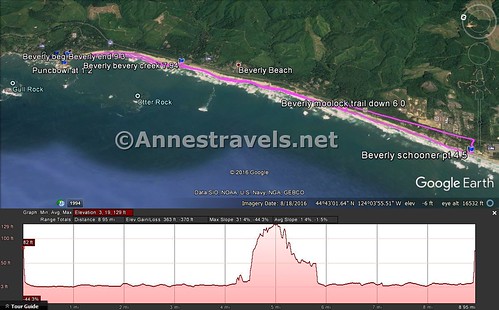
Visual trail map and elevation profile for my hike from the Punchbowl parking area to Schooner Point, then back up US-101 to Moolack Beach and from there up the beach to the parking area.
This Week’s Featured Product!
For even more hiking opportunities – as well as lighthouses, museums, and more – along the Oregon coast, check out this book.
Pingback: Sneak Peak: A Land of Volcanos and Oceans - Anne's Travels