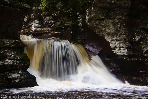
The Evergreen Trail is often overshadowed by the Falls Trail (Ganoga Glen and Glen Leigh) in Ricketts Glen State Park, and rightly so. But by missing out on the Evergreen Trail, you also miss out on the lovely Adams Falls (then again, you may be totally waterfalled out by the time you get done with the Falls Trail… not me; I really like waterfalls). In fact, these waterfalls are only steps from the parking area. The Evergreen Trail goes beyond this to, well, mostly just forest, but it’s well worth checking out the falls even if you don’t go beyond that.
Quick Stats
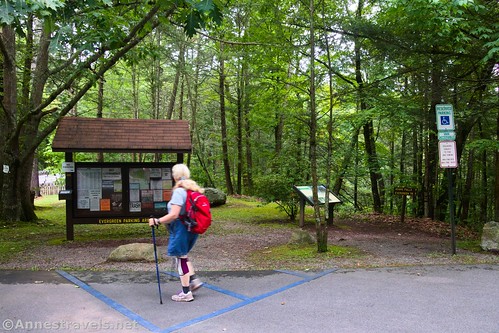
The trail begins to the right of the kiosk sign marked “Evergreen Parking Area.” (Note that this is the same parking area as the traditional trailhead for the Falls Trail, even though most people (including me) start at Lake Rose Trailhead.) Another sign points straight (really right) toward Adams Falls and the Evergreen Trail.
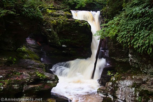
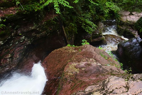
Follow the path toward Kitchen Creek and the sound of rushing water. The trail brings you out close to the top of Adams Falls; be sure to walk a bit to the left to see the gorge from above. (The falls are actually a set of cascades; you can see various parts of the falls from various vantage points but not the entire falls at once.)
At this point, I didn’t bother following the trail very closely. I probably should have been a little more careful, since the rocks can be slippery. But I walked down and found some good viewpoints from which to view Adams Falls from halfway down…

And again from below.
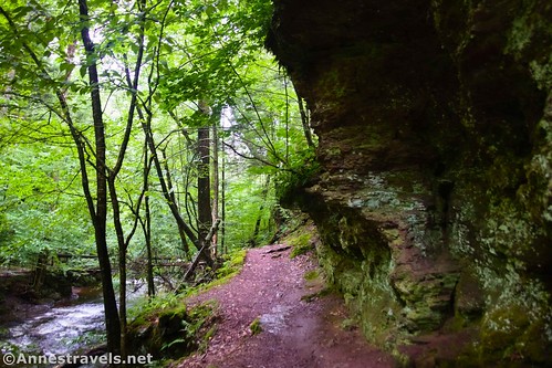
After this, the trail travels on a narrow shelf above Kitchen Creek with cliffs on your right. It’s a scenic part of the trail.
The trail crosses the creek via a bridge; at this point, I turned left to follow a social trail a short distance upstream. A beach offers a decent (if not spectacular) view of the gorge and falls from below. Unfortunately (fortunately?), wading isn’t allowed, so you can’t get your feet wet to snap a photo up the gorge from a better angle.
At this point, you’ve seen the best the Evergreen Trail has to offer. But if you want a peaceful forest walk, go back to the bridge and turn downstream/into the forest to ascend slightly in a mossy wood.
About 0.2 miles from the trailhead (I’d wracked up an extra 0.2 miles with all of my running around and taking pictures), the trail splits. You can go either way (I forget which way the numbers go for the nature trail); I chose to go left. In this area, you’ll also pass a junction with a post telling you that Rt. 118 is to the left. Don’t follow this trail if you’re trying to hike the Evergreen Trail.
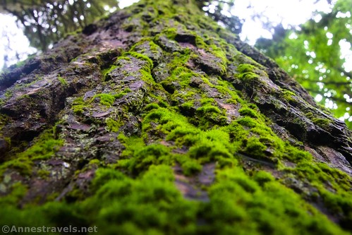
The trail after this isn’t super exciting. On a moody afternoon, the moss glowed as though it had just rained (always pretty in my opinion). There is a lot of green, from the firs and hemlocks to ferns and mosses.
Return to the loop junction after 0.6 miles; turn left to walk back to the parking area.
And that’s the Evergreen Trail! It’s peaceful, quiet, and seems to be miles away from the hustle and bustle of people on the Falls Trail. It’s also so very green and would be beautiful on a misty, rainy day.
Round Trip Trail Length: I went 1.25 miles; I’d guess it’s closer to 1.0 miles if you don’t run all over the place taking pictures (like me). Just to the bottom of Adams Falls and back is about 0.15-0.3 miles.
Elevation Gain: 387ft. (1,278ft. to 1,207ft.) (I’d guess that’s a generous estimate – the trail has a few ups and downs but nothing crazy.)
Facilities: I gather there are restrooms open sometimes. Primitive restrooms are available across the bridge and across the road in the larger “Rt. 118 Trailhead Parking Area.”
Fees: None
Trail Notes: No swimming is allowed along this trail. Also prohibited are fishing, wading, bicycles, rock climbing/scrambling, cliff jumping, camping, alcoholic beverages, and fires. Park hours are sunrise to sunset. There are a couple of inclines, making this closer to a moderate trail than simply “easy.” Be careful near the waterfall, as the rocks can be slippery, and a fall could be fatal.
Trail 


Road 


Signs 


Scenery 


Would I go 100 miles out of my way for this? 


Overall Rating: 


GPS Coordinates for the Evergreen Trail & Adams Falls
Evergreen Trailhead: 41.2993286°, -076.2746391° (41°17.95971′, -076°16.47834′ / 41°17’57.5829″, -076°16’28.7007″) (1,350ft.) (0.0)
Adams Falls: 41.299465000, -76.273996000 (41°17.96790′, -076°16.43976′ / 41°17’58.0740″, -076°16’26.3856″) (1,315ft.) (398ft.)
Loop Junction: 41.298035000, -76.272628000 (41°17.88210′, -076°16.35768′ / 41°17’52.9260″, -076°16’21.4608″) (1,322ft.) (0.41)
Return to loop junction: 41.298012000, -76.272675000 (41°17.88072′, -076°16.36050′ / 41°17’52.8432″, -076°16’21.6300″) (1,305ft.) (1.04)
End: 41.299321000, -76.274595000 (41°17.95926′, -076°16.47570′ / 41°17’57.5556″, -076°16’28.5420″) (1,339ft.) (1.24)
The gpx file for Adams Falls and the Evergreen Trail can be downloaded – please note that this and the GPS Coordinates are for reference only and should not be used as a sole resource when hiking this trail.
Download GPX File size: 20.6 KB Downloaded 108 times
(Note: I do my best to ensure that all downloads, the webpage, etc. are virus-free and accurate; however, I cannot be held responsible for any damage that might result, including but not limited to loss of data, damages to hardware, harm to users, from use of files, information, etc. from this website. Thanks!)
Getting to Adams Falls and the Evergreen Trail
From I-180 (say, Williamsport), take Exit 15 toward US-220. Turn east on US-220N for 4.9 miles; turn right onto N Main Street for 0.3 miles. Turn left onto PA-118E (E Water Street). Drive 25.9 miles. Just before the bridge over Kitchen Creek, turn right into the Evergreen Parking Area.
From I-81 (say, Wilkes-Barre), take Exit 170 toward PA-309N (be sure it’s north, not south!). After 7.1 miles, turn left onto Hillside Road (signs point toward Penn State WB) for 3.2 miles. Then take a slight right onto Old Rte 115 for 0.9 miles, turn left to stay on Old Rte 115 for another mile, and then keep left again to stay on Old Rte 115 for another 1.5 miles. Turn left onto PA-118W. After 12.9 miles, cross a road bridge over Kitchen Creek; the Evergreen Parking Area is on the left just after the bridge.
While the parking area isn’t tiny, it also isn’t huge, so it may be full on a busy summer day. More parking is available across the road on the west side of the bridge.
Today’s Featured Product!
Discover more than 50 different waterfalls in (mostly) eastern and central Pennsylvania – complete with tips on how to photograph them! Buy your copy here.


