

Last week, I said that I’d finish off the “sneak peek” post about all of the hikes (good and bad) that I did on my most recent trip. In that post, I covered Petrified Forest, Glen Canyon National Recreation Area, Grand Staircase-Escalante National Monument, and Death Valley National Park. In this post, we’ll visit Grand Canyon National Park, Glen Canyon National Recreation Area, Grand Staircase-Escalante National Monument, and Death Valley… does this sound like a repeat? We drove a lot of the same roads, but the scenery was totally different, so it’s well worth updating you with some photos!

We started out our first day in Grand Canyon by packing up all the stuff we’d need to hike into the canyon the next day. Unsure of exactly how long the trail would be or if we’d even make it, we wanted to do the best we possibly could to prepare, including water, snacks, winter gear, headlamps, extra batteries, and more. You just never know what you’ll find when you go over the edge of the Grand Canyon! In the afternoon, we drove out to the trailhead for Jicarilla Point. It’s a gorgeous view several miles beyond Hermit’s Rest, accessed through the national forest.

We were up at 4:30am the next morning and on the South Kaibab Trail by 5:30am. Despite the temperatures being near 20F, we weren’t freezing cold (maybe a bit of excitement making the blood pump a little harder?) We celebrated first light at Ooh Aah Point and reveled in pre-sunrise all the way down to McNeil Butte. To quote one of my group members, “I’ve always wanted to hike this section of trail at this time of day!”
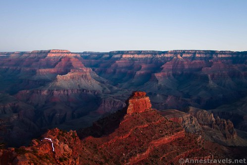
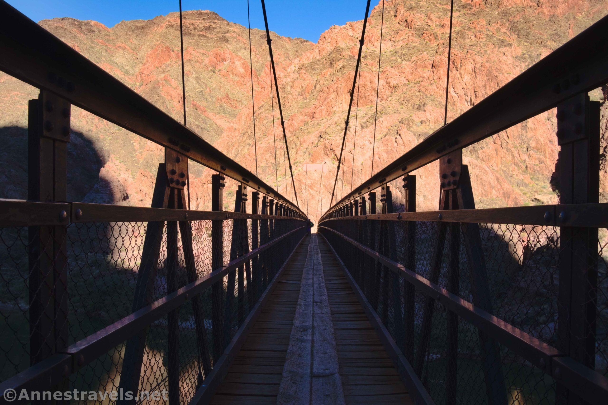
Sunrise was as beautiful as normal (one of my favorite natural phenomena to see), and we continued pounding down the miles. 8:30am – Tipoff, and we were in new territory (we’d gone as far as the Tipoff on another adventure back in 2011). We crossed Black Bridge across the Colorado River about the time the overnight rangers were beginning their ascent. Ate lunch below Phantom Ranch. Dipped our feet in the Colorado River. Crossed over the supposedly closed Silver Bridge (couldn’t tell by me!) Climbed back up “only one big hill” (as one hiker told us) to the rim again… and arrived about 45 minutes before sunset! Woohoo!! We did it!!!

In fact, we were so elated that we rode the shuttle out to Yaki Point for sunset.

The next day, we slept in a little before driving out to Glen Canyon National Recreation Area, specifically to Wiregrass Canyon. We were really a little late to be doing such a long hike, but we went down to the second big arch.
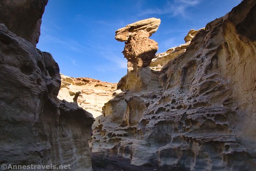
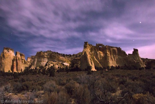
Then we stopped at the Nautilus again (it’s just that cool!) and explored around enough to see so many fun lines in the nearby rocks.
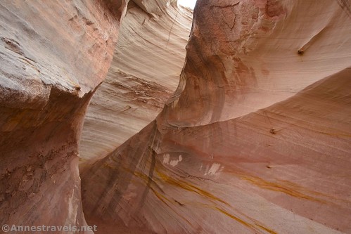
The Cottonwood Road used to be a mainstay on trips, but I’d forgotten how beautiful it is. Our destination this time was Round Valley Draw (very beautiful!)

We ate supper at Grosvenor Arch (how many meals have we eaten there? I don’t know, but it’s a lot!)
We made the mistake of sleeping that night in Cedar City. I say mistake because we woke up to four inches of snow on the van roof! (Thankfully, we’d brought a snowbrush!) We drove around looking for decent weather and, only sort of finding it, we set off to Mustang Pass north of St. George.
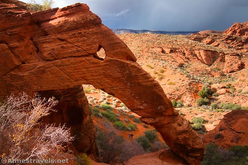
On our way back, we stopped at Elephant Arch.
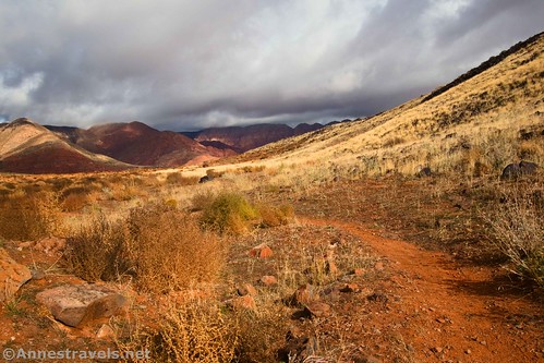
The weather still wasn’t looking nice (highs in the 20s in some places), so off we drove to Death Valley again. Our first stop was Daylight Pass, where we ate lunch before hiking to the top of the unofficially named Daylight Peak.
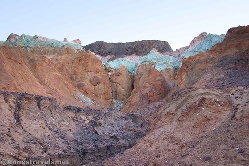
Then we stopped at the Corkscrew Peak Viewpoint and hiked to Hole in the Rock Spring.

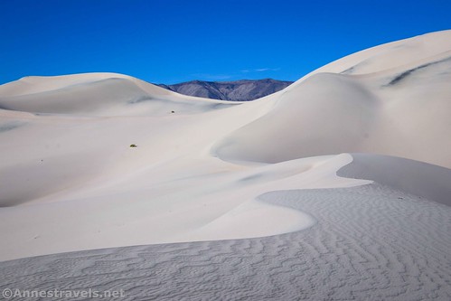
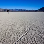
We camped along Lake Hill Road in the Panamint Valley before striking off across the desert toward Panamint Dunes the next day. We had the entire area to ourselves, and it was so very, very quiet! The dunes were also a great experience.
On our way back from the dunes, we went cross-country to the Big 4 (War Eagle) Mine. It seems that lead, zinc, silver, gold, and copper were all mined in this area.
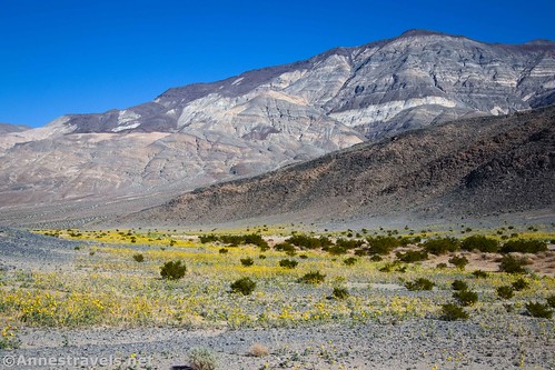
Lake Hill was our destination the next day. The views were fantastic, but I really loved the fields of wildflowers.
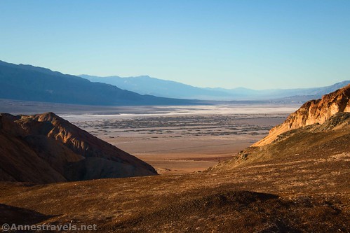
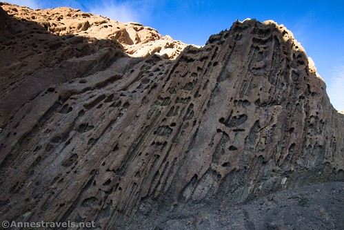
We drove back over to the main valley to hike up Desolation Canyon (prettier than Golden Canyon and usually close to deserted)…
…and South Desolation Canyon.
We spent the night along Hole in the Wall Road…
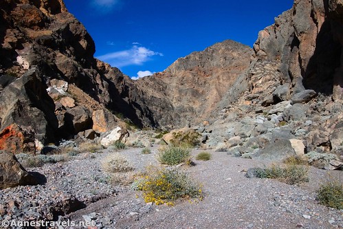
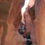
…and hiked to Slit Canyon and the mouth of Undertaker Canyon (I think I could have gotten in, but that would have been some pretty massive scrambling!)
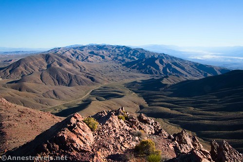
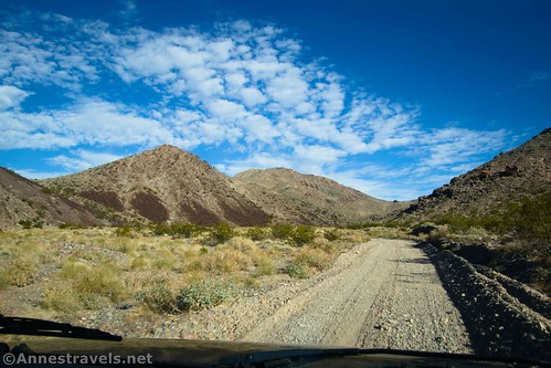
We had a few more hours of daylight and didn’t feel like we’d really ended the trip very well. So we drove up the Echo Canyon Road (it should be noted that both Hole in the Wall and Echo Canyon Roads become 4×4 along the way… I was able to drive them due to the fact that both had recently been reestablished, so they were firm enough for my 2WD van). It turned out to be a great choice.
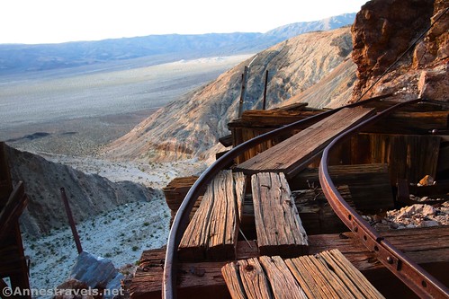
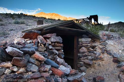
At the top, we found the Inyo Mine. So exceptionally cool, especially since I know that none of it has been sanitized for tourists!
We called the trip a wrap and headed home between two winter storms. Yikes! There’s a reason traveling this time of year is a little bit dicey. But we hiked a total of 130 miles and saw so many beautiful areas… I’m so glad we did it!
Today’s Featured Product!
I put a few of my favorite, most view-saturated hikes into this little guide! It’s available in eBook or physical editions. Buy your copy here!

More Related Posts:
 Epic Day Hiking Road Trip to Southern Utah
 Alternate Views of Famous American Wilderness Areas
 10 Places to Go Exploring in the Western US
 Sneak Peak: Petrified Forest, Southern Utah, and Death Valley!
 Death Valley, Grand Canyon, Canyonlands… and a Lot of Off-Trail Adventures!
 12 Trails that Require Hands & Knees, River Crossings, and Other Adventures