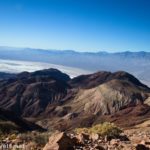

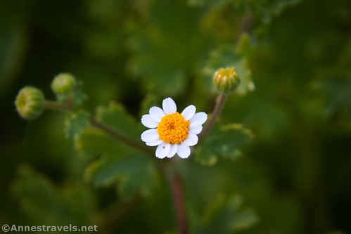
On our way down into the valley from Daylight Peak last fall, I stopped at the Corkscrew Peak Viewpoint to hike to Hole in the Rock Spring. I wasn’t expecting much – desert springs are more often jungles of brush than something to look at in my experience. But it turned out that Hole in the Rock Spring is slightly different. Tucked away in a hole in a rock (fancy that!), with a great view down toward Death Valley and the Panamint Mountains, and complete with a few wildflowers, it was definitely worth an evening jaunt!
Quick Stats
(This post contains affiliate links.)
There is no official trail to Hole in the Rock Spring. In fact, I wandered around a bit before I found the social trail that will take you into the correct wash. So be ready for some wayfinding to get this one!
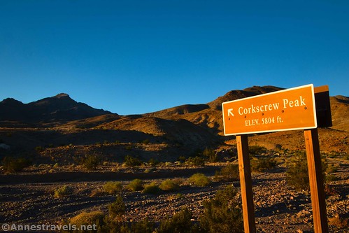
From the small pulloff with the sign for Corkscrew Peak, walk up the road (physically up toward Daylight Pass and away from the valley). After a tenth of a mile, turn left up a social trail that climbs the hill.
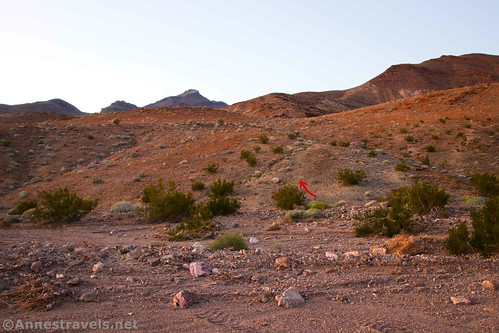
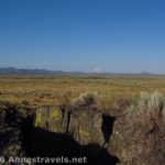
The social trail will take you up and over the shoulder of the hill and finally drop you smack into a dry desert wash. It’s not impressive, though the landforms are interesting.

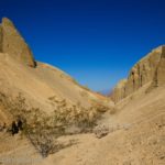
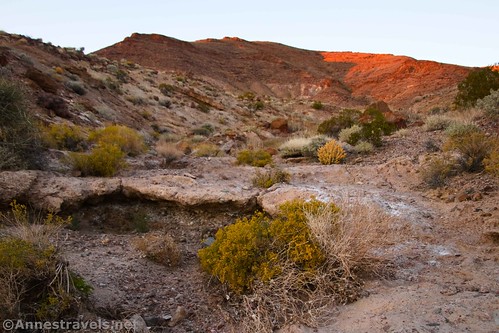
Turn right to continue up the wash. Only 0.45 miles from the parking area, you’ll arrive at the spring, which is located on the right side at a bend in the wash, just below a small dryfall.
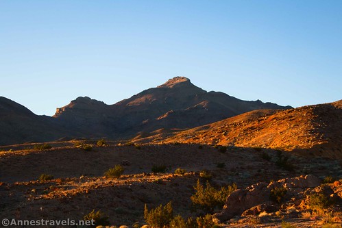
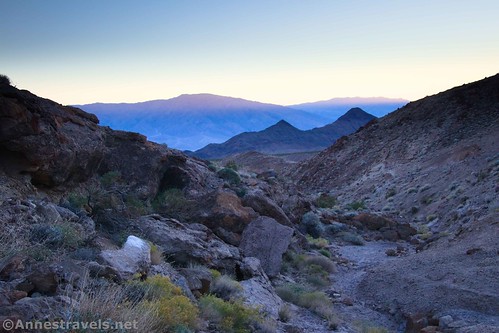
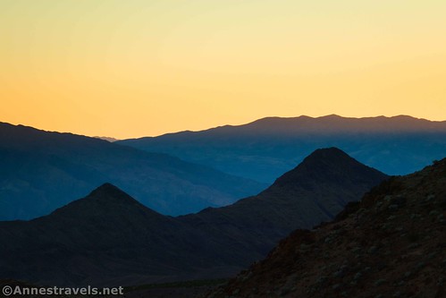
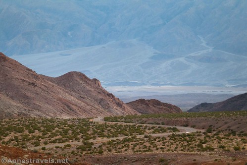
Looking down the canyon, the Death Valley Buttes are prominent.
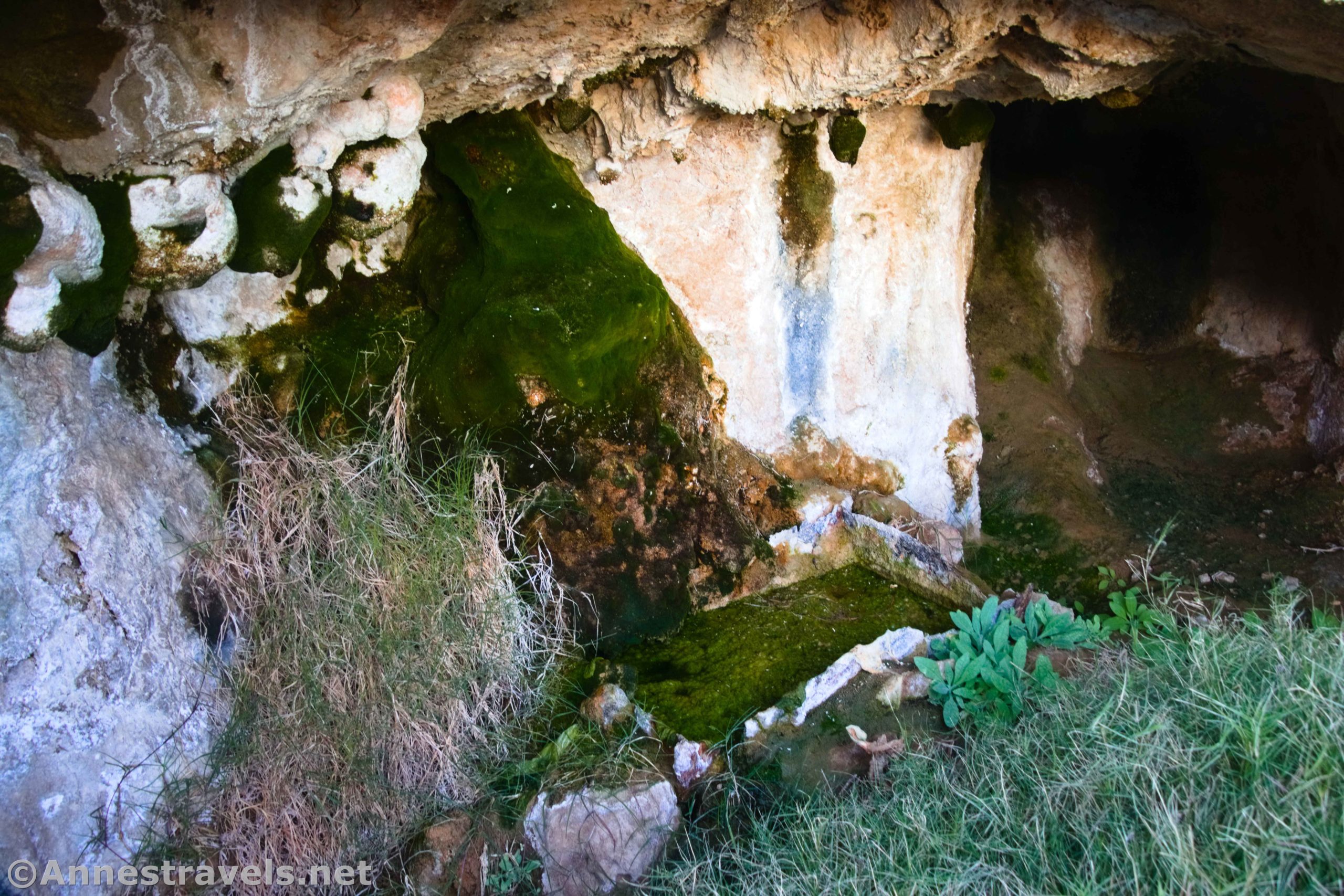
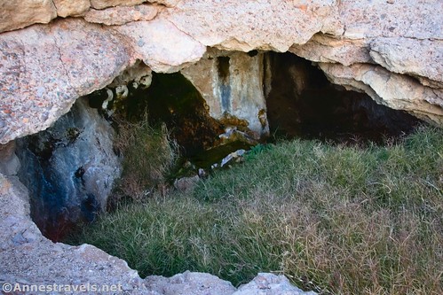
Perhaps more interesting, the spring has been contained with a metal box. The box is in poor condition, and the water is super disgusting. (TMI, but it’s true.) I watched, fascinated, as water dripped from the ceiling to land plop! in the box.

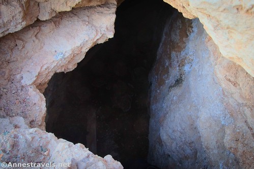
Beyond the spring is a cave. I’m not 100% sure where it goes, but it looks like others have used it long before my visit. I stuck my camera inside – but not too much of my head!
Retrace your steps to your vehicle. Hole in the Rock Spring is definitely not the star attraction of Death Valley (far from it!), but if you want a quick look into one of the life sources that provided for miners, travelers, and visitors back to antiquity, this is a cool way to do it!
Round Trip Trail Length: I went 0.9 miles
Elevation Gain: 262ft. (2,695ft. to 2,894ft.)
Facilities: None
Fees: $30/vehicle, valid 7 days. America the Beautiful National Park & Federal Lands Passes and Death Valley Annual Passes are also accepted.

Trail Notes: Once you find the social trail, it’s not too hard to get to the spring. But finding the social trail can be tricky, especially if you’re not accustomed to locating vague trails in a rocky, barren desert. Be prepared for wayfinding here. Don’t try this in the middle of a hot day; November-April are the best months due to the extreme heat. Don’t drink the water (eeewww!) Swimming and wading is not permitted in the spring, but you wouldn’t want to touch it anyway.
Trail 
![]()
![]()
![]()
Road ![]()
Signs ![]()
![]()
![]()
![]()
Scenery ![]()
![]()
Would I go 100 miles out of my way for this? ![]()
![]()
![]()
Overall Rating: 
![]()
![]()
GPS Coordinates for Hole in the Rock Spring
Beginning: 36.7390350°, -116.9680870° (36°44.34210′, -116°58.08522′ / 36°44’20.5260″, -116°58’05.1132″) (2,709ft.) (0.0)
Not beginning of trail: 36.7406200°, -116.9667190° (36°44.43720′, -116°58.00314′ / 36°44’26.2320″, -116°58’00.1884″) (2,756ft.) (0.15)
Hole in the Rock Spring: 36.7438240°, -116.9670480° (36°44.62944′, -116°58.02288′ / 36°44’37.7664″, -116°58’01.3728″) (2,916ft.) (0.45)
Real trail beginning: 36.7404040°, -116.9671960° (36°44.42424′, -116°58.03176′ / 36°44’25.4544″, -116°58’01.9056″) (2,752ft.) (0.80)
End: 36.7390320°, -116.9680860° (36°44.34192′, -116°58.08516′ / 36°44’20.5152″, -116°58’05.1096″) (2,709ft.) (0.92)

The gpx file for Hole in the Rock Spring can be downloaded – please note that this and the GPS Coordinates are for reference only and should not be used as a sole resource when hiking this trail.
Download GPX File size: 24.6 KB Downloaded 353 times
(Note: I do my best to ensure that all downloads, the webpage, etc. are virus-free and accurate; however, I cannot be held responsible for any damage that might result, including but not limited to loss of data, damages to hardware, harm to users, from use of files, information, etc. from this website. Thanks!)
Getting to Hole in the Rock Spring Trailhead
From Furnace Creek, drive north on CA-190 (toward Stovepipe Wells). After 10.9 miles, turn right onto the Beatty Cutoff Road. The road travels uphill for 10 miles and then Y’s into the Daylight Pass Road. Continue right 1.2 miles to a small, paved pulloff on the left with a small sign pointing to Corkscrew Peak.
The pulloff is 18.1 miles from the US-95 junction in Beatty.

Today’s Featured Product!
See the best Death Valley has to offer with this brand-new guide. It covers 50 trails across the breadth of the park with a wide variety of scenery and history to discover. Buy your copy here!