

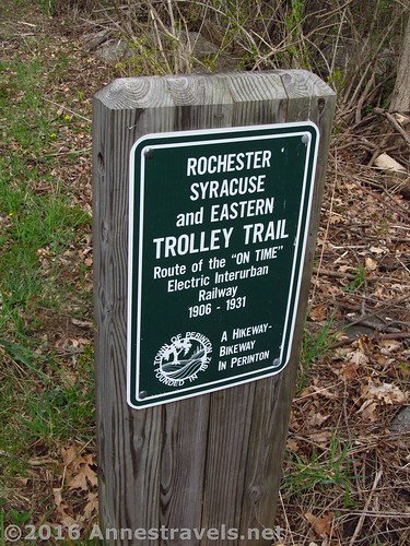
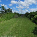
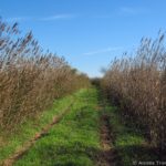
Well, it’s that time of year again: time for the Big Birthday Bike Ride. A few weekends ago, we loaded up all the bikes, drove down to the far southeast end of the Rochester, Syracuse & Eastern Trail (at Pannell Road). This isn’t a very impressive starting point – it’s a tiny parking area (about big enough for two, possibly three, cars) next to a run-down farm market. On the other hand, it’s also not too difficult to miss if you know what you’re looking for (see the picture).
Quick Stats
(Affiliate links are present on this page.)
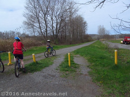
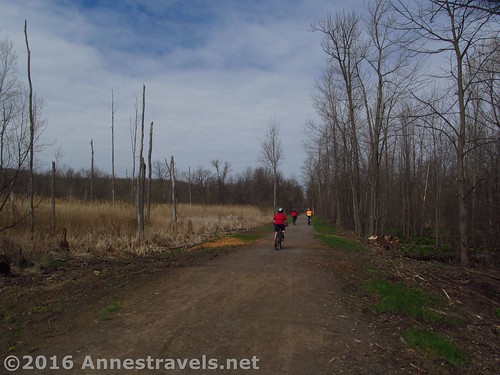
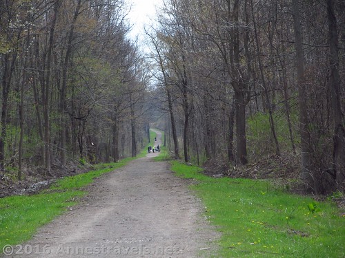
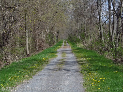
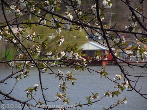
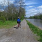
The Rochester, Syracuse & Eastern Trail is a Rails to Trails, so it’s fairly flat (though there is a steep grade or two (mostly downhill) that I would think would have been a bit steep for a trolley or a train). The first section of the trail goes through a bit of a swamp; in the summer, this might be buggy if you were going too slowly, but on bikes in late April, it was just pleasant (if a bit drab, since the leaves weren’t out yet).
Cross Victor Road by going directly across. On your left is Lollipop Farm, so we spotted a few horses in pens along the trail. On the right were a few houses (just close enough to the trail to let you know you’re not in the wilderness anymore). Note: you can park here at Victor Road; there are no more places to park until you reach the canal path.
At Palmyra Road, turn left along the sidewalk, and cross at the light. Then cross Mason Road to find the continuation of the path (it’s more or less catty-corner from where you come out at the light).
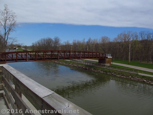
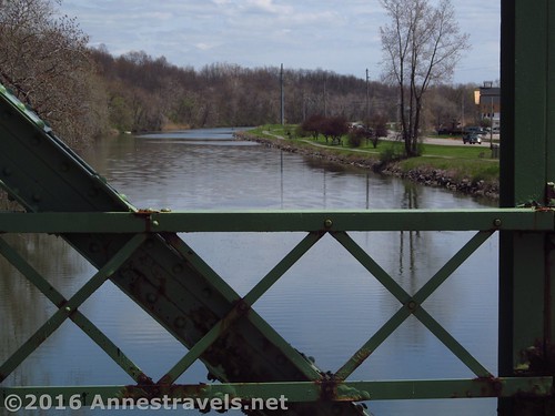
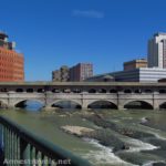
From here, the trail travels through forests and with occasional houses until it meets the canal path at mile 4.4. The path goes over a major bridge – really cool – to get to the other side of the canal (I think the access ramps were one of my group member’s favorite parts of the entire ride). We had gone from the Genesee River to Fairport a couple years ago, so we figured since we were near Fairport, we’d continue east along the Erie Canal Path through Palmyra and then over toward Newark (New York – not New Jersey).
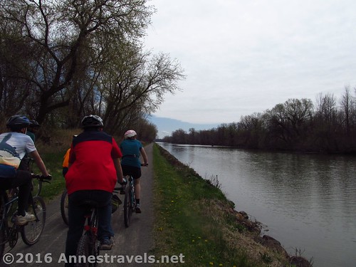
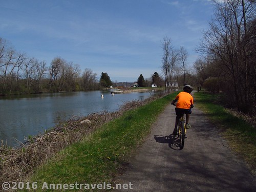
So at the end of the access ramp, on the north side of the canal, we turned left and headed out along the canal.
At this point, there weren’t many (almost any) boats on the canal. Later in the season, there can be quite a few which would make it more interesting. The trail follows the canal closely – so close a slip could mean sliding down the bank into the water, no joke – but the water was brown and very uninviting. The trail passes by a landfill (it doesn’t look too awful, but the stench is breathtaking).
Just before Wayneport Road, the trail goes along a road through some houses. It’s actually really sad, because the houses are pretty much dumps – condemned, unkempt, etc. Some are ok, but others aren’t. Cross the paved road, take and immediate right, and continue down the trail.
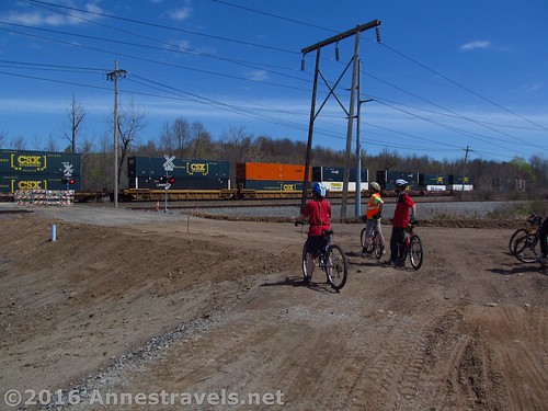
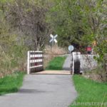
We had a little issue crossing Canandaigua Road; they were doing major bridge work, so the trail was very nearly closed. On the other hand, we got to watch a train go by, which was a high point for other members of the group!
We’d planned on eating lunch at Bullis Park (across the canal via Canandaigua Road – I used to play t-ball there so many years ago!), but with the bridge out, we had little choice but to continue. We finally worked it out with the people who were with the van that we’d meet them at Macedon Canal Park for lunch. (Cell phones. What did we do in the days before cell phones?)

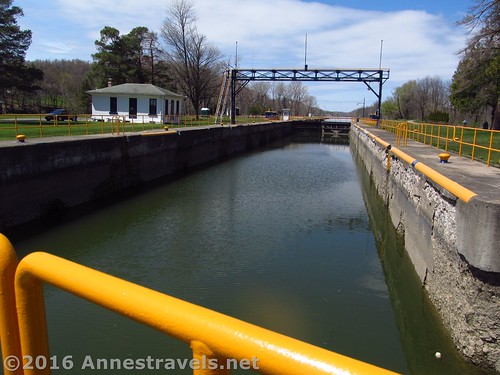
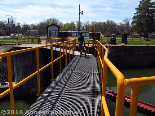
This turned out to be a lovely place to eat. From the trail, cross Lock 30 (literally walking across the lock gates – don’t worry, there’s railings and it’s oh-so-cool!). You can then access the park proper as well as a portable restroom and a short trail (the Butterfly Trail) that talks about the canal in its earlier days.
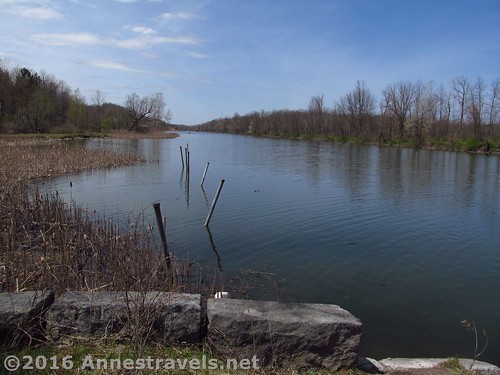
The nearby waterway was part of the Expanded Erie Canal, but now carries water around the locks. You can also look out at the New Erie (really, Barge) Canal. It’s quite nice.
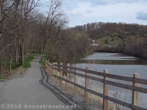
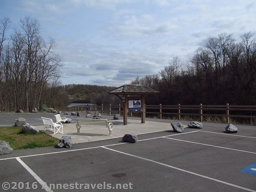
We chose to eat at the picnic tables next to the canal path. One of the good things about the canal path is that nearly all the road crossings (at least to the west of Pal-Mac Aqueduct County Park) have places to park.
After lunch, we continued on our way toward Palmyra. At the very next road crossing (O’Neil Road), you’ll have to cross the canal via the bridge and take the path down the southern side of the canal. It’s not hard, just needs to be done. (I also highly recommend taking a side-trek to the Lock 60 Historic Site, about 0.4 miles away along Quaker Road, where you can walk through the lock chambers of one of the original Erie Canal Locks, widened and enlarged later.) Between this and Yellow Mills Road is actually an interesting section (though not my favorite). On one side is the canal, and on the other (about 10 feet of grass away) is a fairly busy road. It certainly adds excitement to life!
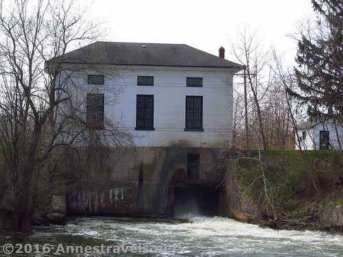
After Yellow Mills Road, the Erie Canal Path veers into Pal-Mac Aqueduct County Park. This was actually a really cool place, as well, though we didn’t spend much time exploring it or Lock 29, which is in the park. There are a few nice waterfalls created by water diversion, etc. When you come out in the park (after crossing the bridge) head across the road toward the other pedestrian bridge. You actually want to go under the bridge to continue on the path, so what exactly the pedestrian bridge is for I don’t know. But it is fairly impressive.
The trail crosses a few roads (you’re in the middle of Palmyra here, so while there are trees and swamps, there are also plenty of houses), then comes to Division Street. Here, again, you’ll have to recross the canal and pick up the path on the northern side.
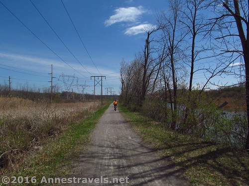
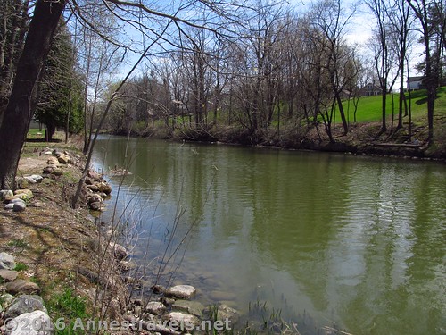
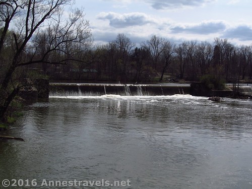
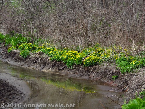
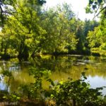
From here, the scenery really begins to improve. For one thing, you’re heading out of Palmyra Proper, so the woods begin to get wild again. You’re not as close to the canal as sometimes, but that’s ok. The further you go, the more the trail rolls until it is high above the canal (which at this point looks like a major river). After crossing Rt. 21 and before Galloway Road, you’ll cross Ganargua Creek – twice – and be able to see a spillway from the canal into the creek. That in itself is worth the ride!
The trail continues to be fairly wild, but the canal widens to very wide river status, especially after E Palmyra Port Gibson Road. (Apparently, this section is called “The Wide Waters”, but I didn’t know that at the time). It’s an extremely pleasant place to ride.
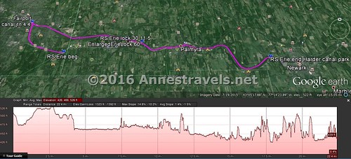
We finally ended, 22.7 miles from our starting point, at Harder Canal Park just past Whitbeck Road. At the moment, if you look on Google Maps, the parking area is on the west side of Whitbeck Road; now that area is completely closed to the public (it’s owned by Dolomite, I think), so our drivers had to turn down W Shore Blvd for a few hundred feet to park in the spacious, very nice parking area. From here, views toward a farm in Newark are quite nice. And you could always choose to go a bit further… maybe I will next time 🙂
Trail Length: We did it as a shuttle, so only went 22.7 miles. Round trip would be 45.4 miles. Only doing the Rochester, Syracuse & Eastern Trail would be 9 miles RT, or 4.5 with a shuttle vehicle (turn right (west) on the canal path and there’s a parking area close by).
Highest Elevation: 526 ft.
Lowest Elevation: 423 ft.
Net Elevation Loss: 103 ft. – We definitely did this the right way – it was mostly downhill!
Facilities: There are restrooms or picnic tables occasionally, especially in Macedon Canal Park and Pal-Mac Aqueduct County Park.
Fees: None
Trail 
Road
Signs ![]()
Scenery ![]()
![]()
![]()
Would I go 100 miles out of my way for this? ![]()
![]()
![]()
![]()
Overall Rating: 
![]()
Key GPS Coordinates for the Rochester, Syracuse & Eastern Trail and the Erie Canal Path to Harder Canal Park:
Rochester, Syracuse & Eastern Trail Beginning (Pannell Road): 43.05845N / -077.37557W (43° 3′ 30.42″ / -77° 22′ 32.0514″) 590ft. (0.0)
Erie Canal Trail Junction: 43.09499N / -077.42912W (43° 5′ 41.964″ / -77° 25′ 44.8314″) 480ft. (4.4)
Lock 30: 43.07313N / -077.30127W (43° 4′ 23.2674″ / -77° 18′ 4.572″) 465ft. (11.5; left 12.8)
Harder Canal Park (end): 43.05265N / -077.12659W (43° 3′ 9.5394″ / -77° 7′ 35.7234″) 452ft. (24.0 – so really 22.7)
The gpx file for the Rochester, Syracuse & Eastern Trail and the Erie Canal Path to Harder Canal Park can be downloaded – please note that this and the GPS Coordinates are for reference only and should not be used as a sole resource when hiking this trail.
Download GPX File size: 176.1 KB Downloaded 543 times
(Note: I do my best to ensure that all downloads, the webpage, etc. are virus-free and accurate; however, I cannot be held responsible for any damage that might result, including but not limited to loss of data, damages to hardware, harm to users, from use of files, information, etc. from this website. Thanks!)
Getting to the Pannell Road Trailhead for the Rochester, Syracuse & Eastern Trail:
From I-90: Take Exit 45 onto I-490W. Take the first exit (Exit 29) and turn right onto US-96 toward Victor. After 0.5 miles, turn right onto High Street for 0.2 miles, then turn left onto Valentown Road for 2.0 miles. Take another left onto Victor Egypt Road. After 0.5 miles, the road will change names to Victor Road; continue straight for another 0.8 miles. Turn right onto Wilkinson Road for 0.7 miles, then left onto Pannell Road for 1.0 miles to the trailhead, on left across the road from an old silo.
From Fairport: Drive south on S Main Street (US-250S) 1.5 miles. Turn left onto NY-31E for 3.3 miles, then right onto Pannell Circle. After 0.2 miles, turn right onto Pannell Road for 0.3 miles to the trailhead, on right just after Chase Farm Market and across the road from an old silo.
From Macedon: Drive southwest on NY-31W / W Main Street 3.8 miles. Turn right onto Pannell Circle. After 0.2 miles, turn right onto Pannell Road for 0.3 miles to the trailhead, on right just after Chase Farm Market and across the road from an old silo.
Zoom map out to browse nearby hikes & places of interest
This Week’s Featured Product!
This book features family-friendly bike riding (or hiking) trails in the Rochester, NY area! The rides range in difficulty and length, from 1.1 miles to over 28 miles in length. Others can be combined for nearly 100 miles of riding. The trails are also organized by length, difficulty, and nearby features for a fun family experience. Having done a number of the trails mentioned in the book, I can say that they are definitely family-friendly, no matter the experience level of your family.
More Related Posts:
 Erie Canal: Meridian Center (Rochester) to San Souci Park (Brockport)
 Biking the Genesee Valley Greenway
 Genesee Riverway and Erie Canal Path: History via Bikes
 Biking the Auburn Trail / Lehigh Valley Trail
 Genesee Valley Greenway-Lehigh Valley Trail Loop in Rochester!
 “Marsh Loops” Biking or Hiking Trails on Holden Beach
2 responses to “Scenic Bike Ride: Rochester, Syracuse & Eastern Trail + Erie Canal Path”
[…] blossoms along the Erie Canal Path, New […]
[…] paid for by your New York Thruway (I-90) tolls. The canal path is also well-used by cyclists (that would be me), runners, hikers, and even dog sleds in winter (if you believe the stories of some friends with a […]