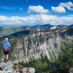
Mossy Ledge Falls is one of those almost-unknown secret hikes in Big Cottonwood Canyon near Salt Lake City, Utah. It’s named for the picnic area that once sat at the trailhead. Calling it a “trail” is a bit of a misnomer, as you pretty much just scramble up the streambed for most of the way after the initial climb to the old picnic area. Still, the falls is nice, so if you happen to need a very short hike and don’t mind scrambling over slippery rocks, at least there’s a nice reward at the end.
Quick Stats
This site contains affiliate links. If you click one of these links and make a purchase, I may receive a small commission. There is no extra cost to you.

I hiked Mossy Ledge Falls on a wet morning in mid-September. It wasn’t exactly raining, but it wasn’t exactly dry, either. I did meet another family, and I also met one group who was trying to find their way and gave up fairly quickly. So it’s not like this place is unknown, just not exactly official.
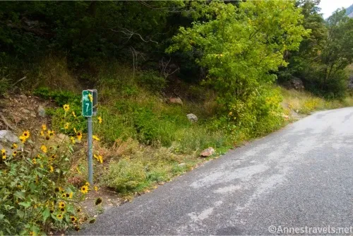
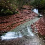
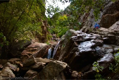
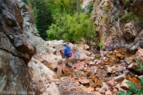
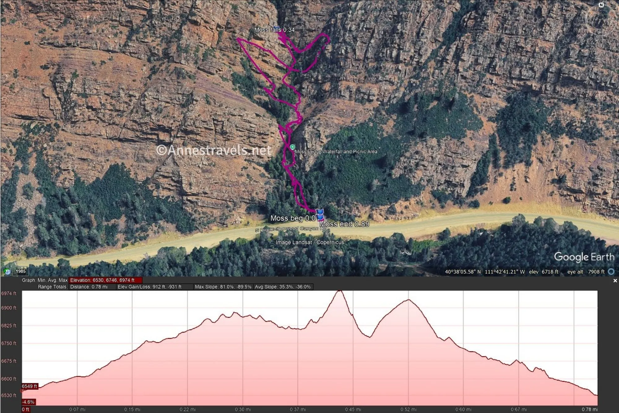
0.0 Mossy Ledge Pulloff (6,550ft.). The pulloff is next to mile marker 7 in Big Cottonwood Canyon. There is space for maybe three or four cars in the pulloff. Cross the road and pick up the light (but very real) trail up to a level place where there were once picnic tables in the Mossy Ledge Picnic Area. Stay left of this flat area and try to locate a trail heading up the gorge. I did not find it easy to locate, so be warned. When you find it, start scrambling up the gorge. For the most part, you’ll be rock-hopping or else scrambling over boulders, though at times you might find a light trail, especially on the right side of the gorge. Be careful to stay in the gorge, as some of the trails seemed to climb out of it rather than go up it. There are many small waterfalls in the stream. (40.6342610°, -111.7113190°)
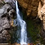
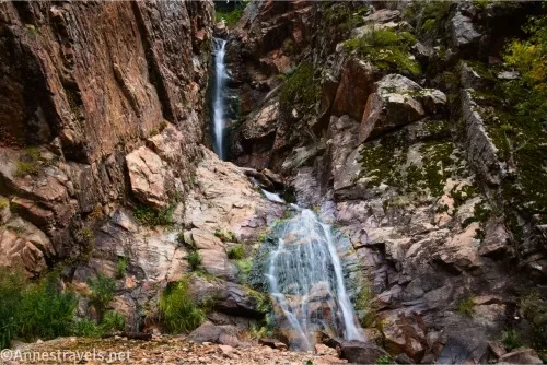
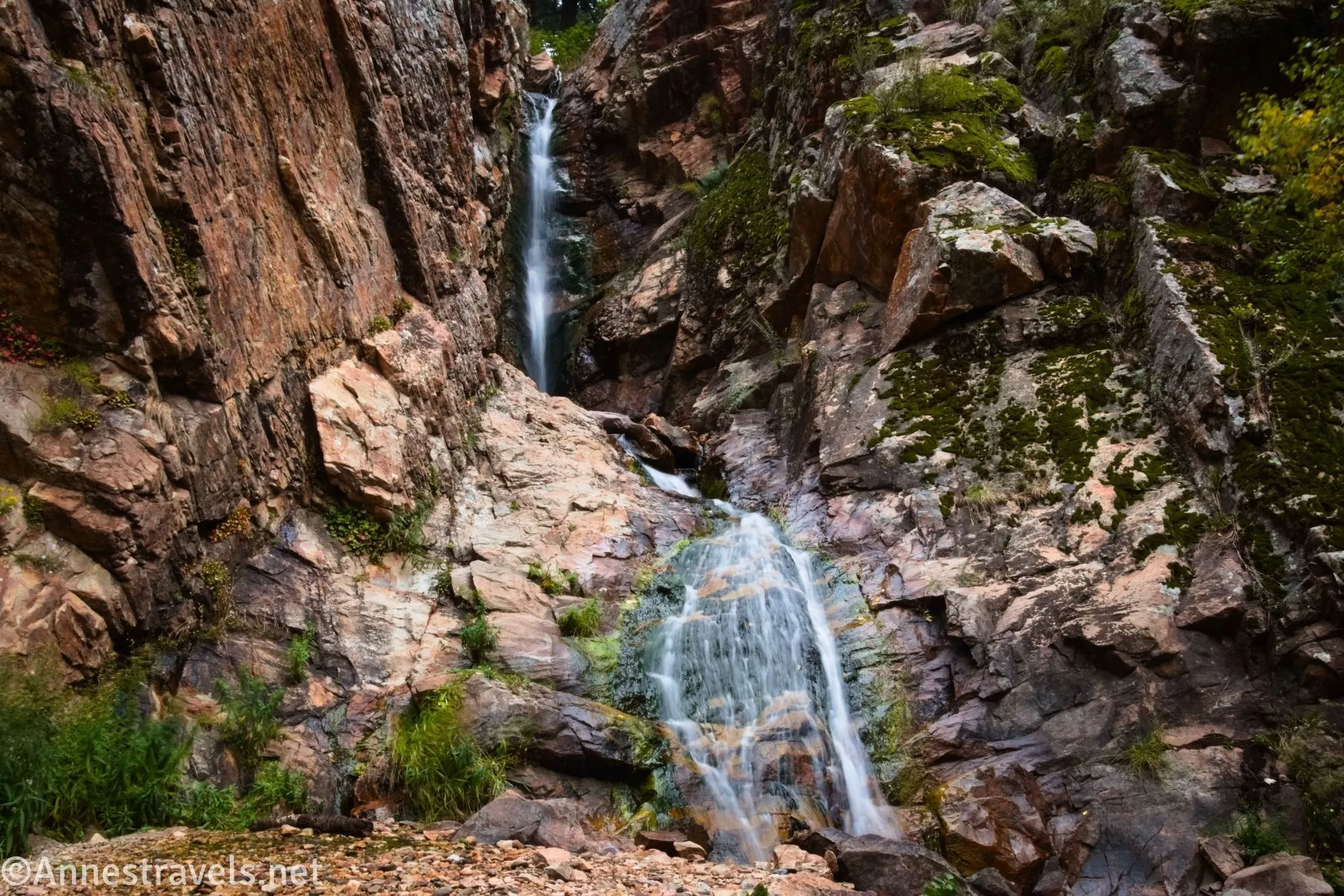
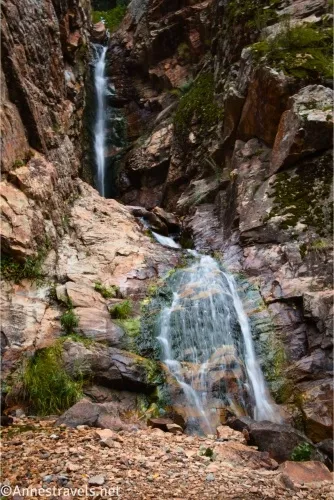
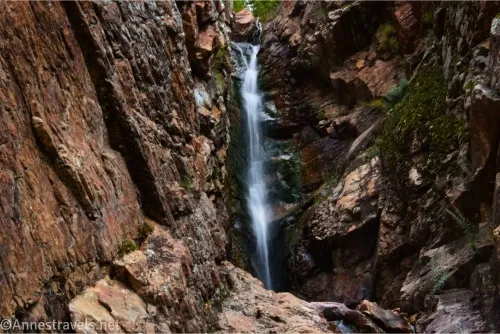
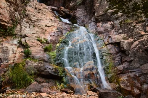
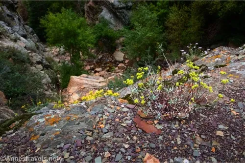
0.3 Mossy Ledge Falls (6,896ft.). The falls is in a couple of tiers; I scrambled up the left side so I could see it better. It’s actually quite impressive, and definitely more impressive than nearby Hidden Falls (as lovely as Hidden Falls is, and it’s also much easier to access). When you’ve finished admiring the falls, scramble (carefully!) back down the gorge to the pulloff. (40.6365930°, -111.7119990°)
Round Trip Trail Length: I went 0.9 miles (which is interesting considering Mossy Ledge Falls is only 0.3 miles up the gorge… no, I did not hike it three times!)
Elevation Gain: About 600ft. (6,530ft. to 6,884ft.)
Facilities: None
Fees: None that I know of, though Big Cottonwood Canyon has instituted fees at some of the trailheads.
Trail Notes: Wear good shoes for this one, and be ready to get your feet wet if the creek is really roaring (which it wasn’t on a rainy day in September). Also, note that there is no trail – It’s mostly a rock scramble up a creek. Take your time and be very careful not to slip!
Trail 
![]()
![]()
![]()
Road ![]()
Signs ![]()
![]()
![]()
![]()
Scenery ![]()
![]()
![]()
Would I go 100 miles out of my way for this? ![]()
![]()
![]()
Overall Rating: ![]()
![]()
![]()
GPS Coordinates for Mossy Ledge Falls
TH: 40.6342610°, -111.7113190° (40°38.05566′, -111°42.67914′ / 40°38’03.3396″, -111°42’40.7484″) (6,550ft.) (0.0)
Mossy Ledge Falls: 40.6365930°, -111.7119990° (40°38.19558′, -111°42.71994′ / 40°38’11.7348″, -111°42’43.1964″) (6,896ft.) (0.34)
End: 40.6341970°, -111.7113220° (40°38.05182′, -111°42.67932′ / 40°38’03.1092″, -111°42’40.7592″) (6,543ft.) (0.89)
The gpx file for Mossy Ledge Falls can be downloaded – please note that this and the GPS Coordinates are for reference only and should not be used as a sole resource when hiking this trail.
Download GPX File size: 24.0 KB Downloaded 188 times
(Note: I do my best to ensure that all downloads, the webpage, etc. are virus-free and accurate; however, I cannot be held responsible for any damage that might result, including but not limited to loss of data, damages to hardware, harm to users, from use of files, information, etc. from this website. Thanks!)
Getting to Mossy Ledge Falls
The Mossy Ledge Pulloff is 5.1 miles up Big Cottonwood Canyon from where UT-210 goes off. It’s also 0.8 miles beyond the Lake Blanche Trailhead.
Find More Hikes near Salt Lake City
Explore more of the best, most beautiful, and most interesting hikes near Salt Lake City with this guide, which covers over 45 trails. Buy your copy here.