
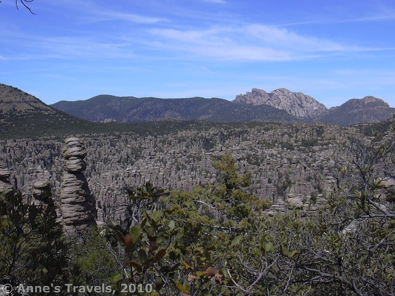

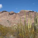
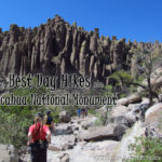
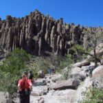
If you like rock formations, and you’ve worn out Moab, Utah, the place for you to visit is Chiricahua National Monument in southern New Mexico. Here, gray rock towers point skyward in the most amazing shapes and number. Many of the rocks have been named as well, such as “Kissing Rocks”, “Thor’s Hammer”, and even the imaginative, “Duck on a Biscuit”. You can see many of the towers from the road within the park, and even hike around in the rocks without going very far from your vehicle; however, to get to the really cool formations, you’ll have to hike the Heart of the Rocks Trail, which goes into the very heart of the rock formations.
(Affiliate links are present on this page.)
To get to Chiricahua, take I-10 east from Tucson to the first exit for Willcox. Go 3 miles into the town, and turn right at the stoplight onto Arizona State Hwy 186 and travel 32 miles. At the junction with Arizona State Hwy 181, turn left and drive to the entrance station—the road just goes into the park. Along the way there is a dirt road that goes past several ranches and eventually enters a national forest. We have slept in the national forest several times (there’s a nice place for one vehicle to park just on the other side of the cattle guard), despite the sign at the beginning of the road. The general idea of the sign is that you are traveling at your own risk; this road is known be to used by smugglers, drug dealers, and illegal aliens. In other words, if you get into trouble, no one’s going to come looking for you, and no one will be patrolling the road. If this doesn’t bother you, go ahead and sleep in the national forest. There is also a campground inside the park ($12/night or $6/night for Golden Age/Golden Access Pass holders) (9/10).
 the Heart of the Rocks Trail")
The Heart of the Rocks Trail itself is only about a mile long, but to get to the trail you’ll have to hike at least 3 miles just to get to the start of the loop. There are two options of how to hike the trail: you can park at the Massai Point parking lot and hike to the Heart of the Rocks Trail (7.5 miles RT; going out it’s mostly downhill), or you can hike up from the visitor center (7.3 miles RT; it’s definitely downhill coming back!). You can also leave a shuttle vehicle in the visitor center parking lot, drive another vehicle up to Massai Point, and have a hike that is mostly downhill 🙂 Depending on the season, you might also be able to park in the visitor center parking lot and take the park shuttle up to the start of the trail. We’ve done both the out-and-back from Massai Point, and the park shuttle. I recommend the park shuttle, but it does get you on a bit of a time-schedule, which might or might not work into your plans.

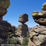
If you’re going to hike up from the visitor center, take the Lower Rhyolite Canyon Trail 1.5 miles (mostly slightly uphill) to the Sarah Deming Trail. This trail climbs nearly 1,000 feet in the nest 1.6 miles, but gets you right to the place where the Heart of the Rocks Trail goes off. However, I highly recommend that you go up the Big Balanced Rock Trail for a little ways to see the Big Balanced Rock—it’s really, really cool. (The Sarah Deming Trail, Heart of the Rocks Trail, and Big Balanced Rock Trail intersect at the start of the Heart of the Rocks Trail).

If you decide to hike from Massai Point, take a 0.3 mile trail down to the Ed Riggs Trail (the signs around here are quite good, so you may be able to follow the directions to the Heart of the Rocks all the way from the parking areas). Follow the Ed Riggs Trail for 0.7 miles; turn left onto the Mushroom Rock Trail. I’m not exactly sure where the Mushroom Rock is, but as I recall it’s pretty covered in trees. After 1.2 miles is the trail to Inspiration Point. This is an optional side trip (1 mile RT) to a viewpoint of the valley full of rock towers. It’s amazing; I definitely recommend it, although if it’s too long it’s not a terrible loss. If you can do this or Heart of the Rocks, go for Heart of the Rocks.

At the same trail junction as the Inspiration Point Trail is the start of the Big Balanced Rock Trail. To get to the Heart of the Rocks, take this trail for 1 mile until you reach the intersection with the Heart of the Rocks Loop. Here you are in the midst of the beginnings of the formations, which is really nice.
Besides the fact that this route is mostly downhill, you also get to walk through the formations more than you do when you come up from the visitor center. You can also get some great views of the valley full if rock formations along the Sarah Deming Trail, so there’s payoffs no matter which way you decide to go.

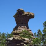
The Heart of the Rocks Trail (Loop) itself has new things to see at every bend. Many of the rocks in this area have been named, including “Punch & Judy”, “Pinnacle Balanced Rock”, and “Duck on a Rock” (which looks more like a duck than “Duck on a Biscuit”). We usually have lunch in this area, along the trail in the midst of the formations. It certainly is a scenic lunch spot!
Return by the way you came, or to your shuttle vehicle. It’s an all-day or most-of-the-day hike, but the formations make it well worth it.

Another interesting sight in Chiricahua is the historic buildings which I believe are called Faraway Ranch. You can stroll around between the buildings and see what a ranch in this area actually looked like. Some of the buildings are furnished, so I wonder if perhaps they are open some times of the year.
Fees: $5.00 per person, children 15 and under free; pass valid 7 days. Interagency/Golden Age/Golden Access/Chiricahua Park passes are accepted. (9/10) Update: The entrance fees to Chiricahua have been eliminated, so you can now visit for free! Also, visit this link for my updated review of this loop!
Trail 
![]()
Road
Signs
Scenery
Overall Rating:
This Week’s Featured Product!
There’s something for everyone in this guide with 120 hikes in Arizona. From famous to infamous to nearly unknown, there’s a wide variety of trails.
One response to “Fantastic Rock Formations at Chiricahua”
[…] actually only happened once, in Chiricahua National Monument. You can’t blame us, either: we had to catch the shuttle at the visitor center, and the sliding […]