

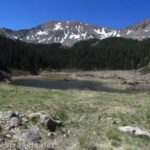
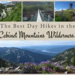
After arriving at Williams Lake, we thought we would hike a bit further before ascending Mount Walter and Wheeler Peak (our actual destination for the day). Like most alpine lakes, there are a number of social trails leading hither, thither, and yon along the lakeshore. However, the day before, a couple forest rangers had shown me a map of the area. The fact that there was a waterfall – known as Williams Falls – in one of the lake’s inlets was intriguing. So I set out to see if I could find it.
Quick Stats
(Affiliate links are present on this page.)
I’ll admit I wasn’t sure what to expect. Waterfalls in New Mexico might be called “rills” in New York (we’re a bit spoiled, having Niagara Falls so close, not to mention Letchworth, Watkins Glen, Ithaca, etc.). Just looking at the area around the lake, it was pretty obvious the falls wasn’t going to be on par with Niagara. But it might be worth visiting – or recommending others not visit.
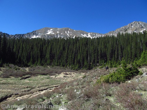
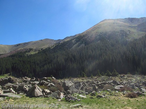
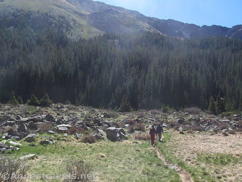
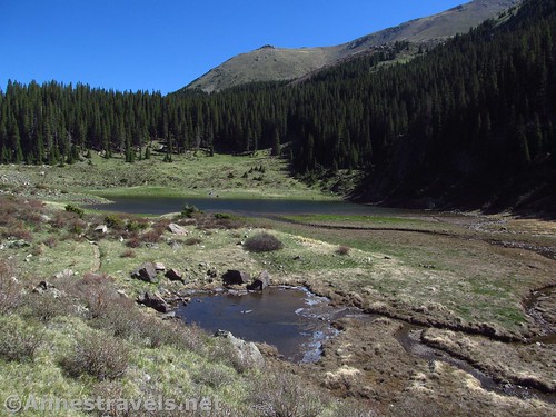
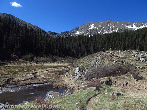
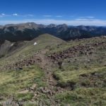
We took the social trail along the right (western) side of Williams Lake. It passes above the lake, through meadows, then disappears into a small boulderfield. Take the best route possible across the rocks and come out on the other side. It won’t be too long before you either connect again with the trail, or else intersect a deeply eroded (if narrow) trail that goes along the lake’s southern shore.
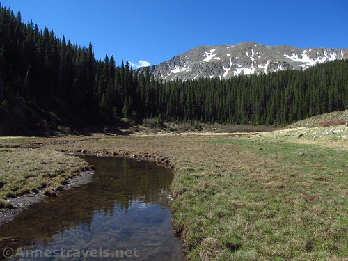
Whenever you intersect the trail that heads generally east-west, turn right (uphill and towards the woods). The trail mostly follows the stream as it approaches the woods.
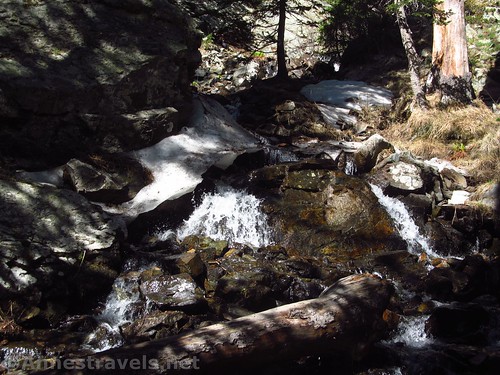
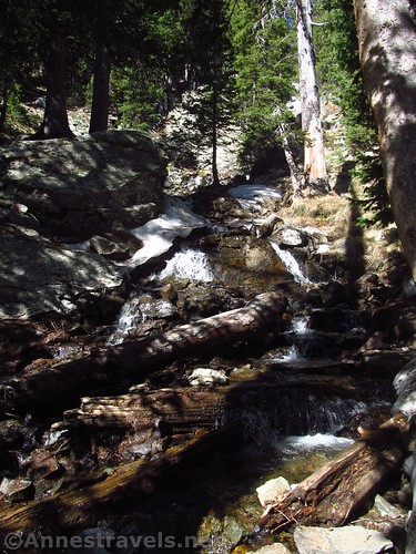
I entered the woods. There were a few rills and I was very disappointed. Even in New Mexico – known as a desert state – I had hoped that the falls would be more than a few rocks in the stream. I took a few pictures for posterity – just to show what it really looked like – and then noticed that the trail became better defined and continued upward.
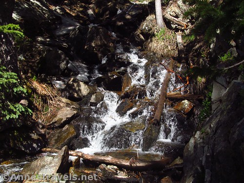
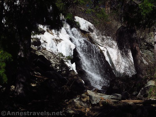
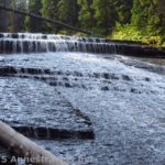
I followed the trail as it scrambled up rocks, over tree roots, and generally took a steep course better fit for a mountain goat than a hiker. So suddenly I almost walked over the edge, the trail leveled out (momentarily) with a viewing area right next to a 10 or 20 foot drop into the stream.
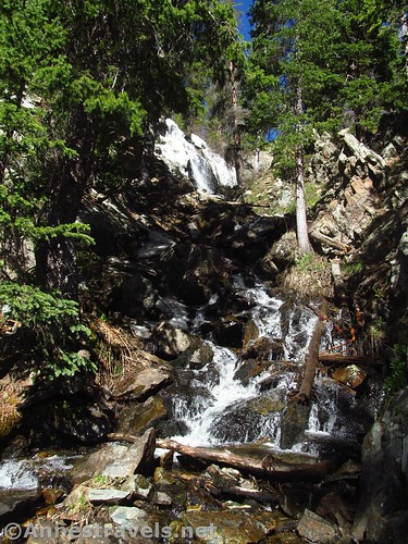
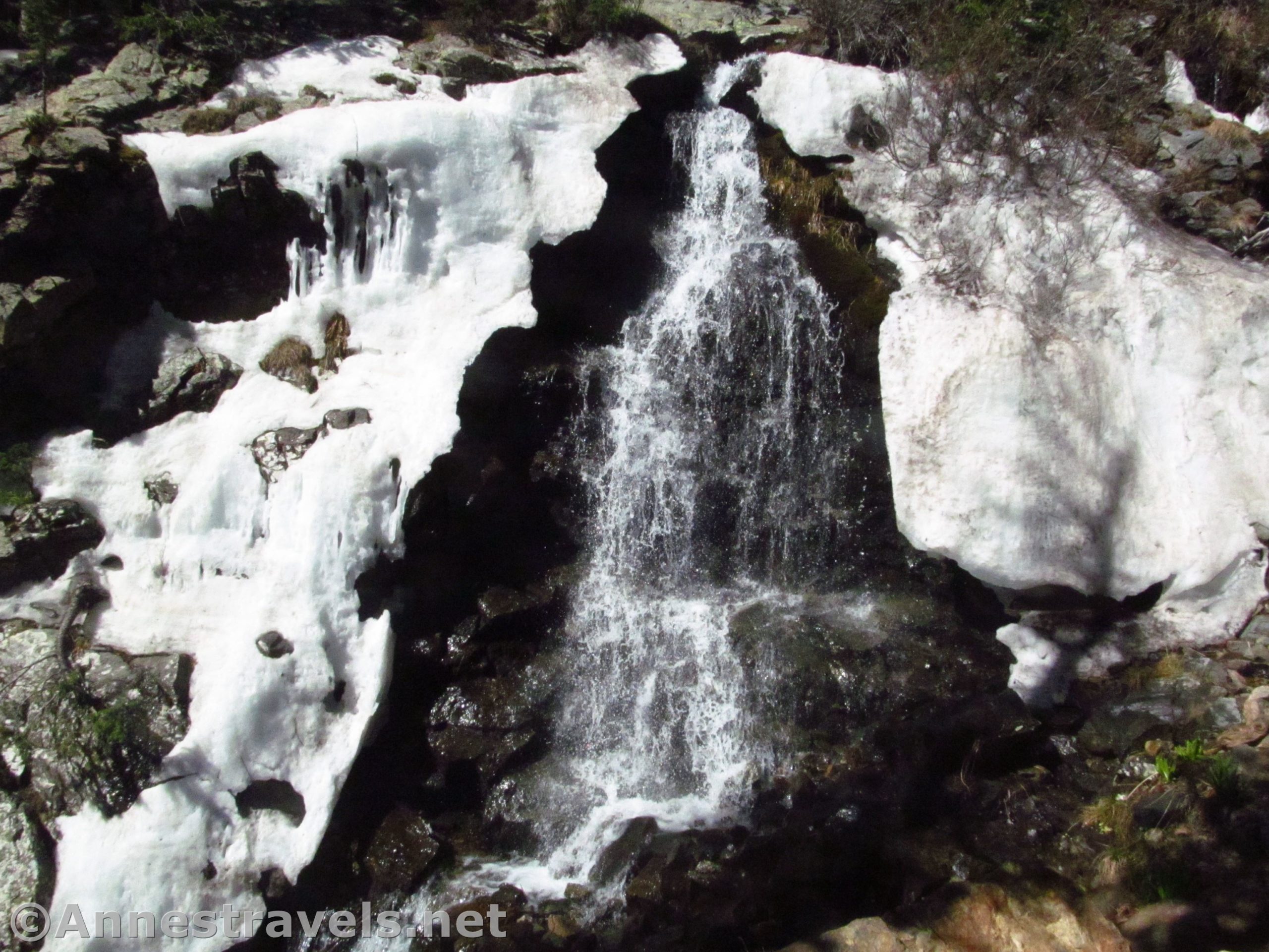
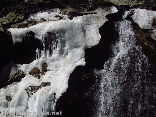
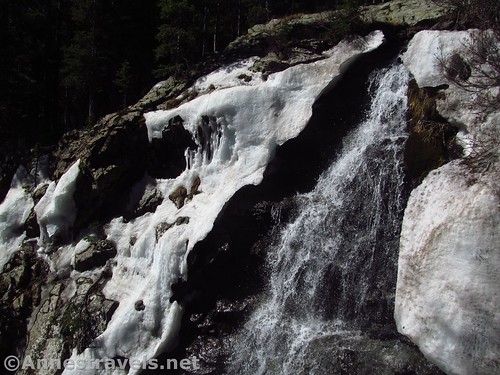
Right across from the viewpoint was a waterfall. A real waterfall. Not on par with Niagara Falls, or even Watkins Glen, but definitely a waterfall worth being called a waterfall. I’ve read since that Williams Falls is 35ft. high and flows all year, though the cascade is better in June than October.
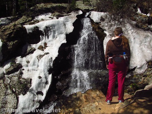
Being late May, the falls was still iced in (despite not seeing snow on the rest of the hike, even up on Wheeler Peak). But in some ways that gave it a unique charm.
We scrambled back down, armed with pictures to show the others who, I was pretty sure, did not want to play mountain goat to get up to the viewpoint!
We wandered back along the far side of Williams Lake. You can’t really walk all the way around the lake unless you like scrambling sheer walls, but it was pleasant to stroll back along the lakeshore!
Round Trip Trail Length: About 6 miles
Net Elevation Change: 865ft. (10,299ft. at the trailhead to 11,164ft. at the waterfall)
Facilities: A couple picnic tables and possible port-a-potties at the trailhead. Many more amenities (food, lodging, etc.) in Taos Ski Valley.
Fees: None
Trail Notes: I’ve heard that Williams Falls flows all years, but of course the flow is better during spring runoff (June). The area had received 25% average snowfall the previous winter, which is why the trail was open at all and we saw no snow in late May (usually there are snowbanks well into June). You should be used to following social trails and ready for a stiff climb / scramble (class 2) to get to the waterfall overlook.
Trail 
![]()
![]()
Road ![]()
![]()
Signs ![]()
![]()
Scenery ![]()
Would I go 100 miles out of my way for this? ![]()
Overall Rating: 
![]()
GPS Coordinates for Williams Falls
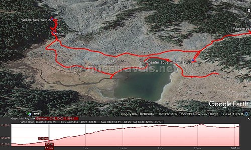
Trailhead: 36.5791833°, -105.4400500° (N36° 34.751′ W105° 26.403′ / 36°34’45.0600″, -105°26’24.1800″) (10,299ft.) (0.0) (end 11.3)
Trail / Road Junction: 36.5759167°, -105.4390833° (N36° 34.555′ W105° 26.345′ / 36°34’33.3000″, -105°26’20.7000″) (10,299ft.) (0.30)
Begin Trail: 36.5713500°, -105.4355333° (N36° 34.281′ W105° 26.132′ / 36°34’16.8600″, -105°26’07.9200″) (10,506ft.) (0.73)
Enter Wheeler Peak Wilderness: 36.5704167°, -105.4341333° (N36° 34.225′ W105° 26.048′ / 36°34’13.5000″, -105°26’02.8800″) (10,581ft.) (0.88)
Rock Pile #1: 36.5690667°, -105.4331833° (N36° 34.144′ W105° 25.991′ / 36°34’08.6400″, -105°25’59.4600″) (10,646ft.) (1.01)
Rock Pile #2: 36.5623833°, -105.4327667° (N36° 33.743′ W105° 25.966′ / 36°33’44.5800″, -105°25’57.9600″) (10,999ft.) (1.7)
Rock Pile #3: 36.5611000°, -105.4319500° (N36° 33.666′ W105° 25.917′ / 36°33’39.9600″, -105°25’55.0200″) (11,019ft.) (1.86)
Wheeler Peak Junction: 36.5593167°, -105.4314500° (N36° 33.559′ W105° 25.887′ / 36°33’33.5400″, -105°25’53.2200″) (11,120ft.) (2.14; return 9.42)
Above Williams Lake: 36.5576500°, -105.4299667° (N36° 33.459′ W105° 25.798′ / 36°33’27.5400″, -105°25’47.8800″) (11,061ft.) (2.35)
Wheeler Falls Base: 36.5544667°, -105.4314833° (N36° 33.268′ W105° 25.889′ / 36°33’16.0800″, -105°25’53.3400″) (11,080ft.) (2.87)
Wheeler Falls Viewpoint: 36.5543500°, -105.4320167° (N36° 33.261′ W105° 25.921′ / 36°33’15.6600″, -105°25’55.2600″) (11,164ft.) (2.99)
The gpx file for Williams Falls (along with Williams Lake, Mt. Walter, and Wheeler Peak) can be downloaded – please note that this and the GPS Coordinates are for reference only and should not be used as a sole resource when hiking this trail.
Download GPX File size: 75.4 KB Downloaded 390 times
(Note: I do my best to ensure that all downloads, the webpage, etc. are virus-free and accurate; however, I cannot be held responsible for any damage that might result, including but not limited to loss of data, damages to hardware, harm to users, from use of files, information, etc. from this website. Thanks!)
Getting to Williams Lake Parking Area
From Taos, New Mexico, drive north on US-64W. Outside of town, turn right on NM-150N, turning away from the The Rio Grande Gorge Bridge (which is a worthy destination unto itself.) (If you’re coming in from the north, take this turn where NM-522S meets US-64 – turn left toward the Taos Ski Valley).
Follow the NM-150N for almost 15 miles (a GPS is useful, but not required). You’ll pass through typical northern New Mexico plains, then enter an alpine canyon more fit for Colorado – it’s a beautiful (if steep) drive. Just before the main part of the ski valley, turn left up a wide, gravelish road / hill / parking area. Keep following the road upward, passing the Bull of the Woods Trailhead (it will probably say something about “Wheeler Peak Trail”, and while it will take you to Wheeler Peak eventually, you’re better off starting from the Williams Lake Trailhead). You’re now in a crazy network of roads – I highly recommend a GPS and common sense (because one can fill in where the other is lacking). In general, just keep driving upward on the very, very steep main road. About 2.2 miles above the beginning of the Ski Valley, a parking area will be on the right for Williams Lake. Park here. The roads may be closed until early summer due to snow.
Hike up to Williams Lake, following the roads and then trails up to the lake.
Zoom map out to browse nearby hikes & places of interest
This Week’s Featured Product!
Looking for more waterfalls? This book contains dozens of waterfalls, all within 85 miles of Toas!

2 responses to “Discovering Williams Falls”
[…] out one very freezing May morning heading for the lake. (I’ll talk about the lake in this post, Williams Falls – an almost unknown destination not far from the lake – in the next post, and in the post after […]
[…] Peak. We visited Williams Lake (a worthy short side trip from the Wheeler Peak Trail), discovered Williams Falls (a little lengthier, but still worth visiting), and then up Mount Walter, a beautiful little high […]