
I wanted to climb Wheeler Peak. It’s not just that I liked the pictures others had taken from the top – I figured climbing the highest point in New Mexico would be fun. It would be an accomplishment. It would be a challenge. And I figured we were up for the challenge. Besides, since you could visit Williams Lake along the way, what a better way to start the hike than to visit a lake before hiking the peak?
Quick Stats
So we started out one very freezing May morning heading for the lake. (I’ll talk about the lake in this post, Williams Falls – an almost unknown destination not far from the lake – in the next post, and in the post after that, I’ll talk about actually ascending Wheeler Peak. Oh, and somewhere in there, I’ll talk about summiting Mt. Walter, too!)
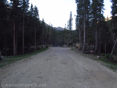
The parking area is between two sections of the Taos Ski Area, so the first thing you’ll want to do is to walk down the old road near the signboard. Keep following the signs for hikers and Williams Lake. Basically, you keep following the roads upward.
After passing the Phoenix Grill (about 0.3 miles from the trailhead), the trail turns left and upward, no longer as a public road, but as another old road. It’s rougher than the other dirt roads in the Taos Ski Area, but not too hard to hike (other than being fairly steep). After another 0.4 miles, the road ends and the trail becomes a true hiking trail through the woods.
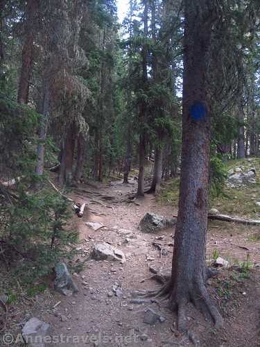
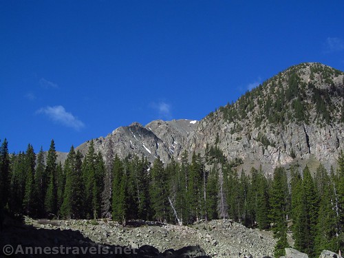
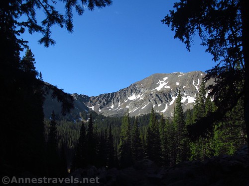
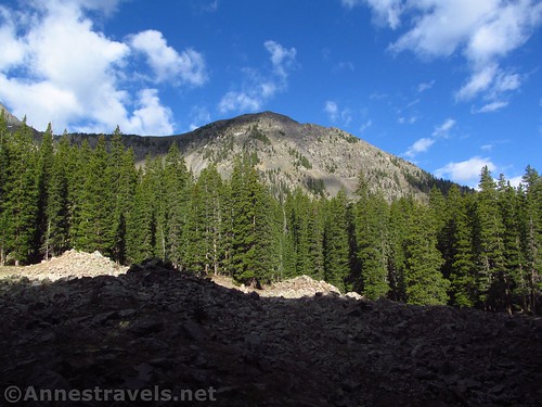
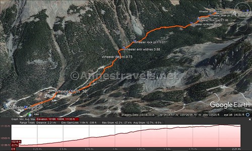
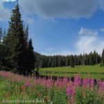
The route generally wanders upward, entering the Wheeler Peak Wilderness at 0.8 miles and passing by rock piles at 1.0, 1.7, and 1.8 miles, respectively. The rock piles offer a bit of view of the low peaks across the valley and otherwise pose no difficulties (trail finding or otherwise).
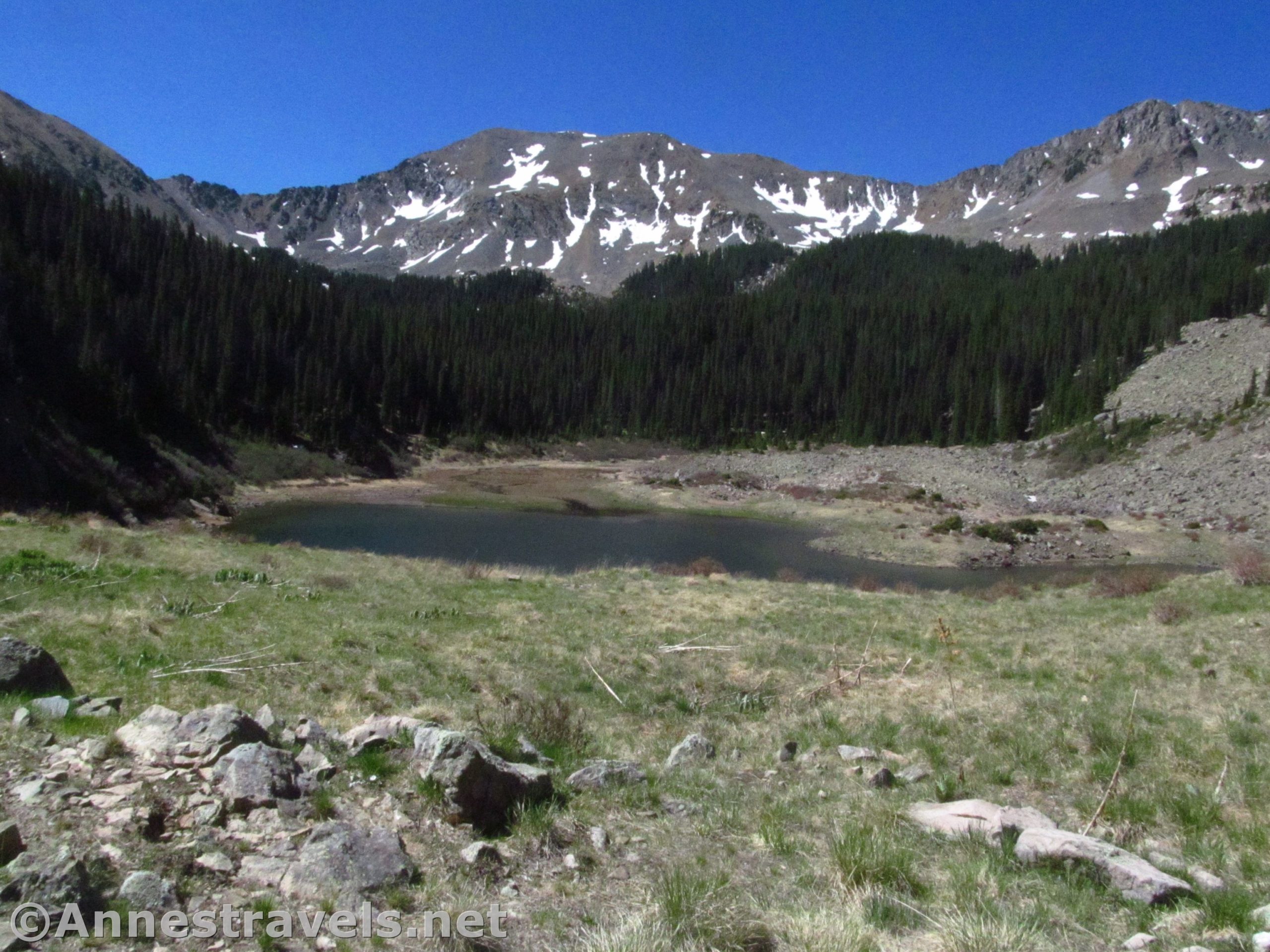
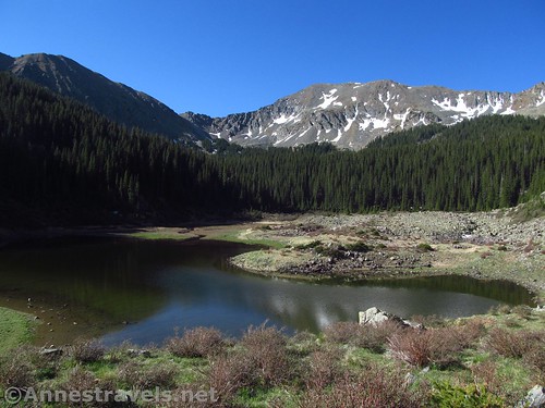
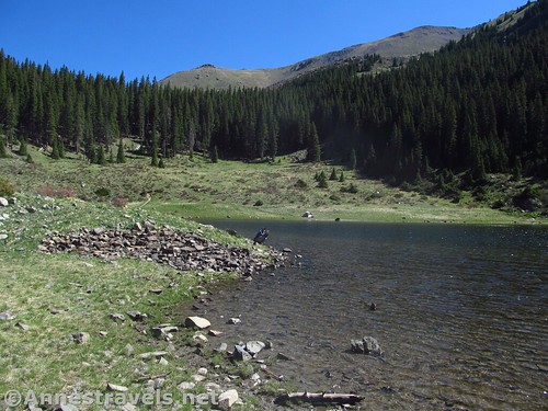
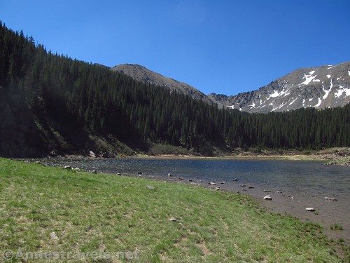
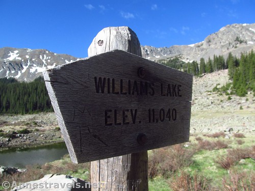
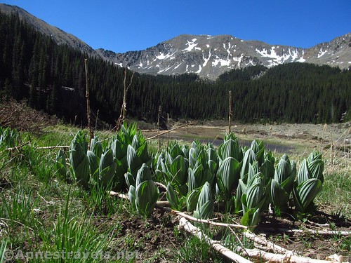
At 2.1 miles, the trail comes to the junction with the Wheeler Peak Trail. Continue hiking straight as the trail descends some of that hard-won elevation and then suddenly breaks out of the trees less than a quarter mile later above Williams Lake.
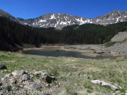
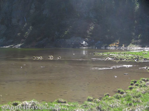
When I visited, it was late May, but the snowpack had been about 25% of normal (yikes!) so the lake was very low and there wasn’t any snow on the trail, like there possibly would be in normal years. There was still a little snow on the peaks, though, so that made for better pictures than might be expected.
We met one other group so early in the morning – a couple guys – and later a dad and his two sons came down to see the lake before pushing on up Wheeler Peak. It was nice to have it to ourselves. I hear it can be a bit more crowded at midday in the summer months.
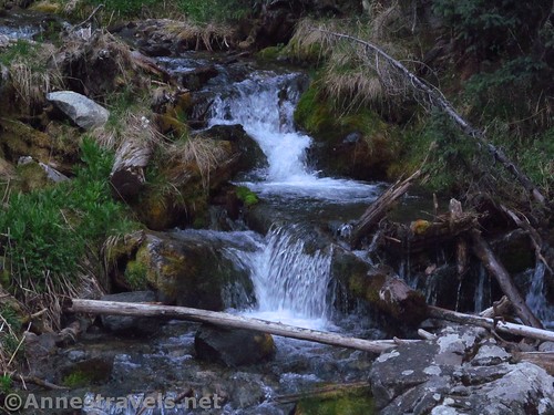
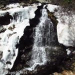
We enjoyed the view for a bit, then, following a map a couple forest rangers had shown me the day before, we went off in search of Williams Falls – but that’s a topic for another post!
Round Trip Trail Length: 4.8 miles (down to the lakeshore & back)
Elevation Change: 821ft. (10,299ft. at the trailhead to 11,120ft. at the Wheeler Peak Trail Junction)
Facilities: Small shelter with a couple picnic tables at the trailhead, also a few port-a-potties when I visited. If the Taos Ski Valley is open (they seem to be trying to make it into a summer resort as well as a winter one, so it’s pretty likely some of it will be open), there is lodging, restaurants, and more quite close by.
Fees: None
Trail Notes: This is a popular trail for families because it poses a challenge while not being all that long, complicated, or difficult, but still has a pretty destination at the end. I highly recommend checking out Williams Falls while you’re there and if you’re up for another short challenge. If you decide to climb Wheeler Peak after the lake, take note: Maps show a trail spurring off the northeast side of the lake and connecting to the Wheeler Peak Trail. It does exist, but it’s not obvious or maintained (see my post on hiking Wheeler Peak).
Trail 
![]()
![]()
Road ![]()
![]()
Signs ![]()
Scenery ![]()
Would I go 100 miles out of my way for this? ![]()
Overall Rating: 
![]()
GPS Coordinates for Williams Lake
Trailhead: 36.5791833°, -105.4400500° (N36° 34.751′ W105° 26.403′ / 36°34’45.0600″, -105°26’24.1800″) (10,299ft.) (0.0) (end 11.3)
Trail / Road Junction: 36.5759167°, -105.4390833° (N36° 34.555′ W105° 26.345′ / 36°34’33.3000″, -105°26’20.7000″) (10,299ft.) (0.30)
Begin Trail: 36.5713500°, -105.4355333° (N36° 34.281′ W105° 26.132′ / 36°34’16.8600″, -105°26’07.9200″) (10,506ft.) (0.73)
Enter Wheeler Peak Wilderness: 36.5704167°, -105.4341333° (N36° 34.225′ W105° 26.048′ / 36°34’13.5000″, -105°26’02.8800″) (10,581ft.) (0.88)
Rock Pile #1: 36.5690667°, -105.4331833° (N36° 34.144′ W105° 25.991′ / 36°34’08.6400″, -105°25’59.4600″) (10,646ft.) (1.01)
Rock Pile #2: 36.5623833°, -105.4327667° (N36° 33.743′ W105° 25.966′ / 36°33’44.5800″, -105°25’57.9600″) (10,999ft.) (1.7)
Rock Pile #3: 36.5611000°, -105.4319500° (N36° 33.666′ W105° 25.917′ / 36°33’39.9600″, -105°25’55.0200″) (11,019ft.) (1.86)
Wheeler Peak Junction: 36.5593167°, -105.4314500° (N36° 33.559′ W105° 25.887′ / 36°33’33.5400″, -105°25’53.2200″) (11,120ft.) (2.14; return 9.42)
Above Williams Lake: 36.5576500°, -105.4299667° (N36° 33.459′ W105° 25.798′ / 36°33’27.5400″, -105°25’47.8800″) (11,061ft.) (2.35)
The gpx file for Williams Lake (along with Williams Falls and Wheeler Peak) can be downloaded – please note that this and the GPS Coordinates are for reference only and should not be used as a sole resource when hiking this trail.
Download GPX File size: 47.3 KB Downloaded 446 times
(Note: I do my best to ensure that all downloads, the webpage, etc. are virus-free and accurate; however, I cannot be held responsible for any damage that might result, including but not limited to loss of data, damages to hardware, harm to users, from use of files, information, etc. from this website. Thanks!)
Getting to Williams Lake Parking Area
From Taos, New Mexico, drive north on US-64W. Outside of town, turn right on NM-150N, turning away from the The Rio Grande Gorge Bridge (which is a worthy destination unto itself.) (If you’re coming in from the north, take this turn where NM-522S meets US-64 – turn left toward the Taos Ski Valley).
Follow the NM-150N for almost 15 miles (a GPS is useful, but not required). You’ll pass through typical northern New Mexico plains, then enter an alpine canyon more fit for Colorado – it’s a beautiful (if steep) drive. Just before the main part of the ski valley, turn left up a wide, gravelish road / hill / parking area. Keep following the road upward, passing the Bull of the Woods Trailhead (it will probably say something about “Wheeler Peak Trail”, and while it will take you to Wheeler Peak eventually, you’re better off starting from the Williams Lake Trailhead). You’re now in a crazy network of roads – I highly recommend a GPS and common sense (because one can fill in where the other is lacking). In general, just keep driving upward on the very, very steep main road. About 2.2 miles above the beginning of the Ski Valley, a parking area will be on the right for Williams Lake. Park here. The roads may be closed until early summer due to snow.
Zoom map out to browse nearby hikes & places of interest
This Week’s Featured Product!
Want even more hikes near Taos? Check out this book with 52 hikes near Taos and Santa Fe.


3 responses to “Hiking to Williams Lake, New Mexico”
[…] Our biggest destination in New Mexico was to climb Wheeler Peak, the highest point in the state. I was a little worried that it might still be snowed in, but due to the light snow year, we barely saw snow the whole way up. While we were on the trail anyway, we visited Williams Lake… […]
[…] arriving at Williams Lake, we thought we would hike a bit further before ascending Mount Walter and Wheeler Peak (our actual […]
[…] the Williams Lake Trail 2.1 miles to the Wheeler Peak Trail Junction and turn left up the Wheeler Peak Trail. You can […]