
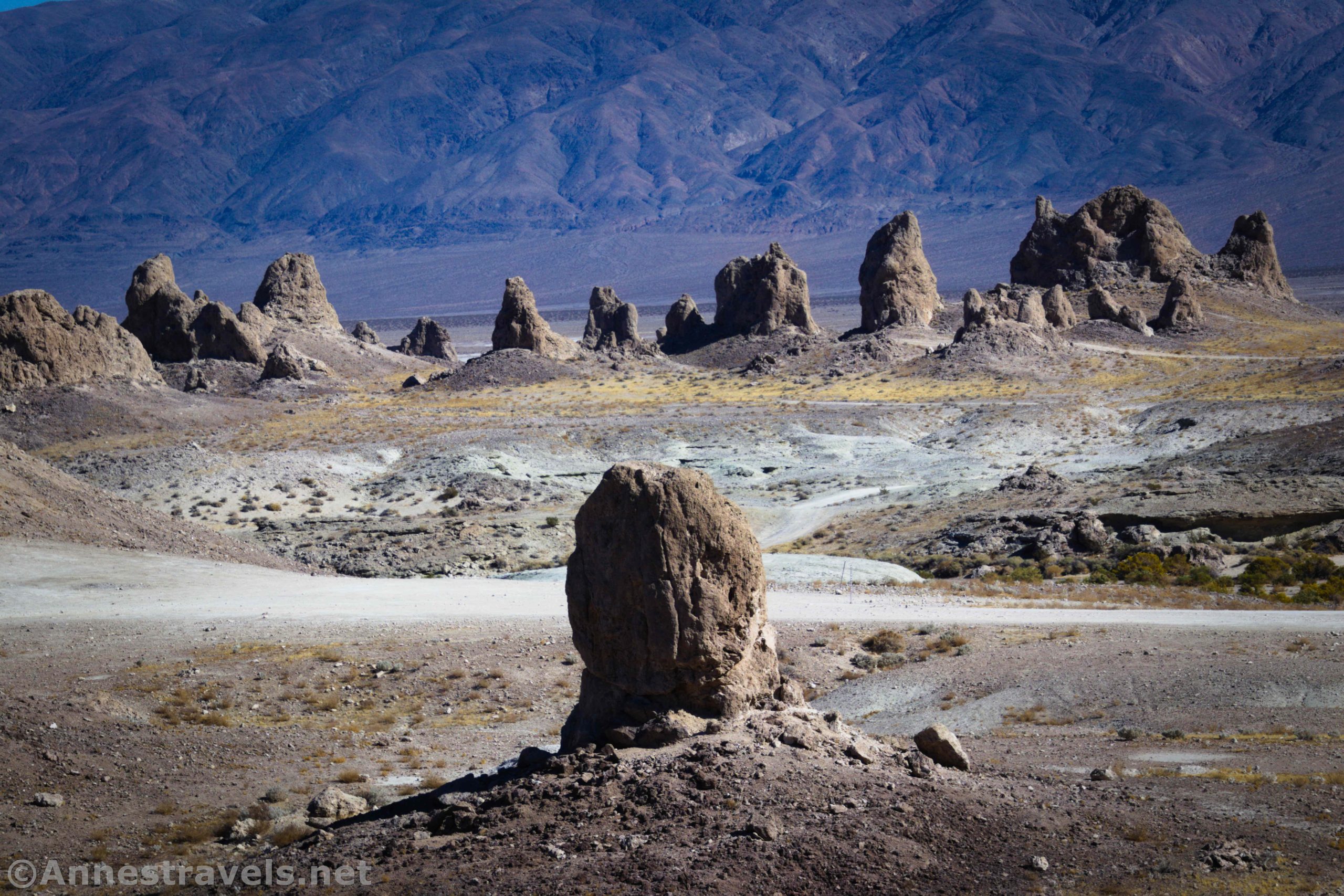
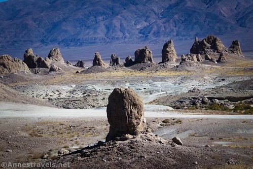
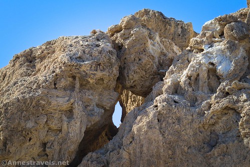
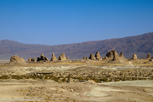
West of Death Valley National Park and east of the town of Ridgecrest, the Trona Pinnacles National Landmark is a very unique place to visit. The signs on-site said that the pinnacles are made of tufa (calcium carbonate), the leftovers of the bed of an old lake. Because the pinnacles are on BLM land, they’ve been the background of many ads and films, and after doing an hour or so of photography, I can see why they’re so popular!
Quick Stats

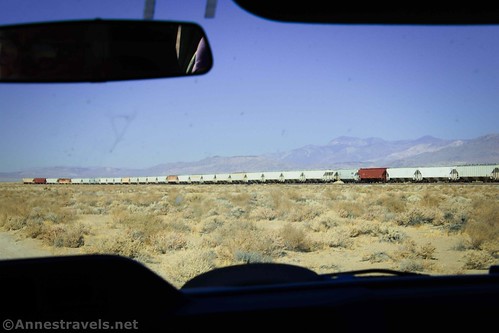
I didn’t know much about the spires before I visited, other than seeing the point of interest on our AAA-issued California map and one or two web sources. Still, it looked interesting enough that we took it in as a day-trip on our way from the Alabama Hills back into Death Valley National Park. (It’s not exactly on the way. So it was a full-day excursion down there and then back into Death Valley, including a stop in Ridgecrest for gas and internet.)

We arrived about 11am with scorching sunny skies (in November – I can’t imagine what the place would be like in July) and only one other car in sight. We stopped to read the signs and then continued down the road to the Trona Pinnacles, themselves.
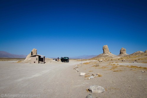
We parked near the restrooms (there’s a single BLM-issue vault toilet here, but no trash receptacles, so please pack out your trash). A trail started up the hillside into the formations from here, so we followed it.

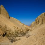
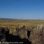
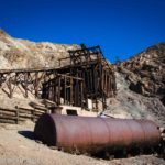
Pretty quickly we ran into an old mine shaft. The miners didn’t get too far, nor did they get far in a couple of other shafts I found on the hillside. Still, it was interesting to see.

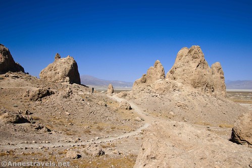
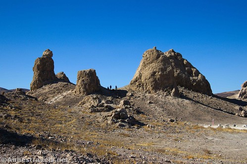
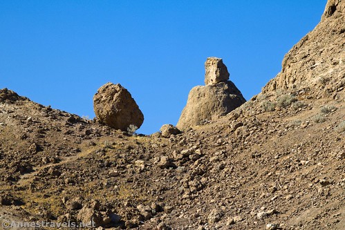
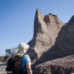
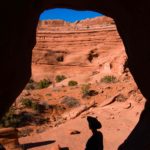
From there, we wandered around the formations. There’s a maze of trails amongst the maze of roads that wind between the formations (please stay on existing roads with your vehicle – it’s the law, but you also don’t want to trample vegetation, and the dirt is soft off of the road). It would be pretty easy to get lost, but also pretty easy to follow one or more of the roads around to find your vehicle.

I’m not going to try to detail the route we took. We wound this way and that, sometimes retracing trails, sometimes scrambling up formations. The heat kept us from doing everything we might have if it had been more comfortable out, but we still saw a good portion of the pinnacles.
I was disappointed that it was midday and therefore not the best time for photography. I had been looking forward to testing the metal of my new Canon M6 camera (well – a year old, but this was its first long trip). As it turned out, Trona Pinnacles was one of the most photogenic places we stopped even under noon-time skies. I’m afraid the photos turned out better than real life – or maybe I was so dazzled by the sun and heat that they were beautiful but I couldn’t tell at the time!

We wandered for about an hour. During that time, I saw close to a half dozen vehicles drive up and drive away. Some people checked out the formations on foot, others drove in, turned around, and left. It seems a lot of people see the sign and turn in to see the formations without intending to stay long.
I’ve heard that dispersed camping is allowed on the roads around the Trona Pinnacles. We could see where people had made small fire pits – make sure this is ok before you make a fire. For camping regulations, visit the official BLM site. I’d expect this place would be stunning at sunrise and sunset, so spending a night here would be high on my list if I was just passing through.

Overall, chances are you won’t want to spend a full day at the Trona Pinnacles unless you just like sitting and taking in the view. In fact, you probably won’t want to spend more than 30 minutes or so. But they’re worth a stop if you happen to be in Ridgecrest or you’re traveling up US-395 from SoCal to places like Death Valley, the High Sierras, or Yosemite.
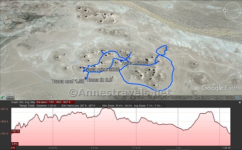
Round Trip Trail Length: Varies. I went 1.5 miles.
Elevation Gain: Varies. I gained 287ft. (1,767ft. to 1,837ft.)
Facilities: Primitive restrooms
Fees: None

Trail Notes: The trails seem to be mostly of the social variety, so some are more usable than others. In general, they’re a little bit loose underfoot. Be sure to not leave trash or other debris behind. Be careful of the few exposed mine prospects among the Pinnacles. I don’t recommend going here at midday, and especially not when it’s summer – that plain holds in the heat and it is super hot out there among the Trona Pinnacles!

Trail 
![]()
![]()
![]()
Road ![]()
![]()
Signs ![]()
![]()
![]()
Scenery ![]()
Would I go 100 miles out of my way for this? ![]()
![]()
Overall Rating: ![]()
![]()
GPS Coordinates for the Trona Pinnacles
Trona Pinnacles TH: 35.6181500°, -117.3734500° (N35° 37.089′ W117° 22.407′ / 35°37’05.3400″, -117°22’24.4200″) (1,748ft.)(0.0)
Trona Mine: 35.6183167°, -117.3728333° (N35° 37.099′ W117° 22.370′ / 35°37’05.9400″, -117°22’22.2000″) (1,781ft.) (300ft.)
Mine 2: 35.6167333°, -117.3723167° (N35° 37.004′ W117° 22.339′ / 35°37’00.2400″, -117°22’20.3400″) (1,827ft.) (no mileage)
End: 35.6181667°, -117.3734667° (N35° 37.090′ W117° 22.408′ / 35°37’05.4000″, -117°22’24.4800″) (1,766ft.) (1.50)

The gpx file for my walk through the Trona Pinnacles can be downloaded – please note that this and the GPS Coordinates are for reference only and should not be used as a sole resource when hiking this trail.
Download GPX File size: 30.7 KB Downloaded 475 times
(Note: I do my best to ensure that all downloads, the webpage, etc. are virus-free and accurate; however, I cannot be held responsible for any damage that might result, including but not limited to loss of data, damages to hardware, harm to users, from use of files, information, etc. from this website. Thanks!)
Getting to the Trona Pinnacles
From Ridgecrest, CA, drive east on CA-178 (note that if you’re coming up US-395, you’ll need to get off of it to get to Ridgecrest – follow the signs or US-395 BUS). After 14.2 miles, turn right onto Pinnacle Road – there are two concrete monuments at the junction along with a small sign for the Trona Pinnacles. If you get to the town of Trona, you’ve gone too far. Stay on the main road for about 5 miles of rough (but mostly low-clearance-friendly) dirt road to the Trona Pinnacles.
From Death Valley National Park, you’ll want to take the Panamint Valley Road, which is 28 miles west of Stovepipe Wells via CA-190. Turn south on Panamint Valley Road and drive 52 miles through some scenic vistas and through the town of Trona. Turn left onto Pinnacles Road – there are two concrete monuments at the junction along with a small sign for the Trona Pinnacles. If you get to the town of Ridgecrest, you’ve gone too far. Stay on the main road for about 5 miles of rough (but mostly low-clearance-friendly) dirt road to the Trona Pinnacles.
This Week’s Featured Product!
For more natural and historical wonders in the area to the east of the Trona Pinnacles, check out this book. There’s a lot of history as well as destinations in here.
One response to “Trona Pinnacles: Spires Galore!”
[…] our way back to Death Valley, we stopped at the Trona Pinnacles National Natural Landmark. The spires stick up out of an old […]