
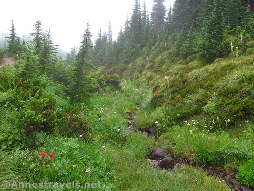
A little stream along the Timberline Trail en route to McNeil Point
The weather really can make or break a trip or a hike. Last year, visiting Mt. Hood, the weather went from socked in to quite cloudy, to totally cloudy and misty and rainy. The last day we decided to do a trail no one in their right mind would do on a rainy day – the Mazama Trail up to McNeil Point. But it turned out not to be so bad. The meadows in the mist was mesmerizing, and while we didn’t do more than glimpse Mt. Hood all day, at least we got some great dew drop photos, found an old CCC hut, and generally had a pretty good time, considering. (And that experience made us pull out of the area early, so we got to do the Upper Geyser Basin and the Lakeshore Trail on the way home!)
Quick Stats for the Mazama Trail to McNeil Point
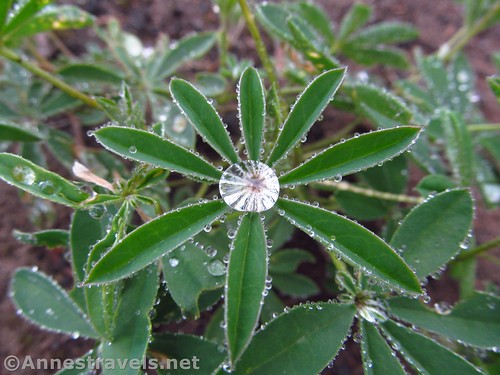
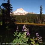
Dewdrops on the lupine leaves
Many hikers to McNeil Point start at the Top Spur Trailhead and hike the trail of the same name and the Timberline Trail up to the McNeil Point Trail Junction, crossing scenic Bald Mountain in the process. However, we accidentally discovered the Mazama Trailhead first, and after some careful calculations using the map at the trailhead, we determined we would save several hundred feet in elevation gain, while the trail length would stay at about 10.5 miles RT.
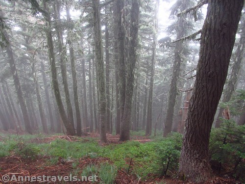
Misty woods
Well, I’m not sure about those higher level mathematics in terms of elevation (especially after looking at sources on the internet), but I don’t at all regret my decision to take the Mazama Trail. The meadows were outstanding, especially on a misty day.
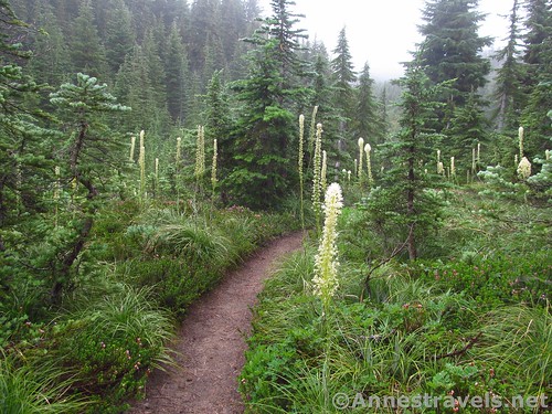
Beargrass in one of the meadows along the Mazama Trail
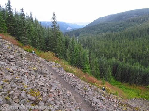
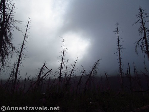
We started very early in the morning, the sky rolling with grey clouds. The trail itself climbs quickly from the first, entering a burned out forest to switchback up the steep hillside before entering the forest and continuing to switchback. At (nearly) the top of the hill, at the end of a switchback, a little viewpoint would be quite good if it hadn’t been so misty. So I took advantage of the mist and shot a few interesting photos.
“In this post-apocalyptic world, we must tread carefully…”
Nearly a mile from the trailhead, the trail enters the Mt. Hood Wilderness. From here on, the trail continues to climb through burned out forests (watch for falling trees), then passes through old-growth forests on a more gradual slope. The great thing was that the burned over areas allowed new growth, such as fireweed and lupines, which were covered with tiny droplets of mist.
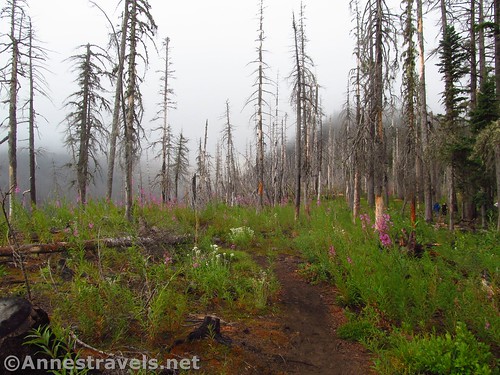
New growth in the burned out forest
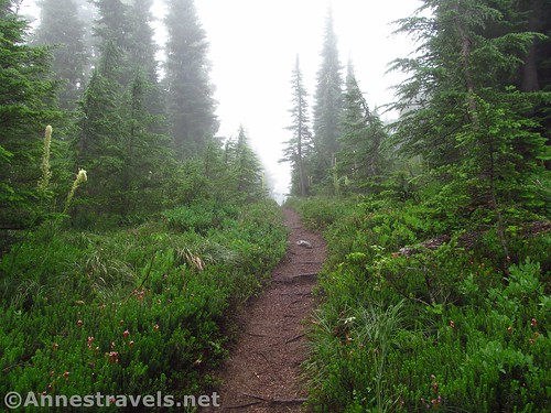
About 3.5 miles from the trailhead, the trail breaks out of the forest to enter the meadows proper, and with it, the misty air proper. But it was great – so many wildflowers, so many dew droplets!

Mist-drenched fireweed
Nearly half a mile later, the trail T’s into the Timberline Trail. Turn left for 0.1 miles, when you’ll pass an area under “Trail Restoration” (aka, you can’t use the social trails in this area). I would expect that your first really good views of Mt. Hood would be in this area, but I can’t say because the mist was pretty thick.
I think that’s Mt. Hood out there… somewhere…
A quarter mile after the Trail Restoration signs, the trail to McNeil Point enters from the right. Turn here to ascend the trail through the meadows.
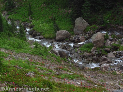
Waterfall below the McNeil Point Trail
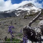
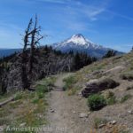
It’s not long before you’ll find yourself on a fin of rock and dirt, with a stream falling away on your left and a meadow falling away on your right. And the views of Mt. Hood would be spectacular from here – it was our one glimpse of the big mountain (just some snow and rock), but wow, what it would be like on a clear day!
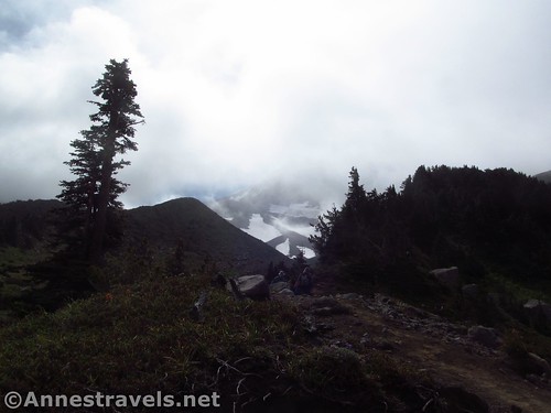
That’s got to be Mt. Hood!
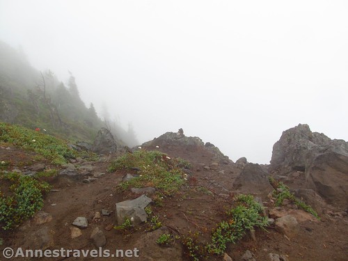
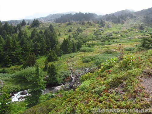
The trail turns to traverse the side of the hill at the head of the meadow that was formally on your right. It crosses some scree fields, then more meadows, making its way across little streams and through clumps of heather and rocks. It was spectacular and mysterious in the fog; I have to wonder what it would be like on a clear day…
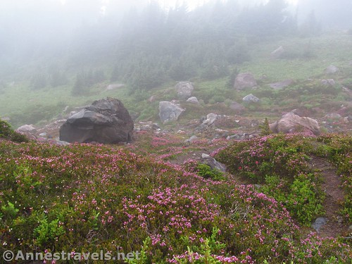
Blooming heather and the very misty meadows on the high reaches of the McNeil Point Trail
After what seemed like an eternity of stumbling through the fog and meadows – but was only 0.9 miles – the trail split. We couldn’t see anything through the mist at this point, so we checked out both trails, and, finding a stone shelter by going right (not left and uphill), decided that sounded like the best option. It’s about 0.2 miles to the shelter built by the CCC’s.
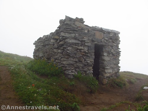
The CCC hut
So I read, the shelter was built to be right along the Timberline Trail. However, after the hut was constructed, the trail builders did their homework and found that the trail couldn’t possibly be built because of snowfields and the rocky terrain. So they rerouted the trail, but left the shelter were it was.
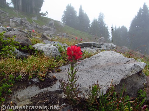
A lone paintbrush
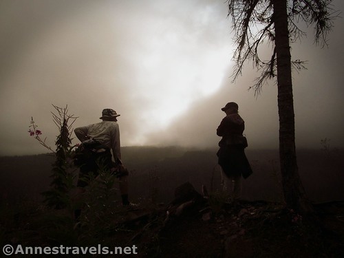
Just behind the shelter (less than 0.1 miles) is McNeil Point, or at least, that’s my best guess. The fog hadn’t lifted much. So we took a few pictures of the mist and went back to the stone shelter.
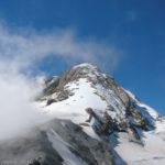
At McNeil Point – Mt. Hood is out there somewhere… I think
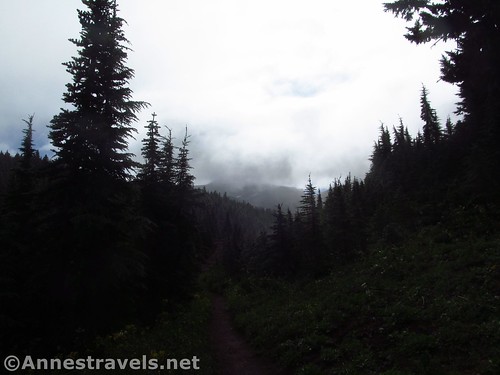
The trip down was just about as unexciting – except that the mist was thicker and more penetrating. Still, it’s hard to complain about misty woods and lovely misty meadows when you can’t see the peak anyway, right?

Misty Timberline Trail
So overall, if you’re ever caught on Mt. Hood on a misty day, the Mazama Trail is a great choice…
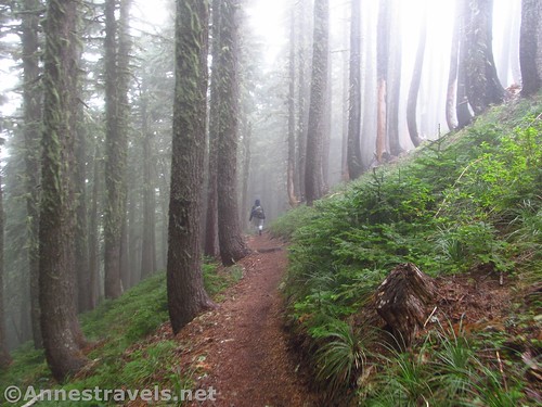
Walking down through the misty woods
Round Trip Trail Length: 10.5 miles up to McNeil Point and back
Net Elevation Change: 2,675ft. (3,422ft. at the trailhead to 6,097ft. at the junction near the CCC Hut)
Facilities: None
Fees: $5 per day, per vehicle fee. Northwest Forest Passes and America the Beautiful (generally known as the National Parks Passes – Annual, Senior, Access, Military, Volunteer, 4th Grader, etc.) also accepted.
Trail Notes: This trail is steep – and most of the elevation is gained in the first 3 miles or so (just the first mile climbs over 700ft). After that it’s an uphill trek winding through meadows. Summer weekends can be crowded. If you do hike during a misty day, I highly recommend layers and clothing that protects from the wet as well as dries quickly.
Switchbacks near the beginning of the trail
Trail 
Road
Signs
Scenery
Would I go 100 miles out of my way for this?
Overall Rating:
Along the Mazama Trail
Key GPS Coordinates for the Mazama Trail to McNeil Point
Parking: 45.437292N / -121.757386W (45°26’14.2500″ / -121°45’26.5900″) (3,369ft.)
Mazama Trail Beginning: 45.434653N / -121.756358W (45°26’4.7500″ / -121°45’22.8900″) (3,422ft.) (0.0; ended 10.5)
Enter Mt. Hood Wilderness: 45.430172N / -121.756117W (45°25’48.6200″ / -121°45’22.0200″) (4,144ft.) (0.95)
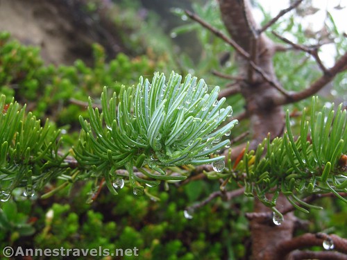
Dew-dripping pine branch
Enter meadows: 45.41424N / -121.74168W (45° 24′ 51.2634″ / -121° 44′ 30.0480″) (5,276ft.) (3.51)
Timberline Trail Junction: 45.40249N / -121.73183W (45° 24′ 8.9640″ / -121° 43′ 54.5880″) (5,598ft.) (3.98)
Meadow Restoration: 45.40192N / -121.73010W (45° 24′ 6.9114″ / -121° 43′ 48.3594″) (5,619ft.) (4.11)
McNeil Point Trail Junction: 45.40276N / -121.72842W (45° 24′ 9.9360″ / -121° 43′ 42.3114″) (5,724ft.) (4.33)
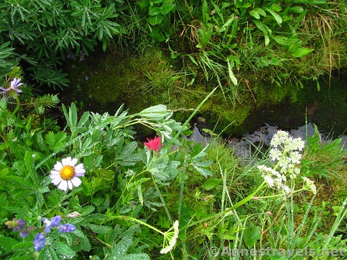
Flowers beside a mossy stream
Shelter Trail Junction: 45.39565N / -121.72886W (45° 23′ 44.3400″ / -121° 43′ 43.8954″) (6,097ft.) (5.2)
CCC Shelter: 45.39555N / -121.73201W (45° 23′ 43.9800″ / -121° 43′ 55.2360″) (6,010ft.) (5.4)
McNeil Point: 45.39536N / -121.73209W (45° 23′ 43.2954″ / -121° 43′ 55.5234″) (6,012ft.) (5.49)
Enter (or leave on way back) meadows: 45.41424N / -121.74168W (45° 24′ 51.2634″ / -121° 44′ 30.0480″) (5,276ft.) (7.85 on return)
Clouds and the burned out forest. If the weather gives you clouds, you might as well make cloud-ade…
The gpx file for the Mazama Trail to McNeil Point can be downloaded – please note that this and the GPS Coordinates are for reference only and should not be used as a sole resource when hiking this trail.
Download GPX File size: 244.2 KB Downloaded 85 times
(Note: I do my best to ensure that all downloads, the webpage, etc. are virus-free and accurate; however, I cannot be held responsible for any damage that might result, including but not limited to loss of data, damages to hardware, harm to users, from use of files, information, etc. from this website. Thanks!)
The sun came out for a few precious moments, illuminating the meadows along the McNeil Point Trail
Getting to the Mazama Trail Trailhead
From Hood River, OR, head south on OR-35S nearly 5 miles. Just before the “town” of Pine Grove, turn right on Dethman Ridge Road – there’s no signs marking this besides the street sign on the left side of OR-35 (it’s just before the “passing lane 1 mile” sign, assuming they don’t move it). After a mile, turn left to stay on Dethman Ridge Road, then turn left after 0.9 miles for the same reason, and left again 0.1 miles later onto Odell Highway. After 0.3 miles, turn right onto Summit Drive for 2.0 miles, when you’ll want to take a slight left onto Dee Highway for 4.1 miles. Veer right, following the sign for Dee, for 0.2 miles, then turn left onto Lost Lake Road. After 1.3 miles, turn left to stay on Lost Lake Road for 0.5 miles more; Turn right to stay on Lost Lake Road for 6.1 miles. Turn left onto NF-18 for 3.1 miles, then take a slight right onto Lolo Pass Road / NF-18 for 5.0 miles (if you went left here, you’d end up at the trailhead for Owl Point and the Vista Ridge Trail. Turn left onto NF-1811 (easy to miss, though obvious enough); after 2.5 miles the parking area will be on the left.
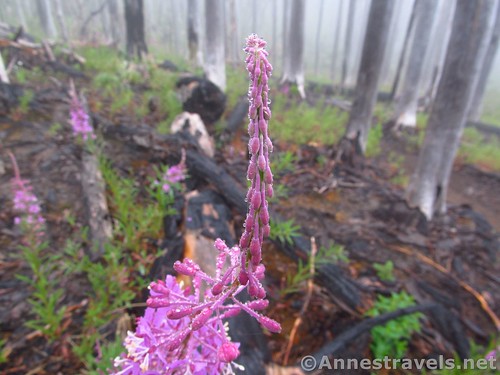
Fireweed buds in the burned out forest
Or, from Mt. Hood Village, drive east on US-26E, turning left onto Lolo Pass Road after about a mile and a half. This is very near Milepost 42. After 10.6 miles, turn right onto NF-1810 (near the Lolo Pass Trailhead / Pacific Crest Trail) for 5.5 miles. Then turn right onto NF-1811 2.5 miles to the parking area, on left.

One more glimpse of misty meadows…
Sound a bit confusing? It is. I highly recommend a GPS out here – but don’t let it take you up any weird roads; ours nearly got us lost 🙂
Zoom map out to browse nearby hikes & places of interest
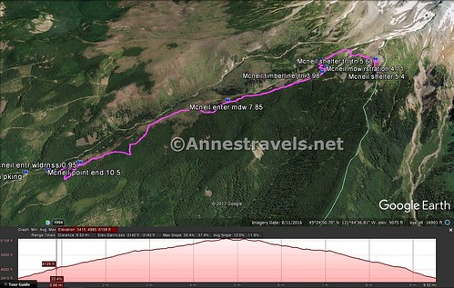
Visual trail map of the Mazama Trail to McNeil Point & elevation profile
This Week’s Featured Product!
Looking to hike more of the Timberline Trail & vicinity? Check out this book with detailed descriptions of the trail.

Pingback: Remember in the Wilderness - Anne's Travels